Subsea and ROV cameras, underwater LiDAR, laser scanners and optical components
Precision cameras and imaging systems provide the high-definition visual data required by engineers and scientists to characterize marine habitats, assess the condition of vital subsea infrastructure, and support the growing autonomy of platforms like ROVs and AUVs. This category showcases leading suppliers of specialized imaging systems, from subsea cameras and laser scanners, to cutting-edge object detection technology and custom optical structures.
If you design, build or supply Cameras & Imaging Systems, create a profile to showcase your capabilities and connect with visitors who have an active requirement for your solutions.
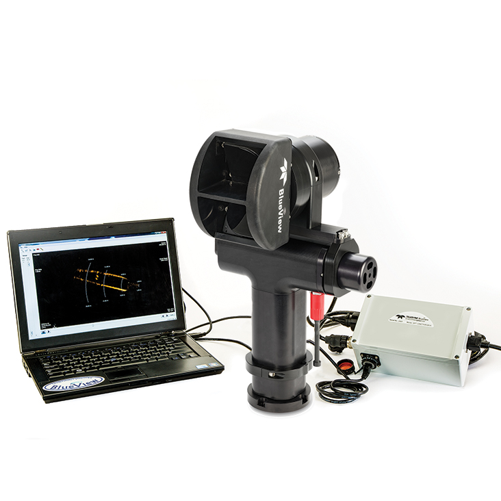
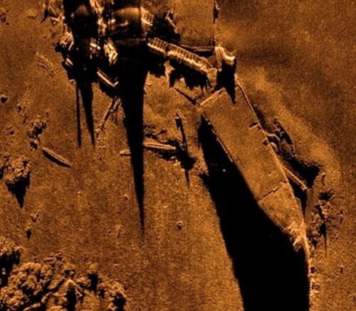
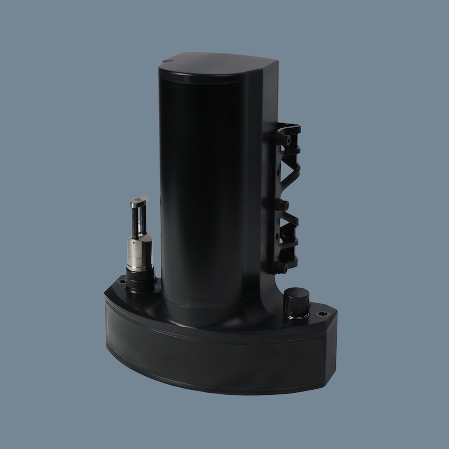
An advanced 3D multibeam scanning sonar for high-resolution underwater imaging
An advanced 3D multibeam scanning sonar for high-resolution underwater imaging
...ion underwater imaging for a range of commercial, defense, and research applications. Engineered for... ...Vs, diver-held systems, and tripod-mounted surveys, the sonar excels in underwater inspection,...
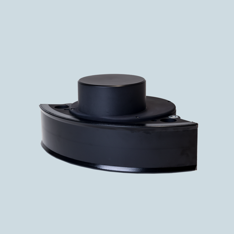
Shallow Water Multibeam Echosounders for Seabed Mapping
Shallow Water Multibeam Echosounders for Seabed Mapping
...powerful sonar system with a built-in Inertial Navigation System. Produces 1024 beams per ring and... ...... kHz, integrated IMU and GPS heading system, and integrated real-time SVP sensor, both...
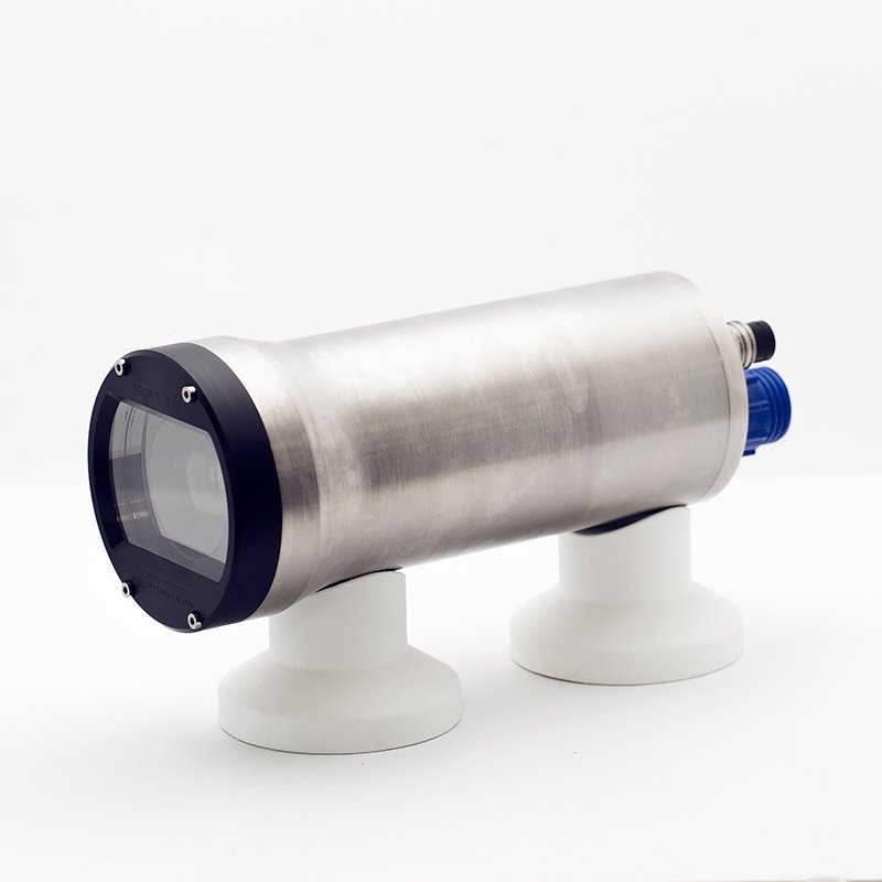
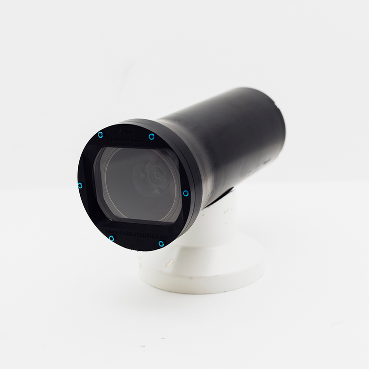
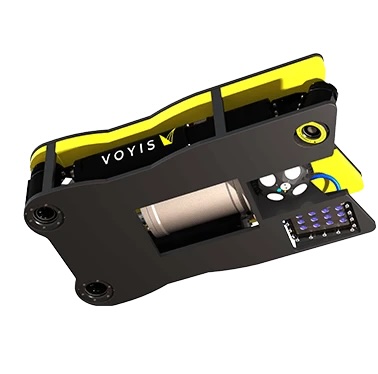
Ultra-deep subsea camera solution for oceanographic research and deep-sea exploration
Ultra-deep subsea camera solution for oceanographic research and deep-sea exploration
...ng-edge subsea camera designed to deliver exceptional imaging performance in the harshest underwater... ...e quality. The system’s plug-and-play design ensures rapid deployment in any operational...
Low-cost, high-performance camera solution for recording & viewing underwater surveys in real-time
Low-cost, high-performance camera solution for recording & viewing underwater surveys in real-time
...l 500m subsea camera delivers unparalleled underwater imaging, combining advanced real-time video... ...grated storage system eliminates the need for external data management devices, simplifying...
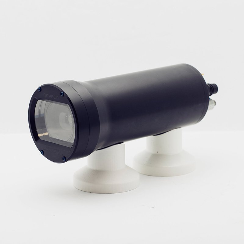
Compact and lightweight subsea camera designed for observation class ROVs
Compact and lightweight subsea camera designed for observation class ROVs
...yfin Micro ROV Camera is a cutting-edge subsea camera engineered to enhance the capabilities of... ......mpact, making it ideal for observation-class systems navigating confined or delicate...
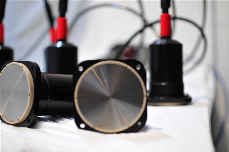
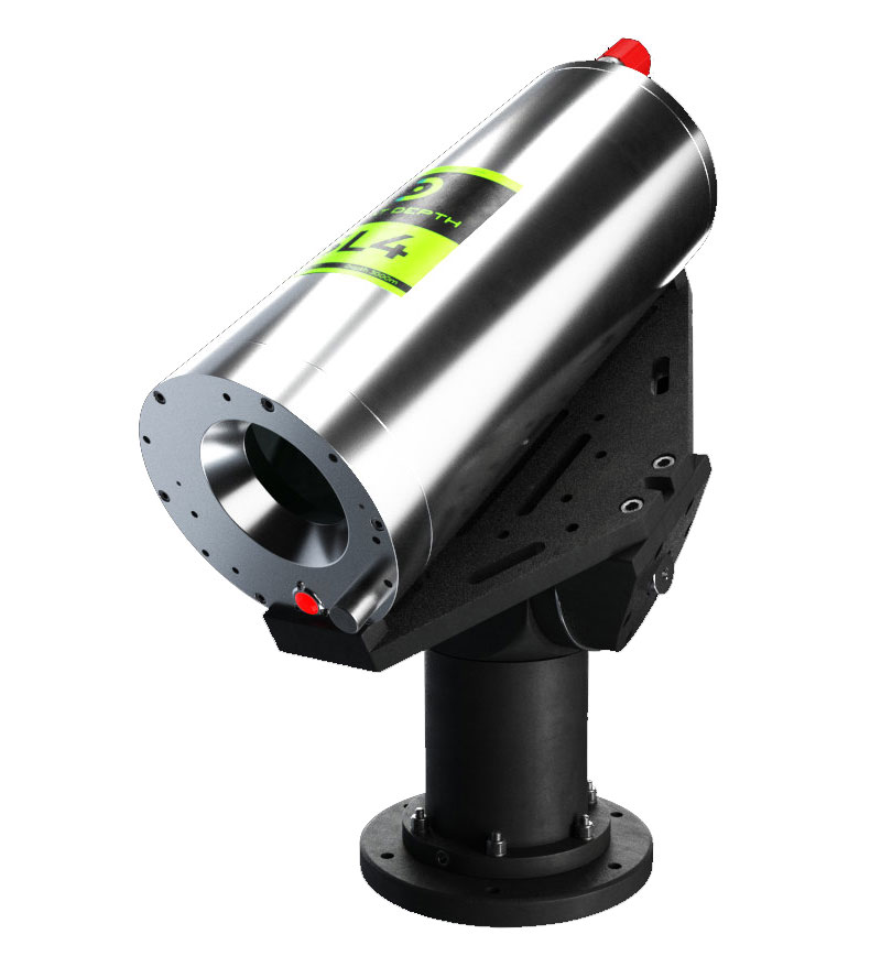
Customizable Ultra-High Resolution Multibeam Sonar System
Customizable Ultra-High Resolution Multibeam Sonar System
...ultibeam sonar system delivers flexible, ultra-compact, and modular performance for precise... ...NGHEAD® sonar system provides full frequency agility between 200 kHz and 700 kHz, generating 1024...
...on bathymetric system. The WBMS X series is designed to be configured to match users' survey needs.... ...ultibeam sonar system engineered for unparalleled high-resolution bathymetric data acquisition. This...
High Performance Wide Band Multibeam Sonars for Imaging
High Performance Wide Band Multibeam Sonars for Imaging
...igh-resolution imaging, obstacle detection, and seabed mapping in demanding marine environments.... ......ive acoustic processing to deliver superior imaging and mapping results. Notable features...
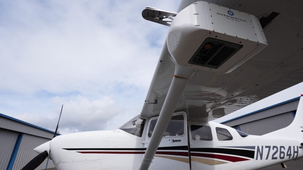
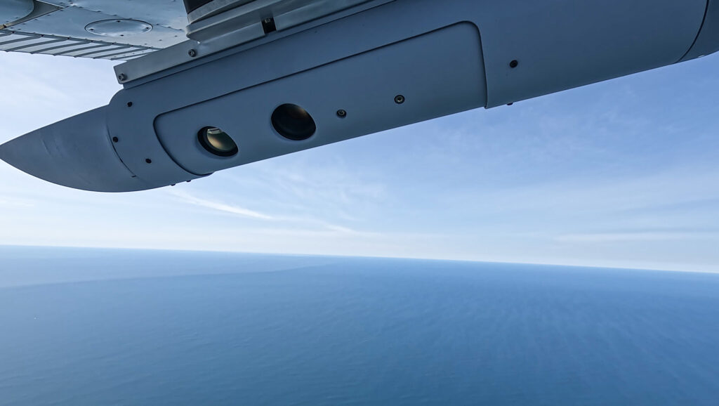
...pact, low-SWaP imaging payload engineered for rapid deployment across a broad range of UAS operating... ...ironments, the system provides persistent monitoring while enabling sensor cross-cueing using...
Versatile EO/IR smart sensor for wide-area day/night search
Versatile EO/IR smart sensor for wide-area day/night search
...tile day-night imagingsystem optimized for automated, wide-area search, object detection, and... ..., enabling the system to share detection location data in real time and rapidly focus collaborative...
Cameras and marine imaging systems are fundamental tools driving modern ocean science and marine engineering. Whether observing shallow coastal ecosystems or documenting the deepest abyssal trenches, high-quality visual data remains the primary method for observation, documentation, and verification in the subsea domain.
Significant advances in optical design, digital imaging sensors, and data processing have transformed the capabilities of subsea camera technology. These systems now move far beyond simple visual capture, enabling sophisticated functions like multispectral analysis, precise subsea 3D imaging, and automated object recognition, often performing reliably under conditions once thought optically impossible.
These imaging payloads are now integrated across an array of platforms, including remotely operated vehicles (ROVs), autonomous underwater vehicles (AUVs), surface vessels, and fixed observatories. Depending on the mission, the camera systems may be modular science packages, part of inspection-class ROV skids, or compact, rugged housing units designed for long-duration deployments.
The Critical Role of Subsea Imaging
High-resolution subsea imaging provides essential visual documentation of seafloor habitats, infrastructure, and dynamic ocean processes. In research, cameras are vital for capturing biological behaviour, mapping sediment transport, and assessing coral reef health. For commercial and industrial sectors, these systems are indispensable in offshore energy, subsea cable inspection, and the verification of marine construction.
Real-time video is crucial for immediate decision-making during operations, while comprehensive time-lapse and survey imagery build historical visual records for change detection and environmental assessment. Increasingly, imaging data forms a critical layer of a multimodal dataset, fused with sonar, LiDAR, and positioning information to generate spatially accurate 3D reconstructions and digital twins of complex subsea environments.
Overcoming the Unique Challenges of the Underwater Environment
Marine imaging is inherently constrained by the physics of the water column. Light attenuation drastically limits the effective visual range, particularly in turbid or deep water where red wavelengths are quickly absorbed. Scattering, caused by suspended particles, introduces backscatter noise and significantly reduces image contrast and clarity. Furthermore, motion from strong currents, dynamic vehicle movements, and tether oscillation complicates the process of achieving image stability.
Engineers must also contend with the brutal reality of the marine environment. Mechanical and optical components must be designed to resist immense high pressure, relentless corrosion, and aggressive biofouling. Designing a camera system for reliable operation at depth demands a specialized engineering approach: careful material selection, robust sealing, and a guarantee of stable optical performance across prolonged durations under significant pressure and temperature gradients. These critical engineering decisions ensure consistently high-quality imaging across the diverse conditions of the global ocean.
Key Types of Marine and Subsea Camera Systems
1. High-Definition and Ultra-HD Video Cameras
Modern high-definition (HD, 4K, and increasingly 8K) underwater video cameras provide continuous, low-latency visual feedback for ROV/AUV pilots, divers, and vessel-based monitoring. These systems rely on robust housings, typically machined from materials like titanium, hard-anodized aluminum, or high-strength engineering polymers (such as PEEK), to protect sensitive electronics at depths potentially exceeding 6,000 meters.
These cameras seamlessly integrate with vehicle telemetry, often streaming live video over low-latency Ethernet or fiber-optic links. Sophisticated adaptive gain control and wide dynamic range sensors are essential features, helping to maintain visual clarity despite rapidly fluctuating lighting conditions in the water column.
2. Precision Still Imaging Cameras
Still imaging systems are critical for scientific and survey applications that demand precise spatial documentation and quantitative analysis. High-resolution CMOS sensors (which have largely replaced older CCD technology due to superior power efficiency and integrated processing) enable high-fidelity photogrammetry for seafloor mapping, benthic habitat analysis, and archaeological site recording. Long-term studies frequently deploy autonomous time-lapse still cameras, powered by internal batteries and sophisticated data loggers, to monitor ecological changes or sediment transport over months or years.
These systems prioritize optical precision, accurate color calibration, and low-noise operation. When paired with synchronized and calibrated lighting, still imagery can yield quantitative data, allowing scientists to calculate organism density, structural complexity, and growth rates.
3. Low-Light and Deep-Sea Cameras
Deep-sea imaging requires extreme light sensitivity to visualize faint bioluminescence and low-contrast features thousands of meters below the photic zone. These systems often utilize Electron-Multiplying CMOS/CCD (EMCCD/EMCMOS) sensors. To minimize disturbance to marine life, these cameras are typically combined with specialized, synchronized LED or strobe systems that momentarily illuminate the scene.
The pressure housings are rated to full ocean depth (FOD). For high-precision applications, the optical windows are often made of fused silica (favored for its exceptional optical homogeneity and low thermal expansion) or sapphire (chosen for superior hardness and scratch resistance) to maintain both mechanical strength and transmission integrity under immense pressure.
4. Multispectral and Hyperspectral Imaging
These systems extend observation capabilities beyond the human visual range by capturing reflectance data across discrete wavelength bands. Underwater multispectral and hyperspectral imaging is used for advanced applications like coral reef health monitoring, sediment classification, and identifying potential mineral compositions on the seabed.
Correcting for the wavelength-dependent absorption and scattering of water is paramount. This is achieved through the use of onboard calibration targets and complex real-time compensation algorithms. Systems mounted on AUVs enable wide-area habitat mapping and the detection of algal blooms, making them vital tools in environmental monitoring and resource assessment.
5. 3D and Stereo Vision Systems (Subsea 3D Imaging)
Stereo and structured-light cameras are the workhorses of subsea 3D imaging, providing accurate three-dimensional models of underwater objects and environments. By capturing synchronized images from offset perspectives, stereo systems calculate the necessary depth information for metrology (precise measurement), volume estimation, and automated object recognition.
These systems are now routine in pipeline inspection, detailed archaeological documentation, and high-resolution habitat mapping. Structured-light approaches project known light patterns onto a scene to enhance measurement precision in close quarters. While they are a newer technology, time-of-flight (ToF) systems are emerging for certain autonomous, close-range operations, though their use is often constrained by high power consumption and the negative impact of backscatter compared to passive stereo systems over longer ranges. Advanced reconstruction software fuses the camera data with navigation and sonar inputs to produce spatially referenced, high-integrity models suitable for rigorous engineering analysis.
Imaging System Components and Integration
Optics, Housings, and Coatings
A camera system’s performance starts with its optical design. Lens materials, such as high-quality fused silica or acrylic, are selected for their refractive stability and transmission properties. To maintain image quality and resist environmental degradation, lens ports utilize anti-reflective coatings to minimize glare and hydrophobic/oleophobic coatings to repel water droplets, oils, and fingerprints, which are common issues during launch and recovery.
Camera housings must carefully balance strength, weight, and corrosion resistance. Titanium and hard-anodized aluminum remain the standard for deep-rated systems. The choice between dome and flat port geometries is critical, as it influences the system’s field of view and optical distortion; dome ports are generally preferred for wide-angle imaging and accurate photogrammetry. Depth ratings and sealing systems must be thoroughly validated through hydrostatic testing and comprehensive pressure cycling.
Software and AI-Driven Image Processing
Software is the engine that unlocks much of a modern imaging system’s analytical capability. Real-time image processing algorithms are employed to dramatically enhance visibility through techniques like dehazing, contrast equalization, and motion compensation. Furthermore, AI and machine learning models are increasingly used to automate the identification of marine species, corrosion defects, or foreign objects, dramatically accelerating the data review process and boosting consistency.
Data fusion techniques integrate imaging outputs with inputs from sonar, LiDAR, and precision navigation systems, creating comprehensive, spatially accurate datasets. These fused datasets are essential for creating digital twin models of complex subsea assets, generating automated inspection reports, and establishing reliable, long-term environmental baselines.
Applications of Marine Imaging Systems
Subsea Infrastructure Inspection and Integrity Management
Imaging systems are integral to monitoring the condition of critical subsea infrastructure. They provide the necessary visual evidence for monitoring the condition of pipelines, risers, moorings, subsea connectors, and offshore foundations. High-definition video, coupled with quantitative subsea 3D imaging, enables the early and reliable detection of damage, stress fractures, corrosion, and biological fouling. Crucially, this advanced capability significantly reduces inspection time, optimizes maintenance planning, and provides a certifiable visual record for regulatory compliance in the offshore energy and utilities sectors.
Marine Biology and Ecological Monitoring
Marine imaging is an indispensable tool for documenting species distribution, behavioral ecology, and fine-scale habitat structure. Stereo video systems provide the metrology needed to accurately quantify fish populations and size distributions, while autonomous time-lapse cameras capture the temporal dynamics of growth, succession, and decay within benthic communities. Extending this capability, multispectral imaging systems enable advanced analysis of water quality, coral bleaching severity, algal blooms, and the overall health of submerged vegetation, pushing ecological monitoring beyond simple visual observation and into quantitative assessment.
Deep-Sea Exploration and Geological Mapping
For deep-sea research, imaging supports geological and geophysical investigations, covering everything from the documentation of active hydrothermal vents to the detailed mapping of mineral deposits like manganese nodules. When integrated into AUVs, high-resolution camera systems capture vast, georeferenced visual mosaics of the seafloor. This true-color visual data is a vital supplement to coarse, sonar-derived bathymetry, offering scientists a detailed, non-acoustic means of characterizing seafloor composition and features across the deep ocean.
Archaeological Site Documentation
Underwater archaeologists rely heavily on high-fidelity imaging systems to document cultural heritage sites precisely and non-destructively. Utilizing photogrammetric imaging, often enhanced by stereo and 3D imaging techniques, allows for the accurate reconstruction of artifacts and complex site geometry. This process facilitates the precise digital preservation of wrecks, structures, and artifacts, enabling detailed study without the need for physical contact or removal.
Pollution Monitoring and Environmental Compliance
Finally, marine imaging plays a critical role in environmental oversight. It provides indisputable visual records for pollution tracking by clearly visualizing debris fields (including plastics), chemical plumes, and localized sediment resuspension events. These visual datasets are essential components in regulatory environmental compliance reporting and inform crucial remediation and spill response planning across the offshore and maritime industries.
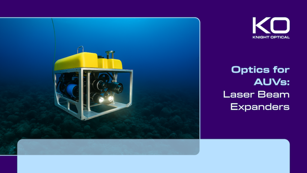
Knight Optical examines how beam expanders and pressure-resistant optical components help autonomous underwater vehicles maintain laser performance for mapping, inspection, navigation, and remote sensing in subsea environments
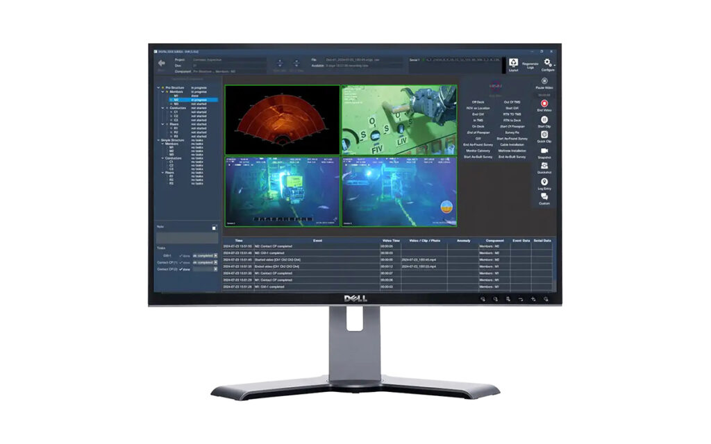
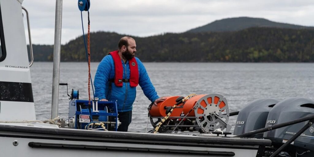
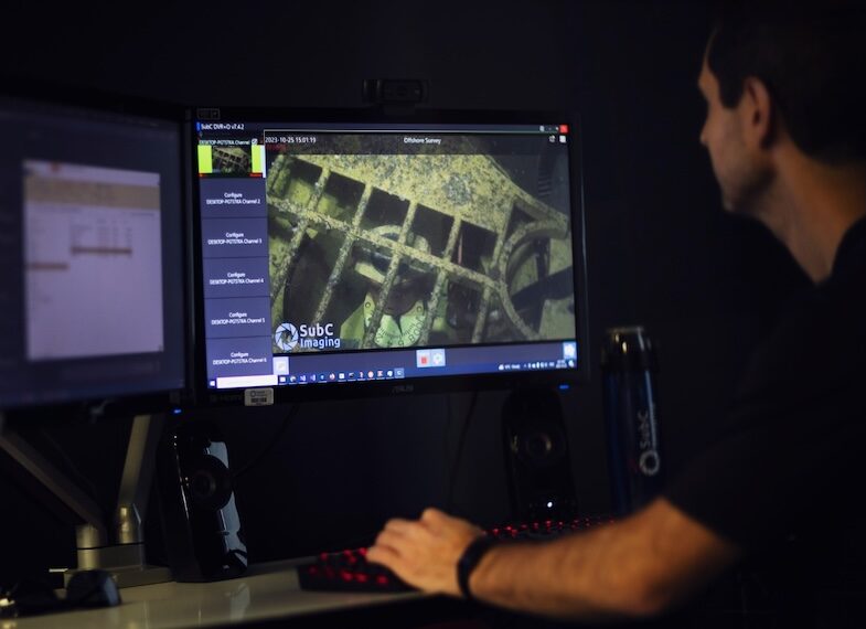
SubC Imaging examines how towed camera systems support repeatable large-area seabed surveys through integrated imaging, lighting, and synchronized metadata collection
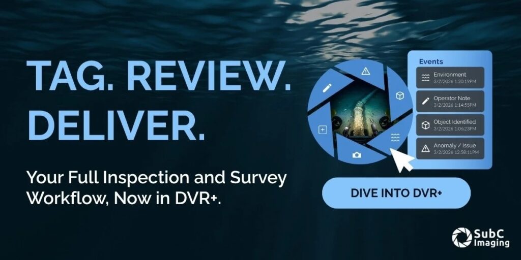
SubC Imaging has released new DVR+ software features that enable live event tagging, post-dive review, and structured export of subsea survey and inspection data
Sightline Intelligence has been acquired by Acron Technologies, adding edge AI, real-time video processing, and target recognition capabilities to support ISR and autonomous platform operations
SubC Imaging examines the key factors influencing subsea video latency, outlining how delays affect offshore operations and how real-time streaming performance can be optimized
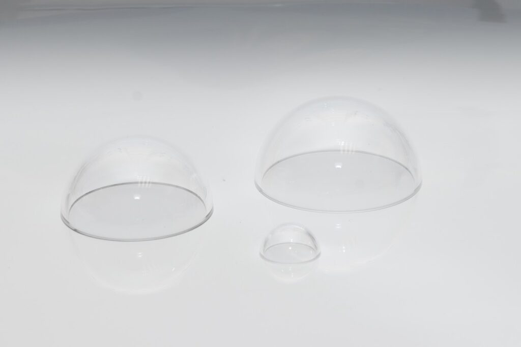
Knight Optical outlines the differences between optical domes and optical windows, detailing how factors such as pressure resistance, field of view, and optical performance influence their suitability for subsea and other demanding applications
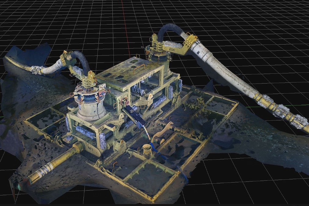
DeepOcean and Woodside Energy have completed a simultaneous subsea inspection and 3D scanning campaign across 69 structures at the Sangomar Field offshore Senegal, reducing offshore time while increasing data output
As marine science missions grow in complexity, SubC Imaging examines how researchers are shifting toward versatile subsea imaging systems that offer selectable internal recording and real-time topside data streaming
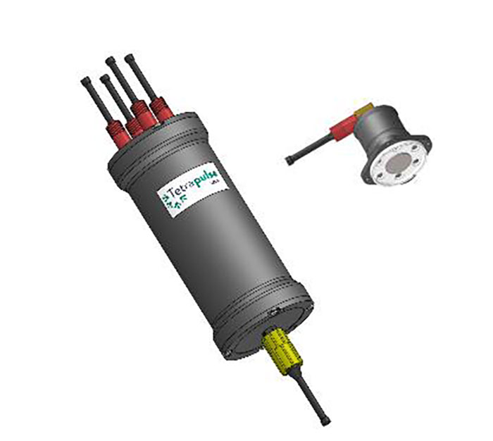
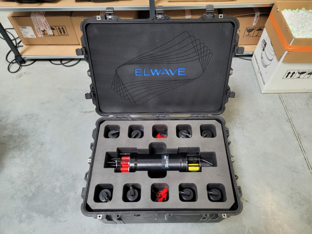
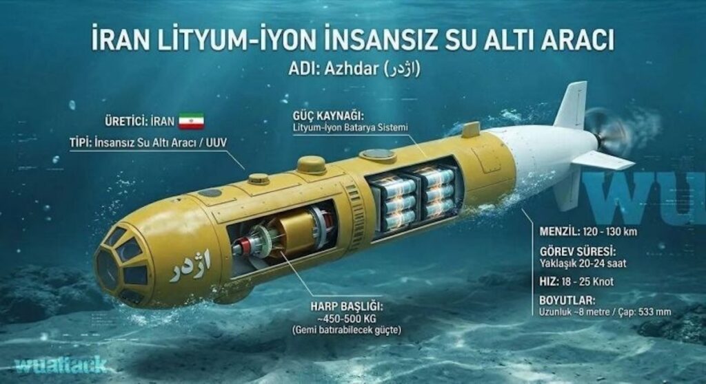
At Undersea Defense Technology, Elwave Sales Director Gary Bagot will address multi-physics sensing approaches for detecting low-signature underwater threats, supported by the company’s ESENSE electrometer