Integrated Aerial Imaging Solutions for UAV Data Acquisition and Processing
Source aerial imaging solutions manufacturers and suppliers delivering integrated hardware, software, and data processing systems for UAV-based mapping, environmental monitoring, and remote sensing applications.
If you design, build or supply Aerial Imaging Solutions, create a profile to showcase your capabilities and connect with visitors who have an active requirement for your solutions.
...pact, low-SWaP imaging payload engineered for rapid deployment across a broad range of UAS operating... ...rts autonomous data collection, onboard analysis, and real-time delivery of actionable intelligence,...
Integrated Aerial Imaging Solutions for UAV Data Acquisition and Processing
Overview by
Eleanor Widdows
Updated:
Aerial imaging solutions combine airborne platforms, imaging sensors, processing software, and analytics pipelines to enable scalable data acquisition across complex marine environments. These systems are deployed in survey operations that require high measurement accuracy under dynamic environmental conditions, such as offshore wind farms, coastal zones, and open-ocean monitoring areas.aeria
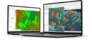
Unlike standalone aerial camera systems, aerial imaging solutions are defined by their integration of payloads, control systems, geospatial software, and data processing workflows. This enables end-to-end capability from image capture through to actionable outputs such as orthomosaics, 3D models, and classified geospatial datasets. These solutions are critical for organizations that require consistent data acquisition, repeatability, and integration with broader ocean monitoring and analytics frameworks.
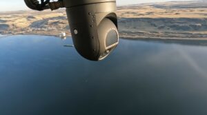
TK-8 Smart Sensor aerial multispectral imaging system by Overwatch Imaging
Applications of Aerial Imaging Solutions
Coastal Monitoring
Aerial imaging solutions support shoreline mapping, shoreline analysis, and coastal monitoring by delivering high-resolution geospatial data. These systems enable consistent data acquisition for erosion tracking and habitat assessment. Measurement accuracy is critical for long-term environmental monitoring programs.
Offshore Infrastructure Inspection
Used in offshore inspection and offshore infrastructure inspection, aerial imaging systems provide detailed visual and geospatial data of assets such as platforms and wind turbines. UAV imaging solutions reduce the need for manual inspection in hazardous marine environments. Data acquisition workflows support maintenance planning and asset lifecycle management.
Marine Habitat Mapping
Multispectral imaging solutions and hyperspectral imaging analysis enable the classification of seabed and coastal ecosystems. Aerial survey solutions deliver high-resolution datasets for biodiversity monitoring and environmental impact assessments. These systems are optimized for survey operations in sensitive marine environments.
Disaster Response and Emergency Mapping
Aerial imaging solutions are deployed in disaster response and emergency response mapping to rapidly capture affected coastal and offshore areas. Drone mapping solutions provide near-real-time aerial data processing for situational awareness. These capabilities are critical for response coordination and damage assessment.
Maritime Surveillance
Integrated remote sensing solutions support maritime monitoring and maritime surveillance operations. Imaging sensors combined with AI-based analytics enable the detection and tracking of vessels and activities. These systems are designed for continuous data acquisition across wide marine environments.
Types of Aerial Imaging Solutions
UAV-Based Imaging Systems
UAV platforms equipped with imaging sensors and GNSS navigation systems provide flexible aerial survey solutions. These systems are widely used for coastal monitoring, offshore inspection, and aerial mapping solutions. Integration with flight control systems ensures stable and repeatable data acquisition.
Integrated Imaging and Analytics Platforms
These solutions combine aerial data processing, geospatial analytics platforms, and cloud-based infrastructure. They support full workflows from data acquisition to aerial data analytics and reporting. Integration with digital twin platforms enables advanced visualization and modeling.
Real-Time Imaging Solutions
Edge-enabled systems with onboard processing pipelines and data transmission systems enable real-time aerial analytics. These solutions are used in time-sensitive applications such as disaster response and maritime monitoring. Edge computing modules reduce latency and bandwidth requirements.
Hyperspectral and Multispectral Imaging Solutions
Advanced imaging systems using hyperspectral sensors and multispectral sensors enable detailed environmental analysis. These solutions support applications such as precision agriculture imaging and marine habitat mapping. Measurement accuracy and spectral resolution are key performance factors.
Components and Subsystems
UAV Platforms and Flight Systems
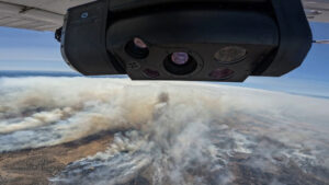
TK-7 Aerial Imaging Solution for Mapping and ISR by Overwatch Imaging
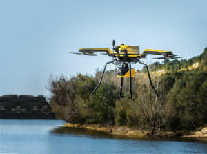
Fixed-wing, rotary, and hybrid UAV platforms are selected based on endurance, coverage area, and deployment constraints. Flight control systems, navigation systems, GNSS modules, and telemetry systems support precise navigation and positioning across coastal monitoring and offshore inspection missions. These platforms enable repeatable survey operations and efficient coverage of large marine environments.
Imaging Sensors and Payload Integration
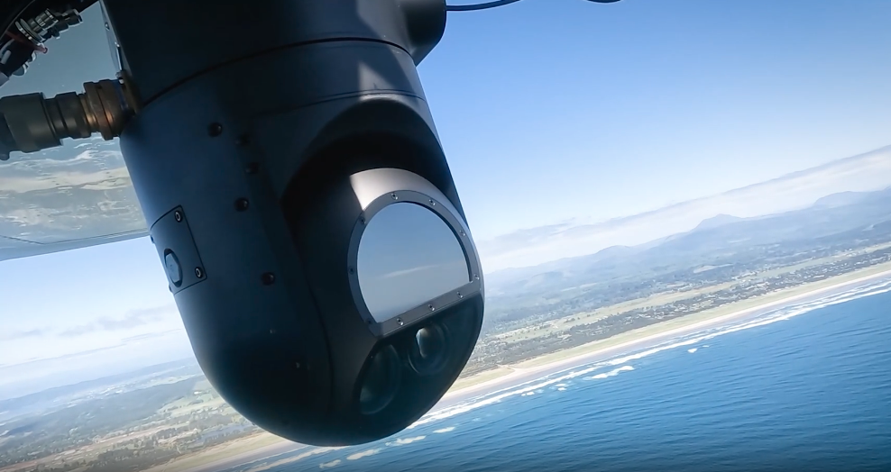
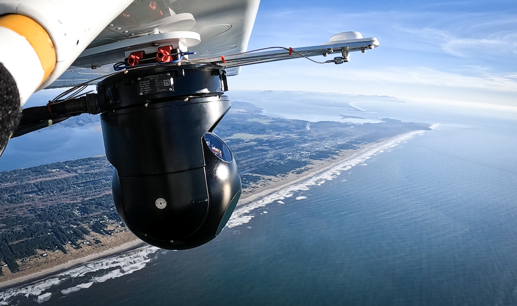
Aerial imaging systems incorporate optical, LiDAR, hyperspectral, and multispectral sensors, depending on survey requirements. Payload selection is driven by environmental conditions, altitude constraints, and required measurement accuracy. Integration with gimbal systems and onboard storage ensures stable data acquisition in maritime monitoring and offshore inspection scenarios.
Imaging Software and Data Processing
Aerial imaging solutions rely on photogrammetry, mapping, and image processing software to convert raw data into usable outputs. Orthomosaic generation, LiDAR data processing, and aerial image analysis workflows are optimized for marine habitat mapping, shoreline analysis, and infrastructure inspection. Data processing software ensures consistent outputs aligned with survey specifications and regulatory requirements.
AI and Computer Vision Integration
Computer vision models, image classification algorithms, and object detection algorithms are integrated to automate aerial analytics. AI software and machine learning models support applications such as maritime surveillance, environmental monitoring, and asset inspection. These capabilities enhance data acquisition efficiency by reducing manual interpretation and enabling scalable aerial data analytics.
Data Infrastructure and Analytics Platforms
Aerial imaging solutions incorporate cloud storage systems, data pipelines, and analytics software to manage large geospatial datasets. Edge computing infrastructure and edge computing modules enable real-time processing in offshore environments with limited connectivity. Integration with dashboards, user interfaces, and API integrations supports operational decision-making and data distribution.
Communication and Control Systems
Ground control stations, communication modules, satellite communication systems, and data transmission systems ensure reliable operation in remote marine environments. Flight and mission planning software enable optimized survey operations under dynamic environmental conditions. These systems are essential for maintaining continuity of data acquisition in offshore and coastal deployments.
Integration Considerations
Successful deployment of aerial imaging solutions depends on system integration across UAV platforms, imaging sensors, and data processing pipelines. SWaP constraints influence payload selection and onboard storage capacity, particularly in long-endurance offshore missions. Compatibility with geospatial software, analytics platforms, and workflow automation systems is essential for scalable operations.
Navigation and positioning accuracy, driven by GNSS and GPS modules, directly impacts measurement accuracy and survey outcomes. Integration with mission planning software and flight planning software ensures efficient coverage and repeatability across survey operations.
Aerial imaging solutions continue to evolve with advances in edge computing infrastructure, AI-based analytics, and sensor technologies. These developments are enabling higher resolution data acquisition, faster processing pipelines, and improved operational efficiency in complex marine environments.
Standards and Compliance
Aerial imaging solutions used in ocean science and offshore applications must align with relevant standards to ensure data quality and interoperability. ISO standards for geospatial data processing and environmental monitoring guide measurement accuracy and data consistency. UAV operations may align with aviation authority regulations governing navigation, telemetry, and communication systems.
Data handling and storage systems must comply with data integrity and security requirements, particularly when integrated with cloud storage and APIs. Survey operations often require adherence to industry-specific frameworks to ensure reliable data acquisition across marine environments.
Blue Marble Geographics details satellite-derived bathymetry integration in Global Mapper® for coastal and hydrographic mapping, featuring TCarta’s free global marine basemap and premium SDB datasets
Blue Marble Geographics’ Global Mapper enables Egis to streamline digital terrain modeling and hydrological analysis, enhancing data processing efficiency across large-scale environmental projects
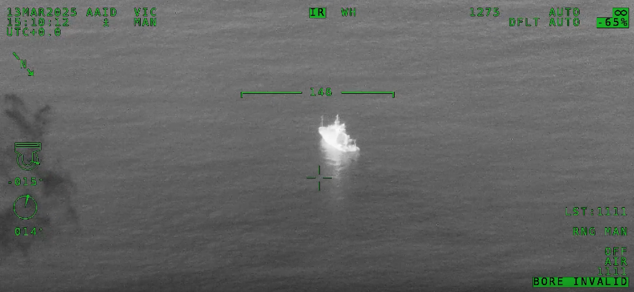
Overwatch Imaging's ASO software autonomously detected vessels over 100 nautical miles away, achieving 115,000 nm²/hour coverage using the L3Harris® WESCAM™ sensor from 40,000 feet at 400 knots
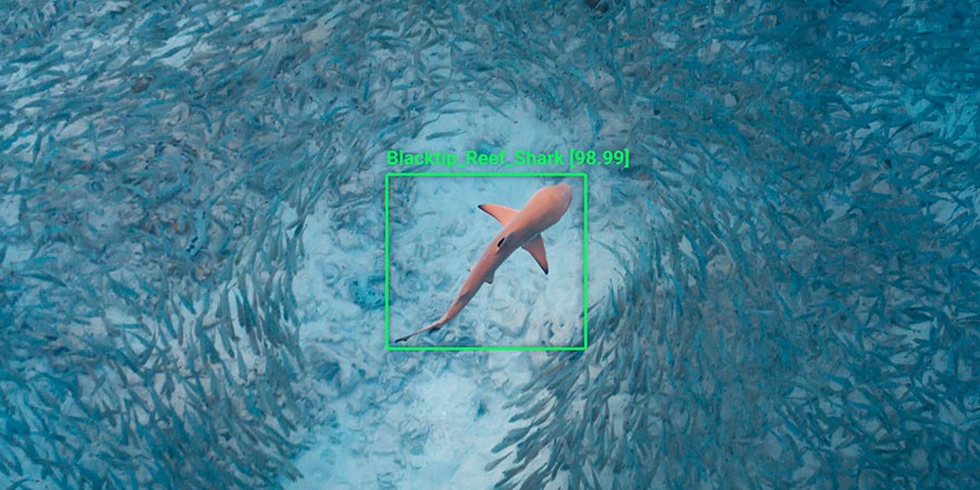
Neousys Technology’s FLYC-300 provides onboard AI computing for drones, supporting real-time video analytics used in shark detection and improving monitoring in challenging environments
Evolved Aerospace has selected Overwatch Imaging's PT-8 smart sensor for its M-200 UAS, providing the Royal Thai Navy with an advanced solution for autonomous maritime intelligence, surveillance, and reconnaissance
Overwatch Imaging has partnered with OST to showcase its artificial intelligence-powered wide-area imaging systems, designed for maritime surveillance and rescue operations
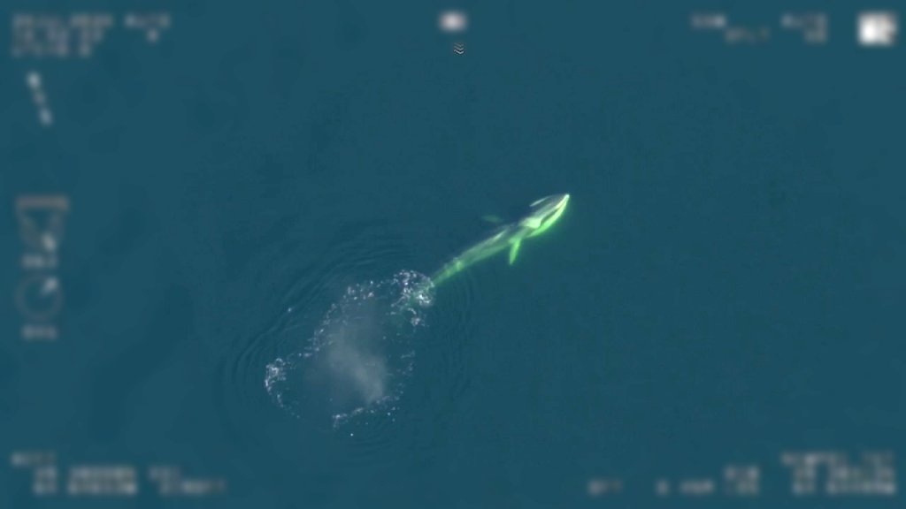
In a collaborative effort, Overwatch Imaging’s TK-7 sensor is being tested to detect endangered North Atlantic right whales in Canadian waters, helping marine authorities to reduce the risk of vessel strikes