Intelligence Surveillance and Reconnaissance (ISR)
Leading Global Suppliers
Maritime Intelligence, Surveillance, and Reconnaissance (ISR)
Intelligence, surveillance, and reconnaissance (ISR) play a pivotal role in modern defense strategies, integrating advanced technologies to enhance situational awareness and operational effectiveness. By leveraging maritime patrol aircraft, airborne ISR systems, and cutting-edge maritime surveillance techniques, ISR operations provide real-time aerial intelligence crucial for tactical decision-making and mission success. These systems deliver comprehensive insights through advanced maritime ISR capabilities, ensuring superior monitoring and analysis in dynamic environments.
If you design, build or supply Intelligence Surveillance and Reconnaissance (ISR), create a profile to showcase your capabilities and connect with visitors who have an active requirement for your solutions.
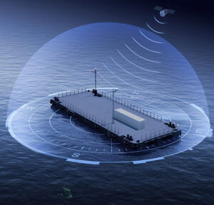
...engineered for maritime security and coastal defense, enabling uncrewed operation and persistent... ...systems extend maritime situational awareness and early warning capacities. The platform’s...
...S operating in maritime and coastal environments. Built around a roll-axis architecture similar to... ...ce, supporting maritime domain awareness, search and rescue, and rapid mapping missions. As a...
Maritime Intelligence, Surveillance, and Reconnaissance (ISR)
Overview by
Sarah Simpson
Updated:
Intelligence, surveillance, and reconnaissance (ISR) systems play a pivotal role in ensuring maritime security and supporting operations across military, governmental, and commercial sectors.
These systems leverage cutting-edge technologies to enhance situational awareness, detect and respond to potential threats, and collect critical data for decision-making processes.
From maritime patrol aircraft to airborne ISR platforms, the integration of advanced ISR systems has transformed the way maritime domains are monitored and secured.
The Role of Maritime Intelligence, Surveillance, and Reconnaissance
Maritime intelligence, surveillance, and reconnaissance encompasses a wide array of operations designed to gather, analyze, and disseminate information related to activities in marine environments.
This can include the detection of unauthorized vessel movements, identification of illegal activities, and monitoring of environmental changes.
The application of ISR systems for maritime domain awareness provides the capabilities for tracking and analyzing surface and subsurface activity.
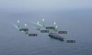
Modern maritime surveillance can combine radar, optical sensors, electronic intelligence systems, and real-time aerial intelligence to deliver comprehensive situational awareness.
This integration enables maritime ISR platforms to operate effectively across vast areas, covering open oceans, coastal regions, and strategic waterways.
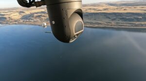
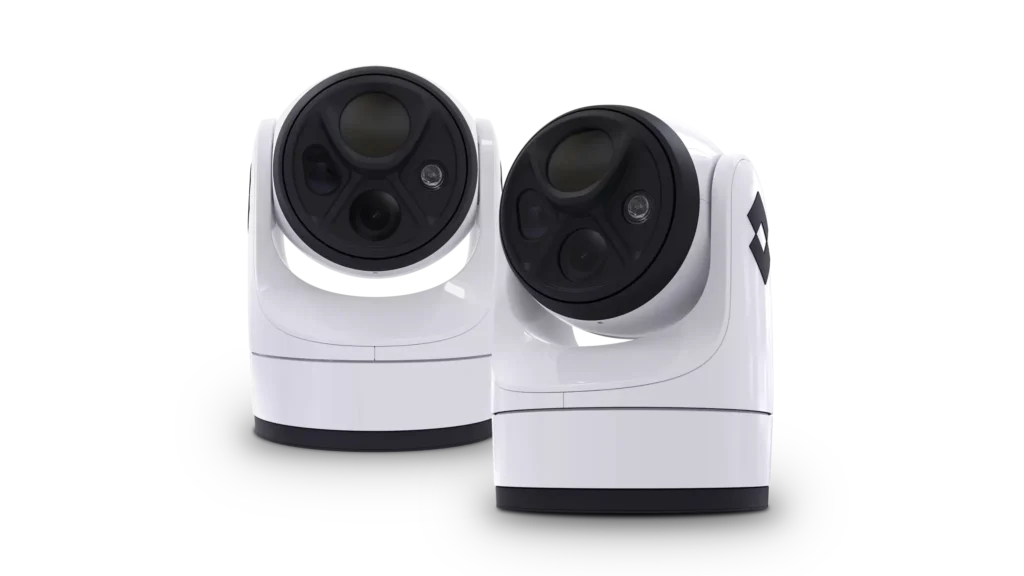
PT-8 Smart Sensor for Maritime ISR by Overwatch Imaging
Key Technologies in Maritime Surveillance
The success of maritime intelligence, surveillance, and reconnaissance efforts relies on a variety of advanced technologies.
Airborne ISR Platforms
Airborne ISR systems are typically integral to modern maritime ISR operations, offering unique advantages in range, speed, and flexibility. These systems often utilize fixed-wing aircraft, rotary-wing platforms, and unmanned aerial vehicles (UAVs) to conduct wide-area surveillance. Airborne maritime ISR platforms can be equipped with sophisticated sensors, including:
Synthetic aperture radar (SAR): Capable of detecting objects through clouds and darkness, SAR can enable continuous monitoring in all weather conditions.
Electro-optical and infrared (EO/IR) sensors: These sensors provide high-resolution imaging for identifying and tracking surface targets.
Signals intelligence (SIGINT): SIGINT systems capture and analyze electronic emissions, enhancing the ability to identify and monitor potential threats.
Maritime Patrol Aircraft
Maritime patrol aircraft serve as critical components of intelligence, surveillance, and reconnaissance efforts. These specialized aircraft can perform a range of tasks, including anti-submarine warfare, search and rescue, and maritime surveillance. Equipped with ISR systems, maritime patrol aircraft are capable of extended operations over water, delivering actionable intelligence in real time.
The integration of real-time aerial intelligence capabilities into maritime patrol aircraft can ensure that information collected during missions is rapidly processed and distributed to decision-makers, reducing response times and improving mission outcomes.
The Integration of ISR Systems
The effectiveness of maritime ISR operations often depends on the seamless integration of ISR systems across platforms and domains. This can include the use of advanced data fusion technologies to combine inputs from multiple sensors, enabling comprehensive analysis and visualization of maritime activity. Key aspects of system integration include:
Multi-platform interoperability: Ensuring that data from maritime patrol aircraft, UAVs, and surface vessels can be shared and analyzed within a unified framework.
Real-time data transmission: Leveraging secure communication networks to provide continuous updates to command centers and operational units.
Artificial intelligence and machine learning: Enhancing the ability to process and interpret large volumes of data, identifying patterns and anomalies that may indicate potential threats.
Applications of Maritime ISR Technologies
Maritime intelligence, surveillance, and reconnaissance is employed in a diverse range of applications.
Border Security
Maritime border security plays a critical role in maintaining national sovereignty and safety. Advanced technologies can enable the continuous monitoring of maritime boundaries to detect and deter illegal activities such as unauthorized immigration, drug trafficking, and the smuggling of goods. With the integration of surveillance systems, including radar and military unmanned surface or aerial vehicles, authorities are able to respond rapidly to potential threats and enhance the protection of coastal areas.
Environmental Monitoring
Monitoring oceanic and marine environments is essential for understanding and mitigating ecological challenges. Sophisticated tools can be employed to assess water quality, measure ocean temperature, and track changes in marine ecosystems caused by natural and human factors. This data supports conservation initiatives, aids in predicting environmental events like harmful algal blooms, and promotes the sustainable management of ocean resources.
Defense Operations
Maritime defense operations rely heavily on actionable intelligence to ensure strategic and tactical superiority. Advanced systems, such as sonar arrays and autonomous platforms, can provide comprehensive situational awareness by identifying adversary vessels, submarines, and surface threats. This information is able to support a variety of missions, from patrols to complex naval maneuvers, enhancing overall security and operational effectiveness.
Search and Rescue
Search and rescue missions typically depend on precise detection and tracking technologies to locate and assist individuals in distress. Innovations like satellite-based communication systems, high-resolution imaging, and autonomous vehicles can allow rescue teams to cover vast areas of open water with greater efficiency. These capabilities significantly improve the speed and accuracy of response efforts, saving lives in critical situations.
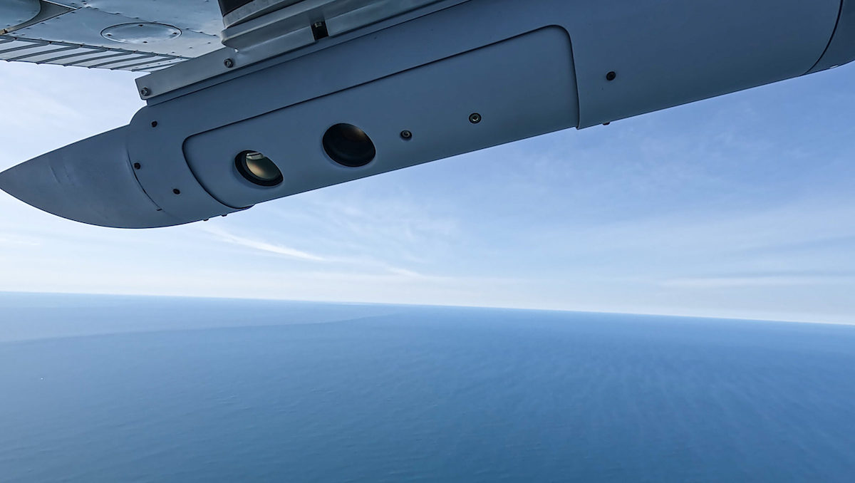
PT-6 Smart Sensor for Maritime ISR by Overwatch Imaging
Future Trends in Maritime ISR
The field of maritime intelligence, surveillance, and reconnaissance continues to evolve, driven by advancements in technology and the growing complexity of maritime challenges. Emerging trends include:
Increased use of unmanned systems: UAVs and autonomous underwater vehicles (AUVs) are expected to play larger roles in maritime ISR operations, providing persistent surveillance and reducing risks to personnel.
Enhanced sensor capabilities: Next-generation sensors are set to deliver greater resolution, range, and accuracy, improving the detection and identification of targets.
Integration of satellite-based systems: Satellite technologies will reportedly complement traditional maritime surveillance methods, offering global coverage and real-time data transmissions
Advanced Solutions for Maritime ISR
The evolving landscape of maritime intelligence, surveillance, and reconnaissance has seen the adoption of cutting-edge technologies that elevate the capabilities of ISR platforms. These advancements enable more efficient data collection, processing, and dissemination for enhanced situational awareness in maritime operations.
Among these are wide-area imaging systems for maritime search and surveillance, which deliver high-resolution imagery and cover extensive areas, ensuring that critical zones are continuously monitored.
The Role of Image Recognition and AI-Powered Image Analysis
Image recognition and AI-powered image analysis are proving instrumental in maritime ISR. These technologies allow for rapid identification of vessels, potential threats, and environmental anomalies.
With the integration of computer vision software, operators can process vast amounts of imagery collected from maritime imaging sensors, uncovering insights that would be challenging to detect through manual analysis. This fusion of human expertise and automated tools improves the accuracy and speed of maritime intelligence.
Enhancing Naval Surveillance Through Multisensor Data Processing
Naval surveillance operations can rely heavily on multisensor data processing to consolidate inputs from diverse sensors. This approach ensures that maritime patrol missions have access to a unified operational picture.
For instance, aerial sensor fusion combines data from radar, EO/IR sensors, and SIGINT systems, offering a comprehensive view of maritime activities. This capability is particularly vital for maritime reconnaissance missions that cover expansive and strategically important regions.
Airborne ISR Platforms and Maritime Patrol Missions
Airborne ISR platforms play a crucial role in maritime intelligence surveillance and reconnaissance by providing high-performance airborne imaging solutions. These platforms, equipped with advanced sensors, can support reconnaissance and surveillance activities in real time.
The use of airborne ISR platforms has been particularly effective for maritime patrol and search-and-rescue missions, where real-time intelligence is essential for mission success.
Intelligence, Reconnaissance, and Surveillance for the Navy
Navy ISR operations are integral to maintaining maritime security and ensuring operational effectiveness. Intelligence, reconnaissance, and surveillance systems can provide critical support for tracking adversary movements and securing naval assets. These systems enable navy ISR missions to leverage advanced imaging capabilities, including drone image recognition, which is increasingly deployed for monitoring vast maritime regions.
Software-Forward Approaches for Airborne Imaging
Innovations in software-forward airborne imaging solutions have transformed the efficiency of ISR systems. These approaches often integrate AI and machine learning to streamline the processing of data collected during missions.
High-performance airborne imaging systems are now capable of delivering actionable insights in near-real time, supporting rapid decision-making processes during maritime intelligence surveillance and reconnaissance operations.
Addressing the Challenges of Maritime ISR
Marine ISR faces unique challenges due to the vastness of maritime environments and the dynamic nature of ocean conditions. However, maritime ISR solutions, including advanced reconnaissance tools and wide-area imaging systems for maritime search and surveillance, can address these complexities.
These technologies are pivotal in monitoring key maritime routes and responding effectively to security threats.
Future Developments in Maritime Intelligence and Reconnaissance
The future of maritime ISR lies in continued innovation and integration. Maritime intelligence surveillance and reconnaissance systems are set to benefit from advancements in maritime imaging sensors and AI-powered analytics.
The development of marine ISR tools is set to further enhance the capabilities of intelligence surveillance systems, ensuring more precise and comprehensive monitoring of maritime domains.
Frequently Asked Questions (FAQs)
What technologies are used in maritime ISR? Key technologies include synthetic aperture radar (SAR), electro-optical and infrared (EO/IR) sensors, signals intelligence (SIGINT), and integrated systems on airborne and maritime patrol platforms.
How do airborne ISR platforms enhance maritime security? Airborne ISR platforms can provide wide-area surveillance, real-time data collection, and rapid response capabilities, using advanced sensors to monitor and analyze surface and subsurface activity.
What are the applications of maritime ISR? Maritime ISR can be applied in border security, defense operations, environmental monitoring, and search and rescue missions, among other areas.
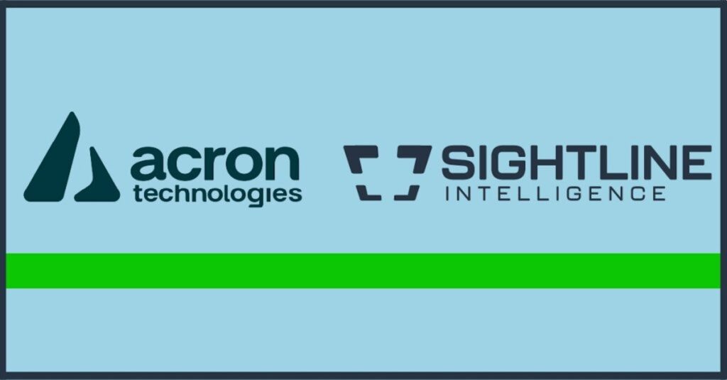
Sightline Intelligence has been acquired by Acron Technologies, adding edge AI, real-time video processing, and target recognition capabilities to support ISR and autonomous platform operations
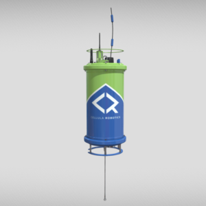
A Metron-led partnership with Cellula Robotics will deliver long-endurance, fuel cell-powered Guardian AUVs, enabling extended missions and payload deployment at range for enhanced maritime defence capability
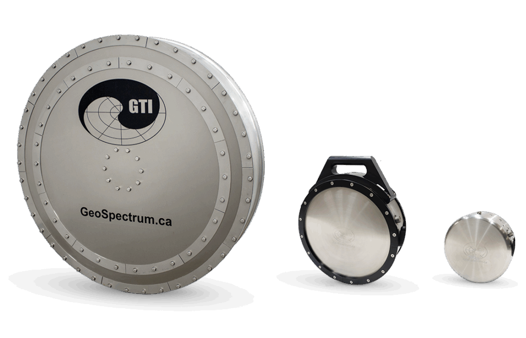
Dainis Nams from GeoSpectrum Technologies explores how acoustic monitoring technologies are being applied across the offshore wind lifecycle to support environmental assessment and compliance
Teledyne Marine has delivered the first four GAVIA AUV systems to Sweden under a multi-year agreement, enhancing underwater surveillance, mine countermeasures, seabed mapping and intelligence capabilities for the Swedish Armed Forces
Cellula Robotics selected for UK Maritime Defence program to strengthen Canada–UK collaboration and advance long-endurance autonomous underwater vehicle capabilities for allied subsea security missions
Cellula Robotics has been shortlisted for Vimy Forge Black Flight Cohort I, advancing within Canada’s defence accelerator program supporting emerging technologies for national security and military capability development
FLIR Marine has unveiled its M460 and M560 multi-spectral maritime cameras, combining AI target tracking, 4K imaging, and three-axis gyro stabilization for superior performance in professional marine operations
Defence iQ's Maritime ISR Conference, set for 28–29 October 2025 in London, bringing together defense leaders and UKHO experts to strengthen global ISR capabilities