Airborne maritime surveillance systems are aircraft-mounted sensor suites used to observe, map, and monitor coastal waters, offshore environments, and open-ocean areas. Systems may integrate visible-light and EO/IR cameras, multispectral or hyperspectral imagers, LiDAR, radar, and laser altimetry.
This category features manufacturers of airborne maritime surveillance systems, supporting coastal mapping, ecological surveys, and vessel monitoring operations.
If you design, build or supply Airborne Maritime Surveillance Systems, create a profile to showcase your capabilities and connect with visitors who have an active requirement for your solutions.
...S operating in maritime and coastal environments. Built around a roll-axis architecture similar to... ...ce, supporting maritime domain awareness, search and rescue, and rapid mapping missions. As a...
Versatile EO/IR smart sensor for wide-area day/night search
Versatile EO/IR smart sensor for wide-area day/night search
...lude wide-area maritimesurveillance, counter narcotics operations, illegal fishing interdiction,... ..., enabling the system to share detection location data in real time and rapidly focus collaborative...
The Complete Guide to Airborne Maritime Surveillance Systems
Overview by
William Mackenzie
Updated:
Introduction to Airborne Maritime Surveillance Systems
Airborne maritime surveillance systems use aircraft-mounted sensors to observe coastal waters, offshore environments, and the open ocean from above. They can collect high-resolution imagery, geospatial data, vessel information, and environmental measurements across areas that are difficult to survey from vessels or fixed stations. Applications include coastal surveillance, environmental assessment, marine habitat mapping, vessel observation, and hydrographic support.
Modern airborne observation can combine cameras, spectral sensors, LiDAR, radar, and tracking systems within a single aerial platform. The appropriate aerial data capture solutions depend on spatial resolution, survey altitude, environmental conditions, area coverage, target type, and the physical properties being measured.
Types of Airborne Maritime Surveillance Systems
Different sensors reveal different characteristics of marine and coastal environments. Optical cameras provide detailed visual imagery, while spectral, laser, radar, and electronic systems can detect properties or activity that conventional photography alone cannot show.
1. Aerial Imaging Systems
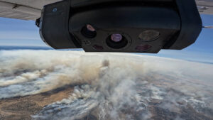
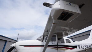
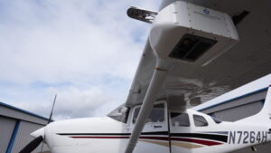
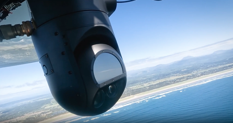
TK-8 Smart Sensor aerial multispectral imaging system by Overwatch Imaging
Aerial camera systems support many airborne maritime observation missions. They can provide photographs, stabilized video, thermal information, or spectral measurements. Common aerial imaging technology includes:
Visible-Light and High-Resolution Cameras: Capture detailed aerial imagery for coastal mapping, infrastructure inspection, wildlife surveys, and visual vessel identification.
Electro-Optical Imaging Systems: Electro-Optical/Infrared (EO/IR) systems combine stabilized cameras, zoom optics, and video capabilities for real-time or recorded observation from moving aircraft.
Infrared and Thermal Imaging: Detect temperature differences that can help identify vessels, wildlife, thermal discharges, and other surface features, including at night.
Multispectral Imaging: Records several defined wavelength bands to distinguish vegetation, sediments, shallow-water habitats, and variations in water properties.
Hyperspectral Imaging: Captures many narrow spectral bands for detailed characterization of materials, habitats, pollution, and selected water-quality indicators.
These aerial imaging solutions can be used individually or combined according to survey objectives.
2. Airborne LiDAR Systems
Airborne LiDAR systems use precisely timed laser pulses to measure distance between the aircraft and surfaces below. With accurate positioning and orientation data, these measurements can produce three-dimensional point clouds and elevation models. Two forms are particularly relevant:
Topographic LiDAR: Maps exposed terrain including beaches, dunes, cliffs, shorelines, floodplains, and coastal infrastructure.
Bathymetric LiDAR: Uses water-penetrating laser wavelengths to measure shallow-water depths and submerged features where water clarity, depth, and bottom reflectance allow.
LiDAR is particularly valuable when a maritime surveillance system needs elevation or depth information alongside conventional aerial imagery.
Radar and laser altimetry complement optical imaging by measuring characteristics that cameras do not directly record. Radar can also extend observation into darkness and many cloud conditions, while altimetry supports precise surface-height measurement. Relevant technologies include:
Synthetic Aperture Radar (SAR): Produces detailed radar imagery for observing ocean surfaces, coastlines, vessels, ice, and other features without relying on daylight. Some systems use Inverse Synthetic Aperture Radar (ISAR) to improve vessel characterization.
Passive Microwave and Radar-Based Observation: Uses microwave emissions or radar returns to examine properties such as surface roughness, waves, ice, moisture, and other ocean conditions.
Laser Altimetry and Specialized Optical Instruments: Measures surface elevation or defined environmental parameters using accurately timed laser or optical measurements.
Maritime surveillance aircraft may also carry surface-search radar, Automatic Identification System (AIS) receivers, and other mission sensors that correlate imagery with vessel identity, position, course, and speed.
Airborne Maritime Observation Platforms
Airborne sensor performance is closely linked to the aircraft carrying the payload. Platform selection affects altitude, endurance, payload capacity, coverage, logistics, and the types of aerial imagery solutions that can be accommodated.
Crewed Survey Aircraft: Carry larger payloads and multiple synchronized instruments for extensive coastal, offshore, and oceanographic surveys.
Unmanned Aerial Vehicles (UAVs): Provide flexible UAV imaging solutions for localized, high-resolution photography, thermal surveys, spectral imaging, and compact LiDAR missions.
Helicopters and Vertical Takeoff Platforms: Support low-speed observation, infrastructure inspection, and operations where fixed-wing aircraft may be impractical.
Long-Endurance Aerial Platforms: Increase time over remote or offshore areas and reduce transit time.
Matching the platform to the sensor package is important because payload weight, power demand, communications, and altitude can affect endurance and data quality.
Applications of Airborne Maritime Surveillance Systems
Coastal and Marine Mapping
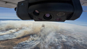
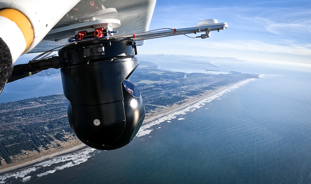
TK-7 Aerial Imaging Solution for Mapping and ISR by Overwatch Imaging
Airborne maritime surveillance systems can map shorelines, beaches, coastal landforms, shallow-water environments, and nearby infrastructure. High-resolution cameras document visible features, while LiDAR can provide elevation and bathymetric information. Repeated surveys can identify erosion, sediment movement, storm impacts, and other changes to coastal morphology.
Ocean Surface and Water-Quality Observation
Multispectral, hyperspectral, thermal, and radar sensors can reveal properties not apparent in standard photographs. Aerial surveys may investigate algal blooms, sediment plumes, surface temperature patterns, pollution events, and other water-quality or ocean-surface features. Sensor selection depends on whether the target is best distinguished by color, spectral response, temperature, surface roughness, or another measurable property.
Marine Ecology and Environmental Surveying
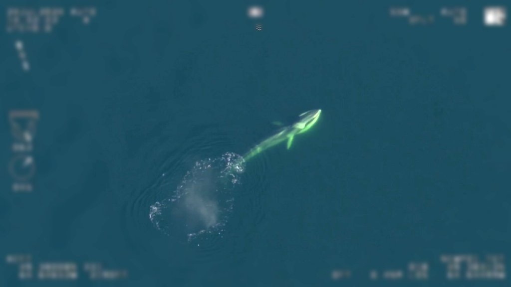
Aerial imaging systems provide a non-contact method for surveying marine mammals, seabirds, coastal vegetation, reefs, and other ecological features. High-resolution imagery can support counts and identification, while multispectral or hyperspectral data may distinguish habitats and vegetation types. Airborne surveys can also cover larger areas than many vessel-based observation methods.
Vessel and Maritime Activity Observation
Visible-light cameras, thermal imagers, EO/IR systems, radar, and AIS can support vessel detection, identification, tracking, and activity monitoring in coastal and offshore waters. A coastal surveillance system may document fishing activity, inspect offshore infrastructure, support search operations, or provide visual confirmation of vessel activity. Maritime surveillance aircraft can combine broad-area detection with higher-resolution imaging of selected targets.
Operational & Regulatory Considerations
Effective airborne maritime surveillance depends on both sensor performance and compliant aircraft operation. Survey planners should consider:
Airspace Requirements: Crewed and unmanned flights must comply with the aviation rules, operating permissions, and airspace restrictions applicable to the survey location.
Beyond Visual Line of Sight (BVLOS) Operations: Long-range UAV surveys may require additional authorization, communications capability, operating procedures, or detect-and-avoid provisions.
Environmental Conditions: Cloud, haze, sun glint, waves, sea state, water clarity, precipitation, and atmospheric conditions can affect optical, spectral, thermal, radar, and LiDAR observations.
Calibration and Validation: Quantitative measurements may require geometric or radiometric calibration, reference targets, or supporting in-situ observations.
Geospatial Interoperability: Accurate coordinates, timestamps, metadata, and compatible data formats help integrate airborne observations with satellite, vessel, buoy, and autonomous-system datasets.
Accounting for these factors improves data consistency and the usefulness of final survey products.
Developments in compact sensors, unmanned aircraft, communications, and onboard computing are expanding the capabilities of maritime surveillance systems used for ocean science, coastal monitoring, and operational surveillance. Areas of development include:
Compact Hyperspectral Imagers: Smaller imaging spectrometers are making detailed spectral observation practical on a wider range of UAV platforms.
Integrated Sensor Suites: Visible, thermal, spectral, LiDAR, radar, and vessel-tracking sensors can collect complementary datasets during a single flight.
Automated Image Analysis: Machine learning and AI software can assist with identifying vessels, wildlife, habitats, pollution, and environmental features across large volumes of aerial imagery.
Coordinated Observation: Airborne systems can contribute to monitoring programs that combine aircraft with satellites, research vessels, autonomous platforms, buoys, and fixed ocean sensors.
These developments expand airborne data collection while supporting broader, integrated marine monitoring networks.
Blue Marble Geographics details satellite-derived bathymetry integration in Global Mapper® for coastal and hydrographic mapping, featuring TCarta’s free global marine basemap and premium SDB datasets
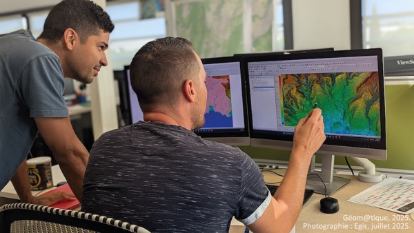
Blue Marble Geographics’ Global Mapper enables Egis to streamline digital terrain modeling and hydrological analysis, enhancing data processing efficiency across large-scale environmental projects
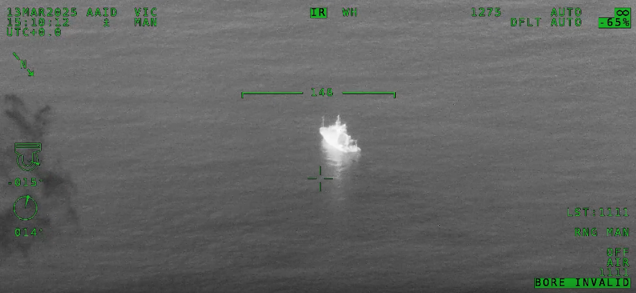
Overwatch Imaging's ASO software autonomously detected vessels over 100 nautical miles away, achieving 115,000 nm²/hour coverage using the L3Harris® WESCAM™ sensor from 40,000 feet at 400 knots
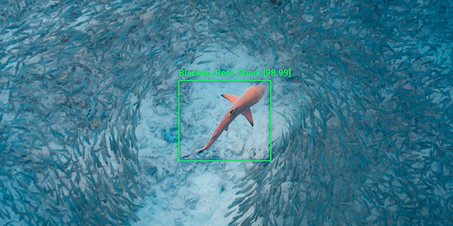
Neousys Technology’s FLYC-300 provides onboard AI computing for drones, supporting real-time video analytics used in shark detection and improving monitoring in challenging environments
Evolved Aerospace has selected Overwatch Imaging's PT-8 smart sensor for its M-200 UAS, providing the Royal Thai Navy with an advanced solution for autonomous maritime intelligence, surveillance, and reconnaissance
Overwatch Imaging has partnered with OST to showcase its artificial intelligence-powered wide-area imaging systems, designed for maritime surveillance and rescue operations
In a collaborative effort, Overwatch Imaging’s TK-7 sensor is being tested to detect endangered North Atlantic right whales in Canadian waters, helping marine authorities to reduce the risk of vessel strikes