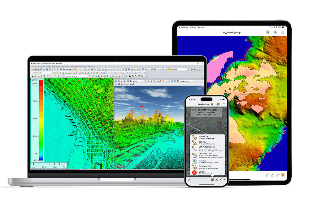
Blue Marble Geographics’ Global Mapper software has become a key tool for advanced digital terrain and hydrological modeling at Egis, where it supports both pre- and post-processing workflows for environmental and civil engineering projects.
Initially adopted over a decade ago to address limitations in file compatibility and data management, Global Mapper is now fully integrated into Egis’ hydrology and geomatics operations.
One of the early adopters at Egis first discovered Global Mapper in 2012 while seeking an effective way to handle incoming DWG/DXF plans and develop digital elevation models (DEMs).
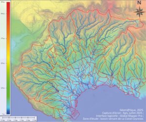
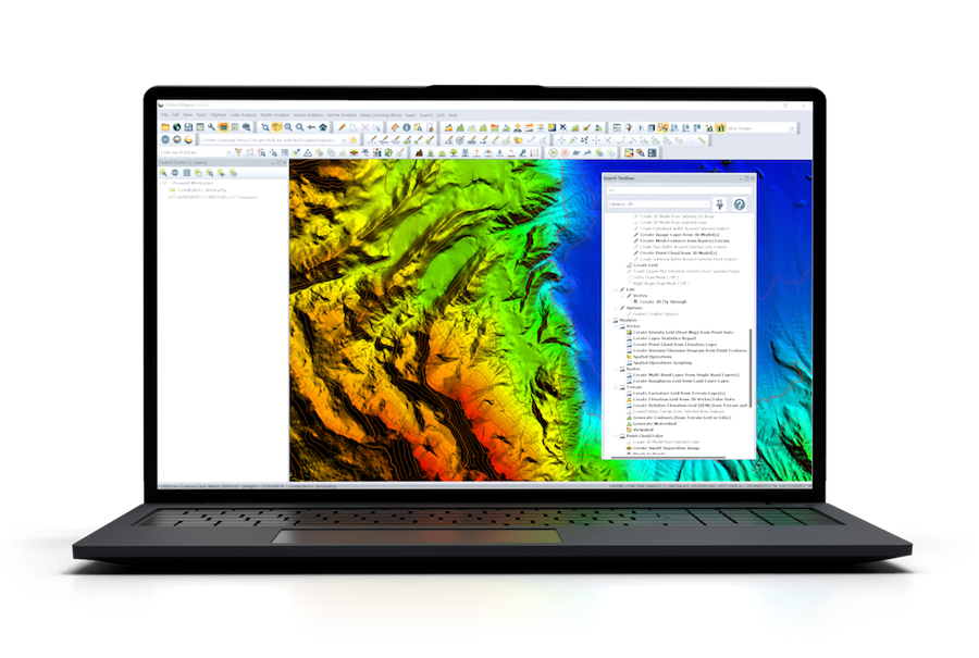
Watershed analysis
The software’s flexibility in opening a wide range of file types, including 3D and georeferenced PDFs, and its straightforward handling of projection systems immediately stood out.
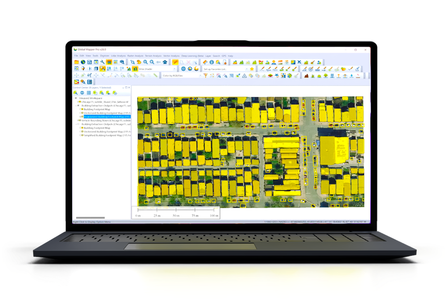
Over successive updates from version 12 to 26, Global Mapper has become an indispensable daily tool across the department. Its capabilities in point cloud management and high-volume data processing have proven especially valuable, allowing Egis teams to manage datasets that would otherwise be difficult to process using other GIS platforms.
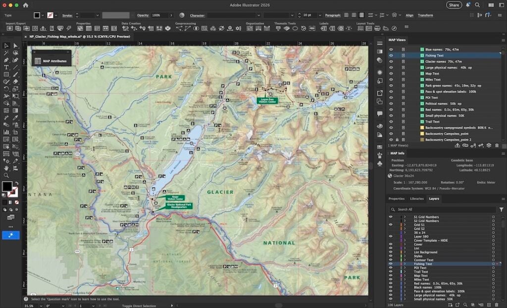
Global Mapper’s intuitive interface and performance have contributed to its widespread adoption throughout the organization. Egis maintains a combination of floating and single-user licenses, and usage metrics are regularly analyzed to ensure sufficient availability. Internal mini-tutorials developed by the team have further streamlined user onboarding, while the French-language interface has made the platform particularly accessible for new users.
Pre-Processing and Terrain Model Construction
At Egis, Global Mapper is primarily used in two stages: model preparation and analysis. During pre-processing, the objective is to generate accurate DEMs and 3D objects from diverse datasets. The team combines terrestrial topography, LiDAR point clouds, and existing elevation data, aligning them through 3D constraint lines to interpolate terrain surfaces. This process enables detailed reconstruction of riverine environments, including both topography and bathymetry for minor riverbeds, where LiDAR coverage is often limited.
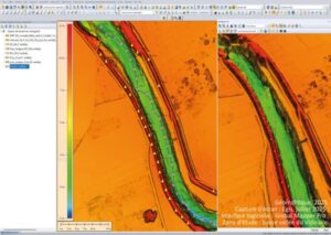
To define riverbanks, the team developed a sequence of operations that extract high points to delineate edges, producing accurate representations of features such as the banks of the Vidourle River. The same approach, applied in reverse with low points, allows for modeling of riverbeds. Once the banks are established, a central line or “skeleton” of the channel polygon is created, providing a consistent reference for hydrological modeling.
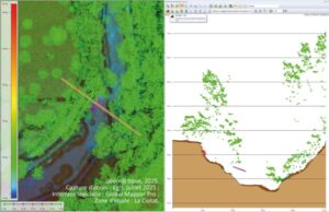
LiDAR and path profile
Watershed analysis tools within Global Mapper are also employed to delineate catchment areas, hydraulic flow paths, and ridgelines, essential elements in hydrological studies. The resulting datasets are then integrated into hydraulic modeling applications such as HEC-RAS.
Post-Processing and Model Analysis
Following model computation, Egis engineers use Global Mapper’s Compare/Combine Terrain Layers tool to evaluate project impacts by contrasting proposed and existing conditions. Derived grids representing flow velocities, water heights, and elevations are analyzed to assess hydraulic behavior. Data are exported as DXF point clouds or processed into longitudinal profiles using the Reduce/Divide by Specified Spacing function.
The integration with spreadsheet formats allows for seamless exchange between Global Mapper and HEC-RAS, where coordinates and elevations are managed in tabular form. Visualization and analytical features such as 3D rendering, slope statistics, and volume calculations are employed to quantify terrain changes, embankment volumes, and storage capacities of basins or dams. Tools like Trace Profile assist in examining elevation variations across multiple DEMs, while custom shaders standardize visual outputs across projects.
LiDAR Processing and Advanced Applications
Recent workflows at Egis have focused on processing high-density LiDAR datasets. The Trace Profile window enables visualization of classified point clouds, helping identify and correct misclassifications. Manual refinement is sometimes performed to accurately represent ground features such as retaining walls and banks where vegetation obscures returns.
Global Mapper’s intervisibility analysis tool has also been used to assess the visual impact of structures such as pylons, while 3D simulation capabilities allow for modeling of sea-level rise and coastal inundation scenarios. These tools support environmental impact assessments and resilience planning in coastal regions.
Core Tools for Hydrological Studies
Terrain analysis
Among the numerous functions within Global Mapper, the Combine/Compare Terrain Layers and Create Skeleton(s) tools are identified as central to Egis’ hydrological studies, enabling precise evaluation of topographic change and efficient delineation of watercourse centerlines. The ability to export results in KMZ format for visualization outside of Global Mapper further enhances communication of project findings.
Through its comprehensive toolset and performance in managing large, complex geospatial datasets, Blue Marble Geographics’ Global Mapper continues to serve as a critical platform for Egis’ terrain modeling, hydrological simulation, and impact assessment workflows.
Visit the Géomatique website to read the full article.