

Global Mapper Mobile is a cutting-edge iOS and Android application designed to support the seamless visualization, collection, and management of geospatial data in marine and coastal environments. Engineered for professionals in ocean science, this robust tool bridges the gap between the field and the desktop, offering unparalleled GIS capabilities directly on your mobile device.
Designed with marine researchers, coastal managers, and GIS specialists in mind, Global Mapper Mobile simplifies the complexities of fieldwork by integrating powerful geospatial tools into an intuitive mobile platform. Its compatibility with Global Mapper Desktop ensures a smooth transition from field data collection to desktop analysis, enabling comprehensive study of marine ecosystems and coastal dynamics.
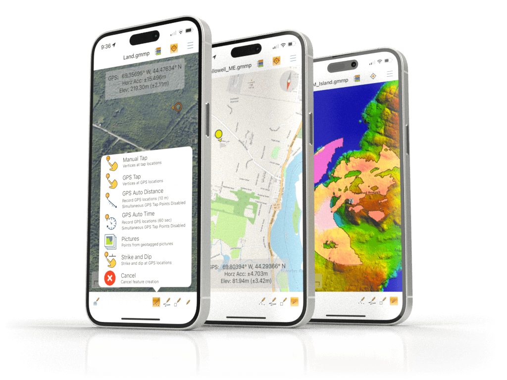
Key Features- Comprehensive Data Support: Effortlessly view vector, raster, and terrain datasets with advanced visualization options, including custom vector styling, raster transparency adjustments, and terrain hillshading to interpret complex landscapes.
- Simplified Layer Management: Intuitive tools for displaying and controlling layers, ensuring quick access to the precise data you need during field operations.
- GPS-Driven Location Services: Leverage your device’s GPS receiver for real-time positioning, enhancing the accuracy of navigation and data collection in dynamic marine environments.
- Offline Accessibility: Store maps locally on your device to ensure uninterrupted access to critical geospatial information, even in remote offshore locations without network connectivity.
- Form-Based Data Collection: Enabled through integration with Global Mapper Desktop, this feature streamlines the capture of detailed attribute information, ideal for environmental monitoring and habitat assessments.
- Advanced Digitizing Tools: Create, edit, and manage geospatial features directly in the app, including the ability to draw new features or digitize existing ones in the field.
- Photo-Enhanced Data Points: Capture geotagged photos or integrate field images into your datasets, creating a rich visual record to supplement spatial data.
- Attribute Management: View, edit, and search attribute data to facilitate in-depth analysis and decision-making during oceanographic studies or field surveys.
- Measurement and Analysis Tools: Measure horizontal distances on maps to support site planning, resource allocation, and project reporting.
- Online Data Streaming: Access OpenStreetMap data for supplemental contextual information, enhancing situational awareness during marine operations.
- Pixel-Level Raster Information: Extract pixel values from terrain models and imagery to support precise analysis, such as bathymetric studies or sediment profiling.
- Seamless Data Transfer: Utilize third-party cloud services like Google Drive and Dropbox for easy data sharing or leverage Global Mapper’s Mobile Data Management tool for wireless transfers directly to the desktop.


