


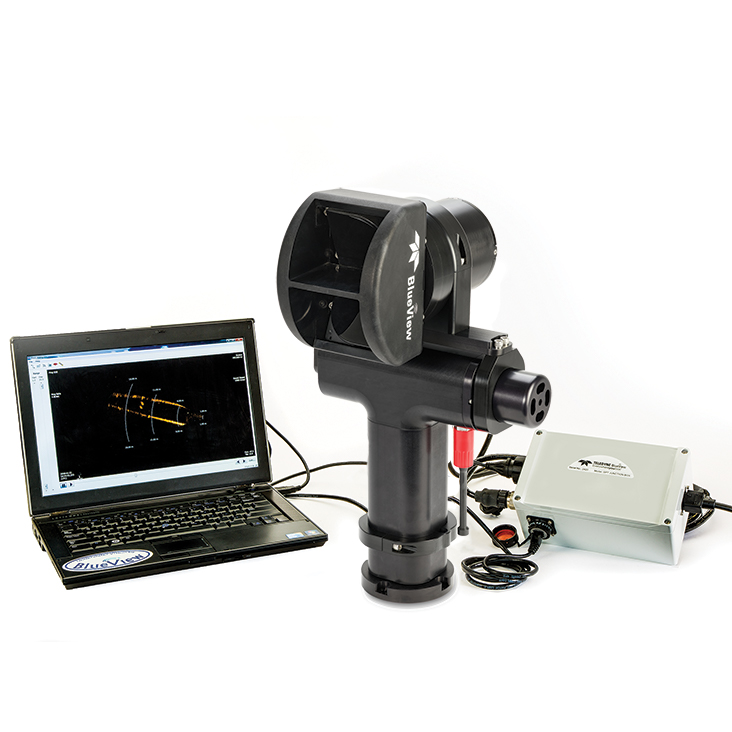
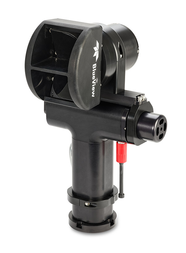

The BlueView BV5000 MK2 3D is an advanced 3D multibeam scanning sonar designed to deliver high-resolution underwater imaging for a range of commercial, defense, and research applications. Engineered for precision and versatility, the system provides detailed real-time 3D point cloud data, enabling superior situational awareness and structural assessment in challenging marine environments.
Key Features & CapabilitiesExtended Depth Rating
Designed for demanding subsea operations, the BV5000 MK2 3D is rated for depths up to 100 meters (328 feet), ensuring reliability in coastal, offshore, and deepwater deployments.
Versatile Deployment & Applications
Suitable for ROVs, AUVs, diver-held systems, and tripod-mounted surveys, the sonar excels in underwater inspection, infrastructure assessment, marine archaeology, salvage, and defense operations.
Seamless Integration
The compact, lightweight system features Ethernet connectivity and supports integration with ROV and AUV control systems, positioning sensors, and survey software, enabling flexible deployment across various platforms.
High-Resolution 3D Imaging & Extended Range
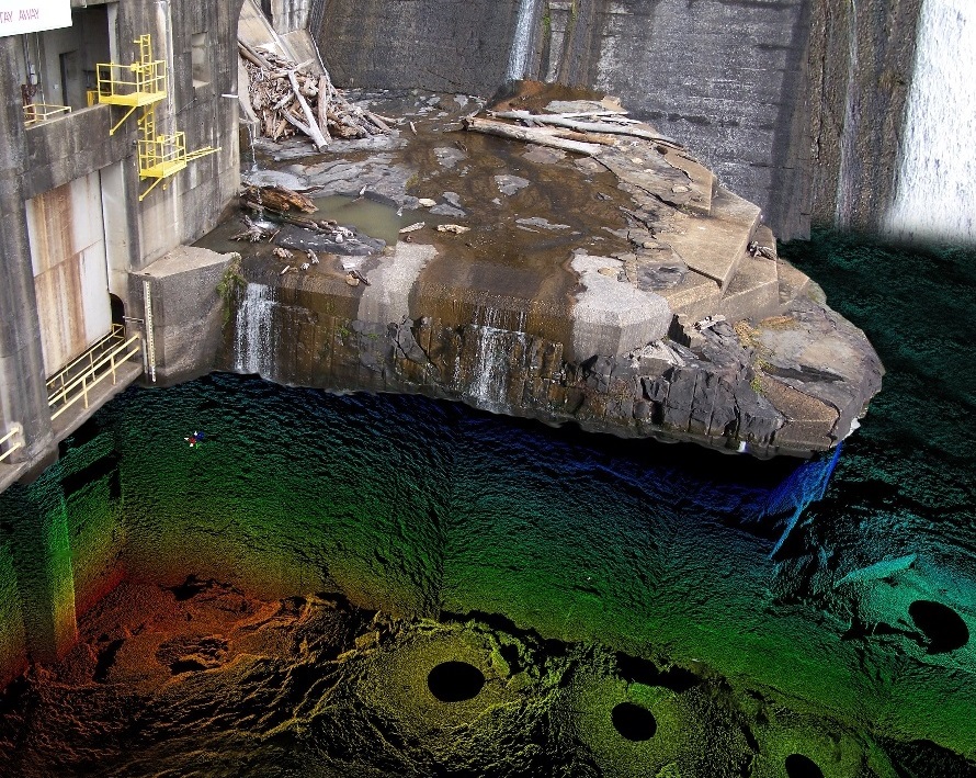
Utilizing multibeam technology, the sonar captures detailed 3D point cloud data with exceptional accuracy at ranges of up to 30 meters (98 feet), ideal for precision mapping and target identification.
Advanced Software & Hardware Compatibility
The system is fully compatible with Teledyne PDS, EIVA NaviSuite, and other industry-standard sonar processing software, allowing seamless data visualization, processing, and analysis.
- Underwater Inspection & Infrastructure Assessment: Enables detailed structural analysis of subsea assets such as bridges, dams, pipelines, ports, and offshore platforms, identifying damage, corrosion, or sediment buildup with millimeter-level precision.
- Marine Archaeology & Salvage Operations: Captures detailed 3D scans of wrecks, submerged structures, and historical artifacts, aiding in preservation efforts and recovery missions.
- Defense & Security Operations: Supports mine countermeasures (MCM), port security, and underwater threat detection, delivering real-time situational awareness for military and law enforcement applications.
- Autonomous & Remote Surveying: Optimized for use on AUVs, ROVs, and unmanned surface vessels (USVs), enabling precise, hands-free 3D mapping in hazardous or inaccessible underwater environments.
- Environmental Monitoring & Research: Provides high-resolution seafloor mapping, habitat assessment, and sediment transport studies, supporting scientific exploration and conservation efforts.
The BlueView BV5000 MK2 3D delivers a powerful combination of portability, high-resolution imaging, and integration flexibility, making it an indispensable tool for underwater surveys, security, and operational safety in complex marine environments.


