SubCtech aids Arved Fuchs’s team aboard ‘Dagmar Aaen’ in gathering sea data. Explore 21 hues of the water detailed in the following case study.
Natural water’s intrinsic tint stems from light absorption, scattering, plus concentrations of dissolved and suspended matter. Primary determinants include colored dissolved organic material (CDOM), suspended sediment particles (total suspended material, TSM), and algal chlorophyll. Often, multiple substances combine, creating an overall water hue impression.
Conversely, water color indicates its composition and quality. This method, originating 130+ years ago with François-Alphonse Forel and Wilhelm Ule, remains relevant. Their Forel-Ule scale, now calibrated using modern spectrometers, encompasses 21 distinct tones ranging from clear oceanic blue to algae-rich, humic substance-laden green and brown. Simple comparison makes it ideal for Dagmar Aaen’s limited analysis space.
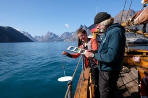
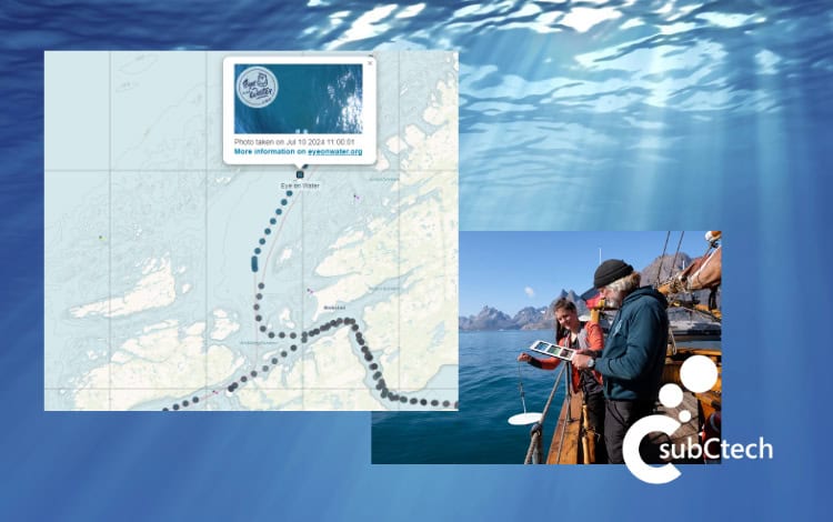
Secchi disc and Forel-Ule scale usage onboard ‘Dagmar Aaen’ allows easy measurement. Results from visual comparison or smartphone app can be digitally entered into a global EyeOnWater map, displaying individual readings.
Ocean Change Expedition 2024 pioneered automated color value recording. A camera attached to the jib boom’s nock captures water surface images every 15 minutes.
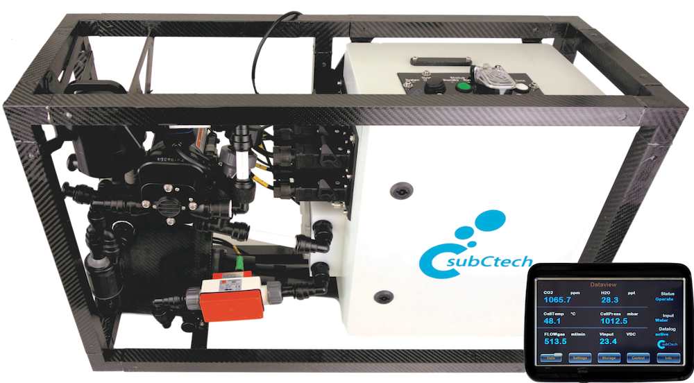
As longtime expedition sponsor, SubCtech equips ‘Dagmar Aaen’ with scientific instruments like OceanPack®, continuously measuring pCO2, sea surface salinity, temperature, and oxygen while sailing. 2024’s expedition introduced an autonomous ocean color detection camera system.
Images transmit via Starlink to GEOMAR Helmholtz Centre for Ocean Research Kiel for processing. An automated routine determines positions and average color values, feeding information to BELUGA website and EyeOnWater project. BELUGA visualizes photos as colored markers along ‘Dagmar Aaen’s route. Daily, images import into EyeOnWater, where a special algorithm (WACODI) calculates Forel-Ule scale color values. Official EyeOnWater map displays ‘Dagmar Aaen’ photos with corresponding values.
Future improvements aim to incorporate environmental metadata (e.g., cloud cover) from ship logbook entries, mast-mounted webcam, or satellite data. Though refinement continues, automated water surface color value recording marks significant progress towards efficient, comprehensive observation.
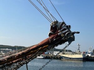
Camera mounted on front of Dagmar Aaen.
This high-density data, collected automatically in remote areas, contributes valuably to environmental monitoring and serves as a technical model for other shipboard installations.
The project exemplifies research, industry, and civil society collaboration, involving Arved Fuchs’s Ocean Change Expedition, Leibniz Institute for Baltic Sea Research, SubCtech (camera technology), GEOMAR (BELUGA platform/infrastructure), Maris (EyeOnWater website), and GMT – German Association of Marine Technology (concept/inspiration).
Read the full article here, or visit the SubCTech website to find out more.