SEP Hydrographic Limited, a company specialized in hydrographic and geophysical surveying, opted for Trimble Applanix technology to enhance asset inspections.
SEP Hydrographic employs high-resolution 3D scanning technology, ensuring superior data quality above and below the waterline. The company works with clients across various industries, providing services for asset integrity inspection and monitoring, post-storm or damage assessments, and pre-construction engineering surveys. Its integrated land and marine services offer clients an efficient, holistic solution.
Challenge
SEP regularly works in ports and harbors, areas known for their high multipath environments with substantial surrounding structures. These conditions often result in GNSS signal masking and interruptions, along with challenges in correction telemetry. To address this, a robust positioning and orientation solution is essential. When tasked with conducting an asset inspection in the constrained environment of Perth Harbour, Scotland, SEP selected Applanix.
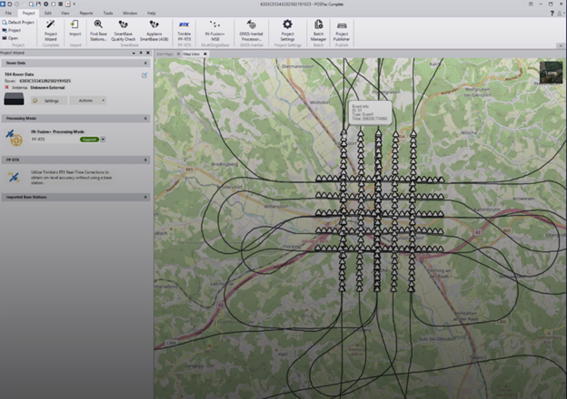
OSPac is employed to enhance the solution in challenging GNSS environments. The blue points represent the real-time solution during a GNSS outage, while the green points depict the processed SBET solution. The divergence between the real-time solution and SBET during a GNSS outage is clearly visible.
Solution
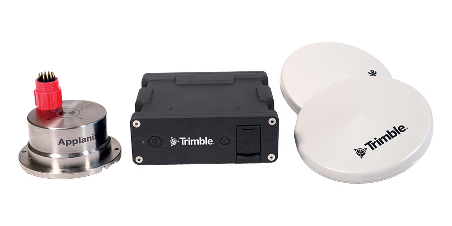
The MV Pulsar, SEP Hydrographic’s 7.2m shallow-drafted catamaran, holds Category 3 certification under the MCA Code of Practice for Small Workboats and Pilot Boats. The vessel is outfitted with a BlueView Scanning Sonar, Carlson Laser Scanner, and a NORBIT WBMS Multibeam system, all integrated with an Applanix POS MV OceanMaster.
Given the potential for GNSS and real-time correction outages during surveys of quay walls, SEP relies on Applanix’s POSPac MMS IN-Fusion SmartBase and SingleBase processing modes.
- POS MV integrates GNSS data with IMU angular rate and acceleration information and heading data from GAMS, ensuring a precise and dependable solution.
- POSPac Mobile Mapping Suite is a leading software for the direct georeferencing of mobile mapping sensors using GNSS and inertial technologies.
SEP Hydrographic commented, “Our confidence in this methodology is often validated in cases where vessel mounted LiDAR is complemented with Terrestrial Laser Scanning (TLS). Post-processed dynamically acquired data has always matched TLS data, which is typically referenced to a network of survey control points, where both sensors capture the same objects or structures.”
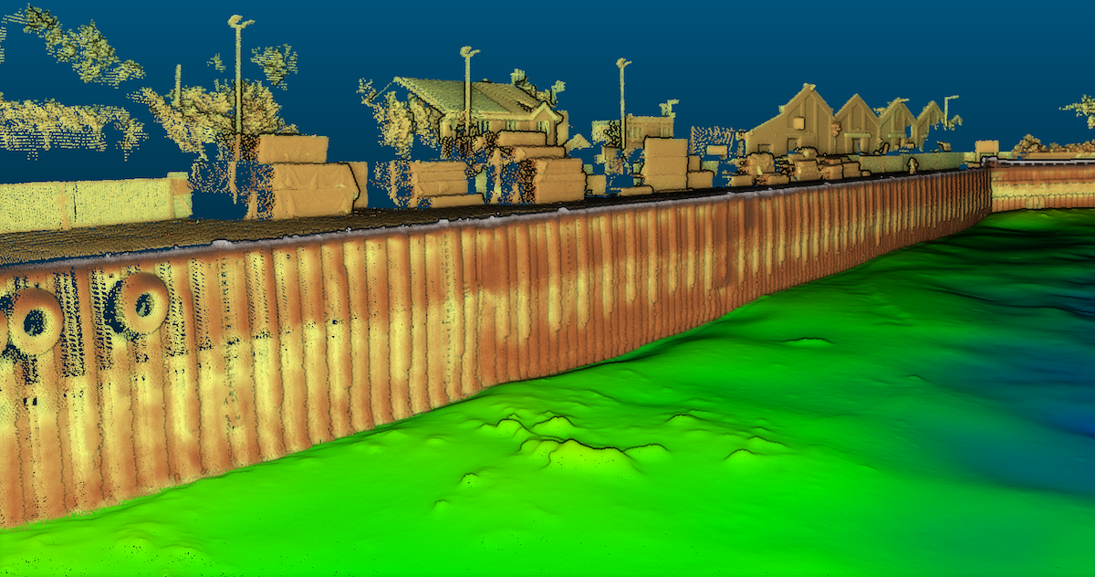
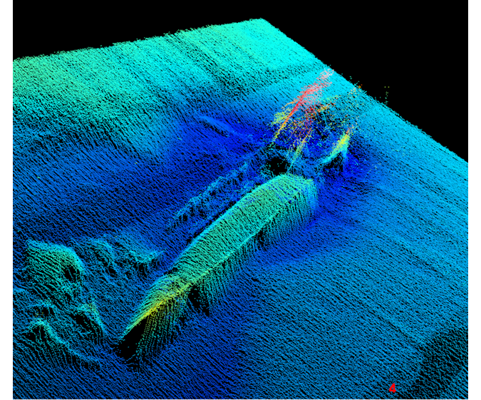
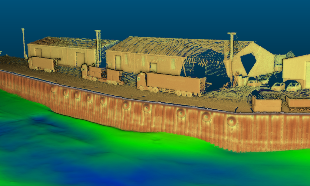
Vessel-mounted LiDAR and Multibeam systems complement one another, delivering accurate data both above and below the waterline. The use of POSPac MMS ensures the precise alignment and integration of data from multiple sources.