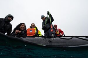
Oceanographic Monitoring and Hydrographic Surveying Technology
Find suppliers and manufacturers of oceanography and hydrographic surveying equipment used for ocean monitoring, marine science data collection, and environmental assessment across coastal and deep ocean environments.
If you design, build or supply Oceanography and Hydrography, create a profile to showcase your capabilities and connect with visitors who have an active requirement for your solutions.
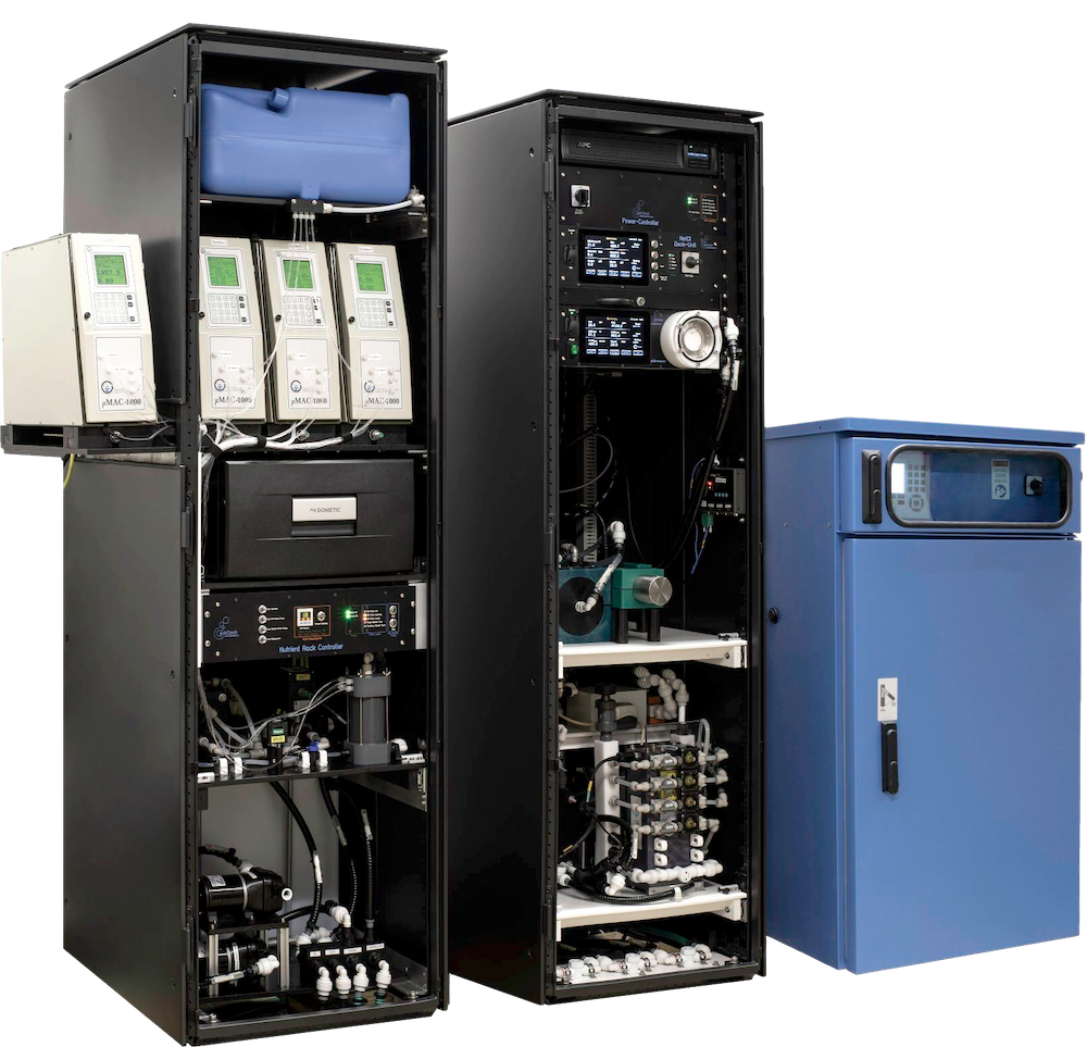
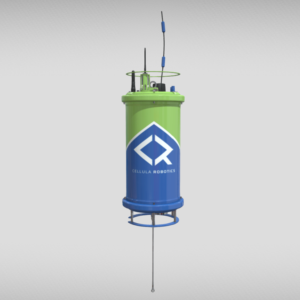
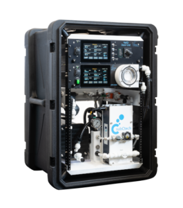
Advanced multiparameter moored system for deep and shallow ocean monitoring
Advanced multiparameter moored system for deep and shallow ocean monitoring
...a moored ocean monitoring system that combines the Deep SeaFET™ V2 pH sensor with the SBE... ... deoxygenation monitoring, and long-term ecosystem observation in both coastal and deep-sea...
Oceanographic Monitoring and Hydrographic Surveying Technology
Overview by
Summer James
Updated:
Oceanography and hydrographic surveying measure and characterize marine environments using advanced sensors, autonomous platforms, and high-precision survey tools. These technologies provide continuous, high-resolution data on physical, chemical, and biological processes for climate research, water quality monitoring, habitat studies, offshore engineering, and seafloor mapping. Modern systems integrate instrumentation, telemetry units, navigation tools, and data-acquisition platforms into networks that span from the surface to the deep ocean floor.
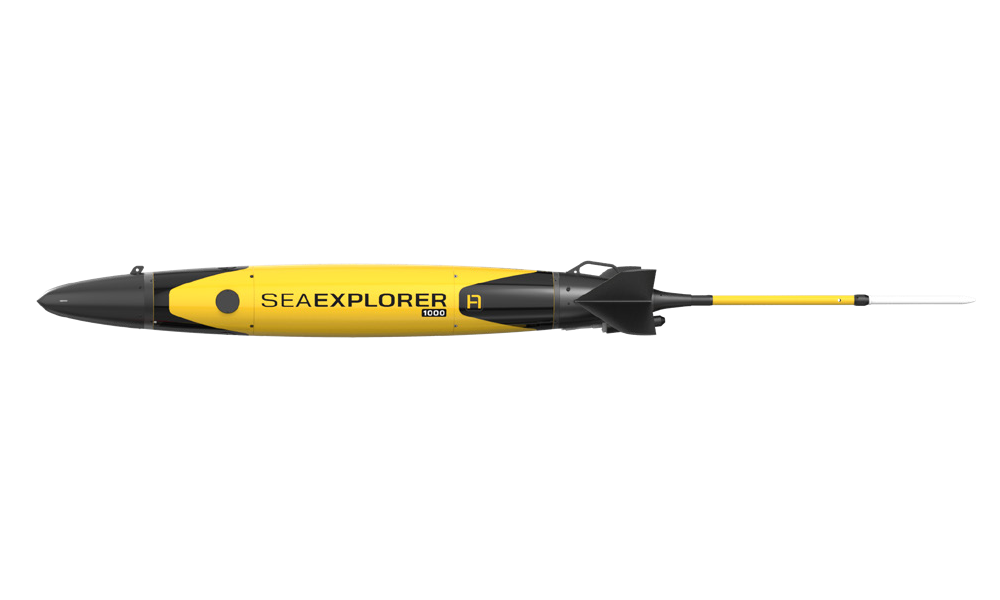
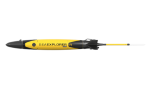
SEAEXPLORER 1000 by ALSEAMAR.
Types Of Oceanography And Hydrographic Surveying Equipment
Equipment selection depends on the specific parameter being measured, environmental conditions, and deployment method. Oceanographic and hydrographic tools include sensing devices, survey systems, autonomous platforms, power systems, and data acquisition modules.
Ocean Sensors And Analytical Instruments
Ocean sensors represent the core measurement technologies used in marine science, environmental monitoring, and hydrographic surveying. These include:
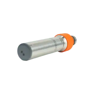
Hydrographic surveys depend on conductivity sensors, temperature probes, pressure sensors, and data loggers to validate and calibrate survey data.
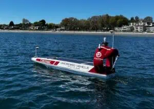
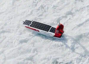
Autonomous Underwater Vehicles And Remotely Operated Vehicles
AUVs and ROVs support underwater exploration, marine surveys, and data collection in shallow and deep ocean environments. Payloads include ocean, optical, and acoustic sensors, as well as methane and CO2 monitoring systems. ROV systems use tether systems for power and communication, while AUVs employ battery packs, power modules, and communication modules for autonomous navigation.
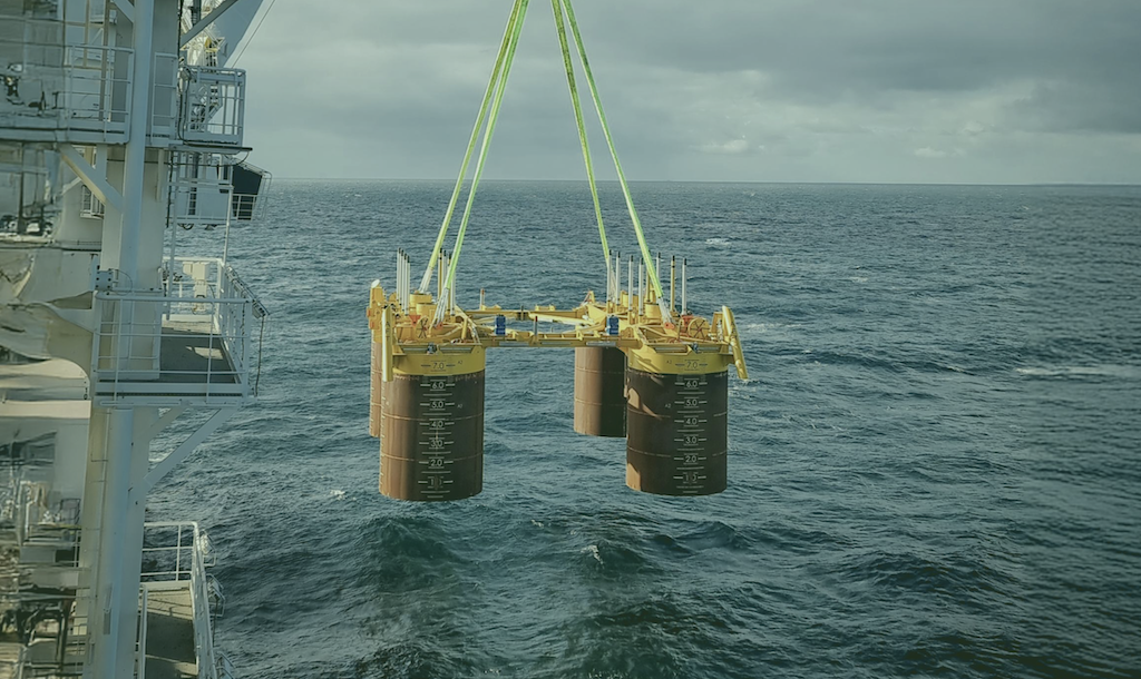
Buoy Platforms, Mooring Systems, And Fixed Observation Points
Buoy platforms, mooring systems, and fixed observation points, including Metocean buoys, provide stable long-duration positions for oceanographic sensors. These structures support temperature-profiling instruments, dissolved-oxygen, conductivity, pH, and nutrient sensors, as well as sample pumps and flow cells. Integrated solar panels, battery packs, and telemetry modules extend deployment duration and enable continuous real-time data transmission.
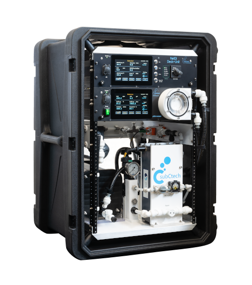
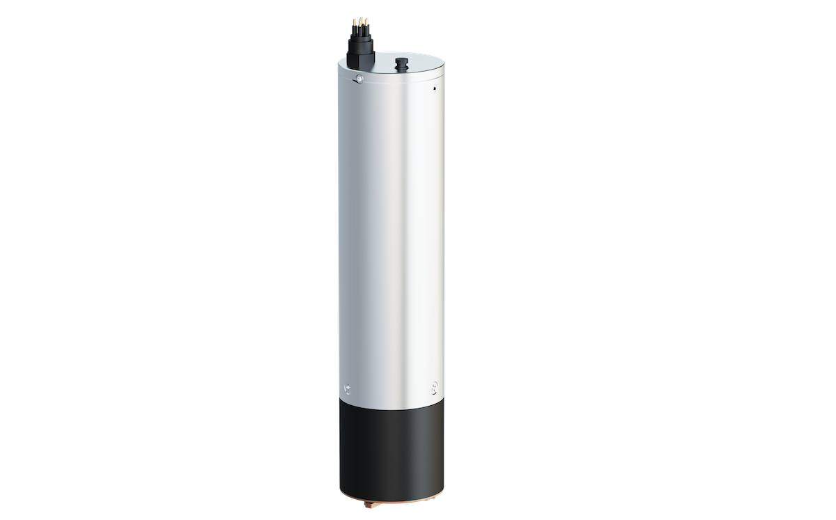
OceanPack CUBE compact and portable ocean monitoring system by SubCtech.
Data Acquisition Units And Telemetry Systems
Data acquisition units, data loggers, telemetry units, telemetry modules, and SATCOM transmitters form the backbone of data communication for marine monitoring. These systems record sensor data, manage onboard storage, and transmit datasets to shore. Flow cells, reagent cartridges, sample pumps, and additional analytical modules support chemical and biological measurements.
Power Systems And Structural Components
Ocean-monitoring equipment relies on stable power sources and robust structural elements. Power systems include batteries, battery packs, power modules, and solar panels. Structural components include mounting brackets, mounting bracket assemblies, flotation collars, sensor housings, cables, and mooring lines. These components ensure reliable deployment and extended operational life in demanding marine environments.
Applications Of Oceanography And Hydrographic Surveying Equipment
Applications serve as the foundation for selecting appropriate sensors, data systems, and survey platforms. Oceanography and hydrography support a wide range of scientific, commercial, and operational requirements where accurate marine data is essential.
Coastal Monitoring And Nearshore Environmental Assessment
Coastal monitoring relies on high-resolution measurements of tides, waves, salinity, temperature, turbidity, and other indicators that influence shoreline dynamics and biological systems. Coastal managers and marine scientists use temperature sensors, salinity sensors, conductivity cells, dissolved oxygen sensors, pH sensors, optical sensors, and telemetry modules to track short-term and long-term changes in nearshore environments. These systems support water-quality assessments, sediment-transport analysis, and coastal habitat studies. Coastal monitoring networks often incorporate buoy platforms, mooring systems, and satellite transmitters to maintain continuous operation.
Offshore Research And Ocean-Climate Projects
Offshore research investigates large-scale ocean circulation, climate variability, ocean acidification, greenhouse gas concentrations, and biogeochemical cycles. Methane sensors, CO2 sensors, pCO2 sensors, CH4 sensors, nutrient analyzers, and optical sensors measure chemical and biological activity associated with climate studies. Oceanographic CTD monitoring systems record temperature, salinity, and pressure across water columns, while wave measurement instruments and ocean current measurement systems characterize dynamic ocean conditions. Climate research programs depend on integrated ocean observing systems that combine fixed moorings, drifting platforms, autonomous underwater vehicles, and satellite-linked telemetry units.
Marine Environmental Monitoring And Impact Assessment
Environmental impact assessments for coastal development, offshore infrastructure, or marine resource projects require precise water quality monitoring and biological analysis. Sensors for dissolved oxygen, nutrients, pH, methane, and CO₂ track changes driven by anthropogenic activity, while pollution monitoring equipment detects hydrocarbons, suspended particles, and chemical contaminants. Acoustic sensors and hydrophones measure underwater noise pollution to assess disturbance from vessels, construction, and industrial activity. Continuous data logging and telemetry modules transmit ocean data to shore for analysis. Marine environmental monitoring systems support regulatory compliance and help identify changes in sensitive habitats.
Deep Ocean Exploration And Seafloor Studies
Deep-ocean exploration demands equipment capable of withstanding high pressure, low temperatures, and low visibility. Autonomous underwater vehicles, remotely operated vehicles, ROV systems, acoustic sensors, high-pressure/temperature probes, and ocean depth measurement systems gather data from ocean basins, canyons, and deep-sea ecosystems. Pressure sensors and conductivity sensors support vertical profiling, while sample pumps and reagent cartridges allow the collection of chemical samples. Deep-ocean current-monitoring instruments characterize large-scale water movements, which are critical for climate modeling.
Hydrographic Surveys For Seafloor Mapping And Navigation
Hydrographic surveying provides the bathymetric and topographic data required for safe navigation, offshore engineering, dredging operations, and port development. Bathymetric mapping systems, Doppler transducers, acoustic sensors, GPS modules, underwater positioning systems, and wave measurement devices support detailed seafloor mapping. Precise ocean depth measurements and tide measurement systems define seabed structure and improve navigation chart accuracy. Hydrographic surveys also support marine ecosystem monitoring by documenting habitat features and seafloor conditions.
Ocean Data Collection For Research Vessels And Autonomous Platforms
Oceanographers use research vessels, AUVs, ROVs, and buoy platforms to collect ocean sensor data across broad spatial areas. Temperature profiling tools, nutrient testing instruments, pH sensors, conductivity cells, optical sensors, acoustic sensors, methane sensors, and CO2 monitoring systems operate individually or within integrated payloads. Telemetry modules and communication modems ensure data transfer between platforms and shore centers. Long-duration deployments utilize battery packs, power modules, and solar panels to maintain continuous operation.
Marine Habitat Monitoring And Biological Assessments
ECO V2 Series by Sea-Bird Scientific.
Marine sciences depend on detailed monitoring of biological activity, water chemistry, and the physical conditions that influence ecosystems. Biological parameter monitoring uses optical sensors, nutrient analyzers, dissolved oxygen sensors, and pH sensors. At the same time, plankton samplers capture baseline data on primary productivity and species composition, and habitat monitoring tools record temperature, salinity, turbidity, and flow dynamics that affect species distribution. Aquaculture ROV systems and other underwater platforms enhance visual surveys, support biological assessments, and facilitate data collection in complex environments. Combined with sediment sampling equipment and underwater navigation systems, these tools enable comprehensive evaluations of marine habitats.
Offshore Operations And Engineering Support
Offshore engineering requires consistent ocean data for infrastructure design, resource development, and operational planning. Hydrographic surveying tools produce seafloor maps, while oceanographic instruments monitor currents, waves, and water-column properties that affect structural loads. Oceanographic quality monitoring supports environmental compliance for offshore energy operations. Combined sensor systems operate on mooring lines, buoy platforms, and autonomous underwater vehicles to provide real-time operational insight.
Climate Studies And Global Ocean Observation
Global climate studies rely on long-term measurements of ocean parameters, including pH, dissolved gases, nutrient concentrations, temperature, salinity, and pressure. Greenhouse gas monitoring systems, ocean acidification monitoring platforms, and integrated ocean observing systems supply critical datasets for climate analysis and climate monitoring programs. Large-scale networks combine satellite transmitters, telemetry units, data loggers, conductivity sensors, and temperature probes to track oceanic changes that influence the global environment.
Comparisons Of Monitoring Approaches
Different oceanographic approaches offer complementary strengths:
Fixed observation platforms provide long-term time series data at a single point for climate research and environmental impact assessments.
AUV and ROV platforms enable targeted data collection, marine exploration, underwater research, and deep-sea exploration.
Drifting profilers and buoy platforms generate vertically resolved profiles across water columns.
Hydrographic survey vessels collect large-area bathymetric data for ocean mapping and seafloor characterization.
Satellite transmitters and communication modules facilitate global ocean observations and remote sensing.
These complementary systems produce comprehensive datasets needed for ocean monitoring, ocean observations, and integrated ocean observing system applications.
Data Integration And System Design Considerations
Ocean monitoring systems must integrate sensors, power components, telemetry units, and mounting systems into cohesive packages. Ocean data collection requires careful planning to minimize data gaps and maximize measurement quality. Sensor calibration, environmental protection, and proper placement of sensor housings ensure accuracy and reliability. Data acquisition units must handle high-frequency sampling, multiple data streams, and extended deployments.
Standards For Oceanographic And Hydrographic Systems
Relevant standards guide the performance, calibration, and interoperability of marine monitoring equipment:
ISO standards for oceanographic measurement and sensor calibration
IEC marine equipment standards for electrical safety and environmental durability
IHO S-44 standards for hydrographic survey quality and bathymetric accuracy
WMO and IOC guidelines for climate monitoring and ocean observation systems
IEEE ocean engineering standards for underwater communication and instrumentation
Adherence to these standards ensures consistent data quality and compatibility across marine science and operational programs.
The Expanding Importance of Oceanography and Hydrographic Surveying
Oceanography and hydrographic surveying support marine research, operational decision-making, environmental assessments, offshore engineering, and climate analysis. These fields rely on oceanographic equipment, hydrographic tools, marine sensors, ocean monitoring systems, and water-quality monitoring systems to provide accurate, continuous information. Applications span marine surveys, marine sciences, ocean science, ocean technology, environmental impact assessments, marine exploration, ocean mapping, and oceanographic nutrient monitoring.
Detailed ocean observations and hydrographic surveys underpin safe navigation, resource management, scientific understanding, and climate research. As coastal regions, offshore operations, and global climate systems face new challenges, integrated ocean sensor systems and ocean observing systems continue to play a critical role in supporting environmental stewardship and operational resilience.
Ocean Sonics unveils the Impact plug-in software and icListen Kayak hydrophone at Oceanology International 2026, advancing real-time underwater acoustic monitoring for marine construction and autonomous deployments
RTS has integrated Subnero M25M acoustic smart modems into its Cube systems to deliver superior data rates and expanded operational range for critical underwater structural monitoring tasks
GeoSpectrum Technologies outlines how Very Low-Frequency (VLF) acoustic systems, including C-Bass, support long-range undersea monitoring, communication, and scientific research in Arctic environments
RS Aqua and partner Turbulent Research have introduced a new four-channel recorder designed for researchers seeking advanced acoustic insights in harsh underwater environments
In this Q&A, Ocean Sonics discusses launching Impact compliance software and the icListen Kayak at Oceanology International, and how these innovations advance real-time underwater acoustic monitoring
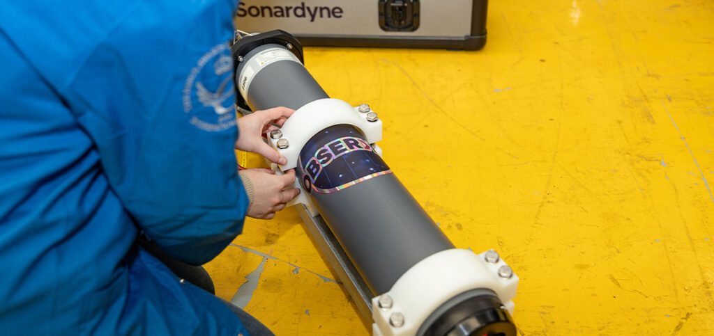
Sonardyne has released Observer, a subsea monitoring system combining motion and position sensing, analytics, and wireless communications to provide real-time insight into offshore infrastructure behaviour at depths up to 3,000 m
Boxfish Robotics outlines how recent autonomous transect missions using the Boxfish AUV deliver repeatable survey geometry, synchronized georeferenced data, and consistent seabed video for long-term marine monitoring programs