


Showcase your capabilities
If you design, build or supply Hydrographic Survey, create a profile to showcase your capabilities and connect with visitors who have an active requirement for your solutions.


Compare hydrographic survey equipment from specialist suppliers and manufacturers for coastal mapping, bathymetric surveys, and underwater inspection. Hydrographic survey equipment enables accurate seabed mapping across coastal, offshore, and inland water environments. Compare hydrographic survey platforms including ROV, UUV, and USV systems equipped with GNSS receivers, inertial measurement units (IMU), multibeam sonar, sidescan sonar, lidar sensors, and integrated data acquisition units.
Read the Technology Overview


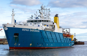
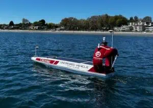
Innovative Uncrewed & Autonomous Surface Vessel Technologies for Maritime Operations

Cutting-Edge Surveying, Positioning & Sensing Solutions for Hydrographic & Oceanographic Applications
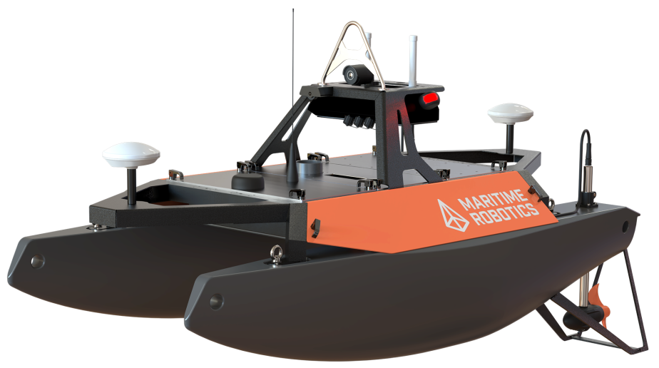
Modular Hydrographic & Oceanographic Instrumentation for Survey, Research & Autonomous Marine Operations
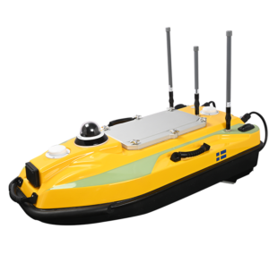
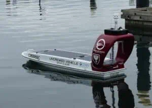
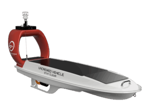
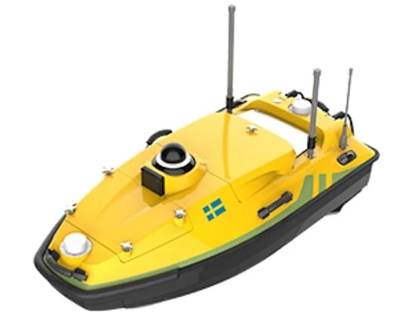
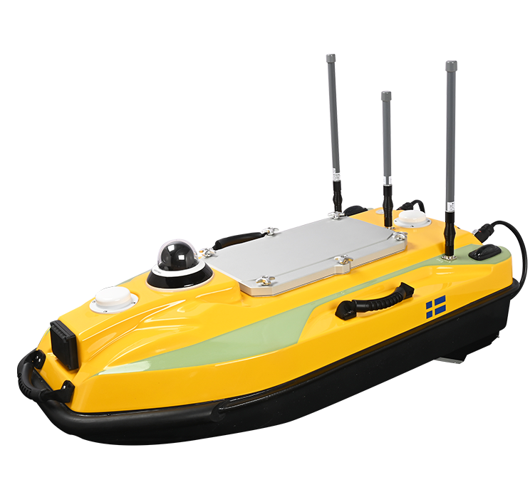
Reliable Solar-Powered ASVs for Real-Time Oceanographic & Maritime Data Acquisition
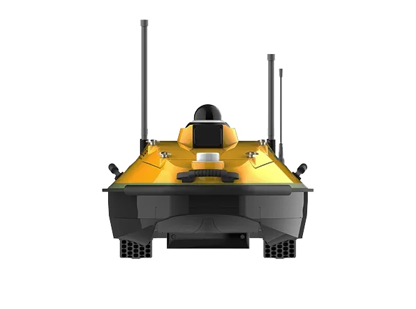
Robotic & Remote-Controlled Solutions for Waste Collection, Rescue Operations, & Aquatic Data Collection
If you design, build or supply Hydrographic Survey, create a profile to showcase your capabilities and connect with visitors who have an active requirement for your solutions.

Hydrographic surveying provides the geospatial basis for navigation safety, marine construction, and ocean research by measuring depth, seafloor features, and sub-seabed layers.
Platforms integrate multibeam sonar, side-scan sonar, sub-bottom profilers, and lidar sensors with GNSS receivers, GNSS correction (RTK), inertial measurement units, and DVLs. Data loggers and data acquisition units synchronize these channels to produce consistent datasets for ocean, underwater, and seabed mapping.
Hydrographic survey platforms may be crewed or unmanned and operate on the surface or underwater. Hydrographic data products, such as bathymetric surveys, hydrographic mapping, and hydrographic maps, support route planning, port mapping, coastal surveys, and marine habitat mapping. Selecting between ROV, UUV, and USV platforms depends on depth, range, seafloor conditions, and operational risk.
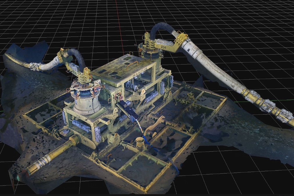
Remotely operated vehicles configured for hydrographic survey are used for detailed investigations in confined or complex underwater environments. These platforms combine multibeam and side-scan sonar, DVL sensors, and cameras with precise thruster control to support close-range inspection of pipelines, risers, port structures, and seabed assets. ROV-based hydrographic surveys provide real-time operator control via tethered communication links, delivering high-bandwidth data to surface control stations and data-acquisition modules. Their maneuverability and ability to maintain stable positioning enable high-resolution mapping around subsea infrastructure and other localized targets.
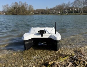
Uncrewed surface vessels provide stable, fuel-efficient platforms for acquiring hydrographic data across coastal zones, ports, and shallow offshore areas. USV-based systems integrate multibeam sonar, side-scan sonar, RTK GNSS, inertial measurement units, marine radar, and telemetry modules into a compact surface platform that can operate for extended periods. Automated line keeping and navigation controllers maintain consistent track spacing for bathymetry surveys and coastal mapping. USVs reduce risk to personnel while producing continuous, high-quality hydrographic survey coverage suitable for harbor maintenance, dredging planning, and marine construction monitoring.
Autonomous underwater vehicles enable long-range, untethered hydrographic survey missions in deep-water and open-ocean environments. AUV platforms carry battery packs, propulsion systems, multibeam sonar, side-scan sonar, sub-bottom profilers, DVL sensors, and acoustic modems in modular payload bays. Mission planning software and onboard navigation controllers manage altitude, heading, and survey line execution without surface supervision. AUV-based hydrographic surveys generate dense data sets for ocean floor mapping, seafloor surveys, and cable or pipeline route investigations. Logged data is retrieved after recovery for processing into bathymetric grids, seabed imagery, and subbottom profiling products.
Coastal and harbor hydrographic surveys provide detailed bathymetric data for port authority survey programs, harbor operations, and marine construction planning. Multibeam sonar, multi-beam sonar, and side scan sonar survey payloads on USV platforms map navigation channels, turning basins, and berthing areas. RTK GNSS and inertial measurement units maintain accurate vessel tracks, while data acquisition modules log depth, position, and motion for post-processing into coastal maps and port-mapping products.
Offshore wind surveys, subsea pipeline inspections, and underwater infrastructure inspections rely on hydrographic survey equipment to characterize the seabed and identify hazards. ROV surveys and UUV-based multibeam survey lines support the definition of pipeline route surveys, cable route planning, and verification of burial depth. Sub-bottom profiler (SBP) systems identify sediment layers and hard ground that affect foundation design. Acoustic modems and underwater acoustic modem links transmit quality control data to surface control stations during offshore surveys.
Environmental hydrographic surveys support marine habitat mapping, seafloor surveys, and long-term monitoring of sediment transport and morphology. Bathymetric mapping and side scan sonar imagery help identify seabed features, reef structures, and sensitive habitats. Coastal surveying and shoreline mapping combine hydrographic survey data with airborne lidar survey and lidar hydrographic survey techniques to quantify shoreline change, flooding risk, and coastal erosion over time.
Dredging surveys support planning, progress tracking, and acceptance of dredging operations in navigation channels, harbors, and port approaches. High-resolution bathymetric survey data and hydrographic mapping confirm that the required design depths are achieved while minimizing over-dredging. Hydrographic survey equipment on USV platforms and crewed vessels validates marine construction survey work for quay walls, breakwaters, and coastal defenses. Repeat multibeam hydrographic survey lines and side scan survey passes to document seabed disturbance and material placement.
Cable and pipeline route surveys require continuous bathymetry, seabed mapping, and sub-bottom profiling to identify optimal corridors that avoid obstacles and unstable ground. UUV and USV platforms equipped with multibeam sonars, side-scan sonars, sub-bottom profilers, and DVL sensors provide dense data coverage along proposed routes. The telemetry system and communication modem links relay navigation and sonar quality indicators to the surface controller for in-field assessment.
Uncrewed surface vessels provide stable, fuel-efficient platforms for hydrographic surveys in coastal waters, ports, and nearshore offshore sites. USV hydrographic survey systems integrate GNSS modules, RTK corrections, inertial measurement units, and marine radars with multibeam sonar or multi-beam sonar payloads. Telemetry modules and communication links connect the USV to a remote control station or navigation controller, enabling supervised or autonomous survey lines. Battery modules or hybrid propulsion modules provide endurance for extended hydrographic surveying, while payload modules host sonar arrays, lidar sensors, and data acquisition hardware.
Hydrographic survey equipment depends on accurate synchronization of sensors, motion reference units, and positioning system components. GNSS receivers and GPS modules with RTK or RTKL corrections deliver geodetic positions for bathymetric surveys. Inertial measurement units, inertial measurement unit sensors, and Doppler velocity logs provide motion and velocity estimates essential for motion-compensated multibeam and side-scan sonar data. Data loggers, data acquisition modules, and SBP systems record sonar, lidar sensor, and navigation data with precise timestamps. Telemetry modules, acoustic modems, and underwater modems provide communication links between platforms and surface controllers.
Hydrographic surveys adhere to internationally recognized standards that define positioning accuracy, depth uncertainty, and quality-control procedures for hydrographic instruments and marine survey equipment. Many ocean mapping and coastal survey projects reference specifications aligned with IHO hydrographic survey standards for different survey orders. Consistent calibration of sonar arrays, GNSS modules, inertial measurement units, and DVL sensor packages, combined with rigorous line planning and overlap, supports repeatable hydrographic mapping, multibeam survey operations, and the production of hydrographic survey system outputs suitable for navigation charts, coastal management, and offshore engineering design.
 Searching Companies & Products

 Subscribe to the Weekly eBrief
The latest engineering and technical developments straight to your inbox - join thousands of engineers who receive it.
Subscribe to the Weekly eBrief
The latest engineering and technical developments straight to your inbox - join thousands of engineers who receive it.