Wave Buoys
Discover cutting-edge solutions from leading global suppliers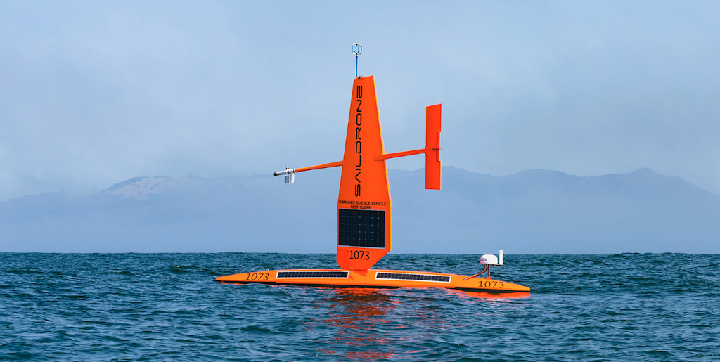
Saildrone and NOAA’s National Data Buoy Center (NDBC) has replaced Station 40612, a moored buoy located in Monterey Bay National Marine Sanctuary, with a Saildrone uncrewed surface vehicle (USV).
The 23-foot Explorer-class SD 1073 was deployed in August and has been on station delivering data since September 1. It is expected to remain on station through June 2024.
While it was important for weather prediction, it was moored in an area with fragile coral on the seafloor. The Saildrone Explorer fulfils the NDBC’s desire to replace it in an environmentally sustainable way, as the Saildrone does not need a mooring to hold it in place while delivering the data needed.
Saildrone will deliver a similar set of meteorological and oceanographic data to that of the former buoy: wind speed and direction, air temperature, relative humidity, barometric pressure, sea surface temperature, significant wave height, and wave period.
The buoy, part of NDBC’s Coastal Weather Buoy observing system, was moored 24 nautical miles south-southwest of San Francisco off the coast of Half Moon Bay.
With storms approaching the coast, it is known as a critical area for the National Weather Service. The defunct buoy has been completely removed.
The NDBC maintains a network of over 200 moored weather buoys around the globe that provide critical ocean data for weather forecasting. When outages occur, crewed ships must be deployed to repair them.
Saildrone’s Explorers, powered exclusively by renewable energy, can stay on station for months at a time and then sail autonomously to port for regular service as another vehicle arrives to take its place.
The data is being provided to the National Weather Service via the NWS Telecommunications Gateway. It will be ingested into the National Centers for Environmental Prediction (NCEP) and provided to the rest of the world via the Global Telecommunication System (GTS). Data from SD 1073 can be viewed on the NDBC website as Station 1801589.
This is the second time Saildrone has replaced buoys for the NDBC. In 2022, two Saildrone Explorers were deployed to the Gulf of Mexico to provide data near two buoys experiencing critical outages.
“NDBC has operated a moored weather buoy southwest of San Francisco since 1980, and NWS forecasters and the public have come to depend on these reliable observations. Through this partnership, we can now maintain these observations while mitigating the deployment of mooring and anchor material in our important national marine sanctuaries,” said Dr. William Burnett, NDBC director.
“NDBC performs an important role in the monitoring and prediction of global weather patterns, and we are proud to be a part of their network, collecting vital weather data without impacting the marine ecosystem and zero operational carbon footprint,” said Cristina Castillo, Saildrone Senior Program Manager for ocean data missions.