Autonomous Underwater Vehicles (AUV)
Discover cutting-edge solutions from 9 leading global suppliers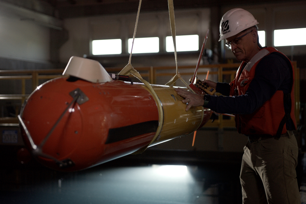
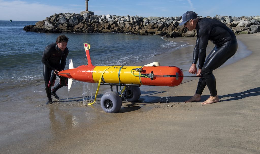
After a decade of extensive testing at sea by MBARI researchers, the long-range autonomous vehicle (LRAUV) is now available to a global market thanks to a commercial licensing agreement with Saab, Inc.
The LRAUV is an innovative robot developed by MBARI engineers to meet the growing demand for technology that can safely and efficiently explore, map, and monitor ocean health.
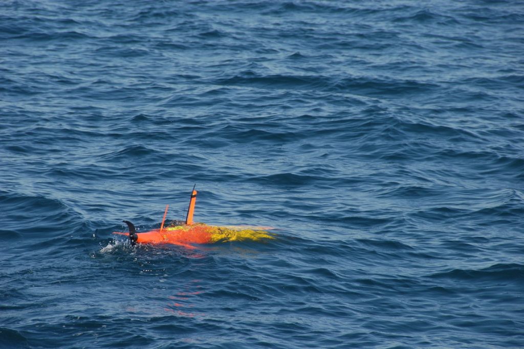
The LRAUV, which will be available commercially as the Saab Tethys, is an innovative, field-ready autonomous robot that can be launched from a ship or from shore.
An ultra-low power transit mode enables shore-based operations with a range of more than 1,000 kilometers (620 miles). The MBARI team developed this technology as a scalable solution to ocean-based data collection.
MBARI’s fleet of 10 LRAUVs has more than 40,000 hours of sea time, including operations with most of the standard AUV payloads, as well as MBARI’s custom payloads that include environmental DNA (eDNA) sampling, plankton imaging, scientific echosounders, and more.
This robust platform has demonstrated some remarkable mission capabilities, from sampling the genetic fingerprints of marine life to monitoring harmful algal blooms in the Great Lakes to detecting and mapping oil spills.
Under its Autonomous and Undersea Systems Division, Saab will transition the MBARI LRAUV to commercial production offering this product for global sales for the oceanographic research, commercial, and military markets.
About two meters (6.6 feet) long, 30 centimeters (12 inches) in diameter, and weighing 110 kilograms (242.5 pounds), the LRAUV is easy for small teams to operate anywhere in the world.
Its unique low-power transit mode and over-the-horizon, internet-based remote control allow users to launch the vehicles from shore and conduct sophisticated missions at remote locations, without a ship.
The LRAUV offers more than 40,000 operational hours offshore and can dive to depths as great as 1,500 meters (4,900 feet).
It is capable of larger, more powerful payloads and can operate in higher currents than oceanographic buoyancy-driven gliders.
The LRAUV can be outfitted with a variety of payloads, including microbial sampling, bioluminescence, active bio-acoustic imaging, water sampling, plankton imaging, and multibeam mapping.
Understanding the ocean’s complex physical and biological processes requires robust observing systems. MBARI engineers envision a future where robotic platforms can monitor ocean health 24 hours a day, 365 days a year.
Licensing the LRAUV technology to Saab, Inc. for commercial production brings the company closer to this vision for an autonomous future for ocean exploration.
“MBARI is one of the few places where a team of engineers and scientists can work together, for more than 10 years, to develop a completely new ocean robot from the ground up. We’re thrilled to now have help from Saab, Inc. to manufacture this unique platform for our peers in ocean science and adapt it for many new applications,” said MBARI Senior Mechanical Engineer Brett Hobson, who leads the LRAUV Team.
“The ocean is at a critical crossroads and we urgently need to grow our ability to autonomously collect physical, chemical, and biological data about the largest living space on our planet,” said MBARI President and CEO Chris Scholin. “Our partnership with Saab, Inc. will make MBARI’s marine technology broadly accessible and offer an important pathway to quickly scale global ocean observing efforts.”