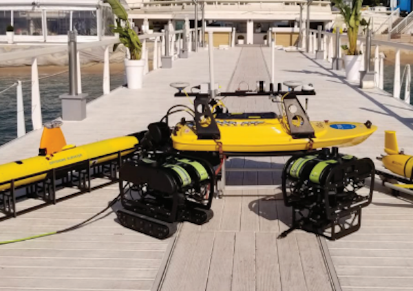
Underwater Acoustic Modems
Discover cutting-edge solutions from leading global suppliersAn expanded network of underwater listening stations (acoustic receivers) in Queensland waters has supported scientists tracking marine life along the length of eastern Australia.
The expanded network, known as an acoustic telemetry array, has improved scientists’ ability to monitor the movements of key species, including sharks, rays, and commercially important fish tagged with transmitters. This advancement is enhancing beach safety and providing new insights into species behaviors and distributions.
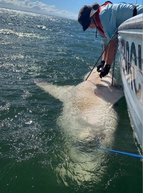
Following the installation of the Queensland IMOS (Integrated Marine Observing System) Acoustic Telemetry Array Project in 2019, scientists recorded a bull shark originally tagged in Sydney, New South Wales, at the northernmost point of the new array in far north Queensland – 2,900 km away. Previously, the longest recorded movement for bull sharks was 1,770 km, from Sydney Harbor to reefs off Townsville, Queensland.
Several bull sharks were detected making repeated long-distance movements between states along this coastline during the three years with the expanded array.
Paper co-author and array project leader Dr Leanne Currey-Randall from the Australian Institute of Marine Science (AIMS) said the initial project results suggested the array enhancement, if sustained over many years, could uncover a range of previously unknown movements that will assist in addressing ecological, fisheries, and conservation questions for multiple species.
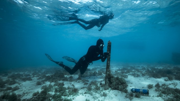
“In the future, we can see the data helping managers understand where animals move within and away from marine park protected area boundaries, and provide greater insights into the movement patterns of highly mobile species of high human and conservation interest. The enhanced array saw an additional 119 acoustic receivers placed in mainly coastal locations spread across 2100km from the Gold Coast to remote far north Queensland increasing detections of priority species. This added to the 208 receivers already in place in Queensland waters.
“Combined with the receiver infrastructure already in place in Queensland and the neighboring states of New South Wales, Victoria and Tasmania, the receiver coverage along the Australian east coast was increased to almost 4000km. The approach has already revealed previously unknown broad-scale movements for some species and highlights that clusters of receivers are not always required to enhance data collection.”
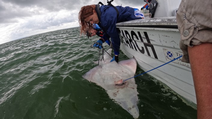
When a tagged animal swims within the detection range of one of the strategically placed underwater receivers, the receiver records the date, time stamp, and unique transmitter identification number. This helps researchers to pinpoint the movement patterns of the 812 animals tagged by this project, in addition to those tagged by several other groups.
Dr Currey-Randall said the enhanced array had been made possible by a partnership with James Cook University, IMOS, and Queensland’s Shark Control Program, as well as by a diverse group of collaborators spanning government, science, industry, and tourism operators.
Study lead author Adam Barnett from James Cook University and Biopixel Oceans Foundation, commented, “Collaborations with existing and new programs and partners resulted in an impressive effort to install and maintain the receivers. This has delivered beneficial data for us all and forged new relationships that we hope will assist with future projects.”
Study co-author Dr Fabrice Jaine from IMOS, added, “The expanded animal tracking infrastructure is providing fascinating new insights into movements of marine species at continental scales, and with an unprecedented level of detail. This would not be possible without vibrant collaboration between numerous research groups from Queensland and beyond, and the diverse operational partners who help make these efforts possible.”
The Queensland IMOS Acoustic Telemetry Array Project was funded by the Department of Environment and Science, Queensland through the Research Infrastructure Co-Investment Fund (RICF) to the Integrated Marine Observing System (IMOS), and was operated by AIMS. Australia’s IMOS is enabled by the National Collaborative Research Infrastructure Strategy (NCRIS).