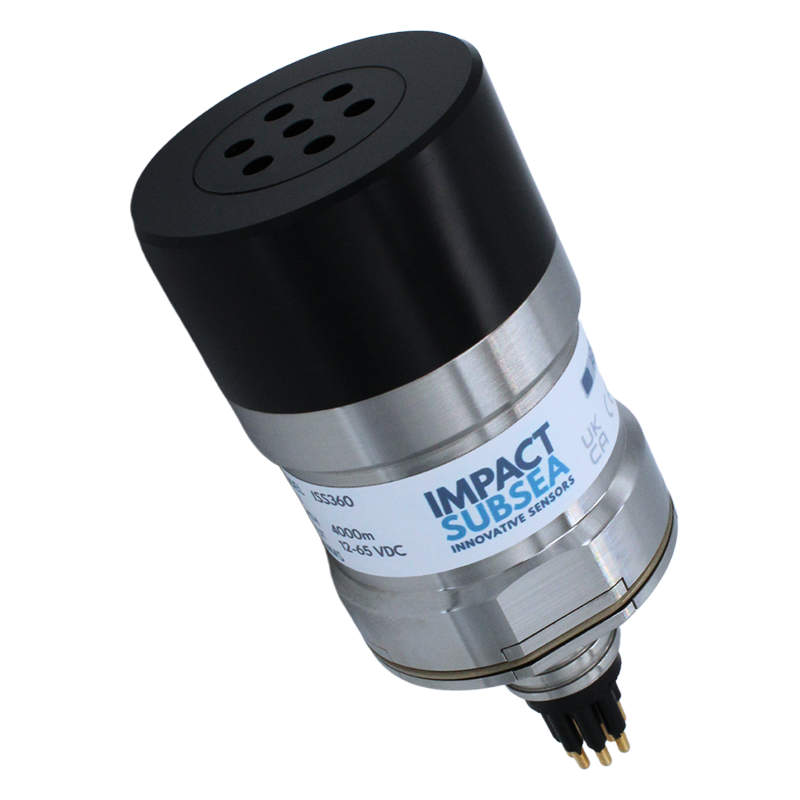
Navigating remotely operated vehicles (ROVs) through confined spaces, pipeline corridors, and sediment-heavy waters requires reliable information about the surrounding environment, particularly when optical visibility is limited. The ISS360 Imaging Sonar from Impact Subsea provides acoustic imaging capabilities for underwater navigation, obstacle detection, and target identification, with scanning modes suited to different operational requirements.
The compact sonar combines 360° scanning, high-speed sector scanning, and a range of up to 90 meters (295 feet). Its operating characteristics are demonstrated through six scenarios covering obstacle detection, low-visibility navigation, long-range imaging, and structural mapping.
ISS360 Imaging Sonar Technology and Capabilities
The ISS360 is described by Impact Subsea as the world’s smallest scanning imaging sonar. It uses the Impact Subsea Signalling Scheme (IS3) to achieve a range of up to 90 meters, with a range resolution of 2.5 mm.
The sonar also provides an angular resolution of 2.2°, allowing operators to identify obstacles, boundaries, and other underwater features through acoustic imagery.
A key aspect of the ISS360’s mechanical design is its inductively coupled transducer, which eliminates the need for slip rings. Slip rings are a potential failure point in alternative scanning sonar systems, and removing them reduces reliance on this type of mechanical electrical connection.
For deepwater applications, the ISS360 is available in a titanium housing rated to depths of 6,000 meters. Optional integrated Pitch and Roll functionality provides information on sonar orientation, allowing operators to ensure that the unit is level when maximum range performance is required.
360° Scanning for Underwater Situational Awareness
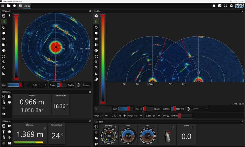
Full 360° scanning provides ROV pilots with acoustic imagery of the environment surrounding the sonar.
One demonstration of the ISS360 shows the identification of pool walls and obstacles using its 2.2° angular resolution. This illustrates how continuous scanning can be used to distinguish surrounding boundaries and potential obstructions.
Such information is relevant when operating in confined environments or navigating near structures, where understanding the position of nearby objects is important for controlling vehicle movement.
High-Speed Sector Scanning for Obstacle Avoidance
In addition to continuous 360° scanning, the ISS360 supports high-speed Sector Scanning with flyback.
Rather than repeatedly imaging the entire surrounding area, sector scanning allows the sonar to concentrate on a selected angular region. The flyback function supports rapid scan updates, making this operating mode particularly relevant to ROV navigation and real-time obstacle avoidance.
An operational demonstration illustrates how the ISS360’s sector scanning capability provides the update rates needed for high-speed navigation.
ROV Navigation in Low-Visibility Conditions
Underwater cameras are dependent on available visibility, which can deteriorate significantly in sediment-heavy or turbid water.
Acoustic imaging provides an alternative means of observing nearby objects and boundaries when the optical camera feed becomes ineffective.
The ISS360’s low-visibility demonstration examines how sonar imagery can provide ROV pilots with information about their surroundings when camera visibility is lost.
This capability is particularly relevant when maneuvering near subsea infrastructure or navigating environments where suspended sediment obscures visual references.
Long-Range Sonar Detection
The ISS360’s maximum range of 90 meters allows operators to detect objects and environmental features at greater distances than those required for close-range maneuvering.
A long-range demonstration shows the sonar identifying features ranging from seabed debris to surface waves.
This illustrates the use of acoustic imaging for detecting different types of underwater targets and environmental boundaries, while the system’s 2.5 mm range resolution provides detailed range measurements.
The available imaging performance depends on the sonar’s operating configuration, including its orientation when maximum range is required.
Aligning Sonar Imagery with the ROV Pilot’s Perspective
Interpreting acoustic imagery is an important element of ROV navigation, particularly for pilots accustomed to camera-based visual references.
One ISS360 demonstration focuses on intuitive navigation by aligning sonar data with the pilot’s perspective.
Presenting acoustic information in relation to the ROV’s orientation can help operators interpret the location of detected objects and understand their position relative to the vehicle.
This approach is relevant to navigation tasks where pilots must transition between optical imagery and sonar-based awareness as underwater visibility changes.
Structural Mapping in Confined Spaces
Scanning sonar can also be used to identify boundaries and structural features in environments where an ROV has limited room to maneuver.
The ISS360’s real-time structural mapping demonstration illustrates how the sonar identifies boundaries within confined spaces.
By providing acoustic representations of surrounding structures, the system gives operators information that can be used when assessing the ROV’s position relative to nearby surfaces and obstacles.
This application complements the sonar’s 360° and sector scanning modes, which provide different ways to observe the underwater environment according to navigation requirements.
Operator Training and Sonar Data Interpretation
Effective sonar navigation depends not only on sensor performance but also on the operator’s ability to interpret acoustic imagery.
The Impact Subsea Academy provides free technical training materials to support users of the company’s sensors. Its resources include explanatory films covering the seaView software, technical FAQs, and guidance on interpreting sonar data.
These materials are intended to help operators understand the information presented by the ISS360 and apply it during underwater navigation and related subsea activities.
Further technical information and training resources are available through the Impact Subsea Academy.
Sonar Data for Autonomous Underwater Vehicles
Beyond manually controlled ROV navigation, the ISS360 also has relevance to autonomous underwater vehicle (AUV) applications.
Impact Subsea has released an open-source software development kit (SDK) supporting software development involving its sonar technology.
The availability of the SDK provides a route for developers working with ISS360 sonar data in AUV applications, including systems concerned with obstacle avoidance and underwater environmental awareness.
Such applications extend the role of sonar beyond providing imagery for an ROV pilot, with acoustic data potentially contributing to how an autonomous vehicle interprets its surroundings.
The ISS360’s combination of scanning modes, range measurement capabilities, compact construction, and software development resources provides a technical basis for both operator-controlled navigation and further work involving autonomous underwater systems.
Read the 2026 Simple Guide to ROV Navigation Using Sonar on the Impact Subsea website.