Showcase your capabilities
If you design, build or supply Marine Magnetometers, create a profile to showcase your capabilities and connect with visitors who have an active requirement for your solutions.



Marine magnetometers are geophysical instruments used to measure magnetic fields and detect anomalies associated with seabed geology, ferrous objects, and submerged infrastructure.
This category showcases suppliers of marine magnetometers for offshore geophysical surveys, seabed mapping, UXO detection, and subsea infrastructure investigations.
Read the Technology Overview
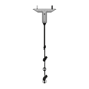
Drone-Based Magnetic Detection Systems for Offshore Survey, Marine UXO & Subsea Target Detection

If you design, build or supply Marine Magnetometers, create a profile to showcase your capabilities and connect with visitors who have an active requirement for your solutions.

Marine magnetometers are specialized geophysical instruments used to measure magnetic fields and detect variations across marine environments. These sensors can identify anomalies associated with geological formations, ferrous objects, submerged infrastructure, and buried metallic materials, supporting applications such as oceanographic research, seabed mapping, offshore geophysical surveying, underwater archaeology, and Unexploded Ordnance (UXO) detection.
Marine magnetometer surveys can be conducted using towed sensor systems, vessel-mounted instruments, and underwater platforms such as Autonomous Underwater Vehicles (AUVs) and Remotely Operated Vehicles (ROVs). Magnetic measurements are combined with positioning and navigation data to create georeferenced datasets that can be processed into anomaly maps, helping operators identify, locate, and investigate potential targets across coastal waters, offshore environments, and the deep sea.
Marine magnetometers use different measurement principles to detect magnetic fields and variations in magnetic intensity, with scalar instruments measuring total field strength and vector magnetometers measuring individual field components. Technologies also differ in sensitivity, sampling rate, power consumption, and operational requirements, making particular sensor types better suited to specific marine survey applications.
| Magnetometer Type | Measurement Principle | Performance Characteristics | Marine Applications |
| Proton Precession Magnetometers | Measures proton precession frequency in a magnetic field | Moderate to high sensitivity, relatively slow acquisition, and absolute total-field measurements | Marine geophysical surveys and geological mapping |
| Overhauser Magnetometers | Uses dynamic nuclear polarization to enhance proton magnetic resonance | High sensitivity, low noise, and efficient total-field measurement | Marine magnetic surveying, geological investigations, and AUV surveys |
| Optically Pumped Magnetometers | Measures magnetic fields using optically stimulated atomic transitions | High to very high sensitivity, with moderate to high sampling rates | High-resolution magnetic surveys and underwater target detection |
| Cesium Vapor Magnetometers | Uses optically pumped cesium atoms to measure magnetic field intensity | Very high sensitivity and rapid, high-resolution total-field measurements | UXO detection, wreck searches, and offshore geophysical surveys |
| Potassium Vapor Magnetometers | Uses optically pumped potassium atoms for magnetic field measurement | Very high sensitivity and high sampling rates, with specialized operating requirements | Precision magnetic surveying and scientific measurements |
| Fluxgate Magnetometers | Measures magnetic field components using magnetically saturated ferromagnetic cores | Moderate to high sensitivity, high sampling rates, and compact vector-field measurement | AUV instrumentation, magnetic signature monitoring, and vector surveys |
| Marine Magnetic Gradiometer Systems | Calculates magnetic field differences between spatially separated sensors | Measures magnetic field gradients for localized anomaly characterization and reduced common-mode interference | UXO surveys, ferrous object localization, and high-resolution seabed investigations |
Marine magnetometers detect localized variations in the Earth’s magnetic field caused by geological features or magnetized objects, allowing survey teams to identify areas that differ from the surrounding magnetic background. These anomalies can indicate ferrous materials, buried structures, or changes in subsurface geology, while processing techniques such as background-field correction, interference compensation, and anomaly analysis can help distinguish potential targets from regional magnetic variations.
Marine magnetometers can identify magnetic signatures associated with ferrous objects such as shipwrecks, anchors, discarded equipment, and submerged metallic debris. Georeferenced measurements collected across multiple survey lines can help estimate target positions and guide follow-up investigations, while analysis of anomaly shape and amplitude may provide additional information about possible target characteristics, although magnetic measurements alone cannot reliably identify the object.
Marine magnetometer surveys generate spatial datasets representing magnetic field variations associated with the seafloor and underlying geological formations. When combined with positioning information, these measurements can be processed into magnetic anomaly maps, profiles, and interpreted target locations that support geological analysis, infrastructure investigations, and marine resource exploration.
Variations in magnetic mineral content and geological structure produce measurable signatures that can be used to investigate faults, volcanic formations, igneous bodies, and other subsurface features. Marine magnetometer data can therefore contribute to offshore geological mapping and scientific research while complementing seismic and other geophysical survey measurements.
Marine magnetometers can measure the magnetic fields associated with submerged objects, structures, and underwater vehicles, supporting magnetic signature characterization, anomaly analysis, and assessment of interference generated by marine platforms or equipment. Vector magnetometers provide directional field information, while scalar instruments measure total magnetic field intensity.
Magnetic measurements can reveal ferrous objects concealed beneath seabed sediments where optical or acoustic sensors may provide limited direct visibility. Detection performance depends on factors such as target size, magnetic properties, burial depth, sensor altitude, and background magnetic conditions, while non-ferrous objects without a detectable magnetic signature may remain undetected and identified anomalies generally require further investigation to establish their source.
Marine magnetometers are widely used in offshore geological and geophysical investigations to map magnetic anomalies associated with seabed and subsurface formations. Applications include studies of oceanic crust, geological faults, volcanic structures, mineral exploration targets, and regional magnetic field variations, often alongside other geophysical survey methods.
Underwater magnetometer systems support searches for shipwrecks, submerged aircraft, lost equipment, and other ferrous objects by detecting magnetic signatures that may remain visible even when the target is buried or obscured. Magnetic surveys can therefore help narrow search areas before subsequent sonar imaging, visual inspection, or other forms of investigation are carried out.
Marine magnetometer surveys are used to identify magnetic anomalies that may indicate ferrous unexploded ordnance on or beneath the seabed, supporting offshore wind developments, subsea cable installation, pipeline routing, and marine construction projects. Detected anomalies must still be assessed to distinguish potential ordnance from geological features, metallic debris, infrastructure, and other magnetic sources.
Marine magnetometers can assist with detecting and locating ferrous subsea infrastructure, including steel pipelines, abandoned equipment, and metallic obstructions that may affect offshore operations. Magnetic survey results can support route planning, pre-construction assessments, offshore asset investigations, and seabed clearance activities.
Compact underwater magnetometers can be integrated into AUVs, ROVs, and Unmanned Surface Vessels (USVs) for remote magnetic surveying across offshore and coastal environments. AUVs are particularly well suited to maintaining relatively consistent sensor altitude above the seabed, although accurate positioning and sufficient separation from onboard magnetic interference remain important considerations when integrating sensors with unmanned platforms.
Marine magnetometers can be deployed in several configurations, allowing surveys to be conducted from surface vessels, autonomous or remotely operated underwater platforms, and fixed seabed installations according to the required sensor position and survey environment.
The most suitable deployment method depends on survey depth, required sensor altitude, target characteristics, magnetic interference, and positioning accuracy. Survey systems may also incorporate navigation receivers, data loggers, and auxiliary sensors so magnetic measurements can be associated accurately with survey locations and processed into georeferenced outputs.
Developments in magnetic sensing, autonomous platforms, and data processing are expanding the capabilities of marine magnetometer systems, particularly for high-resolution seabed mapping, remote surveying, and underwater target detection.
Together, these developments are supporting more flexible and repeatable marine magnetometer surveys across scientific research, offshore engineering, underwater exploration, and seabed hazard detection.
 Searching Companies & Products