
SubC Imaging’s Autonomous Timelapse Camera System has been deployed by the University of Rhode Island to collect a full year of visual observations from deep benthic habitats affected by the 2010 Deepwater Horizon oil spill. Read more >>
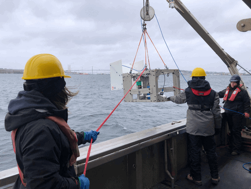
The system was integrated into custom-built landers deployed by the University of Rhode Island, or URI, as part of the Habitat Assessment and Evaluation Project. Working with NOAA and the Department of the Interior, URI is monitoring mesophotic and deep benthic coral and sponge habitats in the Gulf of America, across locations including Henderson Ridge and the West Florida Escarpment.
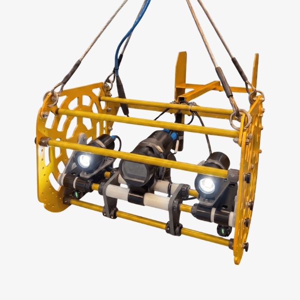
Each lander carries oceanographic sensors, data loggers, and an autonomous imaging system. The landers have been deployed at depths exceeding 1,500 meters, with imaging programmed at intervals ranging from one to four hours over deployments lasting up to 365 days.
Extending Visual Observations Across Long-Term Deployments
Deep-sea habitat recovery can take place over decades, requiring researchers to examine how biological communities respond to changing environmental conditions over time.
For URI, visual observations provide an important complement to environmental sensor data. Periodic surveys or individual dives can document conditions at specific points in time, but the research team also required a way to repeatedly record habitat conditions and biological activity throughout extended deployments.
The objective was to develop a long-term visual dataset that could support restoration assessment, ecological research, and future management decisions.
Operating Beyond 1,500 Meters
Collecting consistent imagery for an entire year at extreme depth introduced several technical requirements.
The imaging system needed to withstand depths beyond 1,500 meters for extended periods. Footage also needed to clearly capture biological activity, habitat conditions, and species interactions while complementing environmental sensor data.
Recording, power, and storage also had to be managed without physical access to the lander for periods of up to 365 days.
Autonomous Imaging Configuration
URI incorporated SubC Imaging’s Autonomous Timelapse Camera System into its custom landers.
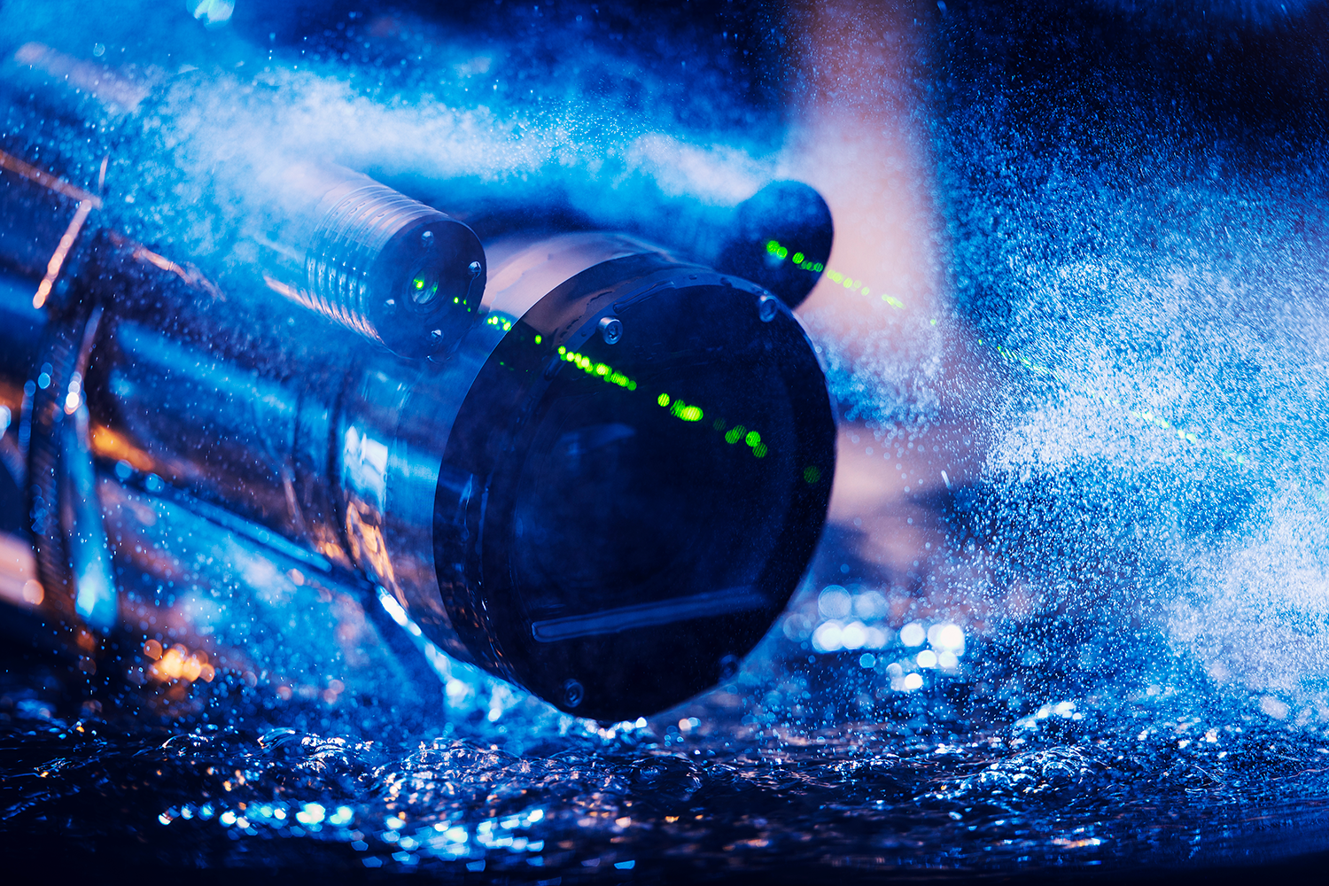
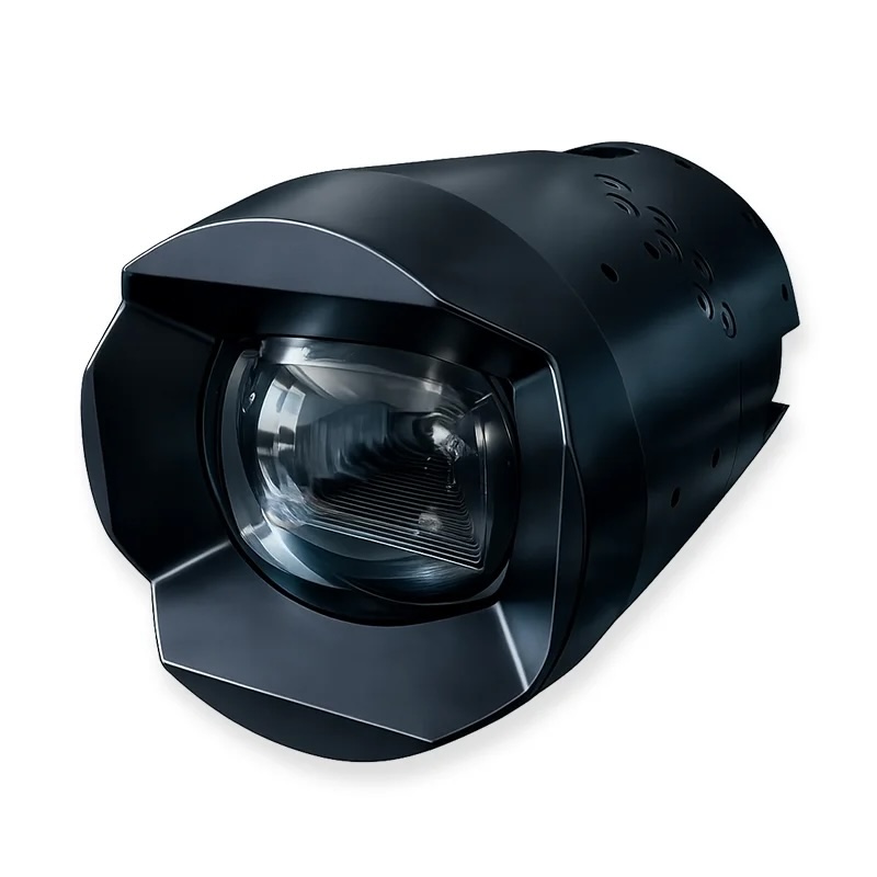
The deployed configuration included Rayfin Benthic Cameras rated to 6,000 meters, using a 12.3 MP sensor for high-resolution still imagery and HD or 4K video. Aquorea LEDs provided underwater illumination with output up to 16,000 lumens in lamp mode and 50,000 lumens in strobe mode. MantaRay Parallel Lasers provided a fixed scaling reference.
For the field deployments, the Rayfin cameras were programmed to capture a still image followed by a 10-second video clip. Recording events took place at intervals ranging from one to four hours.
Between recording events, the camera entered a low-power hibernation state to conserve energy while remaining ready for the next scheduled capture. Recording frequency and clip duration could also be programmed according to the requirements of each deployment.

Aquarists retrieve coral samples collected from a mesophotic reef by a remotely operated vehicle. This work took place in July 2022 during a cruise to study coral spawning in and around Flower Garden Banks National Marine Sanctuary. Credit: Kelly Martin/NOAA
SubC Imaging’s built-in data logging enabled information including date, time, and sensor data to be embedded directly into images through EXIF metadata.
Dr. Jane Carrick, Postdoctoral Scientist, University of Rhode Island, “There isn’t anything else like SubC’s cameras on the market that could withstand that pressure, capture time-stamped video at set intervals, and last for the full duration. This was the one that fit the bill.
Building a Year-Long Visual Record
Using the Autonomous Timelapse System, URI collected 365 days of time-lapse data while operating at depths exceeding 1,500 meters.
The deployment created a structured visual dataset that can be analyzed alongside environmental sensor data. It also documented habitat conditions across multiple locations, from Henderson Ridge to the West Florida Escarpment.
The resulting record gives researchers additional material for examining habitat conditions and biological responses over time.
Carrick added, “It’s fairly unprecedented to have actual video footage of a habitat over this span of time.”
Supporting Continued Deep-Sea Restoration Research
The URI deployments demonstrate that long-duration deep-sea video monitoring can be carried out without physical access to the imaging system during deployment. By integrating SubC Imaging’s Autonomous Timelapse System into its custom lander platforms, URI extended visual monitoring from individual surveys to a full year of observation.
The approach can reduce the need for repeated vessel deployments undertaken solely to check equipment, preserving budget and ship time for research activities.
Programmable imaging, low-power operation, and environmental sensor data provide researchers with a broader basis for examining how deep-sea habitats change over time. The resulting information supports continuing restoration research in the Gulf of America.
URI is also exploring additional deployment flexibility using Rayfin camera capabilities, including real-time topside video transfer during lander placement and setup.