Kraken Robotics Completes High Resolution Route Survey Contract in Australia

The purpose of the surveys was to enable the collection of Maritime Geospatial Information (MGI) to support maritime domain awareness through the acquisition of high-resolution seabed foundation data and associated oceanographic data By Joe Macey / 25 Jul 2024

Marine Environmental Sonar

Discover cutting-edge solutions from 5 leading global suppliers
SUPPLIER SPOTLIGHT
Kraken Robotics Completes High Resolution Route Survey Contract in Australia
Follow OS&T

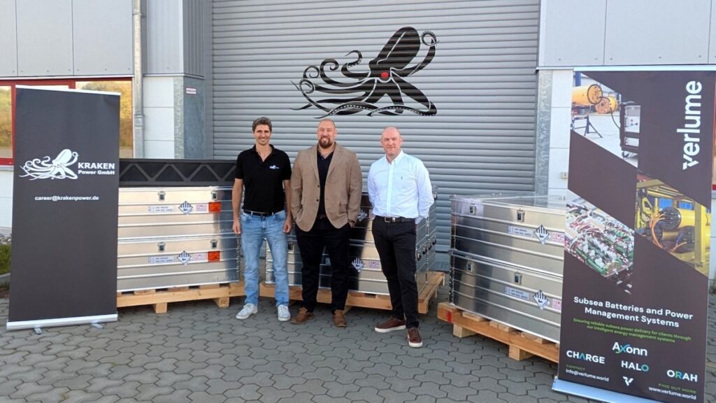
Kraken Robotics has completed of a contract to supply high-resolution seabed mapping sonar service to Precision Hydrographic Services (PHS), a customer supporting the Australian Department of Defence. 

The Australian Department of Defence project sought to undertake Hydrographic High Resolution Route Surveys (RS) for a number of Australian ports. The purpose of these surveys was to enable the collection of Maritime Geospatial Information (MGI) to support maritime domain awareness through the acquisition of high-resolution seabed foundation data and associated oceanographic data.

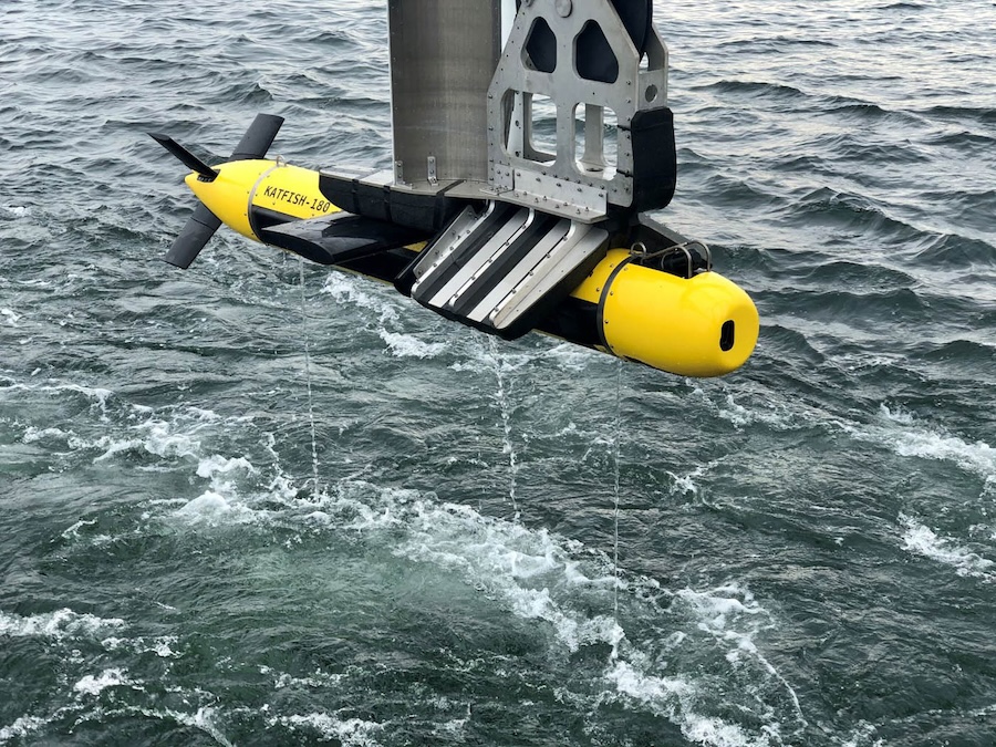
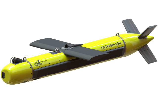
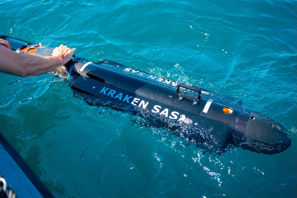
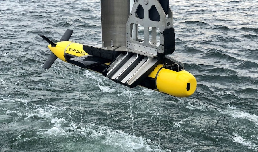
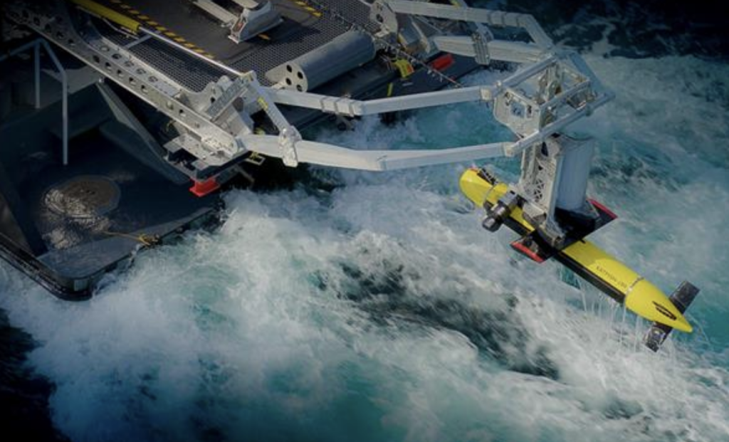
Under the scope of Kraken’s contract, a KATFISH™ high-speed survey/detection solution was used to acquire high-resolution route surveys of Australian ports. This contract follows the results of a successful in-country demonstration of KATFISH™ for the RAN in Q1 of 2023 and the purchase of a KATFISH system by the RAN in Q2, 2023.

Managing Director of Precision Hydrographic Services Pty Ltd (PHS), Neil Hewitt said; “Our decision to partner with Kraken Robotics and the KATFISH synthetic aperture sonar (SAS) system for this important Defence project has proven to be highly successful. Over the course of five months our team travelled non-stop from port to port and surveyed several thousand line-miles of Australia’s most important ports and waterways for Defence. The Kraken KATFISH performed faultlessly with not one hour of downtime.”

Kraken President and CEO, Greg Reid commented; “The Australian Defence Route Survey project has provided an excellent opportunity to test and demonstrate the performance of the Kraken KATFISH system. This is the first time that a customer has undertaken a wide area, multi-port survey project of this scale with the KATFISH – anywhere in the world. To do so in a safe and efficient manner with no downtime is a great credit to the vessel crew and the teamwork of the technical and survey personnel from PHS and Kraken Robotics.”

Posted by Joe Macey Connect & Contact

Latest Articles

Advanced Navigation Integration Enhances Side Scan Sonar Precision

Klein Marine Systems has selected Exail’s navigation technology to enhance the precision and reliability of its 5900 Side Scan Sonar system

May 02, 2025
Uncrewed Surface Vessel Employs Acoustic Tech for Real-Time Marine Mammal Monitoring

A collaboration between JASCO and SeaTrac is set to enhance real-time marine mammal monitoring using autonomous, energy-efficient surface vehicles

May 02, 2025
Profile Spotlight: Cambridge Pixel’s Radar & Sensor Data Solutions for Maritime & Offshore Operations

Cambridge Pixel is showcasing its advanced radar, sensor, and tracking technologies on OST, providing mission-critical solutions for maritime and offshore operations, including surveillance, asset protection, and USV sensor processing

May 02, 2025
Advanced Multibeam Sonar Technology Expands Capabilities in Offshore & Energy Sectors

Oceanscan Singapore expands its global rental fleet with the latest NORBIT multibeam sonar systems, enhancing survey capabilities for energy and offshore markets

May 01, 2025
AGISTAR Unveils Compact Remote-Controlled Motor for Inflatable Boats

AGISTAR has unveiled the OXR-T100, a compact, remote-controlled electric motor engineered for inflatable boats, delivering quiet, eco-friendly performance across demanding marine environments

May 01, 2025
AXYS Technologies MetOcean Observation Networks

AXYS Technologies supplies high-precision MetOcean data solutions that support marine safety, scientific research, environmental monitoring, and policy development across more than 80 countries

Apr 30, 2025

Featured Content

Advanced Multibeam Sonar Technology Expands Capabilities in Offshore & Energy Sectors

Oceanscan Singapore expands its global rental fleet with the latest NORBIT multibeam sonar systems, enhancing survey capabilities for energy and offshore markets

May 01, 2025
D-2 Ultra Low Power CTD Integrated into WHOI Arctic Research

D-2 Inc.’s advanced CTD sensor supports WHOI’s Arctic climate research, enhancing data precision in the Ice Tethered Profiler program’s latest deployments

Apr 30, 2025
Case Study: Impact Subsea Altimeter Supports Antarctic Science

Impact Subsea's ISA500 underwater altimeter plays a key role in the Icefin AUV as it collects vital data, passing through narrow boreholes drilled into Antarctic ice shelves

Apr 23, 2025