Climate change is increasingly affecting communities around the world, particularly those along coastlines. One tool aiding researchers in understanding these impacts is Global Mapper Pro, a GIS software developed by Blue Marble Geographics.
In coastal Maine, Global Mapper Pro is being used to assist in monitoring the effects of climate-driven events on vulnerable shorelines.
Using GIS Tools to Study Coastal Change
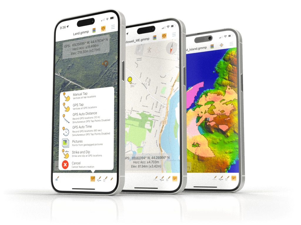
Dr. Will Kochtitzky, a geographer and Assistant Professor at the University of New England (UNE), uses GIS technology, photogrammetry, and lidar data to examine the effects of sea-level rise on coastal infrastructure, with a focus on the Camp Ellis Jetty in Saco Bay, Maine. His research team relies on tools such as Global Mapper to process data collected by drones and conduct detailed spatial analysis.
Dr. Kochtitzky explained, “As we lose mass [of glaciers] in the Arctic, it’s causing sea-level rise across the planet. That’s what we’ve been seeing over the last several decades — as sea-level rise has accelerated, coastal communities are impacted — particularly during storm events.”
Coastal Resilience Efforts in Maine
In the winter, a series of powerful storms caused severe flooding and erosion along the Maine coast. Saco Bay, and specifically the Camp Ellis Jetty, experienced significant damage, with nearly 40 homes lost. Dr. Kochtitzky’s research team recorded a major loss of sand in the region. Restrictions on constructing new seawalls have left communities seeking alternative solutions to mitigate future damage.
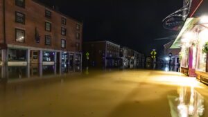
Water St. in Hallowell, Maine last winter, courtesy of Jeff Wood Imagery.
His work ties into efforts aimed at increasing coastal resilience. By generating accurate models of past and potential flood events using Global Mapper’s analysis tools, the research team helps inform community decision-making and emergency planning strategies.
Dr. Kochtitzky stated, “People have adapted to be just [prepared] enough for these big storms… But now we’re seeing higher storm surges and stronger storms — on top of sea-level rise — which leads to high cost of living in coastal environments.”
Understanding Sea-Level Rise
The issue of rising sea levels is not unique to Maine. However, Saco Bay presents a particular challenge due to an atypical current pattern. Instead of following the usual north-to-south flow along the Maine coast, water in Saco Bay moves from south to north, exacerbating erosion at the Camp Ellis Jetty.
In response, a government-led project proposes constructing a spur jetty perpendicular to the existing one to help reduce the rate of erosion.
Kochtitzky added, “My group is very interested to see how this is going to change ocean circulation and coastal erosion patterns in this region moving forward.”
Emergency Response Applications of GIS
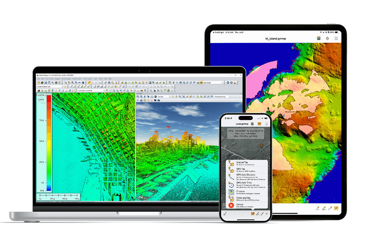
In addition to long-term environmental monitoring, Global Mapper Pro is used to support emergency planning. Its ability to handle lidar and point cloud data enables users to assess which areas are most at risk of flooding. This functionality helps planners and local governments prepare for extreme weather events and related coastal changes.
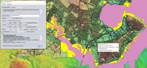
Coastal flood visualization in Global Mapper.
Kochtitzky and his team have applied these capabilities to monitor changes at the Camp Ellis Jetty over time, using drone-based data collection methods.
Analyzing Coastal Ecosystems
Beyond structural erosion, Maine’s coastal ecosystems are also under threat. Beaches along the coast lost an estimated 50% of their dunes during the recent storms. Kochtitzky’s analysis provided insight into the extent of this sand loss.
Maine’s salt marshes are another area of concern. These ecosystems are struggling to adapt to the pace of sea-level rise and the increasing intensity of storms. According to Kochtitzky, when salt marshes are overwhelmed, vegetation dies and large pools of standing water form, further degrading the environment. In prior work, salt marshes were shown to provide critical environmental services and act as a buffer for coastal areas.
Using Global Mapper, Kochtitzky and his students track these changes over time, visualizing vegetation patterns and monitoring coastal erosion.
Education and Research at the University of New England
At the University of New England, Dr. Kochtitzky integrates this research into his teaching. Students in the GIS program engage directly with the tools and methods used to examine coastal resilience, using drones, lidar, and spatial analysis to explore the real-world consequences of climate change.

Dr. Will Kochtitzky (left) and his students at the University of New England
By providing students with direct experience in data collection and analysis, the program aims to equip future scientists and planners with the skills needed to respond to the environmental challenges facing coastal communities.