Suppliers
Add your company
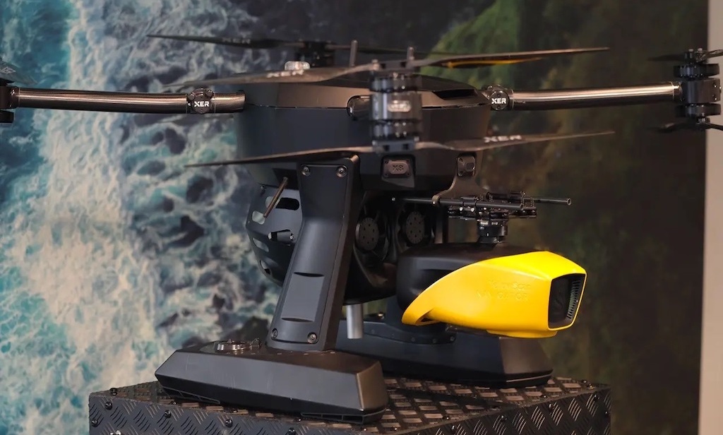
YellowScan
Innovative Bathymetric LiDAR Scanning Solution for Professional 3D Mapping & Surveying Applications
Gold Partner
Showcase your capabilities
If you design, build or supply Bathymetric LiDAR, create a profile to showcase your capabilities on this page
Products
Bathymetric LiDAR Scanning Solutions for Marine Mapping & Surveying

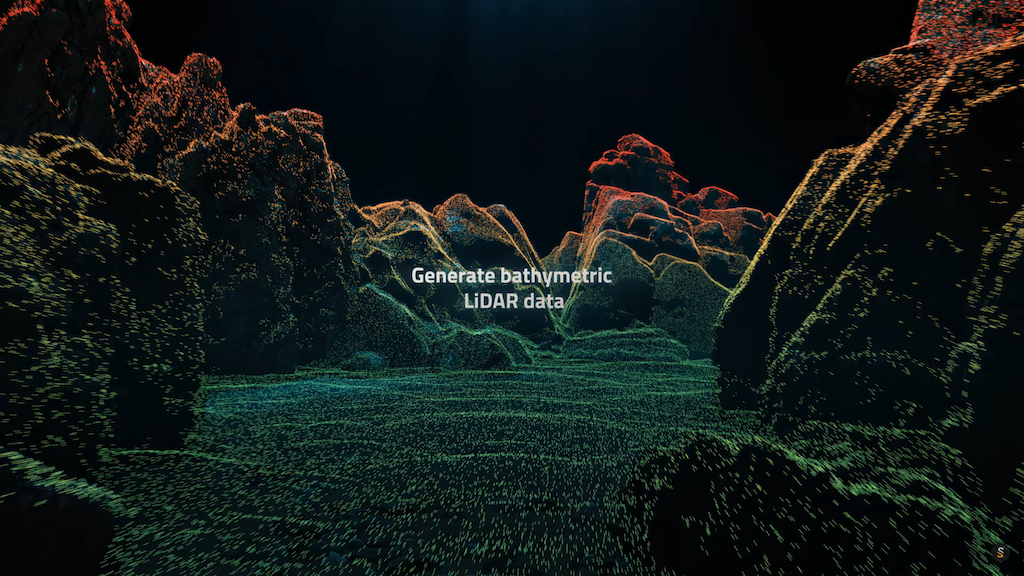
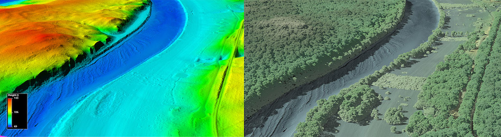
Bathymetric LiDAR, or Light Detection and Ranging, is a laser-based remote sensing technology to measure underwater topography. Unlike traditional sonar or photogrammetry techniques, LiDAR systems offer fast, accurate, and wide-area data acquisition, particularly in shallow and complex coastal zones. This makes bathymetric LiDAR especially valuable for applications ranging from nautical charting and floodplain mapping to ecological monitoring and offshore engineering.
How Bathymetric LiDAR Works
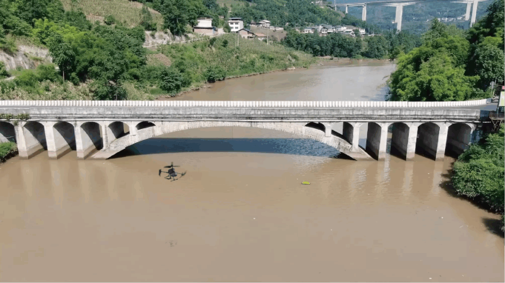
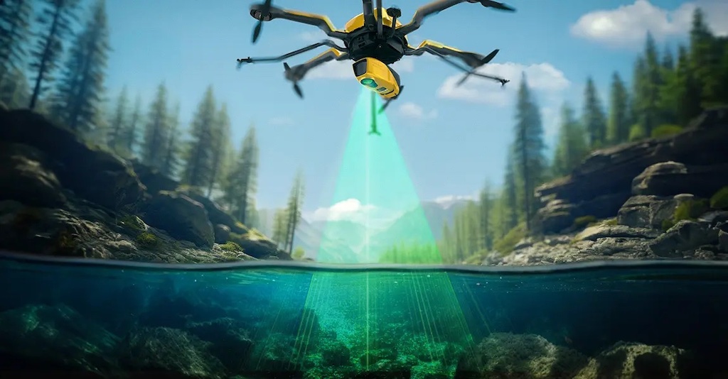
At the core of a bathymetric LiDAR system is a laser scanner that emits pulses of green light, typically at 532 nm, which can penetrate the water surface. By calculating the time delay between the emitted pulse and its reflection from both the water surface and the seafloor, these systems generate precise 3D models of underwater environments. LiDAR sensors are typically mounted on airborne platforms such as helicopters, fixed-wing aircraft, or increasingly, drones. These airborne bathymetric LiDAR systems can quickly survey large or hard-to-reach areas without vessel-based operations.
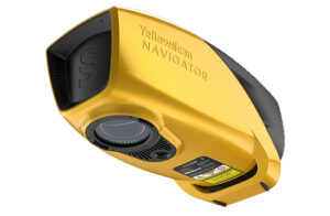
Bathymetric LiDAR scanner from YellowScan.
The system uses multiple returns and waveform analysis to distinguish between surface and subsurface reflections, enabling it to identify features such as submerged vegetation, shipwrecks, and changes in seabed morphology. Advanced bathymetric LiDAR sensors often include integrated GPS and inertial navigation systems (INS), ensuring georeferenced and motion-corrected outputs.
Applications of Bathymetric LiDAR
Bathymetric LiDAR systems are employed across a broad range of disciplines:
- Coastal and Marine Engineering: Engineers use LiDAR survey data for designing seawalls, piers, and offshore structures, ensuring accuracy in environments affected by tides and sediment shifts.
- Nautical Charting and Navigation: Hydrographic offices rely on bathymetric LiDAR scans to update nautical charts, particularly in areas with high sedimentation or erosion.
- Environmental Monitoring: By capturing 3D data on underwater surfaces and vegetation, LiDAR bathymetry supports the monitoring of coral reefs, estuarine ecosystems, and aquatic habitats.
- Disaster Response and Risk Assessment: Floodplain mapping and tsunami modeling benefit from high-resolution maps of coastal and nearshore areas produced by airborne bathymetric LiDAR.
- Archaeological and Cultural Preservation: Marine archaeologists use underwater LiDAR scanners to locate and document submerged historical sites with minimal disruption.
Types of Bathymetric LiDAR Systems
Several types of LiDAR systems are tailored for bathymetric applications:
- Airborne bathymetric LiDAR: These systems are typically mounted on manned aircraft and cover large coastal regions efficiently. They are ideal for producing broad, continuous data sets of nearshore and intertidal zones.
- Bathymetric LiDAR drones: Unmanned aerial vehicles equipped with LiDAR sensors provide flexible and cost-effective alternatives for surveying smaller or inaccessible areas.
- Topobathymetric LiDAR: These hybrid systems capture terrestrial and underwater terrain, allowing seamless transition from land to water in a single pass.
- Marine LiDAR systems: Mounted on vessels, these are suitable for nearshore and shallow water surveys where airborne systems might be limited by vegetation cover or flight restrictions.
Benefits of Using Bathymetric LiDAR
The advantages of bathymetric LiDAR over traditional methods are substantial:
- High resolution: Delivers fine spatial detail of the underwater surface, often to sub-meter accuracy.
- Rapid data acquisition: Scanning large areas in a single flight is significantly faster than vessel-based sonar surveys.
- Safety: Eliminates the need for personnel to work in hazardous or logistically difficult marine environments.
- Integration potential: Bathymetric LiDAR data can be combined with satellite imagery, sonar, and photogrammetry for comprehensive geospatial analysis.
Additionally, modern lidar sensors for drones and aircraft often include modularity and multi-sensor integration, pairing LiDAR cameras and detectors with high-resolution RGB or hyperspectral imaging systems.
Comparing Bathymetric LiDAR with Other Mapping Technologies
While sonar remains a widely used technique for underwater mapping, especially in deeper waters, it lacks the speed and spatial resolution of LiDAR in shallow, clear-water environments. Photogrammetry can provide detailed 3D models but requires clear imagery and ideal lighting conditions. In contrast, a LiDAR detector is largely unaffected by lighting and water clarity, provided turbidity is low.
For large-scale mapping of the ocean floor in shallower zones, airborne bathymetric LiDAR systems outperform traditional methods by reducing deployment time and costs. Combined with topographic LiDAR, these systems offer a unified solution for coastal zone management.
Industry Trends and Emerging Technologies
The growing availability of bathymetric lidar sensors and compact systems accelerates adoption across both public and private sectors. Lightweight bathymetric lidar drones are enabling more frequent surveys with lower operational costs, while improvements in machine learning and data fusion are helping to process vast datasets more efficiently.
Topobathymetric lidar, in particular, is gaining traction for its ability to model dynamic coastal interfaces. At the same time, advancements in green laser efficiency, lidar detector sensitivity, and INS integration improve the range and accuracy of bathymetric lidar scans even in turbid or dynamic marine environments.
Companies are also exploring using autonomous platforms that combine lidar systems with AI-based navigation, potentially expanding coverage to previously inaccessible regions.
Bathymetric LiDAR changes how underwater environments are mapped and understood, offering unparalleled accuracy and efficiency in 3D marine surveying. Whether for charting shifting coastlines, monitoring submerged ecosystems, or supporting marine infrastructure projects, these technologies provide vital data for informed decision-making in ocean science and technology. As innovations in lidar sensors, drone platforms, and data processing continue to evolve, the future of bathymetric LiDAR systems looks both scalable and sustainable, opening new possibilities for precision marine mapping across various applications.