The Global Sourcing Hub for Marine, Subsea & Offshore Technology
Discover cutting-edge solutions from leading global suppliers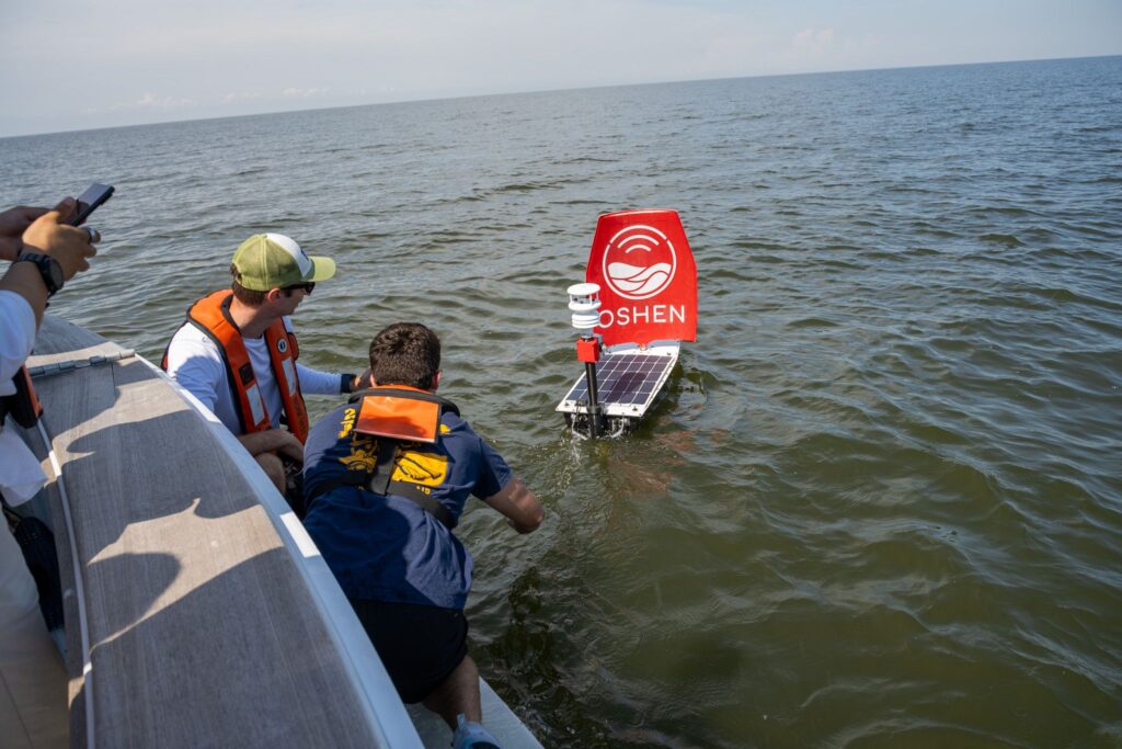
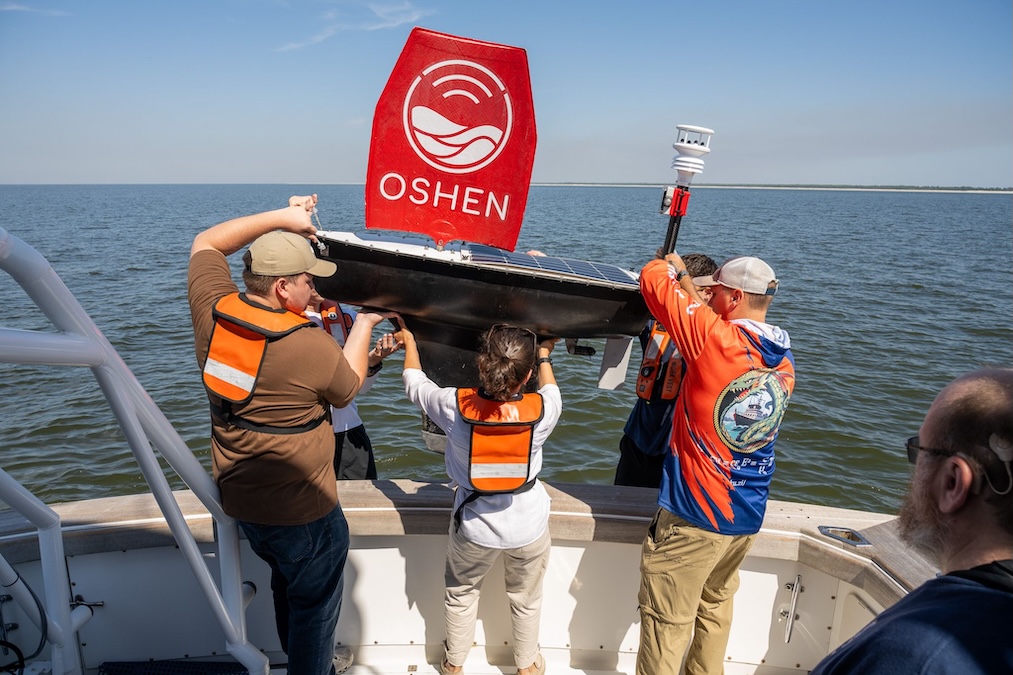
The U.S. Navy and autonomous technology developer Oshen have successfully demonstrated the ability to map shallow coastal waters using a small robotic sailing vessel during joint trials off the coast of Mississippi.
The two-week evaluation, conducted near Cat Island by personnel from the Naval Meteorology and Oceanography Command alongside Oshen developers, targeted the littoral zone — an area traditionally difficult, hazardous, and resource-intensive for standard naval vessels to survey. Operating in currents stronger than forecast, the three-foot, 100-pound C-Star robotic vessel executed multiple bathymetric transects across a dredged channel and sloped seabed using a keel-suspended single-beam echosounder, while also successfully recreating tidal curves from station-keeping depth data.
Stacy Johnson, Technical Director of the Hydrographic Department at the Naval Oceanographic Office (NAVOCEANO), stated, “Surveying littoral and shallow-water zones is critical to our operational readiness, but it presents unique environmental challenges. The modular physical and power architectures of Oshen’s platforms allow us to seamlessly integrate Navy-selected sensors, like the single-beam sonar we are using for this test. It gives us an unprecedented ability to sense and map these restrictive coastal environments safely and effectively.”
Established under a Cooperative Research and Development Agreement within the Navy’s Tech Transfer program, the initiative focuses on pairing agile commercial hardware with naval testing environments to accelerate operational deployment. Beyond hydrographic mapping, the trials evaluated platform maneuverability and speed control — including waypoint versus heading control and slow, zig-zag sailing patterns designed for search-and-rescue applications — on a vessel architecture engineered to survive extreme conditions up to category 5 hurricanes.
Dr. Jason McKenna, Chief Technology Officer, commented, “Through this collaborative Tech Transfer effort, we aren’t just evaluating a piece of hardware; we are accelerating the transition of emerging commercial tech into naval operations. Oshen brings incredible agility and innovation to the table. By pairing their low-cost autonomous sailing platforms with our rigorous testing environments, we are moving at the speed of relevance.”
Anahita Laverack, Oshen’s CEO, stated, “It is a profound honor to partner with the U.S. Navy and have our technology tested by the best oceanographers and sailors in the world. In order for C-Star constellations to make a difference to naval operations, it’s key to get C-Stars in the hands of the end users as soon as possible, tested, evaluated, pushed to their limits and solve the final steps required for operational use – data pathways, deployment Standard Operating Procedures, quality assurance. That wouldn’t be possible without close collaboration in partnership with the end users at the U.S. Navy.”
Naval evaluators view the platform as a potential component of a broader “constellation” strategy, where networks of small Unmanned Surface Vehicles can either disperse across wide areas to gather sparse oceanographic data or converge on specific zones of interest. Concurrently, the Navy is assessing a Data as a Service model to allow hydrographers to receive continuous, secure environmental data streams directly without managing hardware operations.
Warrant Officer Christopher McKinstry, Experimentation Lead at Commander, Naval Meteorology and Oceanography command, added, “The ‘constellation’ approach fundamentally changes how we view ocean sensing. By utilizing multiple C-Star platforms to work in unison, we can dynamically disperse a network of small craft for wide-area coverage, or converge them on a single area of interest. Exploring a Data as a Service framework with Oshen allows our hydrographers to focus entirely on analyzing a secure, continuous stream of high-fidelity environmental data, keeping our focus on the mission.”
By leveraging private sector technology to capture meteorological and oceanographic data from seabed to the stars, the Naval Meteorology and Oceanography Command continues to expand its capability to maintain fleet safety, operational access, and maneuverability in restrictive maritime environments.