



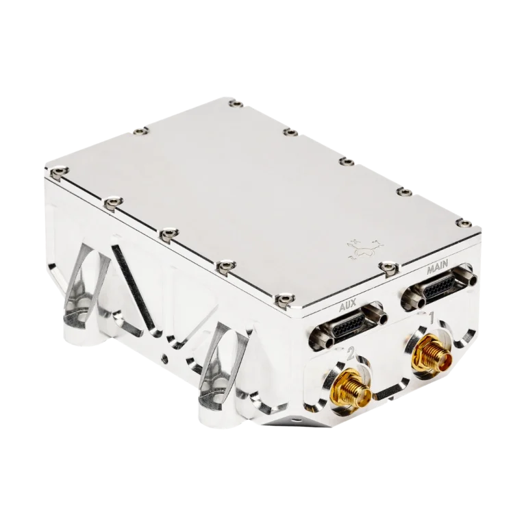
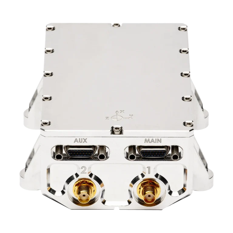
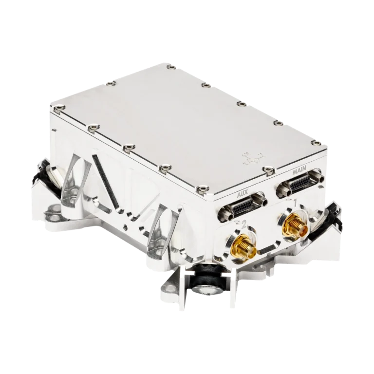
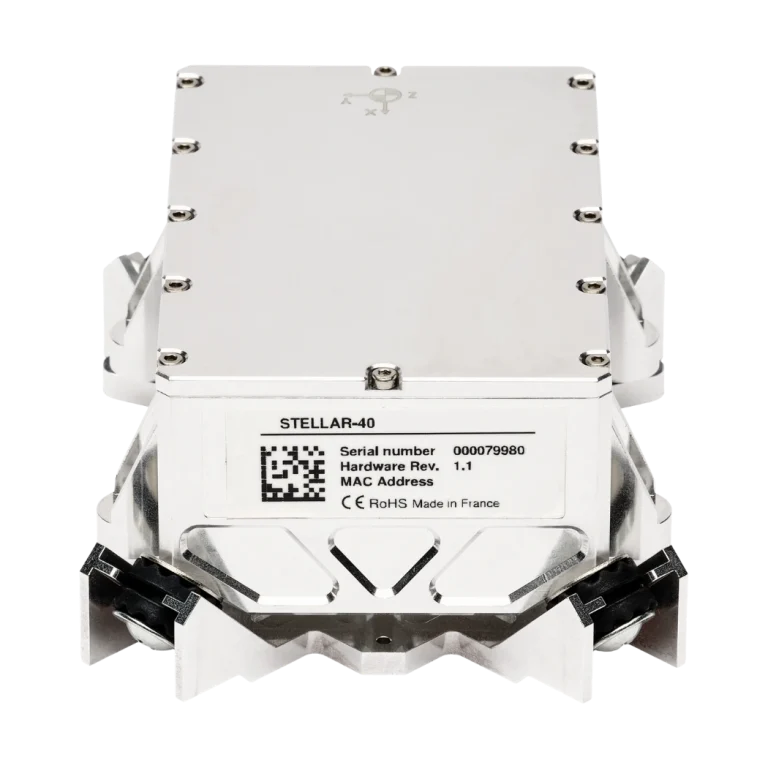
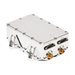
Stellar-40 is a tactical-grade inertial navigation system from SBG Systems that combines a 0.6°/h-class tactical-grade IMU, built-in magnetometers with an advanced calibration algorithm, and a full-constellation, full-band GNSS receiver within a rugged enclosure. Its SAF2Nav fusion engine provides sensor fusion, bias estimation, kinematic modeling, and spoofing supervision, while the GNSS subsystem incorporates automatic anti-jamming and anti-spoofing detection with OSNMA. System performance is specified at 1-sigma over the full temperature range, including 0.06° heading with dual-antenna GNSS, 0.02° roll and pitch with GNSS for marine transit, and 0.015° roll and pitch with RTK GNSS for dynamic marine survey patterns. Horizontal and vertical position performance are 1.2 m and 1.5 m respectively with GNSS, while heave performance is 5 cm or 5% of swell.
Designed for marine navigation, unmanned surface vehicles, and motion compensation, Stellar-40 supports aiding from DVL, loch, generic velocity, USBL, and depth sensors through the SAF2Nav framework. Its marine configuration combines IMU-level damping and a rugged enclosure with embedded vibration spectral analysis, alongside MIL-STD-810H vibration and shock qualification. Integration options include Ethernet, serial, CAN 2.0 A/B, synchronization I/O, NMEA, sbgECom, REST API, third-party protocols, and PX4, ArduPilot, and ROS 2 drivers. Stellar-40 provides IMU and INS output at 200 Hz, operates from 9–36 VDC across -40 to 71°C, weighs 365 g, and measures 107.7 × 85 × 70 mm.
| IMU class: | 0.6°/h class |
| Heading: | 0.06° (dual antenna GNSS) |
| Roll / Pitch: | 0.02° (GNSS) for marine transit; 0.015° (RTK GNSS) for dynamic marine survey patterns |
| Horizontal position: | 1.2 m (GNSS) |
| Vertical position: | 1.5 m (GNSS) |
| Dead reckoning: | 0.4% distance travelled for marine transit; 0.25% distance travelled for dynamic marine survey patterns |
| Heave: | 5 cm or 5% of swell |
| GNSS frequencies: | Full band, all signals in view tracking |
| GNSS constellations: | GPS / Beidou / GLONASS / Galileo / QZSS / NaviC |
| Time to first fix: | <35 s (cold start) |
| Jamming / Spoofing: | Automatic anti-jamming & anti-spoofing detection, OSNMA |
| Output rate: | 200 Hz (IMU & INS) |
| Datalogger: | 8 GB or 48 h @ 200 Hz |
| Protocols: | NMEA, sbgECom (binary), REST API, third-party protocols |
| Main interface: | 1x Ethernet full duplex – Web interface, FTP, PTP / NTP, NTRIP |
| Other interfaces: | Serial (RS232/RS422), CAN 2.0 A/B, sync I/O (RS232 & TTL) |
| Connectors: | 2x Micro-D 15 (I/O); 2x SMA connectors (antennas) |
| Input voltage: | 9–36 VDC |
| Power consumption: | 3 W without antennas |
| Operating temperature: | -40 to 71°C |
| IMU range: | ±40 g; ±490°/s |
| Weight: | 365 g |
| Dimensions (LxWxH): | 107.7 × 85 × 70 mm |
| Vibrations & shocks: | MIL-STD-810H |
| EMC: | MIL-STD-461 & MIL-STD-1275 |