Showcase your capabilities
If you design, build or supply Underwater LiDAR, create a profile to showcase your capabilities and connect with visitors who have an active requirement for your solutions.


Underwater LiDAR has emerged as a pivotal technology in marine exploration, offering high-resolution insights into environments previously considered inaccessible or difficult to map with precision. As ocean scientists and engineers seek more advanced tools for underwater surveying and mapping, LiDAR systems adapted for aquatic use provide unprecedented clarity and data fidelity. This page delves into the technology behind underwater LiDAR, its wide range of applications, and how it compares to other methods like sonar, while also integrating essential supporting technologies such as IMUs, AHRS, and GNSS.
Read the Technology Overview


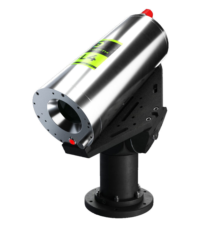
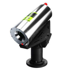
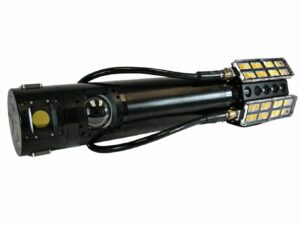
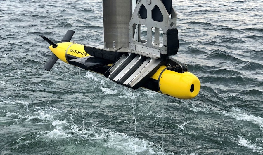
Industry-Leading Underwater Imaging and Power Solutions for Demanding Professional Survey Applications
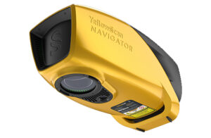
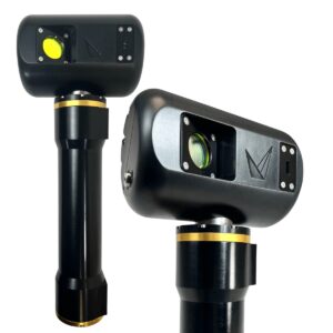
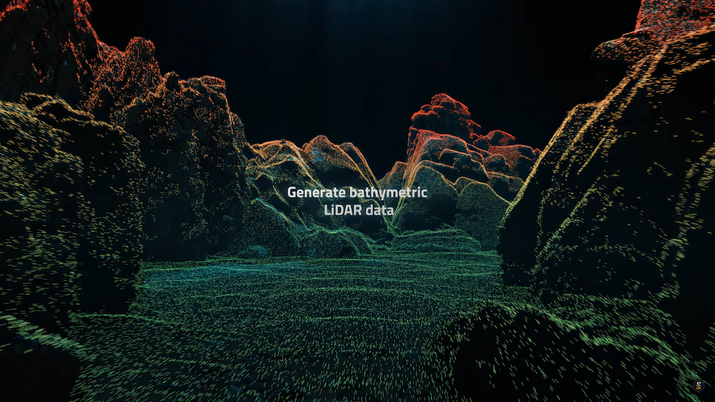
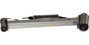
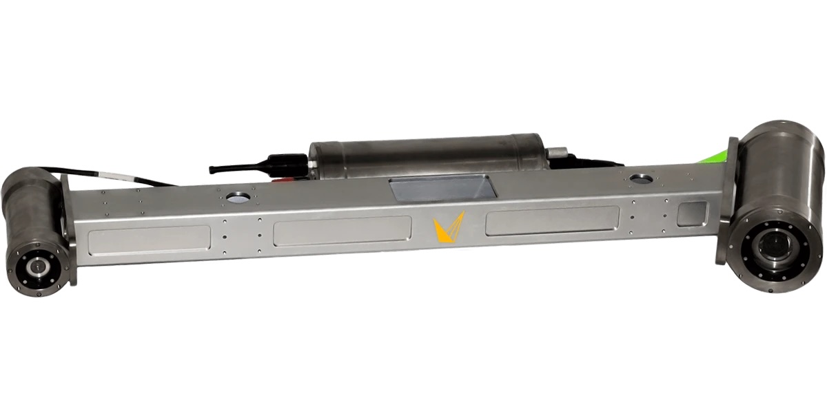
Innovative Bathymetric LiDAR Scanning Solution for Professional 3D Mapping & Surveying Applications
If you design, build or supply Underwater LiDAR, create a profile to showcase your capabilities and connect with visitors who have an active requirement for your solutions.

Underwater LiDAR (Light Detection and Ranging) is a remote sensing technology that uses laser light to detect and map underwater features with high precision. Unlike traditional sonar, which relies on sound waves, LiDAR uses laser pulses. These typically green or blue wavelengths penetrate water effectively to measure distances to seafloor features, underwater structures, or suspended particles. This allows for creating high-resolution 3D maps of the ocean floor, harbor installations, coral reefs, and submerged archaeological sites.
Adaptations for aquatic environments include water-resistant housings, enhanced laser emitters, optical components such as photodetectors optimized for low-light underwater conditions, and integration with other marine survey tools. Systems may include cooling systems to ensure performance stability, timing electronics for accurate pulse measurement, and data acquisition systems to manage large volumes of collected data.
Underwater LiDAR works by emitting a laser pulse and measuring the time it takes for the reflected light to return from underwater surfaces. Special considerations are required because light behaves differently in water than in air, undergoing refraction, scattering, and absorption. Systems often integrate with inertial measurement units (IMUs), GPS modules, and RTK correction signals to provide precise positioning and motion compensation.
Advanced models include underwater LiDAR and laser scanners mounted on remotely operated vehicles (ROVs), autonomous underwater vehicles (AUVs), or surface vessels. These setups typically include a stabilization platform to counteract motion and a data storage unit to handle the extensive datasets generated during mapping operations.
Underwater LiDAR is used across various scientific, commercial, and defense-oriented applications. Its ability to provide accurate, real-time, and high-resolution data makes it indispensable in numerous fields:
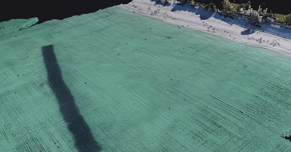
LiDAR systems conduct underwater surveying for coastal engineering, environmental impact assessments, and infrastructure development. Bathymetric LiDAR systems can produce detailed bathymetric maps essential for hydrodynamic modeling, sediment transport analysis, and port and harbor planning.
Oil and gas operators use LiDAR to inspect underwater pipelines and cables. High-resolution scans reveal damage, deformation, or sediment buildup along pipelines. This method is non-invasive, non-destructive, and allows for consistent monitoring with minimal operational disruption.
Underwater LiDAR plays a critical role in discovering and documenting submerged archaeological sites. Its ability to produce detailed topographies aids in preserving historical sites and supports research into ancient maritime activity.
Marine biologists and conservationists employ LiDAR for reef monitoring, seagrass bed mapping, and fish habitat analysis. Its non-destructive nature is ideal for fragile ecosystems and allows for repeated measurements over time to detect changes.
LiDAR systems are deployed to inspect submerged portions of dams and reservoirs. These systems detect cracks, sediment accumulation, and structural deformations, often in areas difficult to reach with divers.
Military and security agencies use LiDAR for underwater mine detection, port and harbor security, and reconnaissance missions. The speed and accuracy of underwater LiDAR allow the safe identification of threats in complex underwater environments.
Ocean scientists leverage LiDAR to create high-resolution maps of the ocean floor, helping to advance our understanding of geological features, underwater ridges, and sediment patterns. This data supports broader initiatives in climate science and marine ecology.
Underwater LiDAR systems rarely operate in isolation. They are part of integrated systems combining navigation systems, attitude heading reference systems (AHRS), and positioning systems to maintain accurate data capture. These technologies correct for pitch, roll, and yaw, ensuring that mapping outputs are precise spatially.
Communication interfaces allow real-time data transmission, while control software interprets raw data into usable models and visualizations. Systems also rely on a combination of rangefinder modules, underwater laser emitters, and photodetectors to optimize performance under different environmental conditions. For extended missions, particularly those using AUVs or ship-based platforms, a robust data acquisition system is essential to ensure all collected information is preserved for analysis.
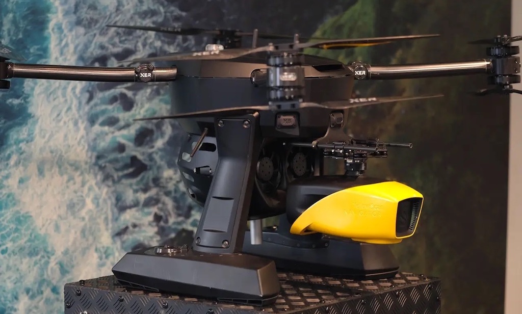
Voyis’ Insight underwater scanners are based on a form of LiDAR
Depending on the application, different types of underwater LiDAR systems may be used:
While both LiDAR and sonar are used for underwater sensing, they operate on fundamentally different principles. Sonar uses acoustic waves and is generally more effective in turbid or deep-water conditions. LiDAR, on the other hand, provides much higher resolution in clearer water and is ideal for applications requiring fine detail, such as underwater archaeology or close-range infrastructure inspection.
LiDAR offers a significantly faster data acquisition rate and is less affected by background noise in the marine environment. However, it can be limited by water clarity, with performance diminishing in murky or particulate-heavy waters.
By delivering high-resolution, three-dimensional representations of submerged environments, it enables better decision-making in fields ranging from environmental monitoring to defense and infrastructure. When integrated with complementary technologies like GNSS, AHRS, and real-time positioning systems, underwater LiDAR becomes a critical tool in the modern marine scientist’s toolkit. With ongoing advances in laser emitters, photodetectors, and data processing algorithms, its utility and range of applications will only expand, helping to map the ocean floor and safeguard marine environments more accurately than ever.
 Searching Companies & Products

 Subscribe to the Weekly eBrief
The latest engineering and technical developments straight to your inbox - join thousands of engineers who receive it.
Subscribe to the Weekly eBrief
The latest engineering and technical developments straight to your inbox - join thousands of engineers who receive it.