


Subsea Imaging Systems
Discover cutting-edge solutions from 12 leading global suppliers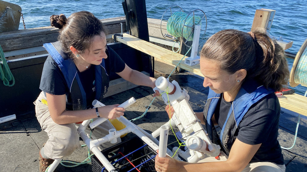
NOAA and the nonprofit Ocean Discovery League (ODL) have made a formal agreement to work together to accelerate deep-ocean exploration through the development of low-cost tools and technologies, such as deep-sea cameras.
These tools and technologies give greater, more equitable access to broader public and scientific communities to explore the deep ocean.
Founded by deep-sea explorer Katy Croff Bell, Ph.D., Ocean Discovery League’s mission is to accelerate deep-ocean exploration by developing accessible systems to broaden the community of those who explore and understand the deep sea.
ODL is developing a strategic approach to expand the area of the seafloor explored, mapped and characterized while reducing expenses by creating lower-cost, easier-to-use tools and technology. These actions, along with a more targeted approach to selecting exploration locations, will expand deep ocean exploration to a broader community of explorers, focusing on those historically excluded from deep-sea research and exploration.
The new memorandum of understanding (MOU) between NOAA and ODL creates a framework for cooperation and coordination to advance mutual goals that accelerate the pace and efficiency of ocean exploration, improving workforce capabilities within the ocean economy, as well as training, education and outreach focused on ocean exploration.
More specifically, NOAA and ODL will:
- Develop targeted and strategic deep-sea locations of mutual importance for future expeditions.
- Develop and implement low-cost, deep-sea technologies required to increase access to ocean exploration, including deep submergence systems and telepresence technologies.
- Develop joint outreach and education opportunities to broaden and diversify the community of deep-ocean explorers.
- Work together to design technology and training initiatives to promote inclusion, accessibility and equity in deep-sea exploration.
- Increase NOAA and ODL training and education programs, career-building experiences and research capabilities for current and future ocean explorers.
ODL’s goal of prioritizing equity and inclusion aligns with NOAA’s mission to make equity central to every facet of our science, service and stewardship mission, from our strategic priorities to our daily operations, practices and partnerships.
The MOU is one of a number of partnerships that NOAA has forged in recent years to advance ocean exploration, mapping and characterization. Many of these partnerships are also helping to accelerate the National Strategy for Mapping, Exploring, and Characterizing the U.S. Exclusive Economic Zone.
This national strategy calls for mapping, exploring, and characterizing the deep waters of the U.S. Exclusive Economic Zone by 2030 and the nearshore waters by 2040. The strategy emphasizes the need for robust collaboration by federal, state, academic and private partners.
Katy Croff Bell, founder and president of ODL, said; “The impact of equitable access to deep-ocean exploration will be explosive. By lowering the cost-prohibitive and logistical barriers, we will see an unprecedented acceleration in new ocean data gathered to help characterize the ocean for science-based decision-making worldwide and dramatically expand our understanding of the ocean’s biodiversity.”
Jeremy Weirich, director of NOAA Ocean Exploration, added; “This partnership with Ocean Discovery League will help us accelerate ocean exploration at a time when only a fraction of the ocean has been explored and allow us to expand access to careers available in this field for underserved communities.
“We are excited to team up with another dynamic partner who shares our mission to fully explore, map and characterize the ocean with an emphasis on exploring the U.S. territorial waters on our doorstep.”


