Wireless Charging and Data Transfer System for Winches

To facilitate SVP or CTD profiling, OSIL’s Micro Profiling Winches have wireless charging and data transfer capabilities, developed in conjunction with AML Oceanographic Ltd. By Abi Wylie / 04 Jun 2024

Discover World-Leading Technologies for Ocean Science

Discover cutting-edge solutions from leading global suppliers
SUPPLIER SPOTLIGHT
Wireless Charging and Data Transfer System for Winches
Follow OS&T

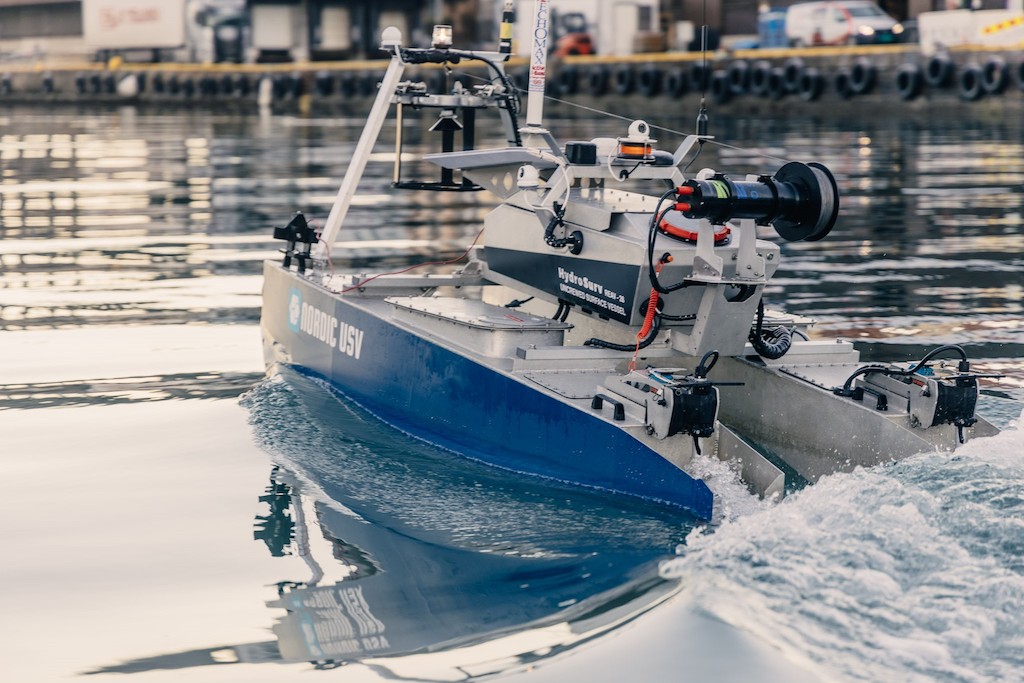
Marine engineering experts Ocean Scientific International Ltd (OSIL), with AML Oceanographic Ltd., have developed a wireless charging and data transfer system for their Micro Profiling Winches.

This wireless charging and data transfer system is designed to be used seamlessly with an AML-3 LGR instrument.

The compact and programmable winches are designed to equip USV systems with the ability to collect SVP or CTD profiles from user specified depths during live operations, enabling surveys to be carried more quickly and cover a wider area in a given deployment. 

The winches are fitted with an instrument capture mechanism which allows for seamless recharging on recovery of the instrument to the surface. Wireless data transfer is accomplished simultaneously using the instruments integrated WiFi transmitter.

The winches are easily integrated into most USV control systems, with status notifications for docking, zero position and payout readings. Each winch can accommodate a wide variety of ropes/cables and slipring combinations, with 5kg line pull at the first layer and a 200m drum capacity (based on 1.6mm dyneema).

The OSIL automated winches have been successfully proven in the field, even in Arctic conditions, with over 60 systems supplied & built in the last 3 years.

Posted by Abi Wylie Edited by Abigail Wylie, Editor and Copywriter experienced in digital media with a keen interest in ocean science technology. Connect

Latest Articles

Profile Spotlight: IQUA Robotics for Autonomous Underwater Survey & Inspection

IQUA Robotics is presenting its hovering AUV technologies on OST, providing precise, maneuverable platforms for subsea mapping, inspection, and reconnaissance

Nov 20, 2025
Precision Terrain Modeling & Hydrological Analysis with Global Mapper

Blue Marble Geographics’ Global Mapper enables Egis to streamline digital terrain modeling and hydrological analysis, enhancing data processing efficiency across large-scale environmental projects

Nov 20, 2025
Real-Time Vibration Analysis Embedded in SBG Systems IMU

SBG Systems’ IMU now features built-in vibration monitoring, delivering real-time analysis to enhance accuracy, detect resonance, and support design, testing, and structural monitoring

Nov 19, 2025
Kraken Robotics Forms Reseller Partnership to Expand Access to Subsea Sonar Technology

Kraken Robotics has appointed BlueZone Group as an authorized reseller of its SAS and KATFISH platform, offering high-resolution underwater imaging, bathymetric mapping, and rapid data collection for defense and commercial surveys in Australia and New Zealand

Nov 19, 2025
Monitoring Marine Environments with Pro-Oceanus Dissolved Gas Sensors

Discover how Pro-Oceanus Systems’ advanced sensors help explore the oceans, measure dissolved gases, and uncover critical insights into marine and climate processes

Nov 18, 2025
Strategic Partnership to Deliver High-Resolution Deep-Sea Seafloor Intelligence & Insights

PlanBlue and Orpheus Ocean have collaborated to integrate advanced AI-driven imaging with autonomous underwater vehicles, enabling enhanced monitoring and analysis of critical deep-sea environments

Nov 17, 2025

Featured Content

FarSounder Integration Delivers Real-Time Seafloor & Obstacle Detection to SYNAPSIS Users

FarSounder has integrated its Argos 3D Forward Looking Sonar with Anschütz’s SYNAPSIS navigation platform, bringing real-time subsurface insights directly into the (W)ECDIS NX interface

Nov 17, 2025
Boxfish ROV Captures Marine Research Footage for Upcoming Premiere

Scientists from the University of Tasmania used a custom Boxfish ROV to survey Beagle Marine Park, capturing underwater footage premiering on YouTube this November

Nov 12, 2025
SubC Imaging Observatory Camera Systems Support Long-Term Ocean Observation

SubC Imaging’s Observatory Camera Systems capture detailed subsea imagery for cabled ocean observatories, enabling continuous observation and long-term marine environmental studies

Nov 11, 2025