AUV Upgrades Trialed Off Australian Coast

The AUV has recently undergone significant upgrades and the addition of new modules, including the subsea ultra-short baseline aiding the vehicle inertial navigation system positioning By Abi Wylie / 26 Feb 2024

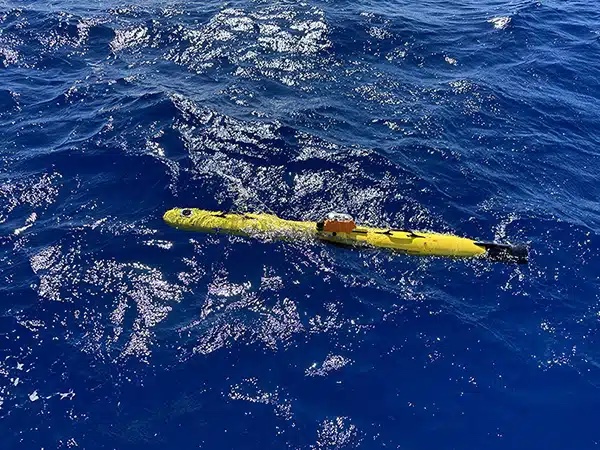
Autonomous Underwater Vehicles (AUV)

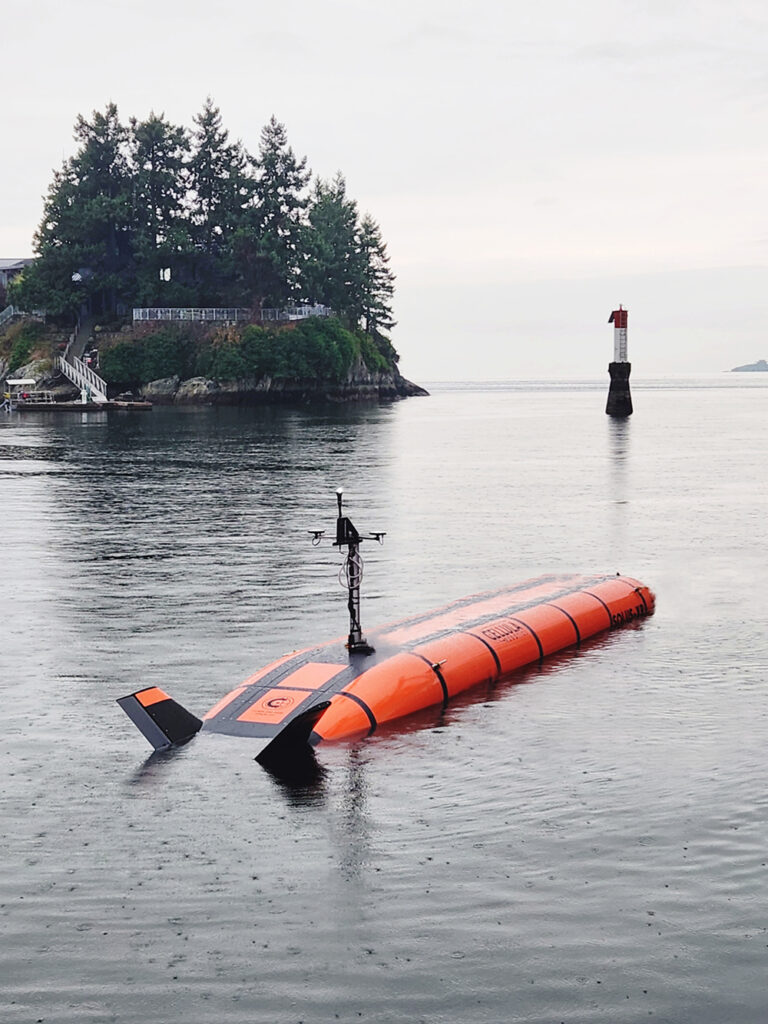
Discover cutting-edge solutions from 9 leading global suppliers
SUPPLIER SPOTLIGHT
Follow OS&T

UTEC, a geo-services brand in Acteon’s Data and Robotics division, conducted a day of ‘Gavia’ Autonomous Underwater Vehicle (AUV) trials off Fremantle in Western Australia. 

The AUV has recently undergone significant upgrades and the addition of new modules including the subsea ultra-short baseline (USBL) aiding the vehicle inertial navigation system (INS) positioning.

The trial tested the AUV in its reconfiguration and provided further training for the local crew with the support of UTEC’s AUV specialists from the UK.

Following on from the training and trials completed since the AUV arrived in Perth at the end of 2022, UTEC has finalised a significant programme of upgrades and improvements of the system. 

It has included INS/Doppler velocity log (DVL) modules (PHINS C3 and Pathfinder DVL); battery modules increasing mission endurance from six hours to 12; cNode USBL modules and nose cone enabling USBL tracking, aiding acoustic communications to the AUV and incorporating a new eight-megapixel camera in the nosecone. 

The control modules also received upgrades including calibration of depth and sound velocity (SV) sensors and a firmware upgrade. 

The most significant upgrade, however, is the addition of the module that enables subsea USBL aiding of the vehicle INS positioning. This means the vehicle does not need to surface periodically to update the internal position and account for INS/DVL drift, creating efficiencies by allowing the vehicle to remain subsea and on task for the full 12-hour mission endurance as well as allowing use of the full 1000 m depth rating. 

Previously, the requirement for the vehicle to return to the surface to update real-world position using Global Positioning System (GPS), meant that the deepest that the AUV had worked was 100 m; anything deeper was too inefficient with the time spent diving and surfacing to update the position in deeper waters.

“The day resulted in several milestones for UTEC in terms of AUV operations with these officially being the deepest dives that we have completed with the Gavia. It was also the first time the AUV has been positioned with USBL aiding. We are looking forward to assisting further clients with their deepwater survey and positioning requirements,” said Paul Barry, Country Manager – Australia, UTEC.

Posted by Abi Wylie Edited by Abigail Wylie, Editor and Copywriter experienced in digital media with a keen interest in ocean science technology. Connect

Latest Articles

Profile Spotlight: IQUA Robotics for Autonomous Underwater Survey & Inspection

IQUA Robotics is presenting its hovering AUV technologies on OST, providing precise, maneuverable platforms for subsea mapping, inspection, and reconnaissance

Nov 20, 2025
Precision Terrain Modeling & Hydrological Analysis with Global Mapper

Blue Marble Geographics’ Global Mapper enables Egis to streamline digital terrain modeling and hydrological analysis, enhancing data processing efficiency across large-scale environmental projects

Nov 20, 2025
Real-Time Vibration Analysis Embedded in SBG Systems IMU

SBG Systems’ IMU now features built-in vibration monitoring, delivering real-time analysis to enhance accuracy, detect resonance, and support design, testing, and structural monitoring

Nov 19, 2025
Kraken Robotics Forms Reseller Partnership to Expand Access to Subsea Sonar Technology

Kraken Robotics has appointed BlueZone Group as an authorized reseller of its SAS and KATFISH platform, offering high-resolution underwater imaging, bathymetric mapping, and rapid data collection for defense and commercial surveys in Australia and New Zealand

Nov 19, 2025
Monitoring Marine Environments with Pro-Oceanus Dissolved Gas Sensors

Discover how Pro-Oceanus Systems’ advanced sensors help explore the oceans, measure dissolved gases, and uncover critical insights into marine and climate processes

Nov 18, 2025
Strategic Partnership to Deliver High-Resolution Deep-Sea Seafloor Intelligence & Insights

PlanBlue and Orpheus Ocean have collaborated to integrate advanced AI-driven imaging with autonomous underwater vehicles, enabling enhanced monitoring and analysis of critical deep-sea environments

Nov 17, 2025

Featured Content

FarSounder Integration Delivers Real-Time Seafloor & Obstacle Detection to SYNAPSIS Users

FarSounder has integrated its Argos 3D Forward Looking Sonar with Anschütz’s SYNAPSIS navigation platform, bringing real-time subsurface insights directly into the (W)ECDIS NX interface

Nov 17, 2025
Boxfish ROV Captures Marine Research Footage for Upcoming Premiere

Scientists from the University of Tasmania used a custom Boxfish ROV to survey Beagle Marine Park, capturing underwater footage premiering on YouTube this November

Nov 12, 2025
SubC Imaging Observatory Camera Systems Support Long-Term Ocean Observation

SubC Imaging’s Observatory Camera Systems capture detailed subsea imagery for cabled ocean observatories, enabling continuous observation and long-term marine environmental studies

Nov 11, 2025