


Discover World-Leading Technologies for Ocean Science
Discover cutting-edge solutions from leading global suppliers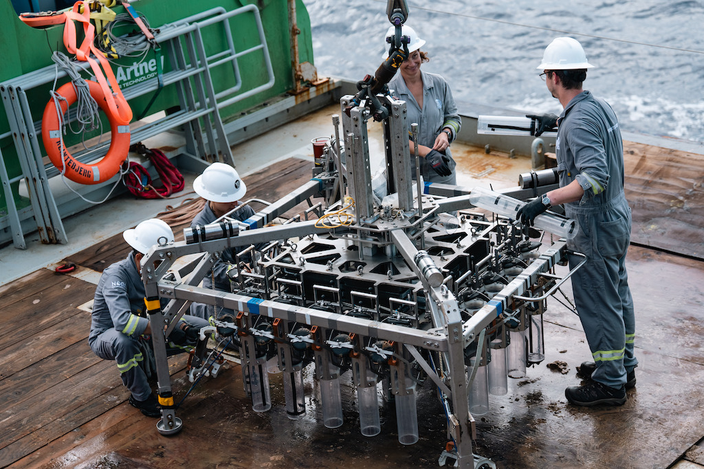
The Metals Company has concluded its latest offshore scientific research campaign to assess seafloor impacts and recovery rates.
The Metals Company, an explorer of lower-impact battery metals from seafloor polymetallic nodules, completed this research twelve months after the pilot nodule collection system test was conducted by the company’s NORI subsidiary.
Despite some obstacles in the collection of key environmental data requested by the ISA’s Legal and Technical Commission, researchers were able to complete the major components of the scientific work scope slated for the campaign.
The data gathered will further support NORI’s application to the International Seabed Authority for a commercial exploitation contract, which it expects to submit following the July 2024 meeting of the ISA.
The team selected 19 sampling stations in the locality of last year’s nodule collection system test and conducted 39 multicore deployments, recovering 395 individual core samples. These yielded more than 600 subsamples that will be shared with independent researchers from leading marine research institutions for further biological analysis.
Additionally, using a remotely operated vehicle (ROV), the research team deployed innovative seafloor lander systems that are capable of measuring seafloor oxygen fluxes using eddy covariance methods.
This resulted in over 600 hours of data acquisition at a maximum deployment depth of 4285m, which NORI believes is the first time these bespoke sensor suites have been deployed at abyssal depths. This data is further supplemented by over one thousand core sub-samples for geochemical analysis.
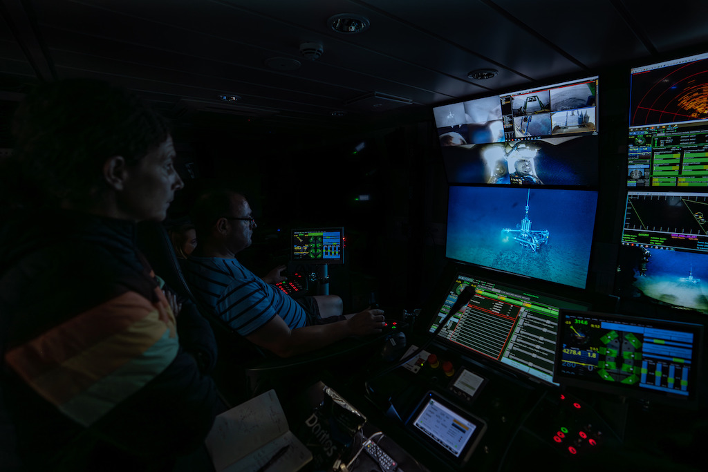
Using the ROV, the team gathered over 30 hours of dedicated video footage of the seafloor, with particular focus on sessile organisms. Based upon a preliminary qualitative assessment, organisms identified during NORI’s environmental baseline studies are still present twelve months on in areas that have been influenced by the seafloor plume. This data will be shared with researchers for further analysis.
Researchers also conducted the fourth annual recovery and redeployment of three oceanographic moorings within NORI-D. The sensor payload on the moorings provides insights into the soundscape, regional oceanographic currents, and particulate organic carbon flux in the Eastern CCZ region. This data contributes to the long-term oceanographic time series and importantly will cover the El Niño-Southern Oscillation fluctuations.
Earlier this month, NORI began sharing emerging data on the characteristics of seafloor sediment plumes. In line with its commitment to share this key environmental data with society, NORI also convened a global stakeholder webinar attended by over two hundred people to provide an update on its environmental program.
NORI’s latest environmental campaign adds to the significant research conducted in the deep sea. Since the late 1960s, over 300 hundred offshore campaigns have been conducted in international waters with over $2 billion invested in environmental baseline and impact studies and technology development, with most of the capital invested by private companies.
To address knowledge gaps, governments and contractors like NORI have spent over 9,000 days – the equivalent of almost 25 years – at sea, assessing the deep-sea environment, research and investment which has accelerated significantly since the establishment of the ISA’s exploration regime.
Dr Michael Clarke, TMC’s Environmental Manager, said; “Despite attempts to disrupt our offshore scientific program the data collected is more than sufficient to meet our objectives for the campaign. This new information provides an insight as to the scale of seabed disturbance from nodule collection and how the benthic communities respond over time.
“Using the data collected during our decade-long research program, we can now conduct a robust, data-driven assessment of the impacts of nodule collection on the marine environment. We look forward to presenting the findings of our studies to the ISA and stakeholders in the coming year.”


