Thoma-Sea to Build NOAA Research Ships

The new ships are expected to be delivered in 2027 and 2028 and will focus primarily on ocean mapping and nautical charting By Joe Macey / 11 Jul 2023

Discover World-Leading Technologies for Ocean Science

Discover cutting-edge solutions from leading global suppliers
SUPPLIER SPOTLIGHT
Follow OS&T

National Oceanic and Atmospheric Administration (NOAA) will add two new ships to its fleet of research vessels.

The agency selected Thoma-Sea Marine Constructors for a $624.6 million contract to initially design and build two research vessels, with an option to purchase two more.

The first two ships will be built in Houma, Louisiana, with an expected delivery date of 2027 and 2028. 

The new ships will focus primarily on ocean mapping and nautical charting as part of NOAA’s mission to deliver tools and information to help mariners safely navigate the nation’s ports and harbors.

The new vessels will have additional capabilities to help assess and manage living marine resources and collect data for oceanographic monitoring, research and modeling activities.

“These state-of-the-art ships will ensure that we can continue to meet NOAA’s mission to support safe navigation, coastal resource management and the nation’s blue economy,” said NOAA Administrator Rick Spinrad, PhD. “I’m also proud that these new vessels will harness modern engines and design that will move NOAA forward in reducing its own emissions with an eye towards achieving a net-zero fleet.”

The ships will be designed to coordinate, acquire and process large data sets like those gathered from mapping the seafloor and characterizing marine habitats. They will also have the ability to deploy crewed survey work boats, scientific equipment and uncrewed systems, which enhance the work the ship does. 

“This is another milestone in NOAA’s effort to recapitalize our aging fleet of ships,” added NOAA Corps Rear Adm. Nancy Hann, Director of NOAA Marine and Aviation Operations and the NOAA Commissioned Officer Corps. “These ships are vital for mapping the United States Exclusive Economic Zone, enabling maritime commerce and responding to natural disasters, and will allow us to meet critical at-sea data collection requirements for the economic security, public safety and national security for many years to come.”

This contract was awarded following a request for proposals that was open June – October 2022. 

The design and construction of these new ships is funded in part by the Inflation Reduction Act – a historic $3.3 billion investment to help communities, including tribes and vulnerable populations, prepare, adapt and build resilience to weather and climate events in pursuit of a climate-ready nation. The act also supports improvements to weather and climate data and services, and strengthens NOAA’s fleet of research airplanes and ships. 

The research and survey ships operated, managed and maintained by NOAA Marine and Aviation Operations comprise the largest fleet of federal research ships in the nation. Ranging from large oceanographic research vessels capable of exploring the world’s deepest ocean, to smaller ships responsible for charting the shallow bays and inlets of the US The fleet supports a wide range of marine activities, including fisheries surveys, nautical charting and ocean and climate studies. NOAA ships are operated by NOAA Corps officers and civilian professional mariners.

Posted by Joe Macey Joseph Macey is a Content Specialist at Ocean Science & Technology, where he has focused on emerging marine technologies since joining in 2022. He brings particular expertise in autopilot systems, AUVs, and subsea imaging. A graduate of Falmouth University in Journalism, Joseph began his career in 2019 as a local reporter. His background in journalism not only hones his reporting skills but also strengthens his ability to conduct in-depth interviews, allowing him to provide authoritative insights on the latest industry trends. Connect

Latest Articles

Profile Spotlight: IQUA Robotics for Autonomous Underwater Survey & Inspection

IQUA Robotics is presenting its hovering AUV technologies on OST, providing precise, maneuverable platforms for subsea mapping, inspection, and reconnaissance

Nov 20, 2025
Precision Terrain Modeling & Hydrological Analysis with Global Mapper

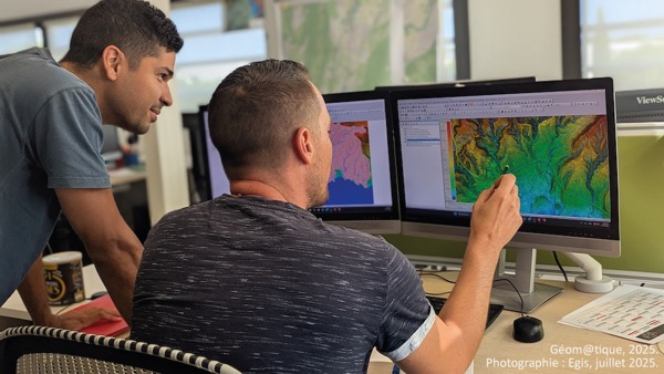
Blue Marble Geographics’ Global Mapper enables Egis to streamline digital terrain modeling and hydrological analysis, enhancing data processing efficiency across large-scale environmental projects

Nov 20, 2025
Real-Time Vibration Analysis Embedded in SBG Systems IMU

SBG Systems’ IMU now features built-in vibration monitoring, delivering real-time analysis to enhance accuracy, detect resonance, and support design, testing, and structural monitoring

Nov 19, 2025
Kraken Robotics Forms Reseller Partnership to Expand Access to Subsea Sonar Technology

Kraken Robotics has appointed BlueZone Group as an authorized reseller of its SAS and KATFISH platform, offering high-resolution underwater imaging, bathymetric mapping, and rapid data collection for defense and commercial surveys in Australia and New Zealand

Nov 19, 2025
Monitoring Marine Environments with Pro-Oceanus Dissolved Gas Sensors

Discover how Pro-Oceanus Systems’ advanced sensors help explore the oceans, measure dissolved gases, and uncover critical insights into marine and climate processes

Nov 18, 2025
Strategic Partnership to Deliver High-Resolution Deep-Sea Seafloor Intelligence & Insights

PlanBlue and Orpheus Ocean have collaborated to integrate advanced AI-driven imaging with autonomous underwater vehicles, enabling enhanced monitoring and analysis of critical deep-sea environments

Nov 17, 2025

Featured Content

FarSounder Integration Delivers Real-Time Seafloor & Obstacle Detection to SYNAPSIS Users

FarSounder has integrated its Argos 3D Forward Looking Sonar with Anschütz’s SYNAPSIS navigation platform, bringing real-time subsurface insights directly into the (W)ECDIS NX interface

Nov 17, 2025
Boxfish ROV Captures Marine Research Footage for Upcoming Premiere

Scientists from the University of Tasmania used a custom Boxfish ROV to survey Beagle Marine Park, capturing underwater footage premiering on YouTube this November

Nov 12, 2025
SubC Imaging Observatory Camera Systems Support Long-Term Ocean Observation

SubC Imaging’s Observatory Camera Systems capture detailed subsea imagery for cabled ocean observatories, enabling continuous observation and long-term marine environmental studies

Nov 11, 2025