Satellites Launched into Orbit for Maritime Domain Awareness

Unseenlabs’ constellation now comprises 11 satellites, resulting in 11 simultaneous RF data collection points thanks to its monosatellite technology By Abi Wylie / 15 Nov 2023

Discover World-Leading Technologies for Ocean Science

Discover cutting-edge solutions from leading global suppliers
SUPPLIER SPOTLIGHT
Satellites Launched into Orbit for Maritime Domain Awareness
Follow OS&T

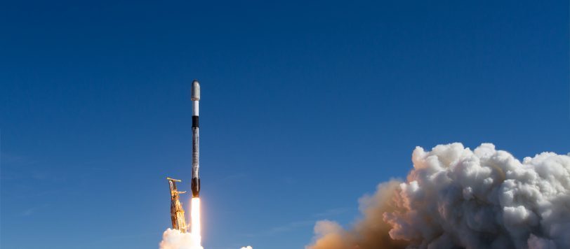
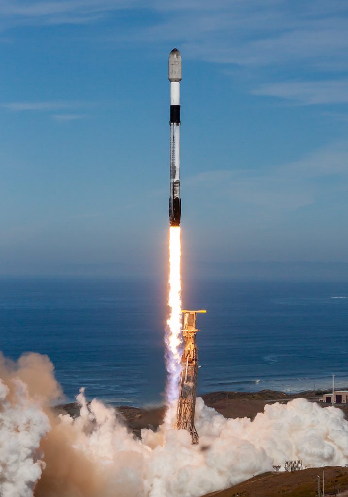
Unseenlabs has successfully launched two new satellites, BRO-10 and BRO-11, as part of the transporter-9 mission aboard SpaceX’s Falcon 9 rocket.

The company, a leader in radio frequency (RF) data and solutions for maritime domain awareness, launched the satellites via Exolaunch from the Vandenberg Space Force Base in California. 

This achievement signifies a significant step forward in Unseenlabs’ ongoing mission to enhance maritime surveillance through its unique technology, capable of detecting the presence of any ship, whether cooperating or not, regardless of its geographical location.

With BRO-10 and BRO-11 now in orbit at an altitude of 520 kilometers, Unseenlabs’ satellite constellation expands, greatly amplifying its capacity to provide RF data and solutions. 

The company’s constellation now comprises 11 satellites, resulting in 11 simultaneous RF data collection points thanks to its monosatellite technology. The success of this launch propels Unseenlabs even further in its mission to offer comprehensive vessel characterization and precise geolocation, meeting the increasing demands of maritime surveillance worldwide. 

The new capabilities introduced by these satellites underscore Unseenlabs’ commitment to safeguarding marine assets and environments from threats and unlawful activities.

The expansion of the constellation thus offers an extended operational reach and increased surveillance and vessel characterization capabilities on a global scale, catering to the needs of government entities, NGOs, and private sector stakeholders such as insurers, worldwide. 

This advancement significantly contributes to improving the global maritime landscape, particularly in a time when maritime activities continue to thrive.

“This milestone not only represents a technological breakthrough for Unseenlabs but also strengthens our position as the global leading provider of data and services for maritime surveillance. with each satellite we add to our constellation, we’re not just collecting more data; we are expanding the depth and breadth of information we can deliver to the global maritime community,” stated Clément Galic, CEO and Co-Founder of Unseenlabs. “With this successful launch, unseenlabs continues its robust growth trajectory, both in France and internationally, solidifying its position as the global leader in radio frequency signal detection from space.”

Posted by Abi Wylie Edited by Abigail Wylie, Editor and Copywriter experienced in digital media with a keen interest in ocean science technology. Connect

Latest Articles

Profile Spotlight: IQUA Robotics for Autonomous Underwater Survey & Inspection

IQUA Robotics is presenting its hovering AUV technologies on OST, providing precise, maneuverable platforms for subsea mapping, inspection, and reconnaissance

Nov 20, 2025
Precision Terrain Modeling & Hydrological Analysis with Global Mapper

Blue Marble Geographics’ Global Mapper enables Egis to streamline digital terrain modeling and hydrological analysis, enhancing data processing efficiency across large-scale environmental projects

Nov 20, 2025
Real-Time Vibration Analysis Embedded in SBG Systems IMU

SBG Systems’ IMU now features built-in vibration monitoring, delivering real-time analysis to enhance accuracy, detect resonance, and support design, testing, and structural monitoring

Nov 19, 2025
Kraken Robotics Forms Reseller Partnership to Expand Access to Subsea Sonar Technology

Kraken Robotics has appointed BlueZone Group as an authorized reseller of its SAS and KATFISH platform, offering high-resolution underwater imaging, bathymetric mapping, and rapid data collection for defense and commercial surveys in Australia and New Zealand

Nov 19, 2025
Monitoring Marine Environments with Pro-Oceanus Dissolved Gas Sensors

Discover how Pro-Oceanus Systems’ advanced sensors help explore the oceans, measure dissolved gases, and uncover critical insights into marine and climate processes

Nov 18, 2025
Strategic Partnership to Deliver High-Resolution Deep-Sea Seafloor Intelligence & Insights

PlanBlue and Orpheus Ocean have collaborated to integrate advanced AI-driven imaging with autonomous underwater vehicles, enabling enhanced monitoring and analysis of critical deep-sea environments

Nov 17, 2025

Featured Content

FarSounder Integration Delivers Real-Time Seafloor & Obstacle Detection to SYNAPSIS Users

FarSounder has integrated its Argos 3D Forward Looking Sonar with Anschütz’s SYNAPSIS navigation platform, bringing real-time subsurface insights directly into the (W)ECDIS NX interface

Nov 17, 2025
Boxfish ROV Captures Marine Research Footage for Upcoming Premiere

Scientists from the University of Tasmania used a custom Boxfish ROV to survey Beagle Marine Park, capturing underwater footage premiering on YouTube this November

Nov 12, 2025
SubC Imaging Observatory Camera Systems Support Long-Term Ocean Observation

SubC Imaging’s Observatory Camera Systems capture detailed subsea imagery for cabled ocean observatories, enabling continuous observation and long-term marine environmental studies

Nov 11, 2025