Real-Time Situational Awareness Technology Project Completed

Harvest’s robust video live-stream technology aimed to facilitate 3D at Depth with its subsea metrology operations, enabling real-time situational awareness By Abi Wylie / 22 Sep 2023

Discover World-Leading Technologies for Ocean Science

Discover cutting-edge solutions from leading global suppliers
SUPPLIER SPOTLIGHT
Real-Time Situational Awareness Technology Project Completed
Follow OS&T

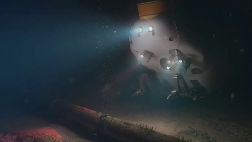
Harvest Technology Group Ltd (Harvest) has completed a project partnering with 3D at Depth to deliver remote metrology services for a leading global subsea services company. 

The operation was conducted successfully, with less than 1Mbs of bandwidth and utilised both 4G (broadband cellular network) and VSAT (two-way satellite) connectivity.

The work scope involved 3D at Depth’s LiDAR laser scanning technology being deployed by ROV and controlled from onshore using 3D at Depth’s own remote operations technologies. This allowed 3D at Depth personnel to run the project from their Aberdeen office, reducing the requirement to mobilise personnel to the vessel.

Harvest’s proprietary Nodestream™ technology was mobilised onboard the offshore subsea construction vessel to support 3D at Depth with their subsea metrology operations, enabling real-time situational awareness, and included ROV video feeds, sonar and navigation screens. 

The company’s robust video live-stream technology allowed for cost-savings and efficiency improvements, even where limited bandwidth would previously have been prohibitive.

“It was a pleasure to work with 3D at Depth on this project, demonstrating the use of cutting-edge technology to deliver real-time remote operations capability,” said Andy Freeman, Head of Sales – EMEA, Harvest Technology (UK) Ltd. 

“We chose Harvest because the technology provides high-fidelity, two-way audio communications, frame-synchronized video, and optimal bandwidth efficiency. This was essential in providing our remote personnel onshore with the situational awareness and communications channels to perform remote laser scanning safely and efficiently,” said Tarry Waterson, Operations & Client Lead, 3D at Depth.

Posted by Abi Wylie Edited by Abigail Wylie, Editor and Copywriter experienced in digital media with a keen interest in ocean science technology. Connect

Latest Articles

Profile Spotlight: IQUA Robotics for Autonomous Underwater Survey & Inspection

IQUA Robotics is presenting its hovering AUV technologies on OST, providing precise, maneuverable platforms for subsea mapping, inspection, and reconnaissance

Nov 20, 2025
Precision Terrain Modeling & Hydrological Analysis with Global Mapper

Blue Marble Geographics’ Global Mapper enables Egis to streamline digital terrain modeling and hydrological analysis, enhancing data processing efficiency across large-scale environmental projects

Nov 20, 2025
Real-Time Vibration Analysis Embedded in SBG Systems IMU

SBG Systems’ IMU now features built-in vibration monitoring, delivering real-time analysis to enhance accuracy, detect resonance, and support design, testing, and structural monitoring

Nov 19, 2025
Kraken Robotics Forms Reseller Partnership to Expand Access to Subsea Sonar Technology

Kraken Robotics has appointed BlueZone Group as an authorized reseller of its SAS and KATFISH platform, offering high-resolution underwater imaging, bathymetric mapping, and rapid data collection for defense and commercial surveys in Australia and New Zealand

Nov 19, 2025
Monitoring Marine Environments with Pro-Oceanus Dissolved Gas Sensors

Discover how Pro-Oceanus Systems’ advanced sensors help explore the oceans, measure dissolved gases, and uncover critical insights into marine and climate processes

Nov 18, 2025
Strategic Partnership to Deliver High-Resolution Deep-Sea Seafloor Intelligence & Insights

PlanBlue and Orpheus Ocean have collaborated to integrate advanced AI-driven imaging with autonomous underwater vehicles, enabling enhanced monitoring and analysis of critical deep-sea environments

Nov 17, 2025

Featured Content

FarSounder Integration Delivers Real-Time Seafloor & Obstacle Detection to SYNAPSIS Users

FarSounder has integrated its Argos 3D Forward Looking Sonar with Anschütz’s SYNAPSIS navigation platform, bringing real-time subsurface insights directly into the (W)ECDIS NX interface

Nov 17, 2025
Boxfish ROV Captures Marine Research Footage for Upcoming Premiere

Scientists from the University of Tasmania used a custom Boxfish ROV to survey Beagle Marine Park, capturing underwater footage premiering on YouTube this November

Nov 12, 2025
SubC Imaging Observatory Camera Systems Support Long-Term Ocean Observation

SubC Imaging’s Observatory Camera Systems capture detailed subsea imagery for cabled ocean observatories, enabling continuous observation and long-term marine environmental studies

Nov 11, 2025