


Multibeam Echosounders
Discover cutting-edge solutions from 10 leading global suppliers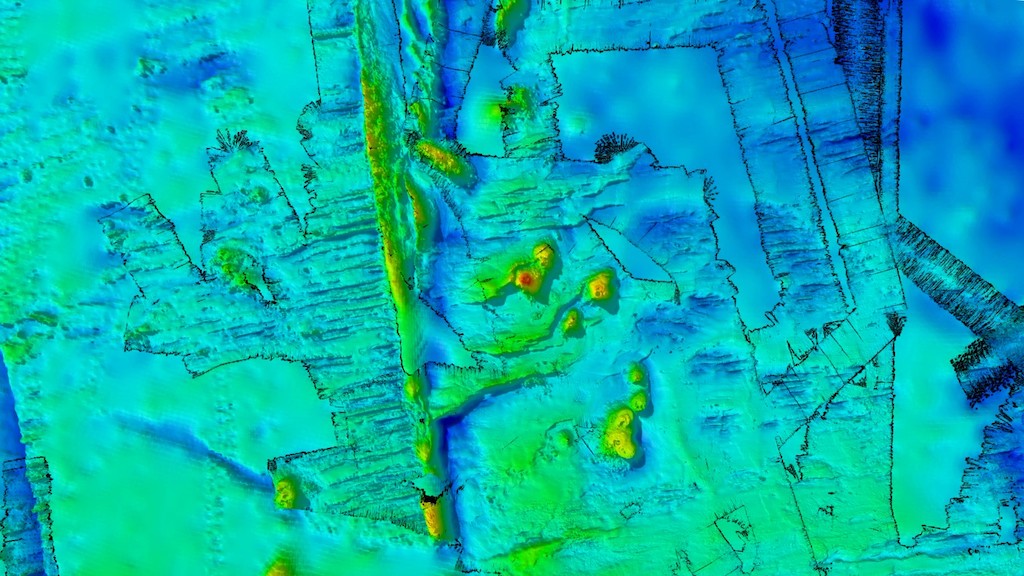
From space to the seafloor, an Australian and international research voyage has mapped a highly energetic “hotspot” in the world’s strongest current simultaneously by ship and satellite, and uncovered an underwater mountain range.
Halfway between Tasmania and Antarctica, the block of the Southern Ocean surveyed in high-resolution, three-dimensional detail stretches over an area of 20,000 square kilometres down through layers of swirling currents to the seafloor 4000 metres below.
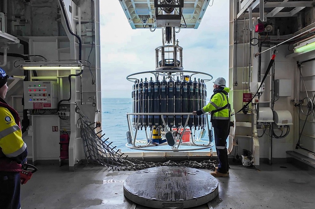
The FOCUS voyage on CSIRO research vessel (RV) Investigator has been working in the Antarctic Circumpolar Current for the last five weeks to understand how heat leaking across this natural barrier contributes to melting Antarctic ice shelves and the potential for sea-level rise.
The voyage was designed to work with the new Surface Water and Ocean Topography (SWOT) satellite, jointly developed by NASA and the French space agency Centre National d’Études Spatiales (CNES) – enabling simultaneous mapping of fine-scale ocean features from the satellite and the ship.
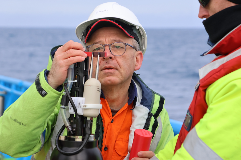
Voyage chief scientist Dr Benoit Legresy said CSIRO, Australia’s national science agency, and the Australian Antarctic Program Partnership worked with collaborators and equipment from the US and France to tackle important climate questions.
“The ocean has absorbed more than 90 per cent of heat due to global warming and around 25 per cent of human CO2 emissions, providing an enormous service as a ‘climate shock absorber,” Dr Legresy said. “Knowing how to deal with human-induced climate change brings an urgency to tracking down the heat and carbon pathways in the global climate system.
“We’ve been working in a gateway where heat is funnelled towards Antarctica, contributing to ice melt and sea level rise. We need to understand how this gate works, how much heat gets through and how this may change in the future.”
While mapping the ocean currents, the companion mapping of the sea floor bathymetry has revealed ancient dormant underwater volcanoes.
CSIRO geophysicist Dr Chris Yule said the team conducted high resolution mapping with RV Investigator’s world-class multibeam echosounder system. The survey spanned a seafloor area of 20,000 km2, most of which hasn’t been mapped before.
“To our delight, we’ve discovered a spectacular chain of ancient seamounts, comprising eight long-dormant volcanoes with peaks up to 1500 metres high and one with a double vent,” Dr Yule said.
He continued; “Four of them are new discoveries, and we filled in details on two seamounts and a fault line ridge partially mapped on a previous voyage. We now know the ridge, just west of the survey area, drops into a valley over a 1600-metre-high cliff.”
The survey area is 200 nautical miles (370 km) west of Macquarie Island and the tectonically active Macquarie Ridge. The seamounts were formed by volcanoes arising from hot-spot magmatism within the last 20 million years.
Voyage co-chief scientist Dr Helen Phillips, from the Australian Antarctic Program Partnership at the University of Tasmania, said new discoveries about the shape of the seafloor are vitally important to understanding ocean dynamics.
“The Antarctic Circumpolar Current ‘feels’ the seafloor and the mountains in its path, and where it encounters barriers like ridges or seamounts, ‘wiggles’ are created in the water flow that form eddies. Valleys and cliffs can also accelerate deep currents at the bottom of the ocean,” Dr Phillips said.
“Eddies are like the weather systems of the ocean, playing a major role in transporting heat and carbon from the upper ocean to deeper layers – a critical buffer against global warming.
“Knowledge of the depth and shape of the sea floor is crucial for us to quantify the influence of undersea mountains, hills and valleys on the Antarctic Circumpolar Current and the leaking of heat toward Antarctica.”
Dr Phillips said that while integrating all the ship and satellite data will take some time, the successful voyage is fundamental to building knowledge of ocean circulation that informs climate policy.
“Ultimately, we want to turn daily maps of ocean sea surface height from satellites into daily maps of the movement of heat in the Southern Ocean toward Antarctica. This will help governments and communities plan how to adapt to rising sea levels and how fast they need to act,” she said.


