


Discover World-Leading Technologies for Ocean Science
Discover cutting-edge solutions from leading global suppliers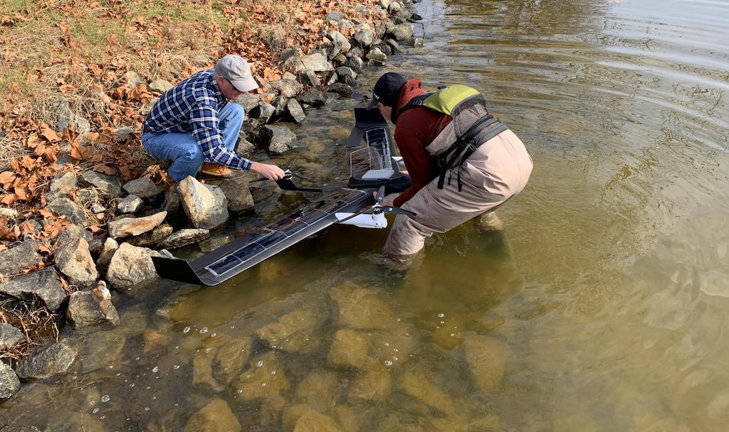
MITRE has partnered with the U.S. Navy to develop an autonomous, small, low-cost UAV with exciting potential in the maritime domain.
The drone can operate at sea for an extended period and support a wide range of operations, from defense to marine biology to meteorology, and beyond.
How does a small drone launched from San Diego get all the way to Hawaii without human intervention? It “hops” across the ocean for weeks—potentially months—at a time, recharging via solar power all on its own.
MITRE’s Hopper Uncrewed Aerial Vehicle (UAV) (a.k.a. drone) prototype, developed in collaboration with the Office of Naval Research (ONR), offers a small, intelligent, autonomous aerial system for maritime environments.
Beyond U.S. Navy campaigns, these include non-military missions like search and rescue, monitoring for illicit activity (e.g., illegal fishing), and detecting meteorological events.
When ONR asked MITRE to help develop the intelligence, surveillance, reconnaissance-capable platform, it delivered a tall order: a cost-effective system that could function autonomously across dynamic ocean environments, carry a range of lower-power passive sensors, and use commercial electronic systems. MITRE engineers reportedly designed and fabricated the prototype in less than 24 months.
Hopper made its public debut in November at the Office of Science and Technology Policy’s “American Possibilities: A White House Demo Day.” Of the 45 scientific and technological innovations at the event, Hopper was one of eight connected to national security.
Deputy Secretary of Defense Kathleen Hicks said; “To stay ahead, we’re going to create a new state of the art…leveraging attritable, autonomous systems in all domains—which are less expensive, put fewer people in the line of fire, and can be changed, updated, or improved with substantially shorter lead times.”
Though in its early stages, Hopper demonstrates strong promise to meet this state-of-art criteria. The platform evolved out of the National Security Engineering Center, the federally funded R&D center MITRE operates for Department of Defense.
The MITRE-ONR team designed the system using computer-aided design (CAD) and advanced simulation software. This allowed them to rapidly iterate on various elements and produce the UAV’s airframe largely through advanced but low-cost techniques such as 3D printing. The design includes small commercial solar cells on the wings’ surface to allow the system to regenerate power while in flight and at rest.
“Swarming” Brings Power in Numbers
The MITRE-ONR team also brought in fresh perspective, working with students from the U.S. Naval Academy. The midshipmen contributed to Hopper’s design, providing key insights from their operations research Capstone project. As leaders of the future maritime battle space, the students have a vested interest in advancing such prototypes.
“This technology works primarily to augment existing maritime surveillance platforms,” said Conor Mahoney, MITRE’s expeditionary group leader. “Where normally you’d have to risk a crewed asset or an expensive uncrewed asset to maintain cognizance over a wide ocean area, Hopper can do so at a fraction of the cost—and free up those other assets.”
Moreover, Hopper demonstrates strength in numbers, with multiple systems operating as a team, or “swarm.” The swarm can cover large areas and collectively direct its elements to maneuver around designated ocean areas. This allows swarms of Hoppers to remain on station when ocean currents, waves, or winds might otherwise push them off course.
These versatile systems could fulfill myriad missions, from signals monitoring to tsunami warning to marine-life biological research, and more. Hopper’s only limitations lie in payload size and power requirements.
The MITRE team is experimenting with integrating miniature radios and satellite transceivers to enable the UAV to communicate from maritime environments anywhere in the world.
With its unique capabilities, this small platform is poised to make a big impact in both defense and civil applications. Mahoney continued; “We’re working to evolve Hopper with expanded payload capacity, longer flight duration, and shorter times between recharges—to create an even more powerful platform.”


