Connect with Leading Marine Technology Innovators
Discover cutting-edge solutions from leading global suppliers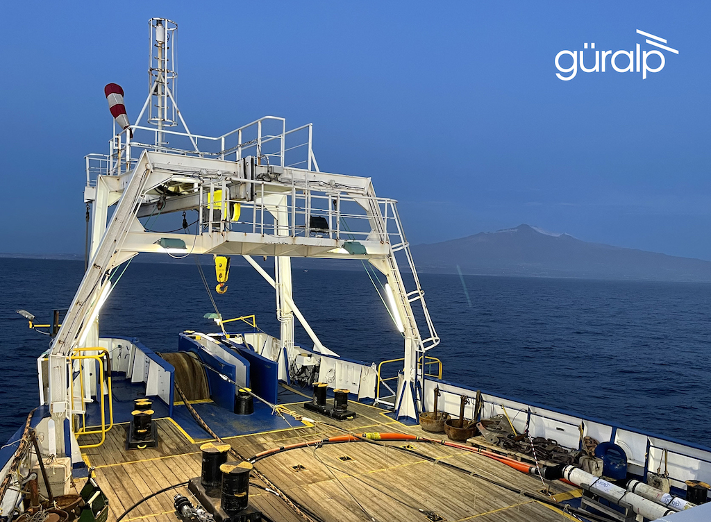
Güralp Systems Ltd, the leading global provider of seismic monitoring instrumentation and solutions, has successfully designed, manufactured and deployed a 21 km ‘SMART cable’ 30 km off the coast of Catania in Sicily, Italy.
The SMART cable (Science Monitoring and Reliable Telecommunications), is an innovative system developed by Güralp in partnership with Istituto Nazionale di Geofisica e Vulcanologia (INGV), for the Italian InSEA SMART cable Wet Demonstrator project which will measure seismic risk off the coast of Sicily.
The InSEA project, funded by the Italian Ministry of Research and managed by the Istituto Nazionale di Geofisica e Vulcanologia (INGV), aims to investigate the use of seismometers and environmental monitoring sensors deployed in and around the repeater housings of traditional telecommunications cables without compromising the scientific or operational value of the data being transmitted by the sensors.
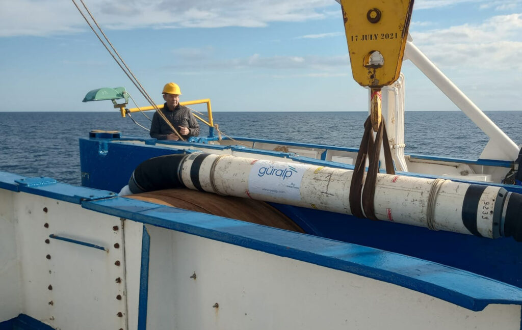
The SMART cable system comprises a 21 km telecommunications cable with three instrumented repeaters located at 6 km spacings along its length.
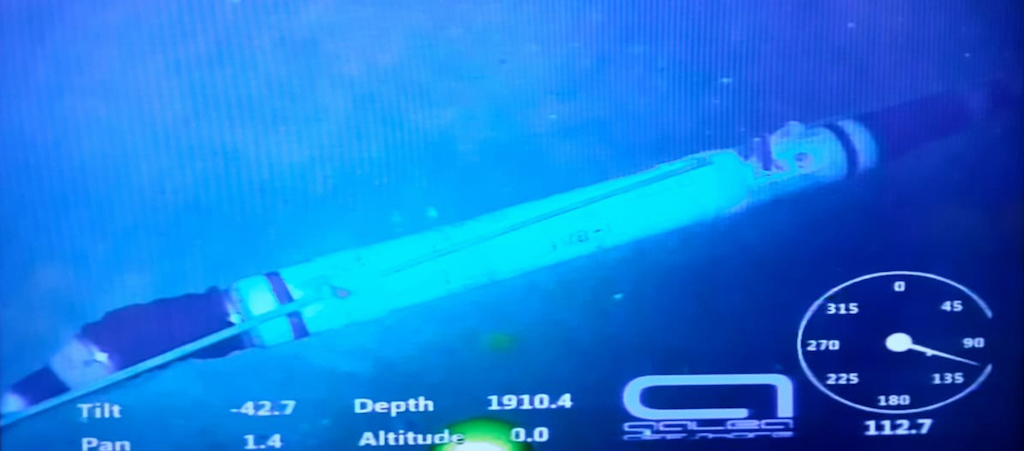
Each repeater houses a Güralp Certimus seismometer, a Güralp Fortimus accelerometer plus an externally mounted instrumentation pod that contains an absolute pressure gauge and a temperature sensor. Global Marine provided Güralp with specialist assistance with the repurposing of the repeater housings.
The system was designed to be laid using standard commercial ocean cable-laying equipment and the successful deployment onto the seabed was undertaken in this way, during a 36-hour window last month, to a depth of 2000 metres.
Initial data collected from the instrumentation following deployment showed that all was working as anticipated. Further analysis of the data collected by the system will be undertaken following a more substantial monitoring period.
The observation area in which the system is deployed is prone to numerous natural hazards including seismicity caused by the nearby Mount Etna. The in-situ measurements from the deployed seismic and pressure sensors will be crucial for generating reliable tsunami height forecasts for the region and will also aid with improving tsunami warning times.
John O’Neill, Systems Director, Güralp Systems, explained; “We have more than thirty years experience in designing and manufacturing for the OBS market. This project offered particularly unique challenges, as we had to work backwards from the expectation that the instrumentation must be housed in existing repeater hardware and deployed using commercial cable laying methods.
“Fortunately, we have advanced sensors that are particularly suited to the demands of the project and we are delighted to see that our design approach coupled with our robust testing regime has ensured the successful deployment of the system.”
Giuditta Marinaro, Head of the Multidisciplinary Research Functional Unit on Geosphere-Ocean-Atmosphere interactions of the Rome 2 Section of the INGV, commented; “The use of innovative underwater telecommunications cables, i.e. equipped with geophysical and environmental instrumentation, represents a solution to extend observations to marine areas never reached, to have real-time access to observations and to support studies on the climate, oceans, on the structure of the Earth and on natural disasters.”
Neil Watkiss, Commercial Director at Güralp Systems, added; “SMART cables have the potential to revolutionise Ocean Science and in delivering this successful project, Güralp is established as a frontrunner in having developed working technical solutions for the SMART cable concept.”