Geo-Data Company Partners for Ocean Health Action & Coastal Resilience

Fugro will collaborate with ORRAA, using its skills and knowledge in technological innovation, scientific research, & sustainable Geo-data solutions to help preserve planet and ocean health By Abi Wylie / 11 Mar 2024

Discover World-Leading Technologies for Ocean Science

Discover cutting-edge solutions from leading global suppliers
SUPPLIER SPOTLIGHT
Geo-Data Company Partners for Ocean Health Action & Coastal Resilience
Follow OS&T

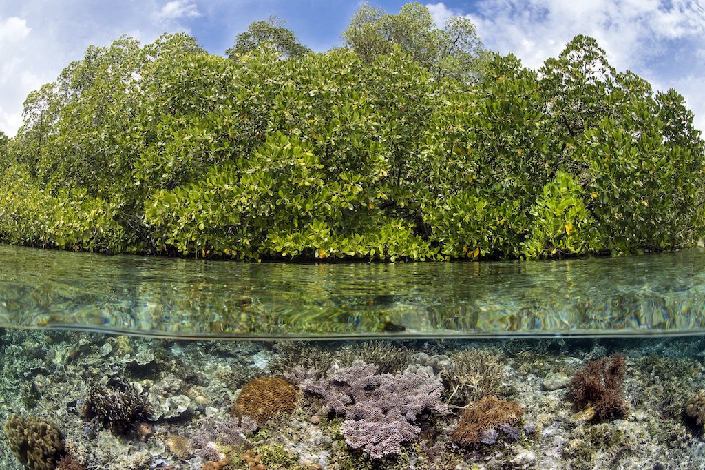
In the face of climate change and environmental threats, Fugro has partnered with the Ocean Risk and Resilience Action Alliance (ORRAA) to help address the complex challenges posed by ocean-related risks. 

Fugro will contribute Geo-data expertise to a diverse coalition of partners, underscoring their dedication to the shared objectives of mitigating climate change impacts and improving ocean health.

ORRAA’s mission is to build the resilience of 250 million climate vulnerable coastal people by 2030, through investing a minimum of USD 500 million into the development of at least 50 novel finance and insurance products. 

The alliance is the only multi-stakeholder organisation focused on driving financial innovations to deliver a sustainable and equitable blue economy and more resilient coastal communities. International finance, insurance, government, non-profits, industry and other stakeholders make up the alliance and contribute to products that include supporting the development of flood-mapping and solutions to other environmental challenges that threaten life. 

As part of ORRAA, Fugro will collaborate by using their skills and knowledge in scientific research, technological innovation, and sustainable Geo-data solutions to help preserve planet and ocean health.

Fugro’s partnership with ORRAA also involves supporting the Coastal Risk Index (CRI), which is an open-source platform providing comprehensive flood maps and data that enable financial institutions, investors, insurers, and policymakers to make informed decisions about coastal risk and resilience strategies. It also identifies areas where natural habitats like reefs and mangroves are crucial for protecting climate vulnerable communities. 

Chip Cunliffe, ORRAA’s Programme and Risk Director, said; “The Coastal Risk Index is a cutting-edge tool through which better data enables financial institutions and governments to make better decisions and deliver better outcomes. We value Fugro’s commitment to contributing towards its development.”

Karen Sack, ORRAA’s Executive Director, added; “We’re delighted to welcome Fugro to ORRAA. Data is absolutely key to monitoring and measuring both the challenges which threaten coastal communities from climate and ocean risk, and our ability to deliver and assess the positive impacts that can be delivered through climate and nature positive investments.”

Mark Heine, CEO of Fugro, expressed his pride in the partnership; “Fugro’s involvement with ORRAA aligns with our commitment to coastal resilience and ocean health. Through ORRAA, we’ll apply our leading Geo-data expertise to tackle the challenges of climate change and ocean risk, reinforcing our dedication to creating a safe and liveable world by preserving our oceans and coastal communities for future generations.”

Posted by Abi Wylie Edited by Abigail Wylie, Editor and Copywriter experienced in digital media with a keen interest in ocean science technology. Connect

Latest Articles

Profile Spotlight: IQUA Robotics for Autonomous Underwater Survey & Inspection

IQUA Robotics is presenting its hovering AUV technologies on OST, providing precise, maneuverable platforms for subsea mapping, inspection, and reconnaissance

Nov 20, 2025
Precision Terrain Modeling & Hydrological Analysis with Global Mapper

Blue Marble Geographics’ Global Mapper enables Egis to streamline digital terrain modeling and hydrological analysis, enhancing data processing efficiency across large-scale environmental projects

Nov 20, 2025
Real-Time Vibration Analysis Embedded in SBG Systems IMU

SBG Systems’ IMU now features built-in vibration monitoring, delivering real-time analysis to enhance accuracy, detect resonance, and support design, testing, and structural monitoring

Nov 19, 2025
Kraken Robotics Forms Reseller Partnership to Expand Access to Subsea Sonar Technology

Kraken Robotics has appointed BlueZone Group as an authorized reseller of its SAS and KATFISH platform, offering high-resolution underwater imaging, bathymetric mapping, and rapid data collection for defense and commercial surveys in Australia and New Zealand

Nov 19, 2025
Monitoring Marine Environments with Pro-Oceanus Dissolved Gas Sensors

Discover how Pro-Oceanus Systems’ advanced sensors help explore the oceans, measure dissolved gases, and uncover critical insights into marine and climate processes

Nov 18, 2025
Strategic Partnership to Deliver High-Resolution Deep-Sea Seafloor Intelligence & Insights

PlanBlue and Orpheus Ocean have collaborated to integrate advanced AI-driven imaging with autonomous underwater vehicles, enabling enhanced monitoring and analysis of critical deep-sea environments

Nov 17, 2025

Featured Content

FarSounder Integration Delivers Real-Time Seafloor & Obstacle Detection to SYNAPSIS Users

FarSounder has integrated its Argos 3D Forward Looking Sonar with Anschütz’s SYNAPSIS navigation platform, bringing real-time subsurface insights directly into the (W)ECDIS NX interface

Nov 17, 2025
Boxfish ROV Captures Marine Research Footage for Upcoming Premiere

Scientists from the University of Tasmania used a custom Boxfish ROV to survey Beagle Marine Park, capturing underwater footage premiering on YouTube this November

Nov 12, 2025
SubC Imaging Observatory Camera Systems Support Long-Term Ocean Observation

SubC Imaging’s Observatory Camera Systems capture detailed subsea imagery for cabled ocean observatories, enabling continuous observation and long-term marine environmental studies

Nov 11, 2025