


Discover World-Leading Technologies for Ocean Science
Discover cutting-edge solutions from leading global suppliers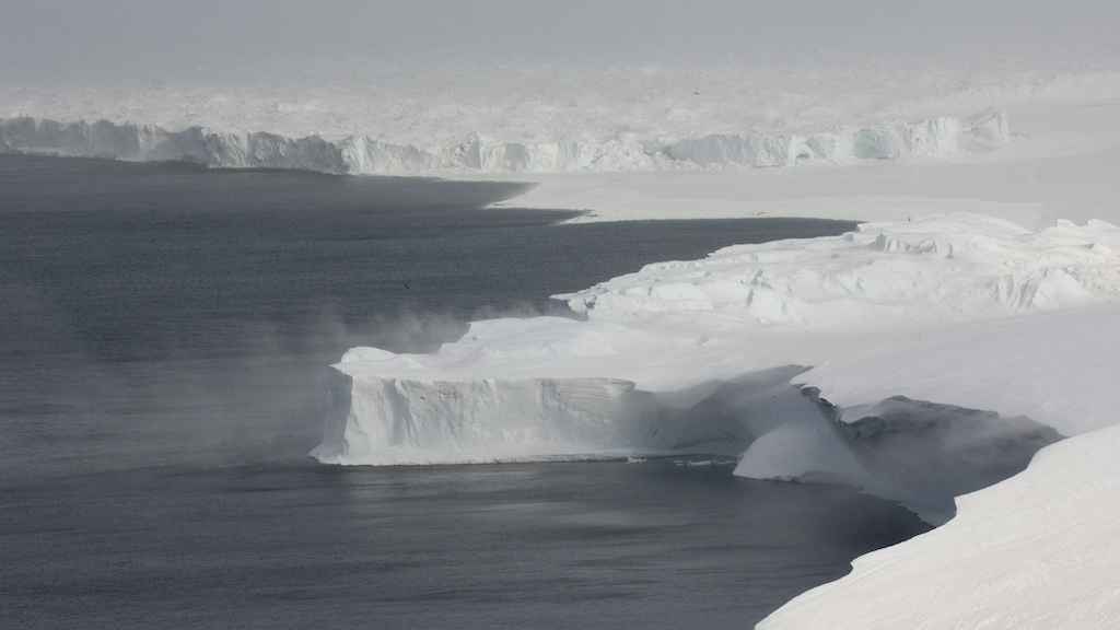
Woods Hole Oceanographic Institution (WHOI) has been awarded a $1.6 million grant from the W.M. Keck Foundation to develop a revolutionary autonomous mooring system for studying Antarctic ice shelf melt.
This innovative technology aims to address one of the most vexing challenges in climate science and decision-making: accurately quantifying mass loss from the ice sheets and predicting the rise of global sea level.
Led by WHOI scientists Catherine Walker and Weifeng (Gordon) Zhang, the project will create a prototype Self-deploying Autonomous Mooring System (SAMS). The cutting-edge device will be capable of autonomously navigating beneath Antarctica’s floating ice shelves to deploy its built-in measuring systems and conduct long-term observations in these hostile, difficult-to-reach locations.
Low-lying coastal zones around the world that are most exposed to sea-level rise are also home to billions of people and trillions of dollars in property and infrastructure, making rising seas one of the most significant threats humanity could face in the coming century. In addition, freshwater from melting ice sheets holds potential to disrupt systems that help regulate Earth’s climate.
Ice shelves act as a giant safety valve around the Antarctic coast that restrain the rest of the vast, continental ice sheet from flowing into the ocean. As the atmosphere and ocean surrounding Antarctica warm, its floating ice shelves melt faster and weaken, allowing more ice to slip into the sea, further rising sea level, and freshening ocean water, which can affect global ocean circulation.
Measuring water properties underneath the ice shelf and quantifying melt at the base of the shelf is crucial to improving predictions that govern societal decisions about how to prepare for future environmental change.
SAMS will be designed to travel deep underneath floating ice shelves and tens of miles horizontally to reach cavities between the ice and the seafloor, where it will anchor itself and remain stationed for years at a time. Over the course of its deployment, SAMS will collect data about the ocean and ice that reveal the patterns and amount of melt occurring and how the ocean is driving or responding to variability in ice melt.
The system is also designed to transmit data back to shore, providing researchers with unprecedented near real-time insight into ice-ocean interactions as they happen. This will significantly refine understanding of these complex processes in difficult-to-reach places and their potential to have far-flung impacts on people around the world.
WHOI scientist Catherine Walker said, “Of all the things that drive global sea-level rise, the response of Antarctic ice shelves to continued warming—from the air above and the ocean below—represents one of the biggest question marks.
“So far, scientists have been able to send underwater vehicles under ice shelves to make measurements for relatively short periods. What we really need are continuous long-term observations to fill that gap in our knowledge about the planet.”
Rick Murray, WHOI Deputy Director and Vice President for Science and Engineering, commented, “Development of SAMS represents a significant leap forward in underwater technology and ocean observing capabilities, especially in extreme environments. This investment by the Keck Foundation will open new possibilities for research in some of the most challenging but crucial parts of our planet.”


