Contract Awarded for Ocean Bottom Nodal Solution

Sercel has delivered one of its GPR300 OBN solutions, a compact, lightweight shallow water module designed for easy manual handling and simplified deployment and retrieval By Abi Wylie / 24 Jun 2024

Discover World-Leading Technologies for Ocean Science

Discover cutting-edge solutions from leading global suppliers
SUPPLIER SPOTLIGHT
Contract Awarded for Ocean Bottom Nodal Solution
Follow OS&T

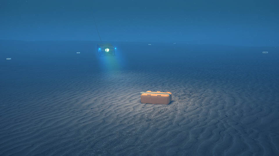
Sercel has sold and delivered a GPR300 ocean bottom nodal solution for a total value of approximately US$20 million. 

Sercel GPR nodes feature the unique QuietSeis® MEMS technology, which provides unprecedented broadband signal sensing capability, fidelity, and ultra-quiet performance, surpassing conventional OBN equipment to deliver best-in-class data for subsurface imaging. 

The GPR300 excels in shallow water depths down to 300 m and has a compact, lightweight design for easy manual handling and simplified deployment and retrieval. 

Key Benefits

System Certified Data

  • Operation Monitoring Environment
  • Proven Reliability

High-Precision Imagery

  • QuietSeis® Delivers Digital Fidelity
  • 3C Recording and Vector Fidelity

Improved Operational Efficiency

  • Compatible with land operations
  • ROV or NOAR Deployment Capability

The solution will be deployed by a major customer on an upcoming seismic survey project in the North Sea.

Jerome Denigot, Sercel CEO, said; “Sercel is totally committed to its solutions delivering the highest quality of seismic data for optimum imaging results. The GPR300, which has been adopted by leading OBN players worldwide, has demonstrated outstanding operational and technological performance in major surveys in the Middle East and Asia. 

“This new sale expands our GPR nodal solution’s presence to the North Sea OBN seismic market where we are confident it will deliver excellent results.”

Posted by Abi Wylie Edited by Abigail Wylie, Editor and Copywriter experienced in digital media with a keen interest in ocean science technology. Connect

Latest Articles

Profile Spotlight: IQUA Robotics for Autonomous Underwater Survey & Inspection

IQUA Robotics is presenting its hovering AUV technologies on OST, providing precise, maneuverable platforms for subsea mapping, inspection, and reconnaissance

Nov 20, 2025
Precision Terrain Modeling & Hydrological Analysis with Global Mapper

Blue Marble Geographics’ Global Mapper enables Egis to streamline digital terrain modeling and hydrological analysis, enhancing data processing efficiency across large-scale environmental projects

Nov 20, 2025
Real-Time Vibration Analysis Embedded in SBG Systems IMU

SBG Systems’ IMU now features built-in vibration monitoring, delivering real-time analysis to enhance accuracy, detect resonance, and support design, testing, and structural monitoring

Nov 19, 2025
Kraken Robotics Forms Reseller Partnership to Expand Access to Subsea Sonar Technology

Kraken Robotics has appointed BlueZone Group as an authorized reseller of its SAS and KATFISH platform, offering high-resolution underwater imaging, bathymetric mapping, and rapid data collection for defense and commercial surveys in Australia and New Zealand

Nov 19, 2025
Monitoring Marine Environments with Pro-Oceanus Dissolved Gas Sensors

Discover how Pro-Oceanus Systems’ advanced sensors help explore the oceans, measure dissolved gases, and uncover critical insights into marine and climate processes

Nov 18, 2025
Strategic Partnership to Deliver High-Resolution Deep-Sea Seafloor Intelligence & Insights

PlanBlue and Orpheus Ocean have collaborated to integrate advanced AI-driven imaging with autonomous underwater vehicles, enabling enhanced monitoring and analysis of critical deep-sea environments

Nov 17, 2025

Featured Content

FarSounder Integration Delivers Real-Time Seafloor & Obstacle Detection to SYNAPSIS Users

FarSounder has integrated its Argos 3D Forward Looking Sonar with Anschütz’s SYNAPSIS navigation platform, bringing real-time subsurface insights directly into the (W)ECDIS NX interface

Nov 17, 2025
Boxfish ROV Captures Marine Research Footage for Upcoming Premiere

Scientists from the University of Tasmania used a custom Boxfish ROV to survey Beagle Marine Park, capturing underwater footage premiering on YouTube this November

Nov 12, 2025
SubC Imaging Observatory Camera Systems Support Long-Term Ocean Observation

SubC Imaging’s Observatory Camera Systems capture detailed subsea imagery for cabled ocean observatories, enabling continuous observation and long-term marine environmental studies

Nov 11, 2025