


Discover World-Leading Technologies for Ocean Science
Discover cutting-edge solutions from leading global suppliers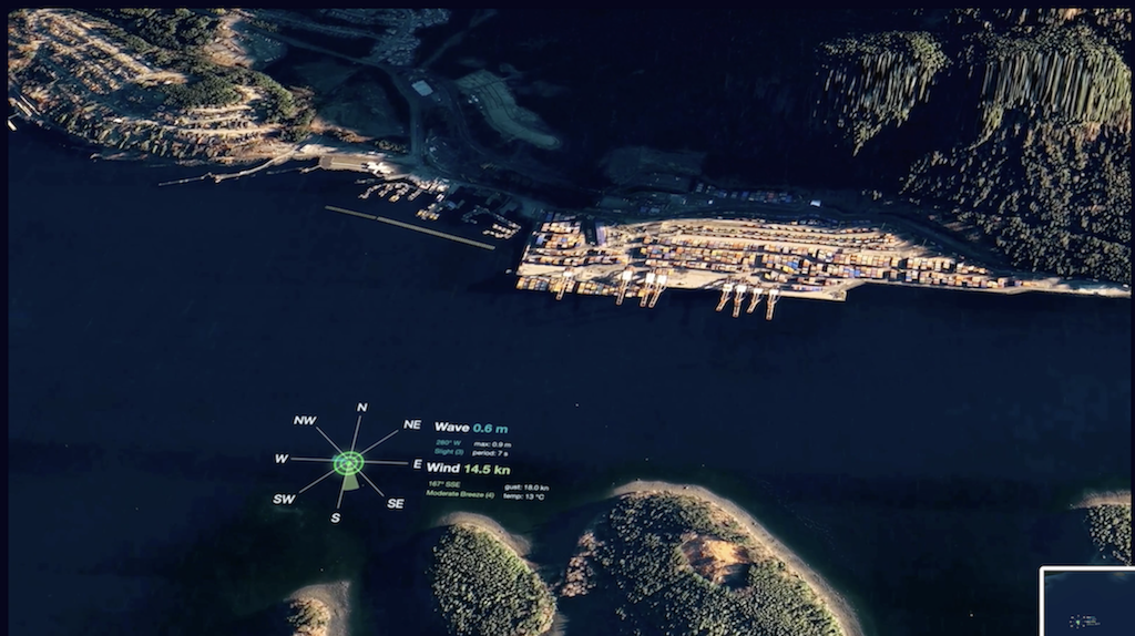
MarineLabs has unveiled Forecast AI, accurate and hyper-localized coastal weather forecasts delivered through MarineLabs’ new machine learning models and extensive data from their fleet of real-time sensor nodes.
Forecast AI is a much-anticipated addition to MarineLabs’ flagship product, CoastAware, a real-time weather intelligence solution that enhances safety, efficiency, and sustainability in maritime operations and bolsters the climate resilience of coastlines.
Ports, harbour masters, and others in maritime industries rely on weather forecasts to make decisions that impact operations, crew and staff safety, costs, and flows of essential goods for consumers. However, there are challenges with the weather forecasting options available. Most weather models provide forecasts at vast global scales, relying on coarse grids to make the computations manageable, which limits their ability to account for local coastal features.
MarineLabs’ Forecast AI generates profoundly more accurate wind and wave forecasts that account for each location’s unique characteristics and geography. It does this by combining extensive observed data from its expanding sensor network with data from third-party forecast models while continuously learning and improving with time.
In an in-depth study over a two-month period from December 2023 to February 2024 at a site on the East coast of Canada, MarineLabs’ Forecast AI produced impressive results versus currently available models. Breaking the test period into 182 eight-hour work shifts, Forecast AI made 23% more correct calls due to significant wave height exceeding critical safety thresholds for port operations than a trusted publicly available forecast model at a decision threshold time of 24 hours.
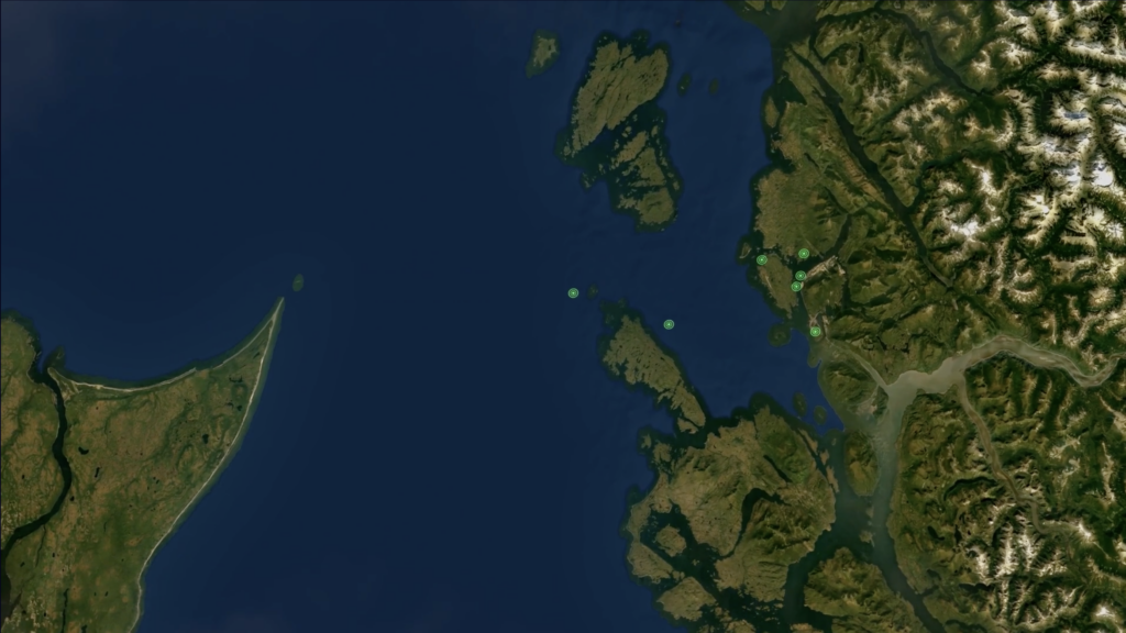
To date, in aggregate over 32 locations in MarineLabs’ sensor network with forecasting available, Forecast AI has 50% lower average errors in predicting weather parameters compared to publicly available maritime forecast models. Access to this kind of tactical, highly reliable, hyper-local forecast data with customizable alerts specific to weather thresholds offers new efficiencies and levels of trust in decision-making for mariners and ports, such as Port Halifax, who, along with other Canadian ports, helped beta test Forecast AI.
A total of 31 buoy locations from MarineLabs’ sensor network along Canadian coastlines in the Atlantic and Pacific now have Forecast AI, with an additional 12 sites in the US and Canada coming online throughout the fall.
Forecast AI is accessed through MarineLabs’ CoastAware platform on desktop or mobile devices. Users can view detailed wind and wave forecast information for up to seven days and set up SMS or email notifications to alert for specific weather conditions based on their operational and safety procedures.
MarineLabs is transforming the global weather intelligence landscape with features like Forecast AI, which empowers port authorities, vessel pilots, and others in the maritime industry to make decisions with more certainty.
“MarineLabs transform weather data into actionable insights,” said Commander (ret’d) Corey Gleason, MMM, MSC, CD, PME, Deputy Harbour Master, Port Halifax. “Their forecasting solution empowers my team to help optimize resource allocation, enhance safety, and improve overall port efficiency through informed strategic planning.”
Dr. Scott Beatty, CEO of MarineLabs, said, “Forecast AI represents a giant stride forward in our mission to revolutionize marine mobility. With CoastAware, we set a new standard in real-time weather awareness.
“Now, by leveraging our unique observations to train thousands of machine learning models, we have the ability to more accurately predict weather in a way that addresses critical gaps in traditional forecasts. This empowers our subscribers and partners with the precise, forward-looking, hyper-local wind and wave forecast information they need to make safe and informed decisions in the face of increasingly volatile weather.”


