Suppliers
Add your company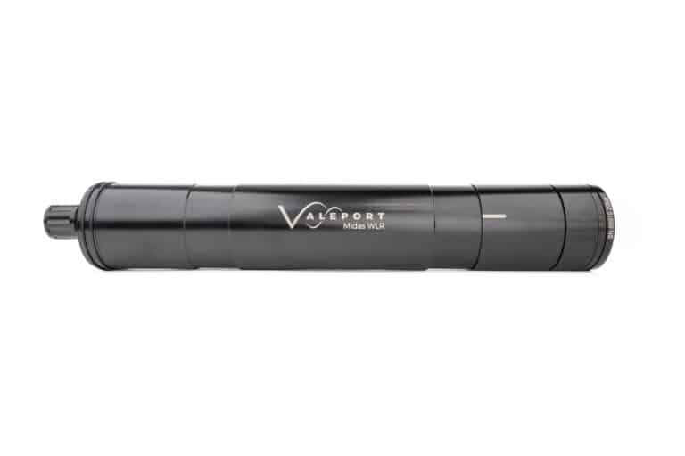
Teledyne Valeport
High-Precision Oceanographic Sensors & Hydrographic Measurement Solutions for Marine & Subsea Platforms
Gold Partner
Showcase your capabilities
If you design, build or supply Tide Gauges, create a profile to showcase your capabilities on this page
Products
Tide Gauges - Acoustic, Pressure & Float

Introduction to Tide Gauges and Sea-Level Monitoring Equipment
The Core Function of a Tide Gauge Instrument
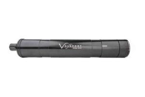
MIDAS WLR by Teledyne Valeport
A tide gauge instrument is fundamentally designed to capture the continuous, vertical movement of the sea surface relative to a stable, fixed reference point on land. By converting these physical changes in water level into a precise electronic record over time, tide gauges furnish the essential data needed to model oceanographic processes, forecast tidal cycles, and track secular trends in sea-level change. These sophisticated tide gauge equipments often transmit their high-resolution data in real-time to regional or global monitoring networks.
Essential Role in Coastal Science and Engineering
Tide data is a cornerstone of modern coastal and ocean science. In oceanography, these measurements provide crucial validation for sophisticated models of ocean circulation and for satellite altimetry missions. For coastal engineering, the long-term data sets inform high-value infrastructure projects, including the design of ports and breakwaters, the planning of maintenance dredging, and the implementation of robust flood defense systems. Critically, tide gauge measurements provide the longest continuous records of sea-level variability available globally, making them indispensable for quantifying global sea-level rise and assessing regional climate impacts for international bodies like the IPCC. These stations form the operational backbone of the tide monitoring system required for maritime safety.
Principles of Operation: From Relative Height to Absolute Data
Relating Water Level to Fixed Geodetic Datums
All tide gauge instruments determine the instantaneous height of the sea surface relative to a fixed geodetic benchmark on the adjacent land. This crucial practice ensures that the measured sea-level changes reflect true oceanic and meteorological effects, isolating them from any localized land motion. The measured water level is then referenced to standard vertical datums. These include Mean Sea Level (MSL), which represents the average sea surface height, and Chart Datum (CD), which serves as the reference plane for all depths shown on nautical charts. Chart Datum is frequently defined by the Lowest Astronomical Tide (LAT), which is the lowest level predictable under normal meteorological conditions. A consistent understanding and application of these datums is paramount for safety in navigation, consistent hydrographic charting, and rigorous oceanographic analysis.
Data Acquisition and High-Frequency Sampling
Modern tide gauge sensors acquire data at intervals designed to meet specific application requirements. For operational oceanographic studies, sampling may occur every few minutes. However, in applications focused on rapid-onset events, such as a tsunami monitoring system or storm surge forecasting, higher-frequency data is essential. Tsunami-capable gauges commonly provide high-resolution data at 10-second or 15-second intervals, with some systems logging internally at 1 Hz for highly detailed analysis of wave noise and seismic effects. Data loggers incorporate filtering algorithms to effectively damp out short-period wave noise while retaining the crucial tidal and surge signals.
Key Types of Tide Gauges and Sensing Technologies
The selection of a tide measurement instrument depends heavily on the deployment environment, required data accuracy, and available infrastructure. The following are the most common types of tide gauges currently in use globally.
1. Traditional Float and Still-Well Gauges
The floating tide gauge is the classic method for sea-level monitoring, operating within a sheltered vertical stilling well that connects to the sea via a narrow inlet. The float transmits its vertical movement via a cable, pulley, or encoder to a mechanical or digital recorder. The stilling well is essential as it effectively dampens high-frequency wave action, isolating the lower-frequency tidal signal. While robust and historically significant, they demand rigorous mechanical maintenance, especially in areas prone to debris or heavy biofouling. When properly maintained, these instruments maintain a high accuracy, typically within +/-1mm.
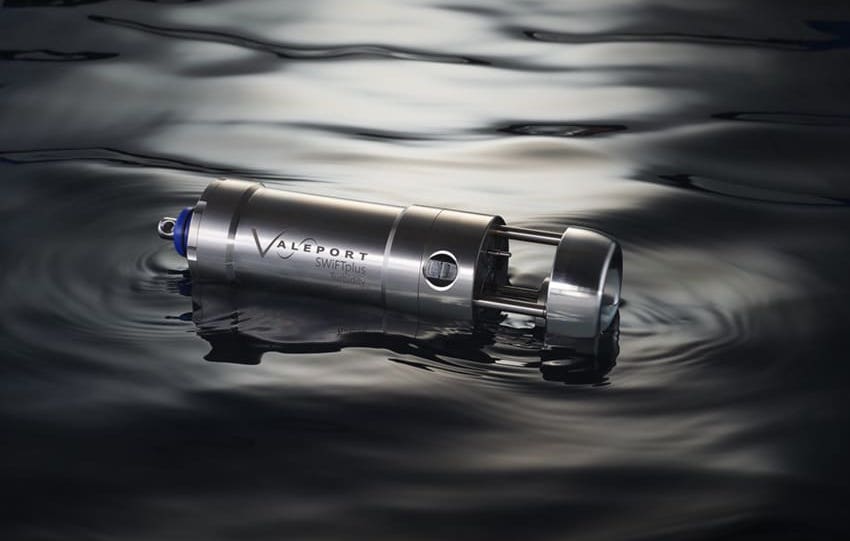
2. Submersible Pressure Tide Gauges
Pressure tide gauges use a submersible pressure transducer to measure the total hydrostatic pressure exerted by the water column above the sensor. This pressure is then converted into an equivalent water level.
The conversion relies on the fundamental depth-pressure relationship, meaning accurate data on water density is required. Therefore, modern pressure tide gauge systems often integrate a thermistor and conductivity sensor to provide real-time temperature and salinity data, enabling automatic compensation for density variations. Deployment is typically done via vented systems, which use a reference tube to automatically compensate for atmospheric pressure changes, or non-vented (absolute) systems, which are sealed for deep or remote deployments but require separate, post-processed barometric pressure data.
3. Acoustic Tide Gauges
Acoustic tide gauges operate on the principle of acoustic time-of-flight measurement. An ultrasonic pulse is emitted downward from a transducer mounted above the water surface. The system measures the travel time for the pulse to reflect off the water surface and return, converting this time into a distance measurement. A key advantage for coastal tide gauges is the non-contact nature of the measurement, which dramatically minimizes issues related to corrosion and marine growth.2 However, they rely on accurate measurement of the local speed of sound in air, meaning variations in temperature and humidity must be calibrated for, either automatically via onboard sensors or through regular checks.
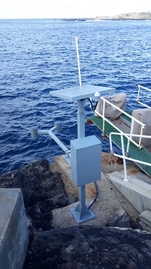
4. Non-Contact Radar Tide Gauges
Radar tide gauges determine water level by transmitting a microwave pulse toward the sea surface and measuring the return time. This non-contact technology is highly reliable as it is fundamentally unaffected by water-column density changes, salinity, fog, or acoustic interference. Due to their minimal maintenance needs and robust performance, radar systems are now a preferred choice for operational tide monitoring, especially within busy port and harbor environments. State-of-the-art radar gauges are known for their precision, achieving accuracy of +/-1 cm or better.
5. GNSS-Based Tide Gauges: Absolute Sea Level
GNSS-Based Tide Gauges leverage satellite positioning technology, using a continuously operating GPS or multi-constellation receiver mounted near the shoreline to measure the sea-surface height relative to the Earth’s reference ellipsoid. These systems provide direct, absolute sea-level information, compatible with global satellite altimetry data.
Crucially, when co-located with a tide gauge benchmark, the GNSS data provides the long-term, geocentric rate of Vertical Land Motion (VLM). This VLM rate is typically determined from the long-term GNSS time series and is then applied as a post-processing correction to the relative tide gauge record. This allows researchers to isolate the true, absolute sea-level trend from local tectonic uplift or subsidence effects, making these systems invaluable for rigorous global climate research.
Environmental Design and Survivability
Given the harsh nature of the marine environment, the design of reliable tide gauge equipment demands exceptional material choices. Components exposed to seawater must utilize materials like titanium or marine-grade stainless steel (316L) to ensure corrosion resistance. Management of biofouling is a continuous challenge for submerged instruments; anti-fouling coatings, copper-alloy protectors, and mechanical wipers are common strategies to ensure long-term data integrity. Furthermore, systems must be engineered for survivability, whether facing ice loading and freezing in polar regions or requiring robust mounting and surge protection to operate through cyclonic storms on high-energy coasts.
Critical Applications of Tide Monitoring Systems
Hydrographic and Coastal Engineering Surveys
Accurate, real-time tide data is essential for depth reduction in hydrographic surveys, which ensures all bathymetric data is normalized to a consistent vertical datum for charting. Coastal engineers utilize tide gauge measurements to precisely control elevations for critical infrastructure, including flood defenses, beach nourishment projects, and the design specifications for harbor infrastructure.
Port Operations and Dredging Management
Integrated tide monitoring systems enable port authorities to maximize operational windows. Real-time tide and water level information is used to schedule deep-draft vessel movements, manage safe transit within navigation channels, and optimize dredging tolerances, providing automated decision support to maintain maximum safety and efficiency. A portable tide gauge is often used for short-term monitoring in temporary construction or dredging areas.
Tsunami and Storm Surge Warning Systems
High-resolution coastal tide gauges are indispensable components of regional and global warning infrastructures. They detect the rapid, non-tidal sea-level changes characteristic of a tsunami event or severe storm surge. Deep-ocean pressure-based gauges (DART systems) complement these coastal instruments, providing earlier confirmation of wave propagation and surge conditions to ensure timely and effective public warnings.
Long-Term Climate Research and Absolute Sea-Level Trends
The historical records from global tidal gauges, some spanning over 150 years, are a critical resource for climate science. These long-term datasets are used to detect long-term secular trends in sea level, to calibrate the shorter satellite altimetry records, and to understand regional variations driven by factors such as ocean circulation variability or glacial isostatic adjustment.
Offshore Engineering and Renewable Energy Monitoring
For offshore energy projects including oil and gas platforms, offshore wind farms, and tidal energy arrays, tide gauges provide the essential reference data to validate hydrodynamic and tidal current models. They are used to ensure that platforms and subsea infrastructure are designed to withstand varying sea conditions and to accurately correlate water level with flow speed for optimal energy yield in tidal power installations.