Showcase your capabilities
If you design, build or supply GPS/GNSS Correction, create a profile to showcase your capabilities and connect with visitors who have an active requirement for your solutions.


GNSS correction services and products provide sub-meter to centimeter-level positioning accuracy by correcting satellite signal errors in real time or through post-processing. These solutions are supplied by specialist manufacturers and service providers supporting hydrographic surveying, autonomous vessel navigation, and the precise deployment of offshore and coastal infrastructure.
Read the Technology Overview
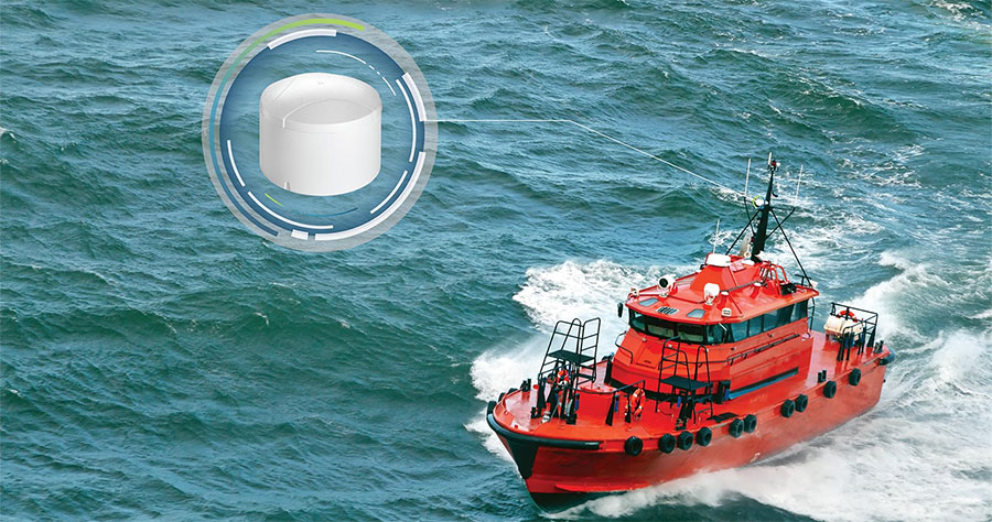
Precise GNSS & GPS Positioning Solutions for the Toughest Marine & Maritime Environments
If you design, build or supply GPS/GNSS Correction, create a profile to showcase your capabilities and connect with visitors who have an active requirement for your solutions.

GNSS correction services compensate for errors in satellite signals, enabling real-time and post-processed accuracy at the centimeter level. From environmental monitoring to hydrographic surveying, these services enhance spatial data quality and operational efficiency in marine and coastal domains.
Several GNSS correction methods have evolved to meet the demanding accuracy needs of ocean-based applications. Each offers distinct capabilities and trade-offs regarding infrastructure, latency, and precision.
RTK is a high-precision method that uses phase measurements of the carrier signal and correction data from a nearby base station. RTK enables real-time corrections, delivering centimeter-level accuracy. It is widely used in coastal hydrographic surveys, port operations, and marine robotics.
PPP utilizes satellite orbit and clock corrections to achieve decimeter- to centimeter-level accuracy, which cannot be achieved using only a standard GNSS receiver and antenna. It is ideal for offshore surveys and operations where base station infrastructure is not feasible. Unlike RTK, PPP offers a broader geographic reach, though with increased convergence time.
This hybrid method combines the global coverage of PPP with the fast convergence and real-time capabilities of RTK. PPP-RTK is suitable for dynamic environments like offshore construction and scientific research platforms requiring rapid initialization and reliable precision.
SBAS enhances GNSS accuracy using geostationary satellites to broadcast correction messages. It supports safety-critical applications in marine navigation systems and is integral to regional ocean observation networks. While SBAS offers meter-level accuracy, its simplicity and availability make it a staple in general vessel navigation.
These methods apply corrections from known reference stations to improve positional accuracy. DGPS and DGNSS are commonly used in ocean mapping and environmental monitoring, particularly for updating nautical charts and supporting autonomous surface vessels.
Network RTK systems use data from a network of base stations to interpolate corrections for a specific location. VRS enhances this by generating a synthetic base station near the user’s location. Both methods support large-scale, high-accuracy marine surveying and precision port infrastructure monitoring.
The Networked Transport of RTCM via Internet Protocol (NTRIP) standardizes the streaming of GNSS corrections over the Internet. Combined with RTCM (Radio Technical Commission for Maritime Services) formats, NTRIP enables real-time delivery of GNSS data across vessels, ocean platforms, and hydrographic sensors.
Dead reckoning uses previous positions, velocity, and heading to estimate the current position. When integrated with GNSS corrections and sensor fusion from IMUs (Inertial Measurement Units), odometers, and other navigation sensors, it provides resilience in signal-degraded environments such as under bridges, harbors, or during GNSS outages.
GNSS correction services support various applications critical to maritime and coastal operations.
High-precision GNSS corrections ensure the accuracy of seabed mapping, enabling safe navigation and supporting the creation of electronic nautical charts. RTK and Network RTK are commonly used for shallow-water surveys.
GNSS corrections improve geospatial accuracy in measuring sea level changes, shoreline erosion, and tidal observations. DGPS and SBAS solutions are often employed in fixed monitoring stations.
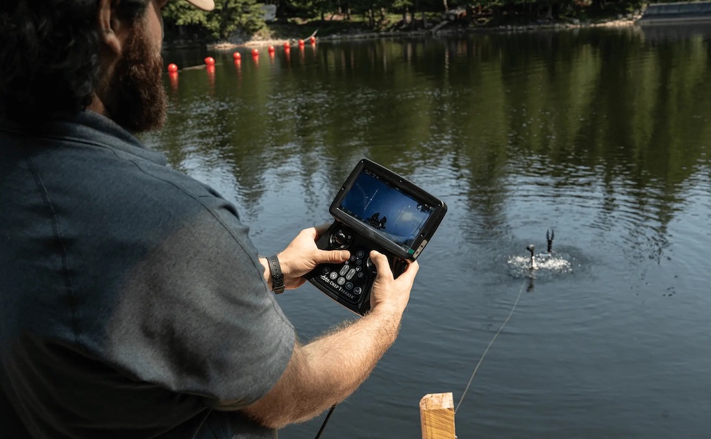
Autonomous surface and underwater vehicles rely on GNSS corrections for accurate navigation. PPP and PPP-RTK are essential for beyond-visual-line-of-sight (BVLOS) operations in offshore environments, while RTK is favored for precise maneuvering in ports and harbors.
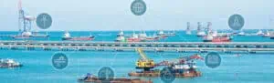
GNSS corrections guide offshore platform placement, cable laying, and dredging activities. PPP and Network RTK services enable precise positioning even in remote locations without dense ground-based infrastructure.
Floating buoys, underwater gliders, and remote ocean instruments depend on high-precision positioning to collect reliable spatial data. PPP and SBAS corrections are commonly integrated into their onboard navigation systems.
GNSS correction services enable accurate tracking of ships, containers, and autonomous craft. Correction-integrated GNSS solutions ensure better route planning, fleet management, and geofencing in port operations.
| Technology | Accuracy | Infrastructure Required | Latency | Coverage | Use Cases |
| RTK | 1–2 cm | Local base station | Low | Limited | Hydrographic surveys, port navigation |
| PPP | 5–10 cm | Global correction data | Moderate | Global | Offshore platforms, autonomous systems |
| PPP-RTK | 1–5 cm | Global + regional corrections | Low | Broad | Scientific instruments, BLOS operations |
| SBAS | 1–2 m | Regional satellites | Low | Regional | Vessel navigation, coastal surveys |
| DGPS/DGNSS | <1 m | Nearby reference stations | Low | Regional | Charting, environmental monitoring |
| Network RTK/VRS | 1–2 cm | Dense base station network | Low | Regional | Construction, marine robotics |
Base stations or reference stations serve as the backbone of GNSS correction networks. These stations log satellite signals from a fixed, known position and broadcast correction data to mobile receivers. Key considerations for base station deployment in ocean science include:
Networked base stations enable scalable correction services for large marine operations, especially when deployed as part of VRS or Network RTK configurations.
GNSS corrections are often combined with onboard sensors such as IMUs, odometers, and magnetometers for enhanced navigation. This fusion improves reliability in GNSS-denied environments, such as:
Inertial navigation units (INS) and sensor fusion algorithms ensure continuous positioning, using GNSS as an absolute reference and dead reckoning during outages.
Various standards and protocols govern GNSS correction technologies and their use in maritime and oceanographic settings:
Compliance with appropriate standards ensures compatibility, safety, and reliability across maritime GNSS implementations.
The field of GNSS correction services is advancing rapidly with innovations in:
These developments aim to improve correction accuracy, robustness, and accessibility for ocean science applications.
GNSS correction services are instrumental in enabling the next generation of marine exploration and monitoring:
As demands for precision and automation grow in ocean science, GNSS correction technologies will remain central to operational success and scientific discovery.
 Searching Companies & Products

 Subscribe to the Weekly eBrief
The latest engineering and technical developments straight to your inbox - join thousands of engineers who receive it.
Subscribe to the Weekly eBrief
The latest engineering and technical developments straight to your inbox - join thousands of engineers who receive it.