


Marine Environmental Sonar
Discover cutting-edge solutions from 6 leading global suppliers
Woods Hole Oceanographic Institution (WHOI) is part of a global program to improve ocean observing capabilities, which are critical for helping understand ocean, coastal, and marine environments.
Ocean Discovery League (ODL), led by oceanographer and National Geographic deep-sea explorer Dr. Katy Croff Bell, has received a $1.2 million ocean technology transition grant from NOAA and the Integrated Ocean Observing System (IOOS) for the development of its next-generation deep ocean sensor and camera system.
This award is believed to be one of the largest single investments to date in easy-to-use, low-cost technology specifically targeting the deep sea.
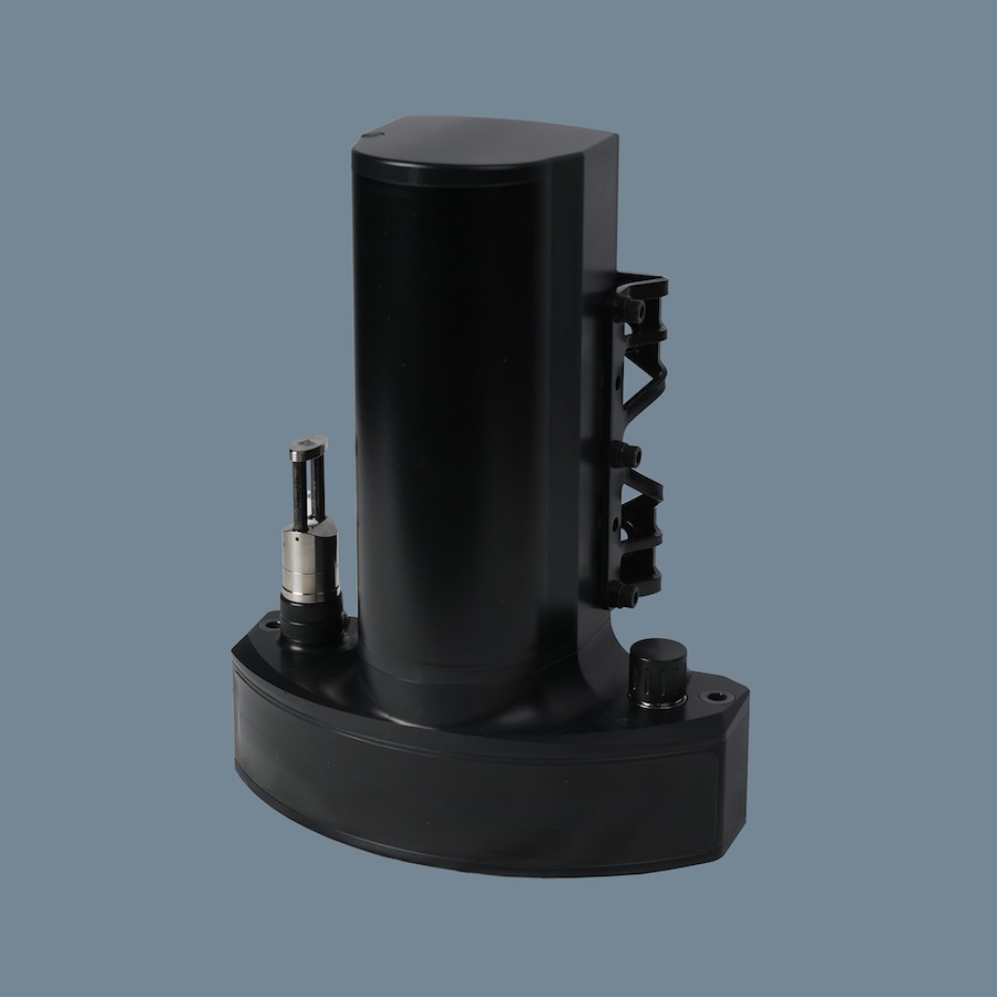
Anna Michel, Associate Scientist at WHOI and Chief Scientist of the National Deep Submergence Facility, will lead the WHOI team that will adapt their CO2/O2 sensor for use as a module for the Deep Ocean Research & Imaging System (DORIS).
Anna Michel said; “We are proud to play a role in this global project. Continuing scientific exploration of the deep ocean is imperative, and broadening exploration access across the ocean community is an important initiative. The adaptation of WHOI’s mini chemical sensor package for use with DORIS will play a role in developing accessible systems and advancing individual user mission objectives.”
As part of this award, ODL will develop the deep-diving, low-cost DORIS to lower the financial and technical barriers to deep-sea exploration and research. DORIS builds on previous modular systems developed by ODL and is a novel, customizable tool consisting of interchangeable sensing and operational modules that can be configured to meet the mission of individual projects. The high degree of flexibility and ease of use allows users to create a technological solution that meets their unique needs.
“We have seen a minuscule fraction of the deep seafloor,” said Bell. “Only through scalable, innovative solutions like DORIS and expanding the community of global ocean explorers will we be able to make significant progress in characterizing this barely explored ecosystem.”
The primary goal of this system is to reduce the reliance on technical expertise for operation and deployment. DORIS will aim to achieve an operational depth of 6,000 meters and include a suite of modules, including sensing modules (e.g., O2/CO2, CTD sensors) and operational modules (e.g., lighting). In 2020, Wayfinder—a prototype developed by ODL’s predecessor, the Open Ocean Initiative at the MIT Media Lab—provided critical lessons in developing easy-to-use modular oceanographic systems.
The grant is in partnership with the Pacific Islands Ocean Observing System (PacIOOS), WHOI, and the University of Nebraska at Lincoln.
PacIOOS supports ocean users and stakeholders throughout the Pacific Islands by providing accurate and reliable coastal and ocean information, tools, and services that are easy to access and use. The partnership with PacIOOS will achieve maximum impact for historically under-served communities, and this grant will leverage their network of communities, regional liaisons, and data visualization platform to bolster community capacity. This grant will support training, user support, and workshops to help address knowledge gaps concerning ocean technology.
“The collaboration with Ocean Discovery League on this grant cuts to the heart of the PacIOOS mission, aiming to empower ocean users in the region through more accessible data and technology,” said Dr. Jordan Watson, Deputy Director of PacIOOS. “This project seeks to provide new and accessible technology while also building capacity for communities without traditional participation in deep ocean science.”
Dr. Dan Novy, an Assistant Professor at the University of Nebraska-Lincoln, is a transmedia experience designer and Imagineer who supervised the development of previous ODL systems. He will advise on the technical design and development of this project.
The broader impact of DORIS is placing the tools of ocean exploration directly into the hands of communities across the Pacific, providing them with the capacity to monitor a changing ocean in regions where climate resilience is the primary concern, and resources are scarce. DORIS will expand access to exploration technology and broaden participation for more equitable and efficient discovery, conservation, and management. Because of its modular and portable nature, it can enable communities to target specific areas of concern within their local environments.
NOAA and ODL also recently signed a formal agreement to collaborate to accelerate deep-ocean exploration by developing low-cost tools and technologies, such as deep-sea cameras, that give greater, more equitable access to the broader public and scientific communities to explore the deep ocean.


