


Discover World-Leading Technologies for Ocean Science
Discover cutting-edge solutions from leading global suppliers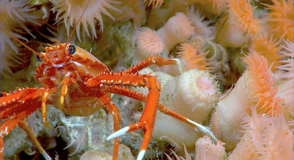
Covering 6.4 million acres, an underwater seascape of cold-water coral mounds offshore the southeast United States coast has been deemed the largest deep-sea coral reef habitat discovered to date.
The coral habitat was assigned the title of largest to date by a paper recently published in the scientific journal Geomatics.
Large cold-water coral mounds were first documented offshore of the southeastern U.S. in the 1960s. Since that time, extensive research has been conducted by regional experts to discover new mounds throughout the Blake Plateau and to document the ecological importance of these habitats.
Fisheries managers have used this information to protect known coral areas from physical damage. The recently completed mapping effort in the region builds on this foundational work by revealing the full extent and characteristics of these important deep-sea coral mound features.
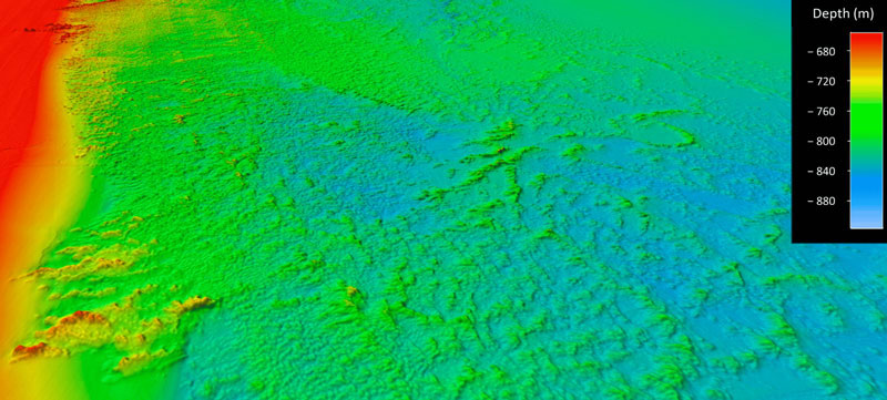
For the study, “Mapping and Geomorphic Characterization of the Vast Cold-Water Coral Mounds of the Blake Plateau”, scientists synthesized bathymetric data from 31 multibeam sonar mapping surveys.
The largest were led by NOAA Ocean Exploration to produce a nearly complete map of the seafloor of the Blake Plateau, located about 100 miles off the southeast U.S. coastline. The study area is nearly the size of Florida, and stretches approximately from Miami, Florida, to Charleston, South Carolina.
The authors used a standardized system developed as part of the study to classify, delineate, and quantify coral mound features. This automated system identified 83,908 individual coral mound peak features in the mapping data, providing the first estimate of the overall number of potential cold-water coral mounds mapped in the region to date.
The study documents the massive scale of the coral province, an area composed of nearly continuous coral mound features that span up to 500km (310 miles) long and 110km (68 miles) wide, with a core area of high-density mounds up to 254km (158 miles) long and 42km (26 miles) wide. The results also highlight how different regions of the Blake Plateau exhibit large variations in the density, height, and pattern of coral mound formation.
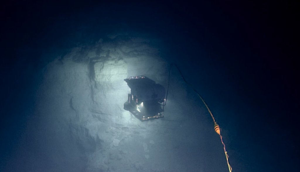
The data analyzed, which included imagery from 23 submersible dives in addition to mapping data, were collected as part of a coordinated, multi-year ocean exploration campaign involving at least 10 different institutes and industry partners.
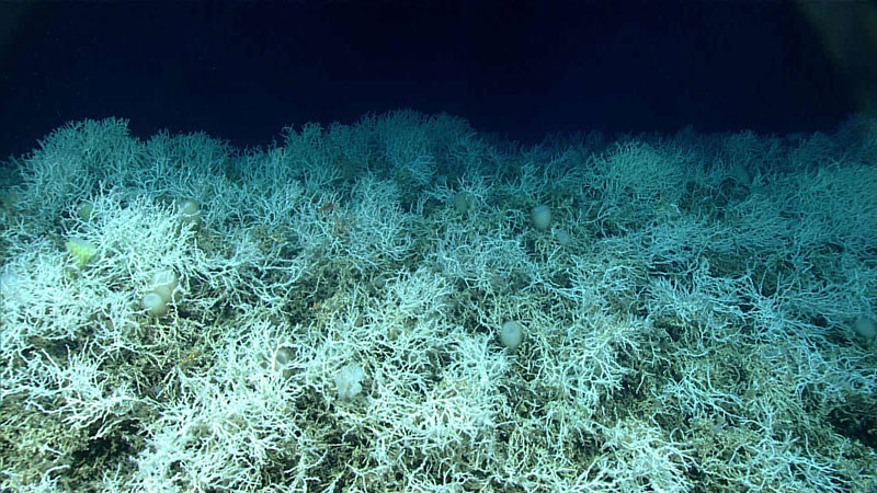
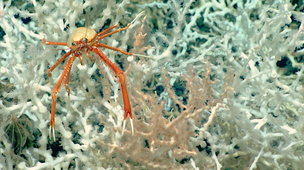
The largest area, nicknamed “Million Mounds” by scientists, is primarily made up of Desmophyllum pertusum (previously called Lophelia pertusa), a stony coral most commonly found at depths between 200 – 1,000 meters (656 – 3,280 feet), where waters have an average temperature of 4°C (39°F).
Cold-water corals such as these grow in the deep ocean where there is no sunlight and survive by filter-feeding biological particles. While they are known to be important ecosystem engineers, creating structures that provide shelter, food, and nursery habitat to other invertebrates and fish, these corals remain poorly understood.
Studies such as this one provide a better understanding of how populations of corals and other deep-sea species may be related across geographically separated locales (a concept known as connectivity) which in turn can offer insight into the resiliency of these populations.
This is important for predicting the impacts of human activities on coral communities and for developing solid plans for their protection.
Derek Sowers, Ph.D., Mapping Operations Manager for the Ocean Exploration Trust and lead author of the study, said; “This strategic multiyear and multi-agency effort to systematically map and characterize the stunning coral ecosystem right on the doorstep of the U.S. East Coast is a perfect example of what we can accomplish when we pool resources and focus on exploring the approximately 50% of U.S. marine waters that are still unmapped.
“Approximately 75% of the global ocean is still unmapped in any kind of detail, but many organizations are working to change that. This study provides a methodology aimed at interpreting mapping data over large ocean regions for insights into seafloor habitats and advancing standardized approaches to classifying them to support ecosystem-based management and conservation efforts.”
Kasey Cantwell, operations chief for NOAA Ocean Exploration, said; “For years we thought much of the Blake Plateau was sparsely inhabited, soft sediment, but after more than 10 years of systematic mapping and exploration, we have revealed one of the largest deep-sea coral reef habitats found to date anywhere in the world.
“Past studies have highlighted some coral in the region, particularly closer to the coast and in shallower waters, but until we had a complete map of the region, we didn’t know how extensive this habitat was, nor how many of these coral mounds were connected. This discovery highlights the importance of exploring our deepwater backyard and the power of interagency collaboration and public-private partnerships.”
The original article, along video about the study including footage of the habitat, can be found on the NOAA website.


