Nortek Signature ADCPs
partner with OST
XEOS Data Relay
Leading Global Suppliers

GNSS/INS for Marine and Maritime Navigation Systems

Find suppliers and manufacturers of GNSS/INS systems that integrate satellite positioning with inertial measurement data to provide precise, real-time navigation for marine and subsea platforms operating in GPS-degraded or denied environments.

Read the Technology Overview

Suppliers: GNSS/INS

Hexagon | NovAtel
Hexagon | NovAtel

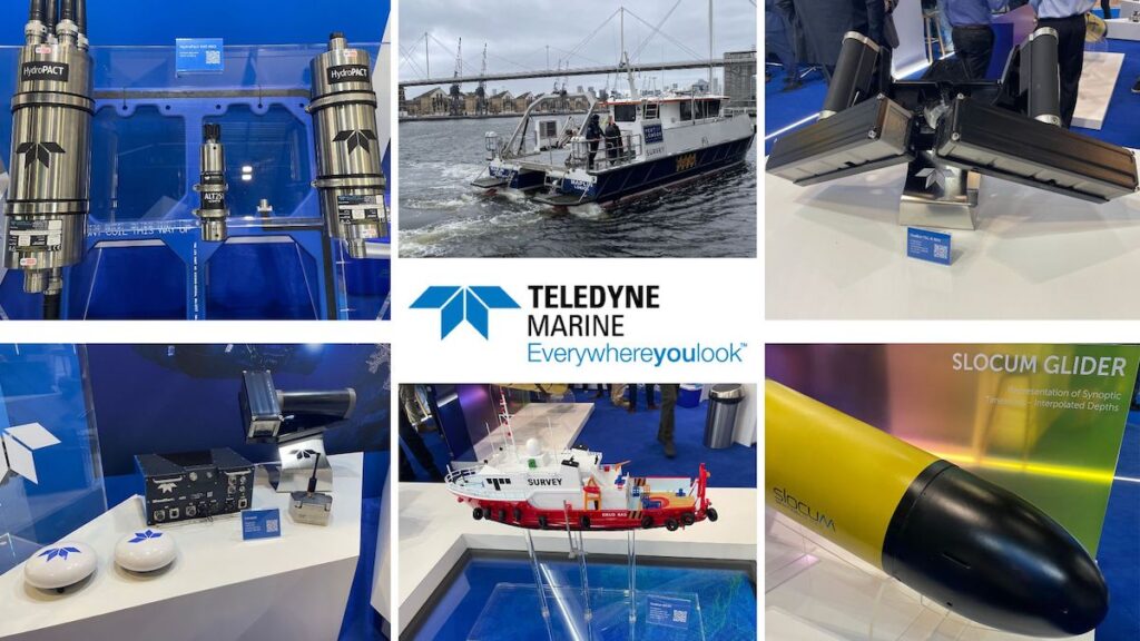
Precise GNSS & GPS Positioning Solutions for the Toughest Marine & Maritime Environments

SBG Systems
SBG Systems

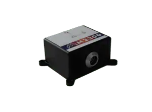
Advanced Inertial Navigation, Motion & Positioning Solutions for Marine Applications

Advanced Navigation
Advanced Navigation

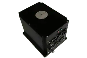
High-Accuracy Inertial Sensors & Acoustic Positioning Systems for Marine, Maritime & Offshore Applications

Xsens
Xsens

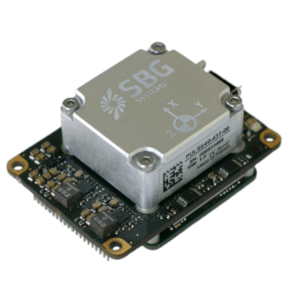
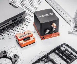
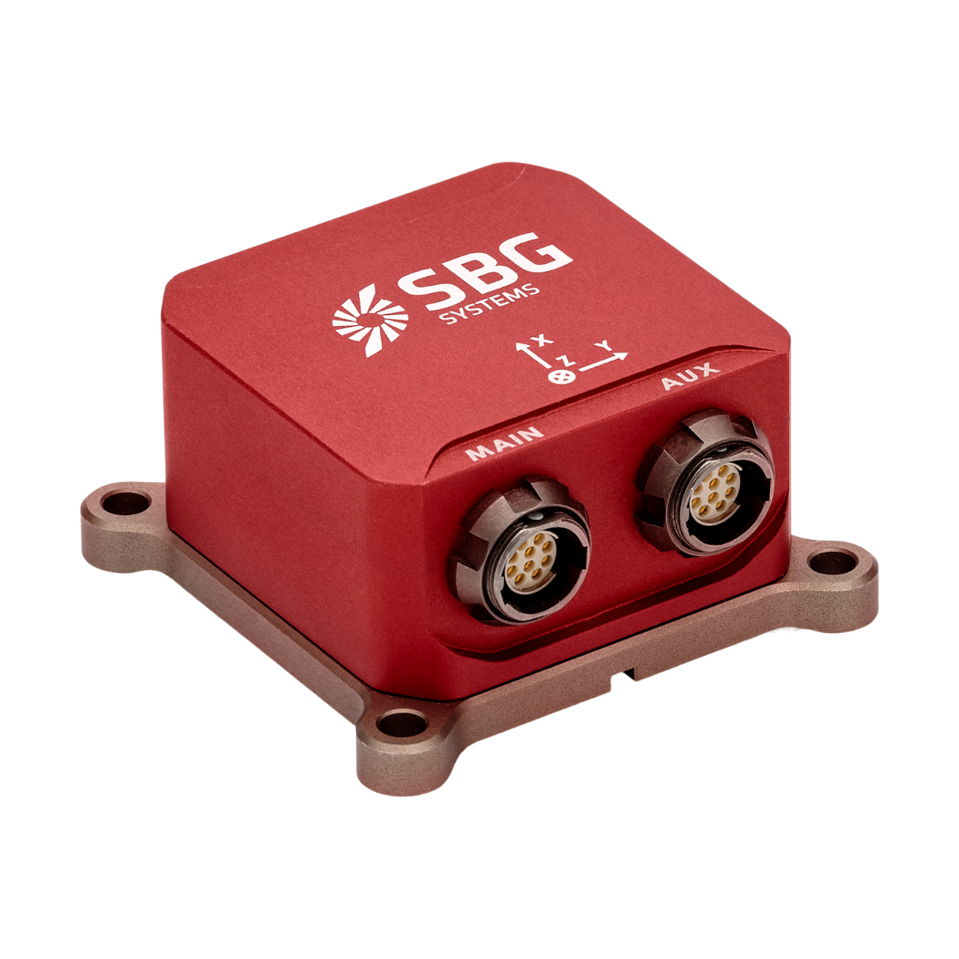
High-Performance Compact Inertial Sensing Modules for Marine & Subsea Applications

Micro Magic
Micro Magic

Marine-Grade Inertial Sensing Systems for the Offshore & Subsea Industries

Showcase your capabilities

If you design, build or supply GNSS/INS, create a profile to showcase your capabilities and connect with visitors who have an active requirement for your solutions.

Create Supplier Profile

Products

12 Cutting-edge Solutions
Add your solutions
MarinePak7 GNSS Receiver

Marine-grade GNSS+INS receiver for nearshore applications

Marine-grade GNSS+INS receiver for nearshore applications
The MarinePak7 is a marine-certified GNSS receiver that utilizes proprietary deeply coupled SPAN...
Ekinox-D
Ekinox-D

Compact dual-antenna GNSS/INS with survey-grade precision

Compact dual-antenna GNSS/INS with survey-grade precision
...n-one inertial navigation system (INS) with an integrated dual-antenna RTK GNSS receiver, engineered... ...high-precision marine systems, Ekinox-D provides real-time or post-processed centimeter accuracy via...
Quanta Micro
Quanta Micro

Ultra-compact high-performance GNSS/INS

Ultra-compact high-performance GNSS/INS
...aided inertial navigation system (INS) tailored for demanding marine, airborne, and land... ...eal choice for marine survey systems, USVs, and payloads where precision navigation is...
Ellipse-N
Ellipse-N

Compact single-antenna GNSS/INS for marine precision

Compact single-antenna GNSS/INS for marine precision
...aided inertial navigation system engineered for precision orientation, positioning, and heave in... ..., and air data systems, enhancing performance in GNSS-challenged areas. Real-Time Kinematic (RTK)...
Ellipse-E
Ellipse-E

Compact GNSS-aided INS for precision marine navigation

Compact GNSS-aided INS for precision marine navigation
......r USVs, AUVs, instrumented buoys, and other marine systems where navigation integrity is... ...aided inertial navigation system engineered to provide precise orientation, position, and heave in...
Certus & Certus Evo
Certus & Certus Evo

Rugged GNSS-aided navigation & positioning solutions

Rugged GNSS-aided navigation & positioning solutions
...utput data for navigation and positioning at sea. The versatile units provide a range of interface...
Boreas D90
Boreas D90

Strategic-grade digital FOG GNSS-INS

Strategic-grade digital FOG GNSS-INS
...bines Advanced Navigation’s new ground-breaking DFOG (Digital Fiber Optic Gyroscope) technology...
MTi 1-Series
MTi 1-Series

Compact surface-mount inertial modules with built-in sensor fusion

Compact surface-mount inertial modules with built-in sensor fusion
......ogy, delivering ready-to-use orientation and navigation data with no external processing... ......he cost-effective modules are ideal for USVs, buoys, AUV and ROV navigation and control, and...
MTi 600-Series
MTi 600-Series

Versatile inertial sensing solutions with rugged & OEM form factors

Versatile inertial sensing solutions with rugged & OEM form factors
......rdability, and are ideal for surface vessels, buoys, AUV and ROV navigation and control, and...
M5000
M5000

Subsea FOG & quartz INS with integrated GNSS receiver & optional DVL

Subsea FOG & quartz INS with integrated GNSS receiver & optional DVL
...based inertial navigation system that provides robust navigation, position and attitude control...
M4000
M4000

Survey-grade FOG INS & MRU with integrated GNSS receiver & optional DVL

Survey-grade FOG INS & MRU with integrated GNSS receiver & optional DVL
...based inertial navigation system that is designed for easy installation into a wide range of surface...
M2300
M2300

MEMS INS & MRU for vessels & offshore equipment

MEMS INS & MRU for vessels & offshore equipment
...ertial sensing system that is available as a GNSS-aided INS or as an MRU, providing...

GNSS/INS for Marine and Maritime Navigation Systems

Olivia Hannam

Updated:

GNSS/INS – also known as GPS/INS technologies provide precise positioning and navigation for marine and maritime vessels, enhancing safety, efficiency, and autonomy across diverse operational environments. Integrated Global Navigation Satellite System (GNSS) and Inertial Navigation System (INS) solutions are increasingly critical to operations where accurate geospatial awareness is essential, even in GNSS-denied environments such as underwater or near complex coastal infrastructure.

These systems combine the global precision of satellite navigation with the local accuracy of inertial sensors. This fusion ensures reliable real-time data on position, orientation, and velocity for crewed and uncrewed platforms operating on or below the ocean surface. These systems support everything from seabed mapping to autonomous docking and are vital for enabling intelligent marine operations in both commercial and defense settings.

Subsea and Marine GNSS/INS Applications

GNSS-INS by Advanced Navigation

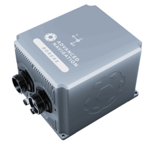
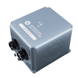
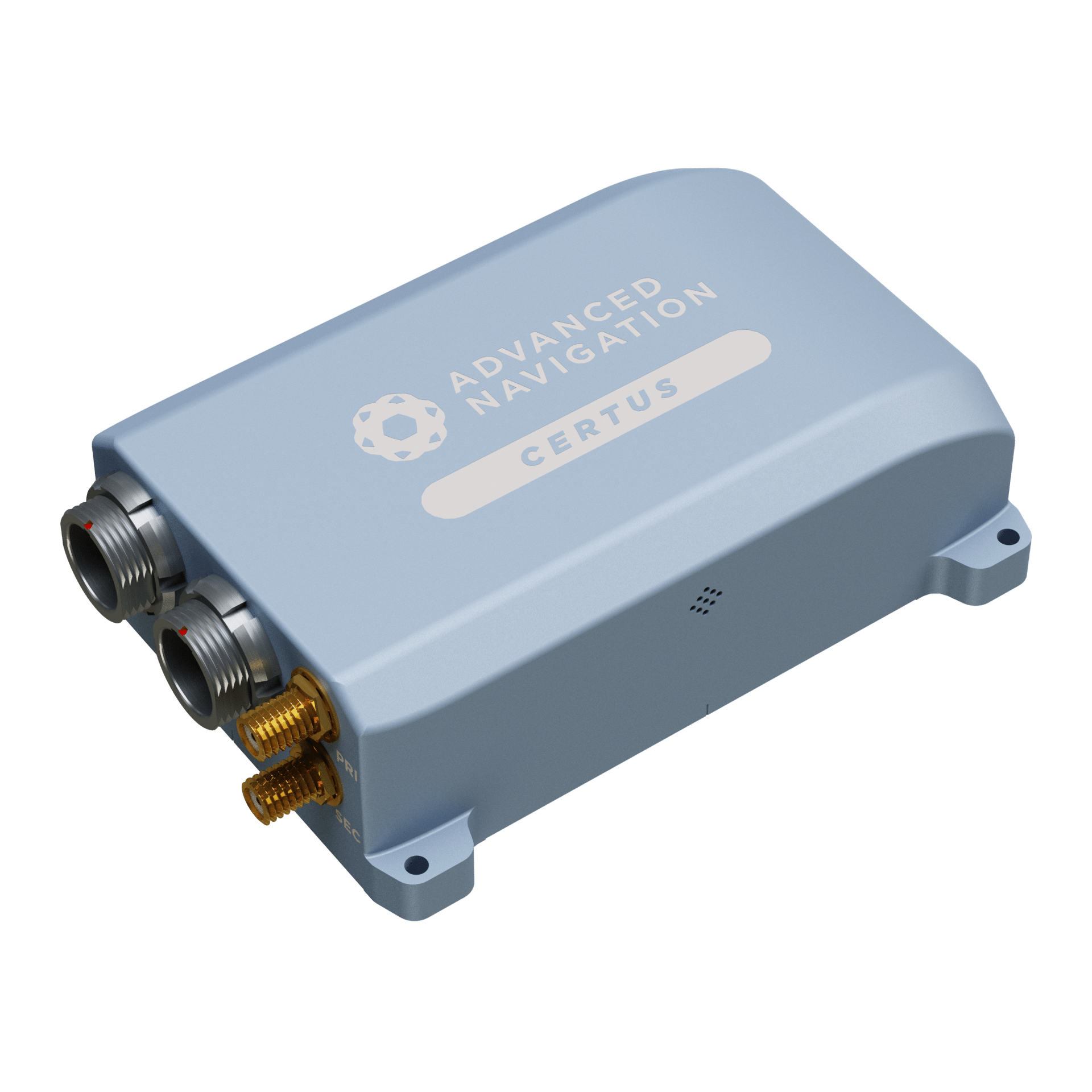
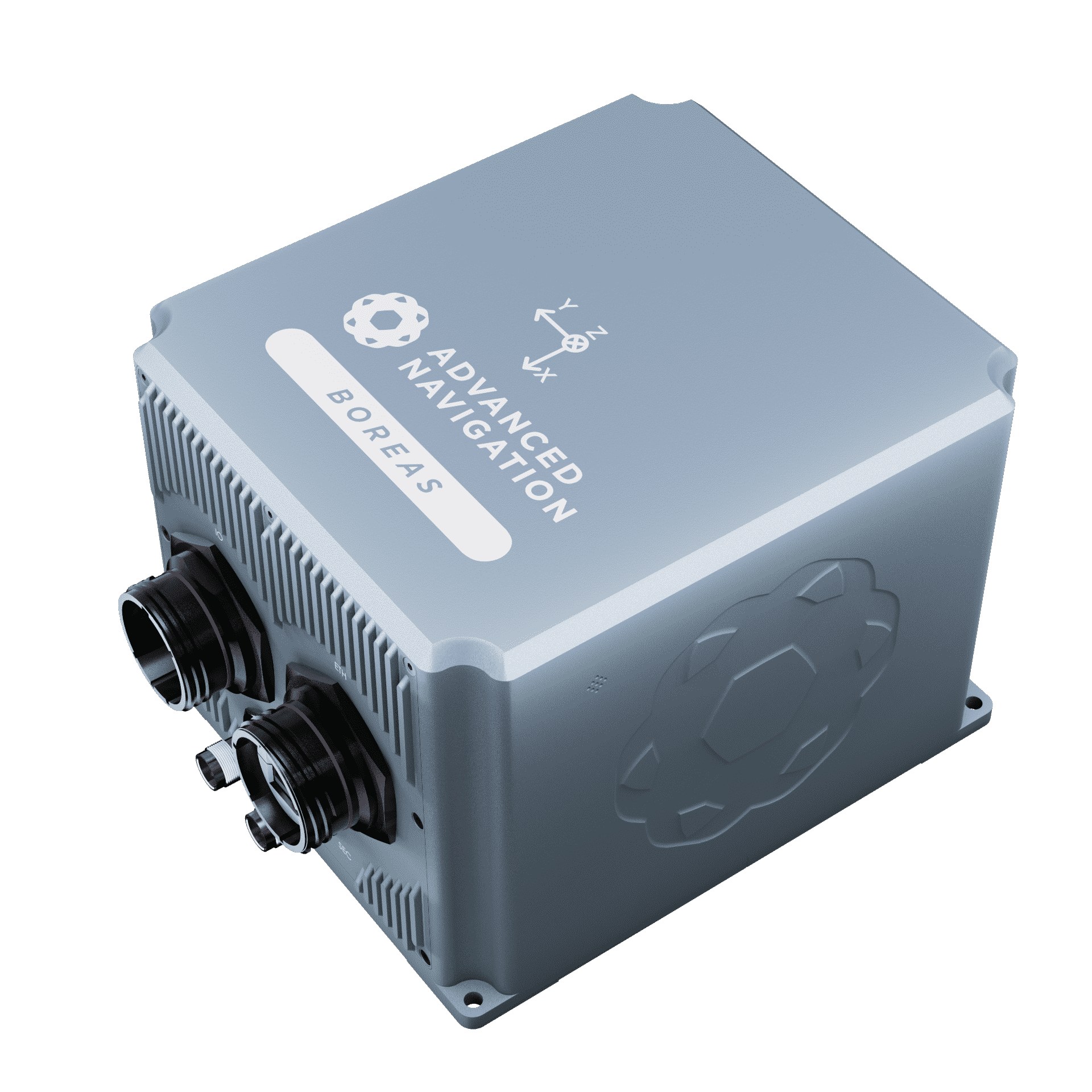
Boreas D90 digital FOG GNSS-INS by Advanced Navigation

GNSS/INS systems are used in many marine applications, providing high-precision navigation and orientation data for vessels and platforms operating in complex or dynamic settings. Typical use cases include:

Hydrographic and Bathymetric Surveys

Survey-grade GNSS/INS systems are used in multibeam and single-beam echo sounder operations, providing accurate georeferenced depth data for seabed characterization, dredging, and infrastructure planning.

GNSS/INS for Remotely Operated Vehicles (ROVs)

ROVs conducting cable inspection, maintenance, or salvage rely on tightly coupled GNSS/INS data relayed from surface vessels to maintain position and execute controlled movements.

GNSS/INS for Autonomous Underwater Vehicles (AUVs)

AUVs use embedded inertial systems and occasional GNSS fixes at the surface or via acoustic modems to navigate complex missions in GNSS-denied underwater environments.

GNSS/INS for Uncrewed Surface Vessels (USVs)

Enables autonomous waypoint navigation, station keeping, and dynamic avoidance for USVs used in survey, security, and environmental monitoring.

Ship Navigation and Collision Avoidance

Large ships use integrated navigation systems for safe routing, docking, and collision avoidance in congested or low-visibility conditions.

Dredging and Port Operations

Accurate INS-corrected positioning enhances dredge head tracking, sediment management, and alignment of port infrastructure.

Offshore Asset Monitoring

Aids in the stabilization and tracking of floating platforms, cranes, and sensor arrays used in offshore oil and gas, wind, and marine energy installations.

Many operations use GNSS/INS in combination with Automatic Identification Systems (AIS), vessel traffic services (VTS), and sonar for comprehensive maritime domain awareness.

Types and Architectures of GNSS/INS Systems

Enables autonomous waypoint navigation, station keeping, and dynamic avoidance for USVs used in survey, security, and environmental monitoring.

  • GNSS-INS System by SBG Systems

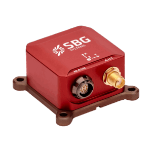
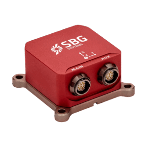
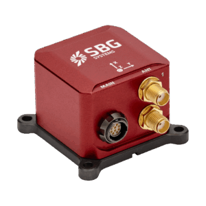
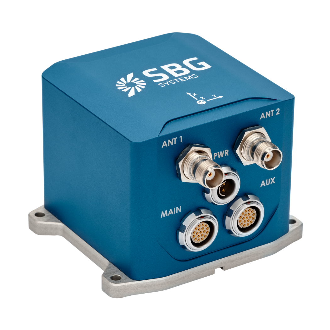
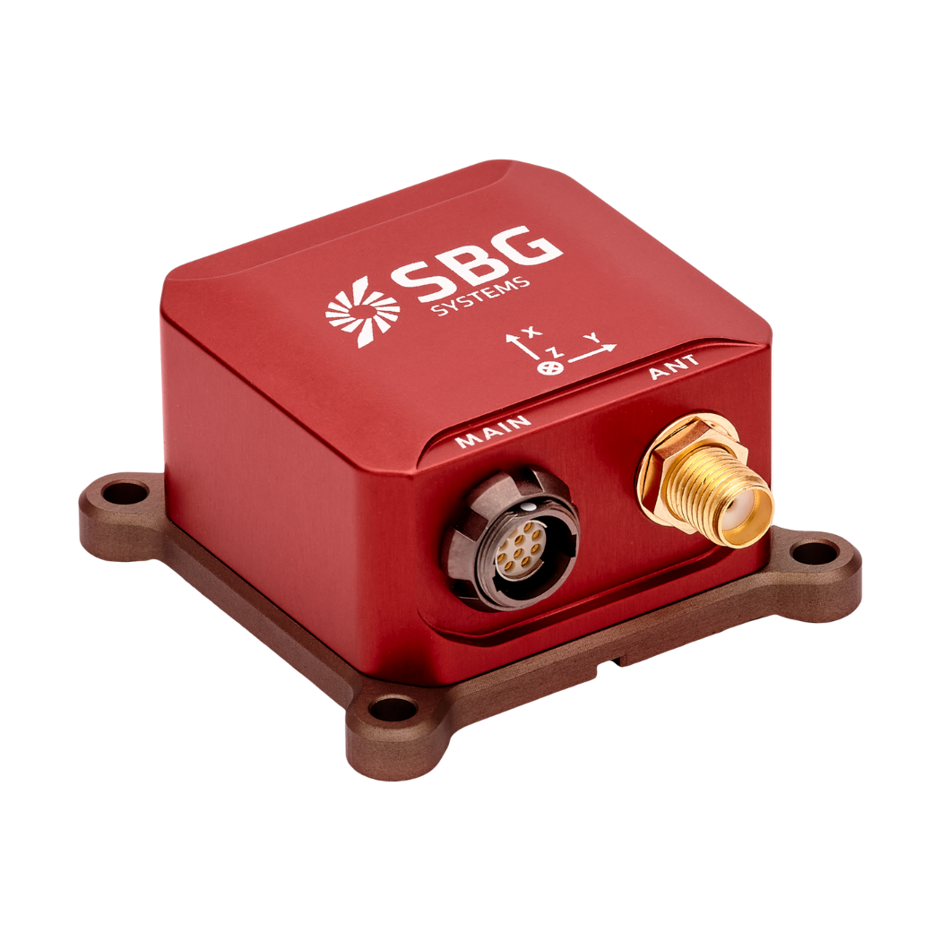
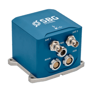
    Compact high-performance GNSS/INS by SBG Systems.

    Tactical-Grade IMU-Based INS: Systems built around tactical-grade MEMS or compact FOG sensors. These balance accuracy with low power and small form factor, making them common in USVs, small AUVs, and portable survey equipment.

  • Survey-Grade INS: Incorporates high-performance FOG or ring laser gyros, enabling centimeter-level accuracy when combined with RTK correction data. Widely used in hydrographic surveys, ROV operations, and precision georeferencing tasks.
  • High-Precision Embedded Units: Compact GNSS/INS modules integrated into control electronics or payloads, optimized for ROVs, AUVs, UAVs, and sensor pods where space is at a premium.
  • EGI Systems (Embedded GPS/INS): Typically deployed in defense, maritime, and aerospace systems, combining robust IMUs with secure, anti-jamming GNSS for mission-critical navigation and targeting.
  • Marine Strapdown Systems: Solid-state designs with no moving parts, offering robustness in high-dynamic environments and resistance to mechanical shock and vibration.
  • AHRS Modules: Attitude and Heading Reference Systems provide real-time orientation data and are often integrated with GNSS/INS in marine platforms to support vessel stabilization, auto-heading, and control.

Coupling architectures define how data integration is managed:

  • Loosely Coupled: GNSS and INS data are processed independently and fused at a higher level. Simpler but less resilient in challenging environments.
  • Tightly Coupled: Raw GNSS signal data and INS outputs are combined directly, allowing navigation even with fewer than four satellite signals.
  • Deep or Ultra-Tightly Coupled: Integrates GNSS signal tracking loops with inertial data, enhancing resilience against jamming and spoofing.

Performance Factors and Metrics

System performance is evaluated across several key dimensions:

  • Position Accuracy: High-end systems achieve sub-meter to centimeter-level accuracy using RTK or PPP corrections. Accuracy may degrade with GNSS dropout, but is stabilized by INS.
  • Attitude Accuracy: Roll, pitch, and yaw measurements are critical for platform orientation, particularly during dynamic movement.
  • Heading Resolution: Especially important for docking, underwater cable laying, and navigation near obstacles.
  • Latency and Update Rate: High-frequency data output is required for real-time control loops in autonomous systems.
  • Robustness: Systems are evaluated for shock, vibration, temperature, and electromagnetic compatibility (EMC), particularly in naval deployments.

High-end systems may also include anti-spoofing, interference mitigation, and redundancy through multiple GNSS constellations or auxiliary sensors.

Regulatory and Industry Standards

GNSS/INS solutions used in maritime environments often conform to international and defense standards. These include:

  • IMO Performance Standards: For shipborne GNSS equipment in commercial vessels.
  • NMEA 0183 / NMEA 2000: Communication protocols for marine electronics.
  • MIL-STD-810 & MIL-STD-461: Environmental and electromagnetic standards for naval and defense platforms.
  • STANAG 4576: Defines INS parameters and formats for NATO forces.
  • RTCM SC-104 & NTRIP Protocols: Used for real-time GNSS correction data transmission.

Adherence ensures system interoperability, mission assurance, and safety of navigation in international waters.

Integration With Marine Systems

Modern GNSS/INS systems are increasingly integrated with other vessel subsystems for real-time data exchange, control, and monitoring. Examples include:

  • Sensor Fusion With Sonar and DVL: For improved underwater navigation and seabed mapping.
  • Linkage to Autopilots and Thrusters: Enabling dynamic positioning and precise maneuvering during docking or equipment deployment.
  • Mission Management Systems: Real-time GNSS/INS data feeds autonomous mission planners and navigation computers.
  • Fleet Management Platforms: Use GNSS/INS data for centralized monitoring, route optimization, and operational coordination across vessel groups.
  • Situational Awareness Dashboards: Provide navigation crews or remote operators with fused geospatial data, alerts, and diagnostics.

Interoperability is enhanced by standardized data buses (e.g., CAN, Ethernet), software APIs, and modular hardware architectures.

As maritime operations become more autonomous and data-driven, GNSS/INS technologies are evolving to meet higher expectations for accuracy, resilience, and integration:

  • Machine Learning for Sensor Fusion: AI-based fusion techniques are being developed to improve robustness in degraded or denied conditions.
  • Compact High-Accuracy IMUs: Enabling tighter SWaP-C performance for small uncrewed platforms.
  • Multi-Sensor Redundancy: Combining multiple GNSS receivers, IMUs, and aiding sensors to provide failover capabilities in critical missions.
  • GNSS-Denied Navigation Research: Exploring hybrid approaches using magnetometers, vision-based localization, and inertial sensing.
  • Cybersecurity and Hardening: Enhancing protection against jamming, spoofing, and cyber intrusion, particularly in defense and dual-use systems.

Continued advancement in GNSS/INS is essential for expanding maritime autonomy, safety, and situational awareness across global ocean domains.


Related Articles

Delivering Precision & Efficiency in Deepwater Navigation Systems

Advanced Navigation’s case study explores how Tamboritha balanced cost, performance, and rapid deployment using the Boreas A70 for precise deepwater ROV navigation

Apr 20, 2026
Oi 2026: Teledyne Marine Showcases Latest Systems & Advanced Survey Technologies

OST visited Teledyne Marine at Oceanology International 2026 in London, where the company showcased sonar, navigation, oceanographic, and autonomous survey technologies

Mar 16, 2026
ANELLO Photonics & Mythos AI Partner to Secure Maritime Navigation

ANELLO Photonics and Mythos AI partner to deliver plug-and-play GPS-denied navigation for autonomous maritime platforms

Mar 02, 2026
Interpreting GNSS-Denied Test Reports for Airborne Navigation

SBG Systems explores how to accurately interpret GNSS-denied test reports, emphasizing the importance of real-world performance data and key factors influencing INS reliability in challenging conditions

Dec 17, 2025
Profile Spotlight: Micro Magic for Marine-Grade Inertial Sensing Systems

Micro Magic is presenting its advanced inertial sensing systems on OST, providing precise navigation, motion control, and stability solutions for offshore, subsea, and marine operations

Dec 11, 2025
Real-Time Vibration Analysis Embedded in SBG Systems IMU

SBG Systems’ IMU now features built-in vibration monitoring, delivering real-time analysis to enhance accuracy, detect resonance, and support design, testing, and structural monitoring

Nov 19, 2025
Profile Spotlight: Hexagon | NovAtel for Precise Marine Positioning & Resiliency

Hexagon | NovAtel is presenting its marine solutions on OST, providing reliable GNSS-based positioning, navigation, and resiliency tools for commercial, defense, and offshore maritime applications

Oct 24, 2025
SBG Systems Demonstrates Enhanced Performance of New Ellipse INS Firmware

SBG Systems evaluates its New Ellipse INS firmware through testing in AHRS and GNSS-aided modes, highlighting improved accuracy in dynamic, magnetic, and GNSS-denied conditions

Jul 15, 2025
Profile Spotlight: SBG Systems’ Advanced Inertial Navigation & Motion Solutions

SBG Systems is showcasing its precision inertial navigation, motion, and positioning solutions on OST, offering robust, ITAR-free sensors designed for a wide range of marine applications

Jun 04, 2025