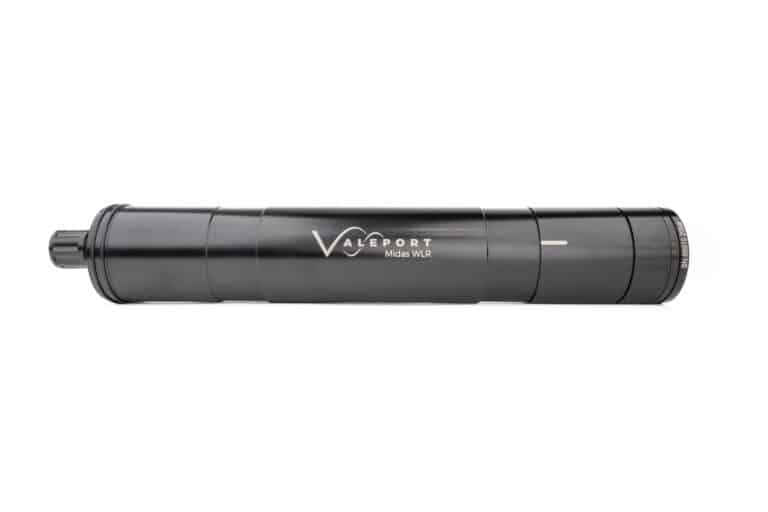
Tide Gauge on Ascension Island Provides Unique Sea-Level Insight

The tide gauge is now transmitting open-access sea-level data in near real-time to the Intergovernmental Oceanographic Commission Sea Level Station Monitoring Facility By echoblue / 27 Jun 2023

Tide Gauges

Discover cutting-edge solutions from leading global suppliers
SUPPLIER SPOTLIGHT
Follow OS&T
Tide Gauge on Ascension Island Provides Unique Sea-Level Insight

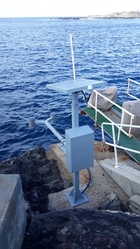
The National Oceanography Centre (NOC) has installed a new tide gauge on the remote Ascension Island through the Climate Linked Atlantic Sector Science project (CLASS) program, providing a unique record of sea-level in the remote ocean.

As sea levels rise, low-lying coastal regions all over the world will be subject to ever more frequent extreme coastal flooding, putting millions of people and properties at risk. NOC scientists and engineers are at the forefront of sea level monitoring technology, having installed monitoring solutions across the globe, supporting capacity development initiatives.

Ascension Island is located in the middle of the Atlantic Ocean 1,000 miles from the coast of Africa and 1,400 miles from the coast of South America. The data from the upgraded tide gauge will provide scientists with open-access high frequency observations on the region which has historically been under sampled. The South Atlantic Ocean has no dedicated warning system for coastal hazards such as tsunamis, meaning the data will also be vital for operational monitoring.

With Ascension Island known to be a notoriously harsh monitoring environment, NOC scientists overcame installation challenges including a closed airport runway and extended COVID restrictions. Although the Ascension government had lifted COVID restrictions in early 2023, airport restrictions remained in place meaning only flights from the neighboring island of St Helena were permitted. Using local contacts built over many years, NOC scientists were able to remotely design and co-ordinate the installation, which was successfully completed in March 2023.

Given the remote location, the innovative tide gauge has also been specially adapted with this in mind, powered solely by renewable energy and utilizing the latest non-contact radar sensors. This will ensure the gauge can operate for long periods of time with little or no maintenance required.  

The tide gauge uses cutting edge communications technology to provide a near real-time data feed that now meets the tsunami monitoring standard, set down by the Global Sea Level Observing System (GLOSS).

The gauge forms part of the South Atlantic Tide Gauge Network, which was originally set up in 1985 as part of the ACCLAIM (Antarctic Circumpolar Current Levels from Altimetry and Island Measurements) program.

The tide gauge is now fully operational, transmitting one-minute averaged sea-level data back, every six minutes to the IOC’s Sea Level Station Monitoring Facility.

Posted by echoblue Connect & Contact

Latest Articles

AGISTAR Unveils Compact Remote-Controlled Motor for Inflatable Boats

AGISTAR has unveiled the OXR-T100, a compact, remote-controlled electric motor engineered for inflatable boats, delivering quiet, eco-friendly performance across demanding marine environments

May 01, 2025
AXYS Technologies MetOcean Observation Networks

AXYS Technologies supplies high-precision MetOcean data solutions that support marine safety, scientific research, environmental monitoring, and policy development across more than 80 countries

Apr 30, 2025
MostaTech to Launch Advanced Gyroscopes at XPONENTIAL 2025

MostaTech will present advanced fiber optic gyroscopes and inertial measurement units at XPONENTIAL 2025, highlighting advancements in low-SWaP, high-performance navigation technology

Apr 30, 2025
D-2 Ultra Low Power CTD Integrated into WHOI Arctic Research

D-2 Inc.’s advanced CTD sensor supports WHOI’s Arctic climate research, enhancing data precision in the Ice Tethered Profiler program’s latest deployments

Apr 30, 2025
Kraken Robotics Secures $11 Million in New Battery Orders

Kraken Robotics has received new orders for its SeaPower™ batteries, powering advanced uncrewed underwater vehicles (UUVs) and driving growth in the defense sector

Apr 29, 2025
SubC Imaging Enhances Data Storage Flexibility with Rayfin Software Update

SubC Imaging has released a new software update, designed to provide enhanced flexibility to the Rayfin camera family

Apr 28, 2025

Featured Content

D-2 Ultra Low Power CTD Integrated into WHOI Arctic Research

D-2 Inc.’s advanced CTD sensor supports WHOI’s Arctic climate research, enhancing data precision in the Ice Tethered Profiler program’s latest deployments

Apr 30, 2025
Case Study: Impact Subsea Altimeter Supports Antarctic Science

Impact Subsea's ISA500 underwater altimeter plays a key role in the Icefin AUV as it collects vital data, passing through narrow boreholes drilled into Antarctic ice shelves

Apr 23, 2025
Kongsberg Discovery Supplies Technology to Convert Sailing Ship into Research Vessel

Kongsberg Discovery has upgraded the Statsraad Lehmkuhl for the One Ocean Expedition, providing advanced systems to support climate and ecosystem research

Apr 17, 2025