Unmanned Surface Vehicles
Discover cutting-edge solutions from 8 leading global suppliers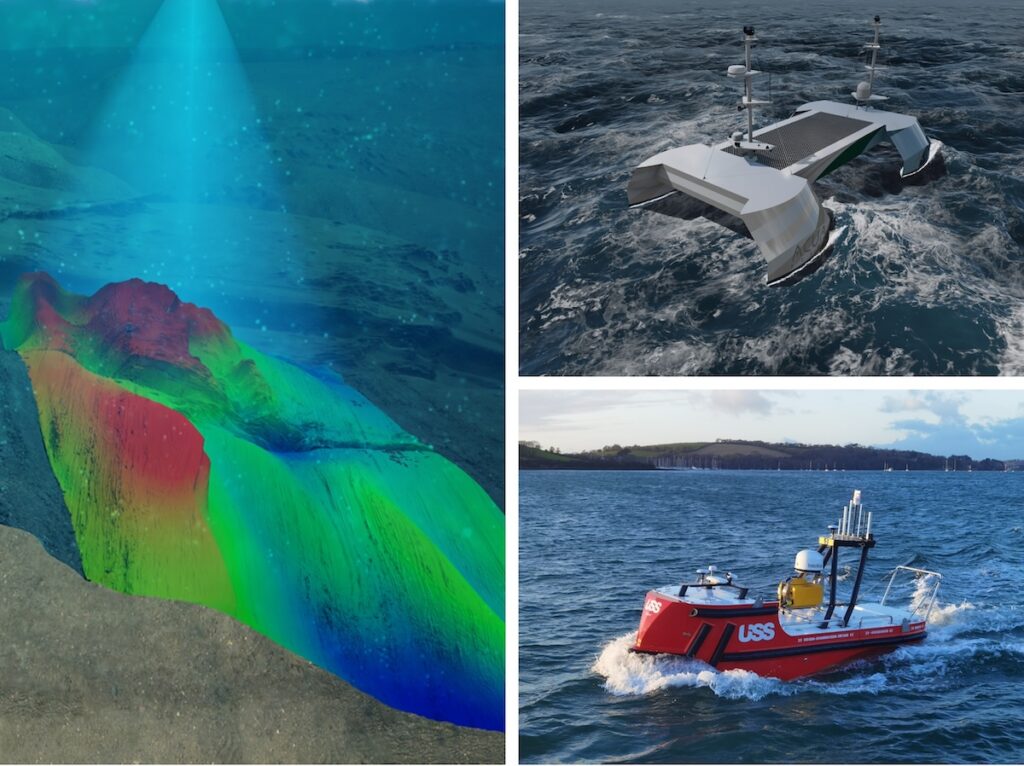
A consortium of Uncrewed Surface Vessel (USV) and hydroacoustic technology companies consisting ACUA Ocean, GeoAcoustics Ltd and Unmanned Survey Solutions (USS) has secured funding under the Defra – Department for Environment Food and Rural Affairs – Improving Observation Capabilities of Biodiversity in UK Waters: Phase 2 programme.
The consortium’s demonstration seeks to combine three cutting-edge technologies into a single approach capable of providing holistic mapping and water quality data of seagrass meadows more efficiently and with lower carbon footprints compared to current sonar-based techniques.
USS has previously incorporated a GeoSwath 4 sonar system and collaborated with GeoAcoustics on a project aimed at providing fully automated end-to-end bathymetric solutions. This groundwork sets the foundation for the current project.
While single-beam echosounders have historically been employed for seagrass mapping, their effectiveness is constrained by their narrow beams, which only survey a limited strip of the seabed per ping. In contrast, this project adopts a strategy leveraging the wide swath capabilities of the GeoSwath system, promising substantial gains in efficiency.
The project will use an advanced interferometric sonar system capable of transmitting sonar beams over 40 times wider than a typical single-beam sonar system, allowing for greater spacing between survey lines and significantly reduced survey times.
The GeoSwath 4 bathymetric sonar features an onboard Artificial Intelligence system to automate data processing and extract sea grass height estimates in real-time. Survey and water quality systems will be deployed from a carbon neutral USV to further reduce environmental impact and operating costs.
“Defra is proud to announce its investment in UK SMEs that are advancing next-generation marine monitoring technologies as components of complete end-to-end monitoring systems. These innovative systems are pivotal to advancing our biodiversity observation capabilities in UK waters and will contribute to strengthening our evidence base as we progress towards the UK’s vision for clean, healthy, safe, productive and biologically diverse seas,” said Vicki Castro-Spokes, Programme Director for Defra’s Marine Natural Capital & Ecosystem Assessment Programme.
Project Lead, James Williams, Chief Executive Officer of Unmanned Survey Solutions said, “USS has worked with GeoAcoustics on a variety of projects where we have integrated the GeoSwath wide swath bathymetry system and GeoPulse compact sub-bottom profiler systems. This new project will be a game changer for seagrass mapping efficiency due to the wide seabed coverage from every survey line. Combined with GeoAcoustics new AI processing and ACUA Ocean’s Natural Capital Assessment tool, our ability to transmit raw data to anywhere in the world will give scientists access to real time data, allowing them to make critical decisions during survey operations.’’
Dr Richard Dowdeswell, Chief Commercial Officer of GeoAcoustics Ltd, said, “GeoAcoustics is delighted to be working with both USS and ACUA Ocean on this exciting project which opens up further applications for our proven sonar technology while demonstrating the operational benefits that our new AI solution unlocks.”
Speaking on the announcement, ACUA Ocean CEO Neil Tinmouth said “ACUA has been working on the development of a Natural Capital Assessment tool for aiding the visualisation of holistic ocean habitat data. The project builds on the work conducted by ACUA during Phase 1 of the DEFRA grant. AO has end-user and potential customers already interested in the systems and services delivered during this project.”