This video from NORBIT Subsea, a developer of wideband multibeam sonar solutions for marine and subsea applications, features scientific surveyor Aleksandra Kruss, presenting the company’s Data Collection Tool (DCT).
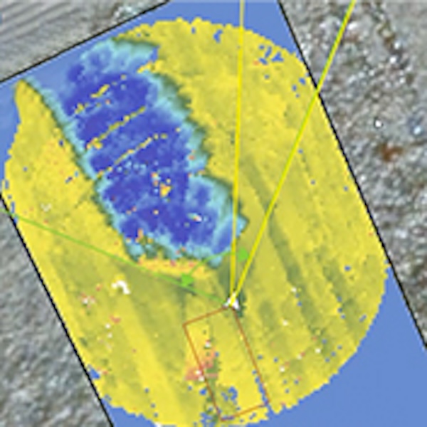
The DCT is a web browser-based application that simplifies data collection while maintaining professional-level quality. It displays the vessel and survey coverage on a Google Maps background, allowing users to plan survey lines, start and stop recordings, and add or delete data as needed.
The platform enables users to see vessel position and heading and supports data collection from mobile phones, tablets, and external devices, which can also start recordings and control survey operations and data quality. A tablet can be provided to a navigator or boat driver, enabling them to record data without professional hydrographic expertise.
This open hydrographic platform by NORBIT supports data recording, storage, and transfer. Users can view data in a web browser or export it to GIS software for post-processing. As an open-source system, it allows development in different directions to meet future needs, while giving full control over how data is processed and stored.