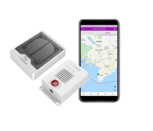
Vessel Monitoring Systems (VMS) are secure maritime tracking and reporting solutions used to monitor fishing vessels, support fisheries compliance, and manage ocean-use activity. These systems typically combine onboard VMS transponders, GNSS or GPS positioning, satellite or cellular communications, and shore-side platforms that record vessel identity, position, course, speed, and time data.
This page showcases leading vessel monitoring system suppliers, supporting fisheries monitoring, protected area enforcement, and fleet coordination.
If you design, build or supply Vessel Monitoring Systems (VMS), create a profile to showcase your capabilities and connect with visitors who have an active requirement for your solutions.
Overview of Vessel Monitoring Systems for Fisheries Compliance
Overview by
William Mackenzie
Updated:
Introduction to Vessel Monitoring Systems (VMS)
Marine Vessel Monitoring Systems (VMS) provide regulatory authorities with secure, structured data to monitor commercial fishing fleets and support compliance with fisheries rules, closed areas, license conditions, and maritime boundary frameworks. These specialized compliance tools record vessel identity, position, course, speed, and time data, then transmit these reports to authorized shore-side management agencies for review, enforcement, and audit purposes.
A functional fishing vessel monitoring system combines onboard VMS transponders, GNSS or GPS positioning, cellular or satellite communications, protected cabling, and shore-side monitoring platforms. Reporting intervals are set by the relevant fisheries authority, license condition, or regional fisheries management organization, while approved systems may also support tamper alerts, power-loss notifications, remote polling, and integration with electronic logbooks, catch reporting tools, or observer systems.
Key Components of a Vessel Monitoring Solution
A functional fishing vessel monitoring system combines specialized hardware and software designed to withstand demanding marine environments. The layout relies on several interconnected elements to maintain data continuity:
Onboard VMS transponders and terminals: These specialized units process reporting logic, manage approved communications links, and may contain internal backup batteries to support continued operation during temporary vessel power interruptions.
GNSS antennas and protected cabling: These external components require clear lines of sight above the superstructure and rely on marine-grade shielding and installation practices to resist environmental exposure and electromagnetic interference.
AI vessel monitoring software and dashboards: These interfaces allow shipboard crews, service providers, fleet operators, or shore-side authorities to verify terminal health, manage mapping views, and respond to alerts where supported by the approved system.
Integration with electronic logbooks and observer systems: This digital bridging can link geographic position history with catch declarations, landing records, electronic monitoring, and onboard camera data where required by the relevant fisheries control framework.
Proper implementation of these components helps ensure that data collection remains consistent despite hull vibrations, power drops, saltwater exposure, and harsh weather conditions.
Applications of Marine Vessel Monitoring Systems
Fisheries Monitoring and Surveillance
Viettel S-Tracking VMS from Iridium Communications
Enforcement agencies utilize vessel tracking system data to verify that commercial fishing vessels operate within permitted coordinates and respect regional quotas, closed areas, and license conditions. This continuous data stream allows maritime patrol assets to prioritize high-risk vessels rather than conducting broad, random surface searches.
Illegal and Unregulated Fishing Detection
While non-compliant operators may attempt to deactivate their tracking hardware or interrupt transmissions, vessel monitoring systems can automatically flag unexpected gaps in reporting. Correlating these alerts with secondary data streams helps maritime authorities investigate possible illegal transshipment, unauthorized fishing, and poaching activities in remote waters.
Protected Area Enforcement and Spill Response
Environmental managers can analyze VMS velocity profiles and track patterns to help distinguish transit behavior from likely fishing activity inside marine protected areas. During hazardous material spills or ecological emergencies, historical tracks may also help identify which vessels were present in the affected area to support incident review, enforcement activity, or liability assessments.
Offshore Support Vessel Tracking
Energy developers and marine planners may use long-term VMS data to map historical fishing patterns, helping to minimize spatial conflicts during the planning phases of wind farms, cable routes, and subsea pipelines. Once offshore assets are operational, VMS data may contribute to broader maritime surveillance and spatial management workflows, although operational protection of sensitive infrastructure is usually handled through wider systems that may combine AIS, radar, patrol reporting, and other vessel tracking technology.
Research and Aquaculture Fleet Coordination
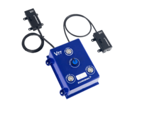
Blue Box V77 VMS from Iridium Communications
Oceanographic institutions may use VMS-style vessel tracking technology to coordinate survey schedules and reduce conflicts with deployed scientific instrumentation such as moorings, gliders, or seabed sensors. Aquaculture companies may use similar tracking tools on support vessels and wellboats to monitor site access, support biosecurity protocols, and maintain operational records. These uses are related to vessel tracking and monitoring systems but may operate under different rules from statutory fisheries compliance systems.
Search and Rescue Support
When a ship experiences a primary communications failure or operates outside standard VHF radio range, its historical VMS track may serve as supporting information for emergency responders where the data is available to authorized agencies. Search and rescue teams can use the last known position to narrow the search sector and coordinate assistance from nearby tracking-equipped vessels, although VMS should not be treated as a distress alerting system.
Standards, Regulation & Compliance
Navigating vessel monitoring compliance involves meeting specific, evolving criteria established by flag states, coastal states, national fisheries authorities, and international treaties. The operational demands shift based on vessel size, fishery, and geographic location.
Regulatory Framework
Target Demographics & Mandates
Engineering & Operational Implications
National fisheries authority approval requirements
Controls vessels operating within domestic Exclusive Economic Zones by enforcing hardware validation, reporting, and communications requirements.
Procurement teams must select equipment accepted by the relevant authority and retain registration, service, and installation records for inspection or audit.
Oversees shared migratory fish stocks across international waters through coordinated regional tracking mandates.
Systems may need to support specific data formats, approved communications routes, and transmission intervals based on vessel type, fishery, and regional rules.
EU fisheries control requirements and vessel tracking obligations
Regulates commercial fleets within EU waters, with amended control rules applying in stages from 2026 and electronic tracking obligations extending to small-scale vessels from 2028.
Larger vessels must maintain approved tracking systems, while smaller coastal craft transition toward mobile or alternative electronic tracking models according to the applicable implementation timetable.
NOAA and national type-approval frameworks
Dictates technical performance, communications, and approval requirements for hardware operating within relevant US fisheries.
Engineers and vessel owners must verify that the selected transmitter model, communications service, and reporting configuration are accepted for the specific target fishery.
VMS Integration with Wider Maritime Surveillance Systems
Modern maritime domain awareness platforms achieve greater accuracy by fusing VMS data with complementary tracking layers. This integration relies on several parallel surveillance technologies:
VMS, SSAS, LRIT and AIS data correlation: Cross-referencing separate data streams can highlight behavioral anomalies, such as a vessel transmitting a valid VMS signal while its public AIS broadcast is unavailable, inconsistent, or intentionally disabled. Access rules differ across these systems, so correlation depends on legal authority and data-sharing arrangements.
Integrating VMS with coastal radar and vessel traffic services: Comparing physical radar returns with active VMS tracking coordinates can help identify non-cooperative or unidentified vessels operating near ports, protected areas, and secure boundaries.
Satellite imagery and synthetic aperture radar cueing: Synthetic aperture radar can detect vessels through cloud cover and darkness, allowing analysts to flag targets that do not match an active VMS, AIS, or other authorized tracking signature.
Role within maritime domain awareness systems: Combining authenticated VMS locations with port records, licensing data, inspection histories, and environmental information transforms raw positioning points into actionable risk-management intelligence.
Fusing these independent datasets provides a more comprehensive operational picture while protecting the sensitive data typical of commercial fisheries tracking.
Emerging Developments in Vessel Monitoring Systems
The technical architecture of modern vessel tracking is shifting toward more connected and automated digital frameworks. This evolution is driven by several advancements in data processing and satellite infrastructure:
Higher-frequency reporting and lower-cost satellite IoT: New satellite IoT and low-Earth-orbit communications services may reduce airtime expenses and transmission latency, making more frequent location updates practical for some small-scale coastal fleets where permitted by the relevant authority.
AI-assisted vessel behavior classification: Machine learning models analyze positional changes, speed profiles, and track topologies to help categorize activities such as longlining, trawling, drifting, or transit without relying solely on manual data review.
Integration with electronic monitoring and e-logbooks: API-driven tracking platforms can link secure location logs with electronic catch reporting databases, landing declarations, and automated onboard camera systems.
VMS as part of digital ocean governance: Marine spatial planners use historical tracking datasets to balance commercial fishing access with renewable energy developments, marine protected areas, biodiversity protections, and other ocean-use priorities.
These technical updates expand the utility of VMS, moving the technology from an isolated tracking device to a core component of modern ocean management.