Showcase your capabilities
If you design, build or supply GNSS Receivers, create a profile to showcase your capabilities and connect with visitors who have an active requirement for your solutions.



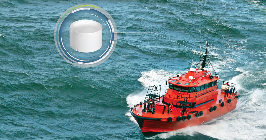
GNSS receivers provide accurate positioning, navigation, and timing for various marine, coastal, and geospatial applications. These systems access multiple satellite constellations to deliver high-resolution location data for surface platforms, drifting buoys, and autonomous vehicles. While GNSS signals cannot penetrate water, their data is often used to initialize and support inertial or acoustic positioning systems for subsea operations.
Read the Technology Overview
Precise GNSS & GPS Positioning Solutions for the Toughest Marine & Maritime Environments

Cutting-Edge Surveying, Positioning & Sensing Solutions for Hydrographic & Oceanographic Applications


Innovative Subsea & Marine Navigation, Positioning & Survey Solutions

If you design, build or supply GNSS Receivers, create a profile to showcase your capabilities and connect with visitors who have an active requirement for your solutions.

Global Navigation Satellite System (GNSS) receivers provide real-time geospatial positioning by acquiring signals from satellite constellations such as GPS, GLONASS, Galileo, and BeiDou. GNSS receivers are a core component in data collection, platform tracking, and navigation for maritime vehicles, buoys, research stations, and coastal monitoring infrastructure.
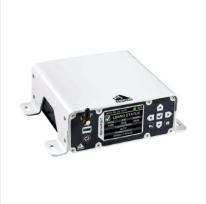
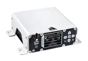
MarinePak7 GNSS Receiver by Hexagon | NovAtel
GNSS receivers are categorized by architecture, integration level, and signal processing approach. These systems may be realized as chipsets, modular components, smart antennas, or fully integrated solutions. Modern designs incorporate software-defined radio (SDR) techniques to support greater adaptability, multi-constellation access, and advanced features like real-time correction.
Compact integrated circuits that perform core satellite signal processing. These chips are typically embedded in custom electronics and represent the lowest level of GNSS integration.
Modules combine GNSS chips with RF front ends, clocks, and standard interfaces. Some advanced modules include support for RTK, multi-frequency reception, or internal SDR cores. These are common in survey-grade equipment, marine vehicles, and compact autonomous systems.
RTK-enabled receivers apply differential corrections in real time to achieve centimeter-level accuracy. Available as both compact modules and integrated systems, RTK GNSS receivers are widely used in hydrographic surveying, unmanned surface vessels (USVs), and precision navigation tasks. RTK capabilities may be embedded in standalone receivers, smart antennas, or hybrid systems. Some RTK solutions incorporate SDR processing for correction handling and constellation flexibility.
These all-in-one devices combine the GNSS antenna with processing electronics and communication interfaces. Designed for simple deployment, they often support multi-constellation tracking and may include RTK or heading capabilities. High-end models may use SDR architecture for enhanced signal handling and future-proofing.
Self-contained systems, often with embedded GNSS engines, antennas, power regulation, and data interfaces. These are ready-to-use units designed for field deployment in marine navigation, coastal monitoring, and autonomous vehicle guidance. Many incorporate multi-frequency, RTK, and inertial support, often using SDR cores for real-time signal processing.
These receivers digitize incoming satellite signals and implement signal processing entirely in software. They offer maximum flexibility regarding algorithm design, signal compatibility, and experimental applications. SDRs are increasingly used in academic marine research, GNSS signal testing, and systems requiring custom or adaptive navigation logic.
Combining GNSS receivers with inertial navigation systems, GNSS/INS systems maintain accurate position estimates in environments where GNSS signals are unreliable or unavailable. Frequently used in subsea operations, polar regions, and under bridges, these systems may be built from hardware or SDR-based receivers, and often support RTK, PPP, or custom correction schemes.
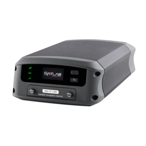
Njord dual-antenna GNSS receiver by SatLab Geosolutions
GNSS receivers are integral to a range of marine and coastal applications where accurate positioning is critical:
Modern GNSS receivers are designed to operate in complex marine conditions and include features such as:
When selecting a GNSS receiver for ocean science applications, several criteria influence performance and usability:
| Parameter | Hardware GNSS Receiver | Software GNSS Receiver | RTK GNSS Receiver | Hybrid GNSS/INS Receiver |
| Precision | High | Variable | Centimeter | Centimeter |
| Customizability | Low to Medium | High | Medium | Medium |
| Processing Load | Low | High | Medium | High |
| Signal Robustness | Moderate | Depends on software | High | Very high |
| Integration Complexity | Low to High | High | Medium | High |
Software GNSS receivers offer great flexibility for research and testing but demand higher computational resources. Hardware receivers are robust and plug-and-play, while RTK and hybrid units excel in high-precision and degraded signal conditions.
GNSS receivers are rarely deployed as standalone components in ocean science and marine navigation. They are typically integrated with a range of subsystems to enhance functionality, robustness, and data utility across dynamic environments.
AHRS units provide orientation data—pitch, roll, and yaw—based on internal accelerometers, gyroscopes, and magnetometers. When fused with GNSS data, AHRS enables full six-degree-of-freedom navigation, essential for platform stabilization, sensor alignment, and coordinated autonomous operations. These systems are widely used on vessels, USVs, AUVs, and buoy-mounted sensors.
IMUs supply high-rate inertial data for short-term navigation when GNSS signals are unavailable or degraded. Integration with GNSS allows for sensor fusion, improving position accuracy through dead reckoning. This is particularly valuable in GNSS-challenged environments such as under bridges, near cliffs, or during brief signal outages in rough seas.
GNSS receivers feed position, heading, and timing data to GIS platforms and hydrographic survey systems. This enables real-time georeferencing of collected environmental, bathymetric, or asset data, critical for scientific mapping, coastal infrastructure planning, and seabed characterization.
GNSS-derived positioning and heading data inform vessel or vehicle control systems for autonomous navigation, station-keeping, and waypoint following (marine autopilot). Integration ensures accurate guidance for ASVs, AUVs, and dynamically positioned platforms operating in constrained or remote waters.
GNSS data are transmitted in real time to shore-based control centers or between vehicles via satellite, cellular, or RF telemetry. This telemetry supports remote monitoring, fleet coordination, and mission tracking for distributed marine operations, including research expeditions and autonomous sensor networks.
Precision timing from GNSS receivers synchronizes data collection across sensors, platforms, and networks. This is vital in distributed measurement systems, seismic monitoring, and applications requiring time-stamped observations such as tide gauges or acoustic arrays..
Choosing the right GNSS receiver depends on:
 Searching Companies & Products

 Subscribe to the Weekly eBrief
The latest engineering and technical developments straight to your inbox - join thousands of engineers who receive it.
Subscribe to the Weekly eBrief
The latest engineering and technical developments straight to your inbox - join thousands of engineers who receive it.