Showcase your capabilities
If you design, build or supply Wave Sensors, create a profile to showcase your capabilities and connect with visitors who have an active requirement for your solutions.


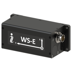
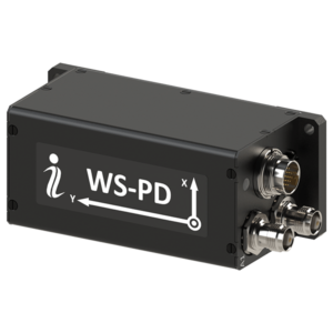
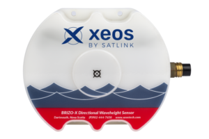
Ocean wave sensors are marine instrumentation systems that measure sea-surface motion and convert it into usable metocean data. These sensors may be deployed on buoys, seabed frames, fixed platforms, vessels, coastal infrastructure, and autonomous vehicles to capture wave height, period, direction, spectra, and sea-state evolution.
This page showcases leading ocean wave sensor manufacturers supporting oceanographic research, coastal engineering, offshore energy, port operations, subsea construction, and autonomous maritime surveys.
Read the Technology Overview
Cutting-Edge Positioning, Navigation & Motion Tracking Systems for Marine & Maritime Vessels & Platforms
Telemetry Tracking Beacons & Equipment for Marine & Offshore Applications
If you design, build or supply Wave Sensors, create a profile to showcase your capabilities and connect with visitors who have an active requirement for your solutions.

Wave sensors are specialized marine instrumentation systems engineered to capture and quantify the physical characteristics of the sea surface. In professional ocean monitoring, these systems provide the high-fidelity data required to characterize sea state, mitigate operational risk for offshore assets, inform coastal engineering designs, and validate numerical wave models. Rather than offering qualitative assessments, a modern wave sensor translates complex surface motion into engineering-grade parameters such as significant wave height, peak and mean wave periods, directional spreading, and wave energy spectral density.
These instruments can be integrated into surface buoys, seabed frames, fixed platforms, coastal infrastructure, commercial vessels, and autonomous vehicles. Depending on operational depth, environmental exposure, and required accuracy, they measure the surface profile directly or infer wave parameters via subsurface pressure anomalies, high-rate inertial platform telemetry, radar backscatter, or acoustic returns.
Ocean wave sensors are often grouped by measurement method, deployment format, and the parameters they generate. Raw time-series data, such as vertical heave or pressure fluctuations, are processed via onboard or onshore algorithms into industry-standard metocean parameters.
Transforming raw measurements into these distinct mathematical products allows operators to consistently evaluate regional metocean conditions across distinct hardware brands and deployment configurations.
Surface wave buoy sensors remain standard for direct, in-situ sea-state measurement. Modern directional configurations measure multi-axis motion to compute precise directional properties, though hull geometry and mooring design must be carefully tuned to prevent signal filtering. While compact hulls simplify deployment, larger buoys support high-power telemetry and auxiliary metocean sensors. The primary benefit is direct interaction with the air-sea interface, while key challenges include mooring fatigue, biofouling, and survivability in severe weather.
Inertial wave sensors estimate sea-surface motion by measuring high-rate linear accelerations and angular velocities. Standard systems isolate vertical acceleration to derive real-time heave displacement, while advanced inertial wave-sensing packages may combine three-axis accelerometers and gyroscopes with GNSS, magnetometers, or sensor-fusion algorithms to improve orientation and heave estimates. The compact footprint and low power consumption of IMUs suit small buoys and autonomous vehicles perfectly. However, removing low-frequency drift and integration artifacts requires rigorous signal processing, often pairing the IMU with GNSS or Kalman filtering.
GNSS wave height sensors track satellite positioning metrics to determine the high-frequency displacement of a floating platform. By recording rapid three-dimensional geodetic position changes, the system can calculate wave height and period, while directional wave parameters may be derived using multi-axis motion data, multiple receivers, or additional orientation sensing depending on the system design. This technology enables highly compact, cost-effective designs for localized observing networks. Its accuracy depends on satellite constellation geometry and line-of-sight availability, meaning data from high-latitude or sheltered zones requires careful validation.
Installed in fixed bottom-mount frames or subsea structures, pressure-based wave sensors measure wave-induced pressure fluctuations caused by passing wave crests and troughs. Processing software applies wave theory and depth-dependent transfer functions to estimate the surface wave profile from subsurface pressure fluctuations. These rugged instruments are ideal for shallow water and harbors where surface buoys risk vessel collision. Because high-frequency wave energy attenuates rapidly with depth, accurate deployment requires balancing sensor resolution against target wave frequencies.
Acoustic wave sensors utilize acoustic time-of-flight or Doppler frequency shifts to monitor the sea surface. Bottom-mounted Acoustic Doppler Current Profilers are highly valued as combined wave and tide sensors because they simultaneously profile the water column velocity structure and orbital wave velocities. This makes acoustic wave sensors uniquely capable in dynamic, high-current environments like tidal inlets and offshore wind arrays. Configuring an ADCP requires precise beam geometry, high-rate sampling, and tilt mitigation to eliminate velocity measurement biases.
Remote monitoring technologies allow operators to gather comprehensive sea surface data without placing instruments directly into the water column.
These non-contact methods significantly reduce maintenance overhead while providing wider spatial awareness around high-value marine assets.
In physical oceanography, wave sensors provide the empirical validation needed to study wind-wave generation mechanics, non-linear wave-wave interactions, and energy dissipation. Long-term, high-fidelity datasets allow researchers to identify multi-decade climate shifts, changing storm track intensities, and fetch variations in polar regions linked to sea-ice retreat.
For coastal engineering, nearshore wave data guides the design of breakwaters, sea defenses, harbor entrances, and beach nourishment initiatives. Engineers rely on quality-controlled wave data streams, often following recognized protocols such as IOOS QARTOD, to ensure that structural designs safely withstand coastal overtopping, erosion, and extreme breaking forces.
The expansion of offshore wind farms has intensified the demand for precise metocean instrumentation. During the pre-construction phase, directional wave sensors define the extreme design wave criteria for fixed monopiles and jackets. For floating offshore wind turbines, directional spectra data is even more critical because low-frequency swell can induce severe pitch and roll motions, stressing dynamic subsea power export cables and structural moorings.
During operations and maintenance, real-time data from wave height sensors dictates safety windows for crew transfer vessels, heavy-lift jack-up operations, and subsea remotely operated vehicle interventions.
Safe vessel navigation and harbor management require a clear understanding of real-time sea states. Port authorities utilize combined wave and tide sensors to manage under-keel clearance for deep-draft commercial vessels, optimize pilotage windows, and prevent dangerous mooring lines snapped by harbor resonance.
In subsea construction and marine cable laying, seabed-mounted wave sensors and acoustic profilers monitor wave-induced orbital velocities near the seafloor. Even when the surface appears calm, long-period waves can create significant near-bed hydrodynamic forces. Real-time subsea wave monitoring prevents premature cable fatigue during touchdown, stabilizes trenching equipment, and ensures the safety of commercial diving operations.
As autonomous platforms become standard tools for marine surveys, integrating wave-sensing payloads has become a priority. Unmanned Surface Vehicles equipped with compact IMU or GNSS wave sensors can operate as mobile metocean stations, gathering regional data without the capital expense of traditional moored infrastructure.
Beyond data collection, real-time wave awareness acts as a primary input for vehicle autonomy. By continuously measuring wave heights, encounter frequencies, and directional alignments, a USV can alter its routing, optimize propulsion efficiency, protect sensitive optical payloads from slam damage, and execute safe autonomous recovery maneuvers.
The marine instrumentation market is evolving rapidly to deliver denser observing networks and lower lifecycle costs.
These technological updates are transforming how engineers and oceanographers interact with real-time environmental data streams.
 Searching Companies & Products

 Subscribe to the Weekly eBrief
The latest engineering and technical developments straight to your inbox - join thousands of engineers who receive it.
Subscribe to the Weekly eBrief
The latest engineering and technical developments straight to your inbox - join thousands of engineers who receive it.