Deep Trekker’s ROVs come equipped with a range of features that make them ideal for capturing high-quality underwater images to be developed into 3D models. Read more >>
The company’s goal is to provide access to intuitive, cost-effective, and portable underwater drones with high-quality 4K cameras, powerful LED floodlights, and exceptional stability, ideal for photogrammetry projects.
Deep Trekker outlines how its ROVs are well-suited to photogrammetry applications, specifically its Mission Planner feature. This utilizes advanced algorithms for intelligent pathfinding, with NAV packages that are equipped with IMUs, USBL, and DVL sensors for interpreting live positional data, enabling seamless autonomous navigation.
In the full article, the company discusses:
- Necessary Equipment for Photogrammetry
- Utilizing Deep Trekker ROVs for Photogrammetry
- Step by Step Guide for Using Deep Trekker ROVs for Photogrammetry
- Case Study: Stantec Using Deep Trekker ROVs for 3D Archaeological Modeling
- Ideal Industries for Using Deep Trekker ROVs for Photogrammetry
- Best Deep Trekker Packages for Photogrammetry
- The Deep Trekker Advantage
The company presents its mission-ready underwater remotely operated vehicles (ROVs) with advanced autonomy capabilities that are ideally suited for photogrammetry.
Read the full article, find out more on Deep Trekker’s website, or continue reading below.
In the vast expanse of underwater environments, the ability to accurately document and measure submerged structures, artifacts, and ecosystems has evolved dramatically over the past decade.
One of the most groundbreaking methods reshaping this field is photogrammetry, a technique that transforms two-dimensional (2D) images into intricate, three-dimensional (3D) models. This method has become indispensable for industries ranging from archaeology to maritime inspections, and thanks to technological advances such as Deep Trekker’s remotely operated vehicles (ROVs), it’s now easier than ever to explore and document the underwater world with remarkable precision.
The Power of Photogrammetry
At its core, photogrammetry is the science of obtaining accurate measurements from photographs. By stitching together multiple overlapping images taken from various angles, a detailed 3D model can be constructed.
This model captures the geometry, orientation, and spatial relationships of underwater objects or environments, providing a digital record that can be used for inspection, analysis, and conservation purposes.
To ensure precision in photogrammetry, it is crucial to use high-quality images. The more detailed the initial imagery, the more reliable and accurate the resulting 3D models. This method involves several stages: from capturing a series of photographs using advanced equipment, to processing the images using specialized software that interprets depth, orientation, and shape through techniques like feature matching, triangulation, and image alignment.
Underwater photogrammetry has found wide use in documenting submerged cultural heritage, mapping coral reefs, and inspecting offshore infrastructure. Its ability to create exact replicas of underwater objects without disturbing them makes it an ideal tool for delicate tasks such as preserving archaeological artifacts or assessing marine ecosystems.
Deep Trekker ROVs: Enabling Underwater Photogrammetry
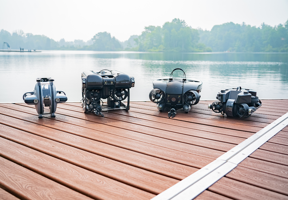
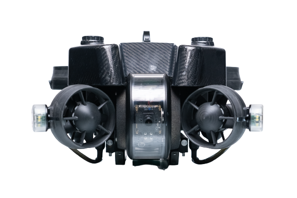
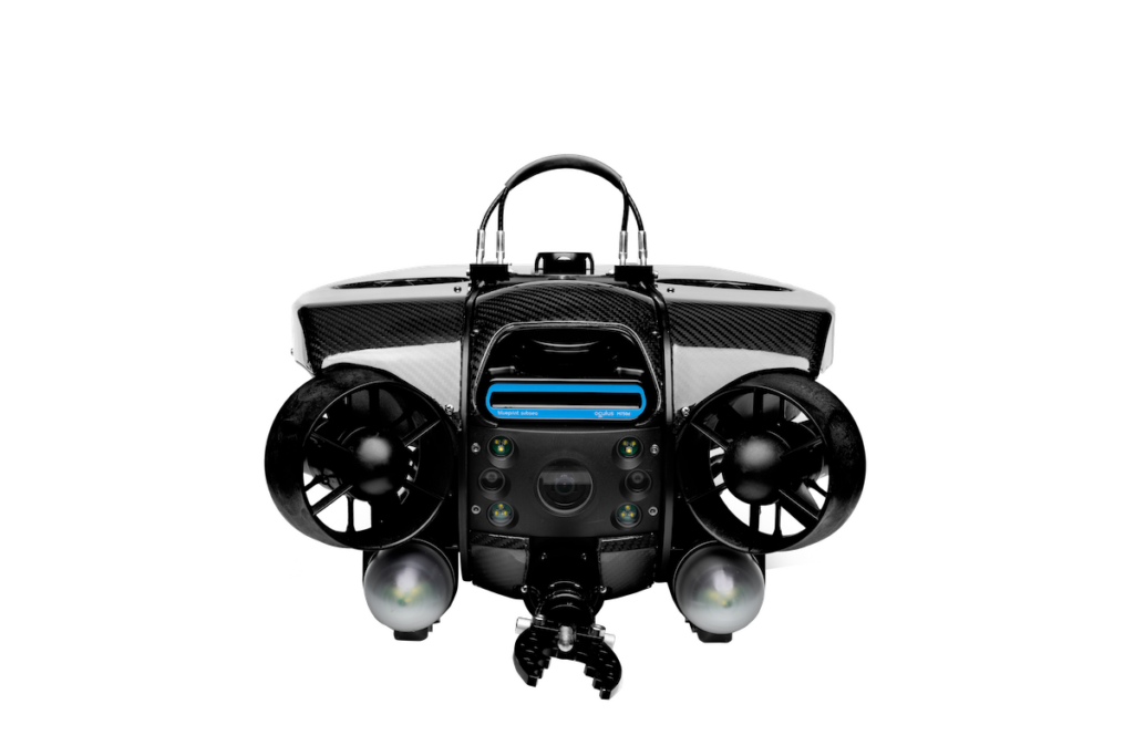
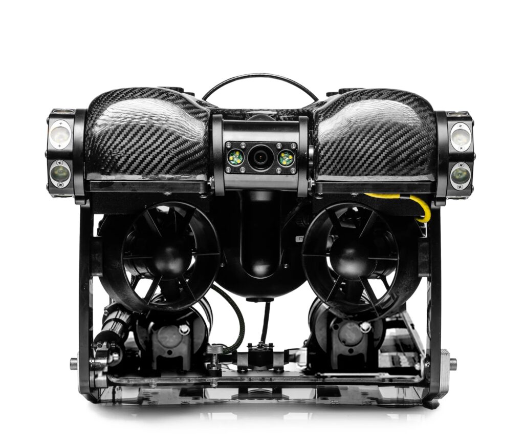
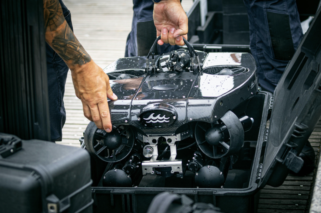
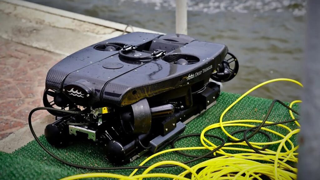
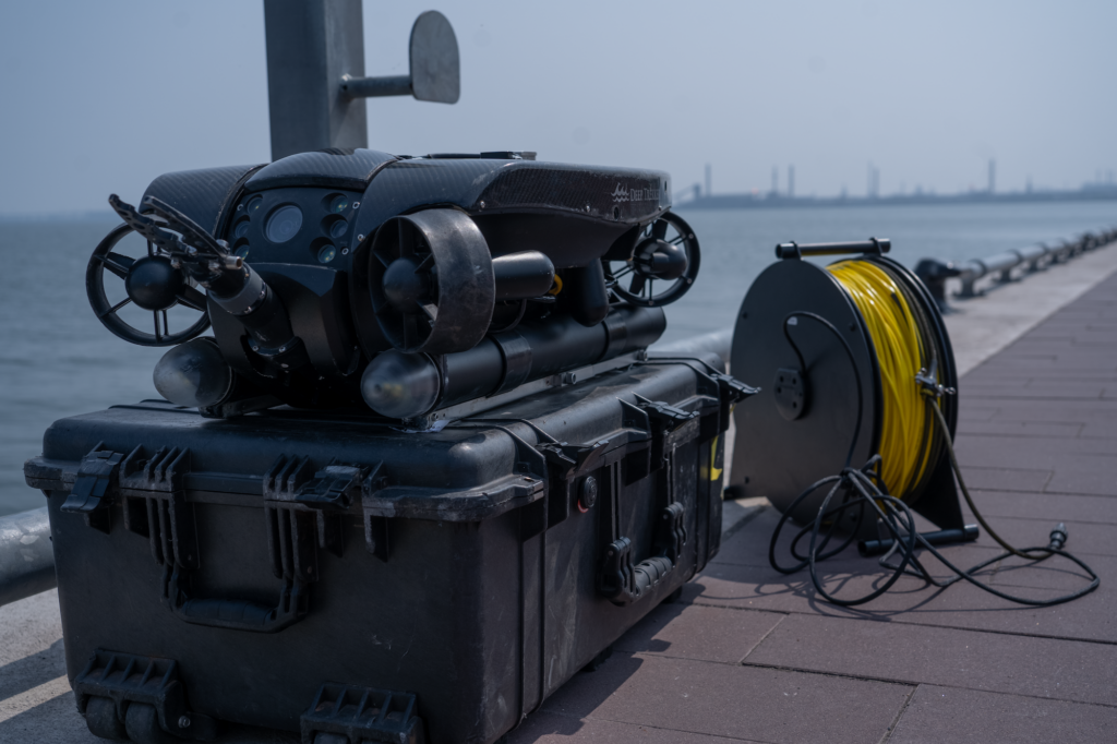
Deep Trekker has become a leader in underwater ROV technology, offering mission-ready submersibles equipped with advanced photogrammetry capabilities. These compact, durable vehicles are designed to operate in challenging underwater environments, allowing operators to capture the images required for 3D modeling.
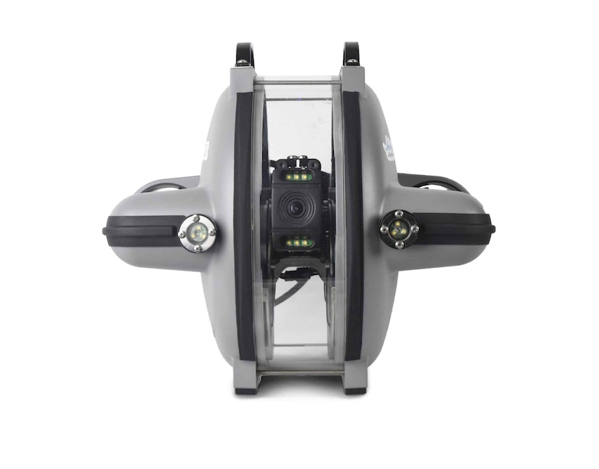
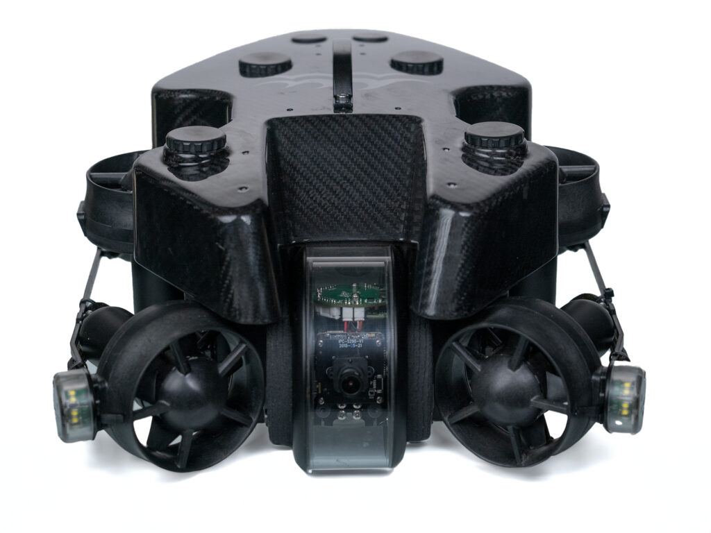
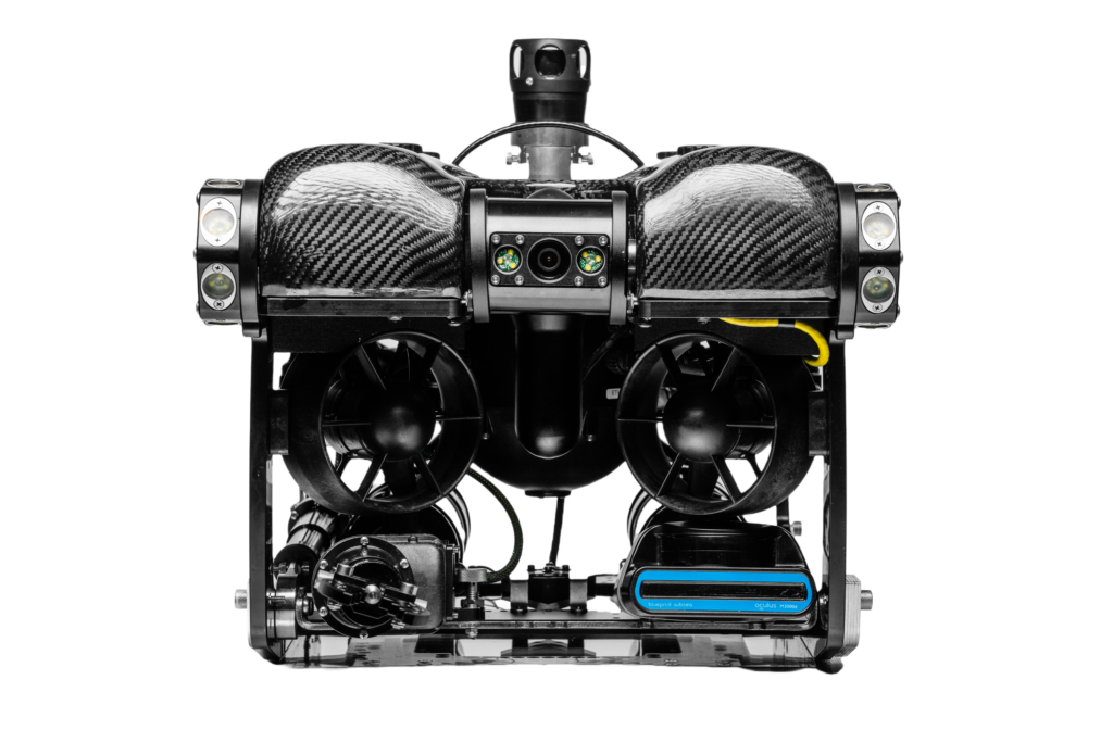
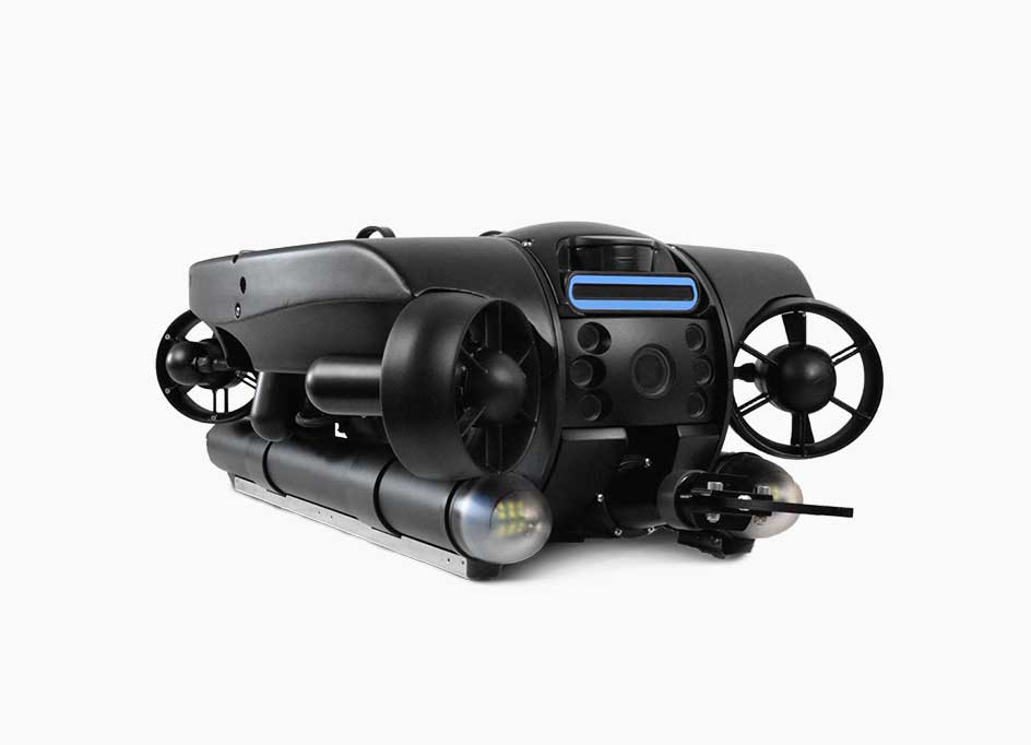
Central to Deep Trekker’s photogrammetry solutions are their PHOTON, PIVOT, and REVOLUTION ROVs, each equipped with high-efficiency 4K cameras, powerful LED floodlights, and enhanced stabilization systems to ensure clear, sharp images even in murky waters.
These features are complemented by autonomous navigation capabilities such as the Mission Planner tool, which allows operators to pre-program precise routes for the ROV to follow, ensuring comprehensive coverage of the target area.
With the Auto-Snapshot feature, capturing images at timed intervals is a breeze, making sure no angle is missed during a survey. The data collected is then processed using photogrammetry software, which builds a detailed 3D model by stitching together hundreds or thousands of overlapping photos.
Underwater Photogrammetry in Action: Case Study from Stantec
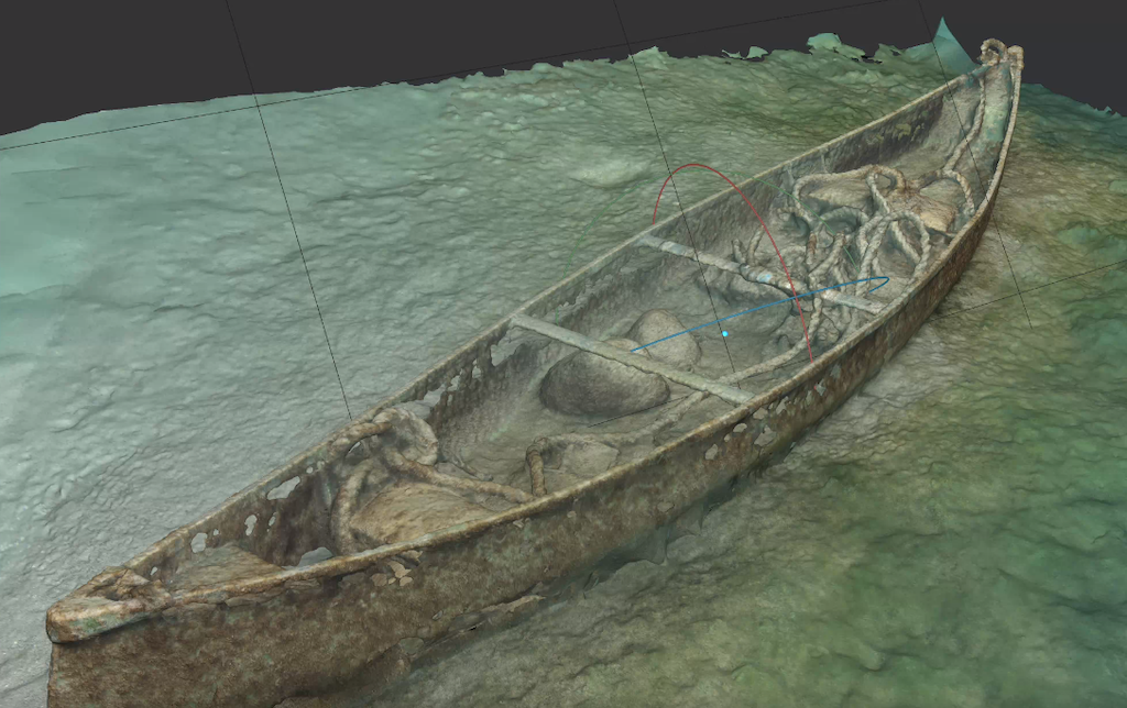
One compelling example of photogrammetry in action comes from Stantec’s archaeological department in Markham, Ontario. The team was tasked with surveying the historical remains of an old dam in Peterborough, Canada, while also inspecting the current dam structure. Given the freezing winter conditions and the hazardous proximity to the dam, using divers was deemed too risky.
Instead, the team deployed Deep Trekker ROVs, outfitted with GoPro cameras and set to capture images every two seconds. By navigating the ROVs in a systematic grid pattern, they were able to gather high-resolution images across a wide area, covering all angles of the submerged structures.
These images were later processed using photogrammetry software, resulting in millimetric accuracy in the 3D models produced. These digital reconstructions allowed the archaeologists to analyze the dam’s construction methods and environmental impacts over time without risking human lives or disturbing the site.
Essential Equipment for Photogrammetry Success
To achieve the best results in underwater photogrammetry, the right equipment is critical. Deep Trekker’s ROVs are equipped with advanced features that make them ideal for this task, such as:
- 4K Cameras: Capture high-resolution images with clarity, ensuring all details of the target are recorded.
- LED Floodlights: Illuminate the underwater environment to minimize shadows and highlight key features.
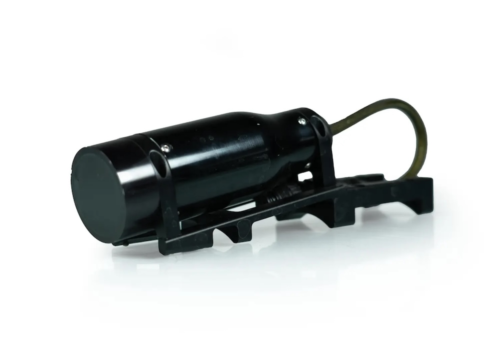
- DVL and USBL Sensors: These sensors provide real-time positioning data, enabling precise control and mapping.
Optional add-ons like the Mission Planner for autonomous navigation and Auto-Snapshot for automatic image capture further enhance the process, ensuring that all the necessary angles and details are covered with minimal operator effort.
Tips for Capturing High-Quality Images
For successful photogrammetry, the quality of the images taken underwater is paramount. Here are several key tips when using Deep Trekker ROVs to capture data:
- Maintain Consistent Lighting: Use either natural ambient light or the ROV’s auxiliary floodlights. Avoid using the camera head lights to reduce backscatter from suspended particles.
- Adjust White Balance: Set the camera to manual white balance mode to achieve neutral tones. Red and blue channels can be fine-tuned based on depth and environmental conditions.
- Slow Navigation: Drive the ROV as slowly as possible to avoid stirring up sediment or blurring the images.
- Consider Underwater Calibration: Calibration helps adjust for changes in focal length underwater, which is longer than in air, ensuring accurate measurements and sharper images.
Rendering the Data: Creating 3D Models
Once the images have been collected, photogrammetry software steps in to convert the 2D images into a 3D model. By analyzing the position and orientation of each photo, the software builds a point cloud—a set of data points in space representing the surface of the object or structure being modeled. From there, the software constructs a mesh by connecting these points, forming the 3D shape with incredible accuracy.
Rendering these models can be computationally demanding, requiring a powerful computer with ample memory and processing power. However, the result is a highly detailed and interactive 3D model, which can be used for further analysis, inspections, or digital archiving.
The Future of Underwater Exploration
Photogrammetry has unlocked new possibilities for underwater exploration, allowing industries to document, inspect, and analyze submerged environments with unprecedented accuracy and efficiency.
As demonstrated by Stantec’s dam project, Deep Trekker ROVs provide a safe, cost-effective, and powerful solution for capturing high-quality photogrammetric data, reducing the need for human divers and accelerating project timelines.
Whether used in archaeology, marine science, infrastructure inspections, or defense applications, the potential of photogrammetry combined with Deep Trekker’s ROV technology is transforming the way we explore and understand the underwater world.
With continued advancements in ROV design and software capabilities, we can expect photogrammetry to play an even more prominent role in future underwater endeavors.
Read the original article, or visit the Deep Trekker website for more information.