applied acoustics is a provider of compact Ultra Short Baseline (USBL) systems for effective and efficient tracking of multiple simultaneous underwater assets such as divers and underwater robotics.
Mapping the seabed or tracking in shallow water requires a different strategy compared to deep-sea projects. Variations in the water environment, depth changes, and the proximity between the seabed and the vessel all pose challenges for shallow water hydrographic surveys.
Surveyors must adjust their equipment and methods to obtain precise data when working in harbors, ports, or near the coastline. Properly utilizing a USBL system is one of the most effective ways to survey shallow water areas.
Shallow water is generally classified as any area where the seabed is at a depth of 300 meters (1,000 feet) or less. Locations near the coastline, along quaysides, or within harbor structures typically fall into this category.
Shallow water hydrographic surveys serve various purposes, such as assessing pre-construction risks for offshore wind farms, detecting navigational hazards in ports or harbors, and conducting environmental monitoring along coastlines. The same subsea technology is also useful for tracking divers.
Using a USBL Positioning System in Shallow Water
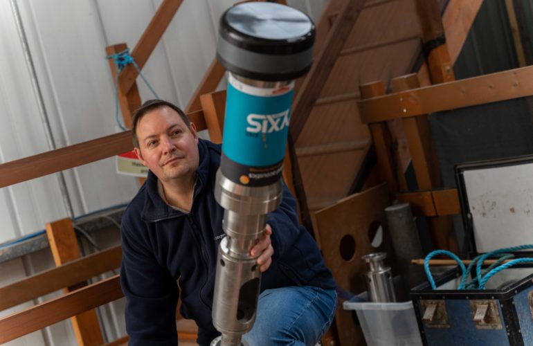
As its name implies, an Ultra-Short Baseline (USBL) system equipped with a transponder beacon and transceiver is well-suited for positioning surveys and diver tracking in shallow waters. While some acoustic positioning systems can function at depths reaching 4,000 meters, they are primarily employed for locating objects and tracking divers in shallower environments.
For optimal performance in areas with reduced depth, a different approach is necessary to ensure accurate measurements.
Tilting the Transceiver
For shallow water applications, it is advisable to tilt the transceiver rather than positioning it directly downward. Angling it at 30 degrees creates an optimal operational cone behind the vessel, particularly when towing equipment such as side scan or multibeam sonar.
However, tilting the head requires adjustments to the system settings. Additionally, this creates a blind spot outside the cone of operation, typically toward the front of the vessel when towing equipment. Since the transceiver does not operate at a negative depression angle, it will not capture data from that direction.
Tilting the head may also restrict operational flexibility, depending on the vessel’s activities. However, if the object being tracked is also being towed, this will not present an issue.
Setting the Speed of Sound
The primary challenge in shallow water measurements is the speed of sound, which refers to the time taken for an acoustic signal to travel through a target and return to the transceiver, determining its precise location.
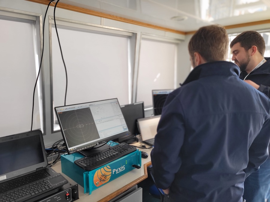
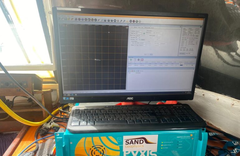
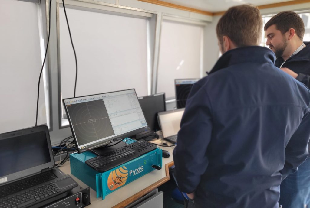
In a USBL system, the receive elements in the transceiver are closely positioned. If the speed of sound setting is inaccurate, positional calculations will also be incorrect, with accuracy decreasing as the target distance increases. Utilizing precise sound velocity probes or other dedicated equipment is crucial for obtaining reliable readings. Systems such as Nexus and Pyxis can address this issue by incorporating accurate sound velocity profiles.
This factor is especially critical in the water column, which is influenced by pressure, salinity, and temperature.
Multi-Path Interference
Multi-path interference occurs when signals reflect off surrounding hard surfaces, the seabed, or the water surface before returning to the transceiver. This can result in erroneous readings, posing a particular challenge in harbors or ports with substantial subsea structures.
Reducing transmit power, utilizing a low-powered beacon, or decreasing receiver sensitivity can mitigate this issue. These adjustments, available within the USBL software, enhance the signal-to-noise ratio for shallow water tracking.
By strengthening direct-path signals and weakening those from multi-path interference, unwanted signals diminish as they travel further. A less sensitive receiver may not detect them or will register them only faintly, allowing the transceiver to differentiate between direct and multi-path signals.
Environmental Factors
Water temperature varies with depth. In warmer regions, the sea surface is relatively warm, while deeper layers experience cooler and more stable temperatures. Accurate temperature measurements are essential for creating a precise profile within the system.
Salinity also fluctuates depending on proximity to the coast, especially near freshwater inflows from rivers. If freshwater alters salinity, it will impact the speed of sound.
The most effective way to measure the speed of sound is with a dedicated sound velocity probe, which can then be used to upload a profile to the USBL system. While USBL consoles include temperature sensors, and tables can estimate speed of sound, direct measurements on the day of operation provide the highest accuracy.
Other environmental considerations include noise from thrusters and interference from nearby vessels. Rough seas and rain typically have little effect. However, extremely calm conditions may cause multi-path interference as signals reflect off the smooth surface. These factors must be accounted for when building an accurate profile.
Hydrographic Survey Vessel Setup for Shallow Water Operations
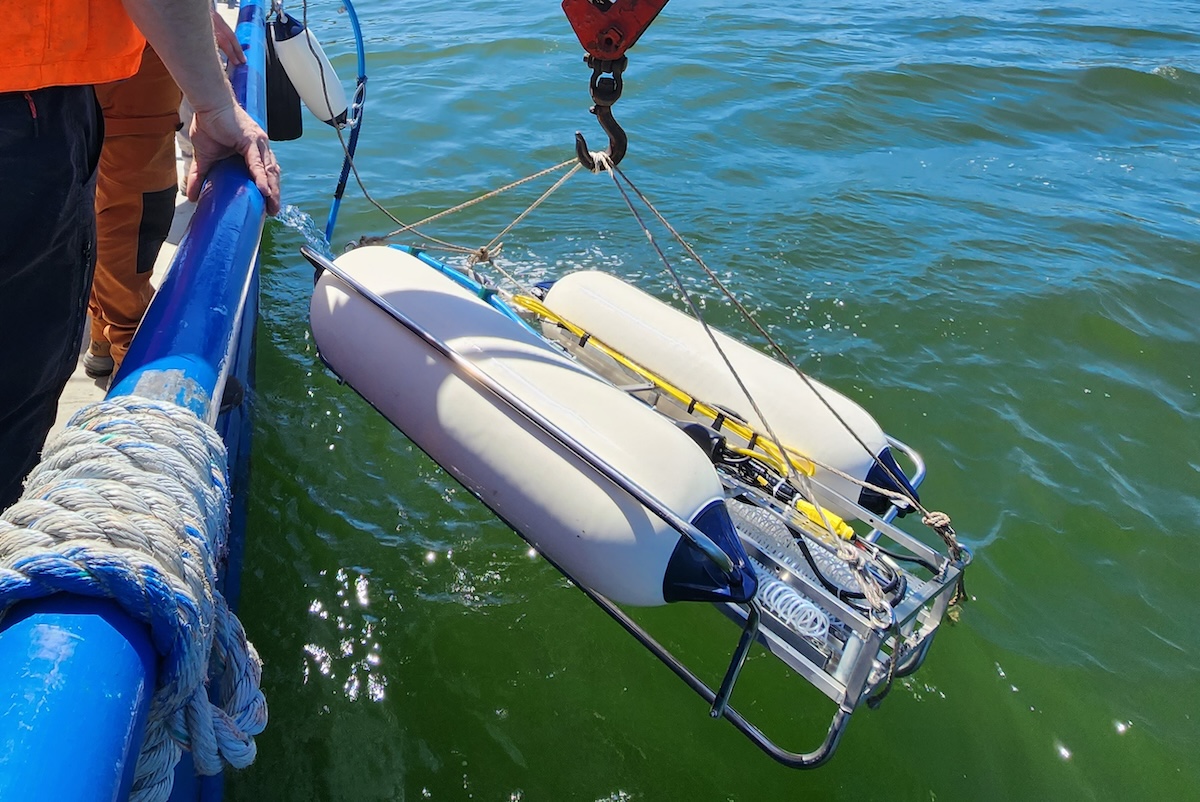
Transceivers can be mounted externally on a pole mount or internally through a gate valve or moon pool. They should always be positioned at least one meter below the vessel’s lowest point. A deeper placement helps minimize vibration-related interference.
Proper positioning also prevents unwanted reflections from the vessel’s hull, which can create false readings. Ensuring the transceiver is clear of the vessel’s bottom, thrusters, and direct propeller wash reduces the risk of inaccurate responses.
Employing the appropriate subsea equipment alongside correct techniques enhances accuracy in shallow hydrographic surveys. This includes selecting the correct transponder beacon and an intuitive USBL system.
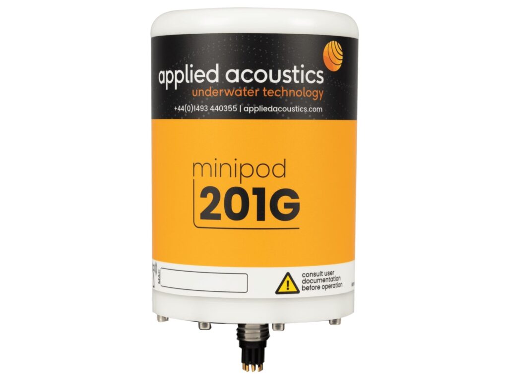
Transponder Beacons
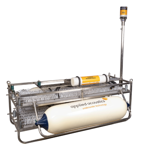
Various transponder beacons are designed for specific applications. Some are attached to divers or ROVs, while others are mounted on fixed frames positioned on the seabed. Both allow for accurate positioning of the frame or beacon.
Data output from transponder beacons can be integrated into a ship’s dynamic positioning system to monitor stationary targets or track moving ones. The information can also be incorporated into standard survey packages and combined with other datasets to generate a comprehensive geographical representation.
Omni-Directional Beacons
Omni-directional beacons provide accurate readings at depths of up to approximately 1,000 meters. They are preferable to directional beacons, which become effective only at depths beyond 750 meters.
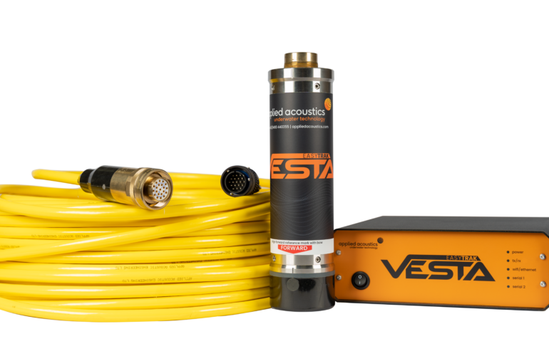
The Nexus 2, Nexus 2 Lite, and Pyxis systems feature omni-directional heads, enabling them to track targets at near-horizontal angles. With operational depth ranges spanning from 500 meters to 3,000 meters, they also include directional heads for deeper-water applications or use with the tilted transceiver method.
USBL Systems
A USBL system with user-friendly software simplifies the process of obtaining accurate readings. The design of applied acoustics’ USBL systems ensures straightforward adjustments, featuring:
- An auto-gain function that dynamically adjusts based on data quality received from the beacon
- On-screen slider-operated settings
- A color-coded histogram indicating reply validity (green for valid responses, red for no response, and orange for received but unusable data)
These features allow users to fine-tune settings and methods according to environmental conditions in real time, all through software controls without needing to access the unit’s internal components.